NWS Lubbock
@NWSLubbock
Official X account for the National Weather Service in Lubbock, TX. Details: https://weather.gov/nws_x
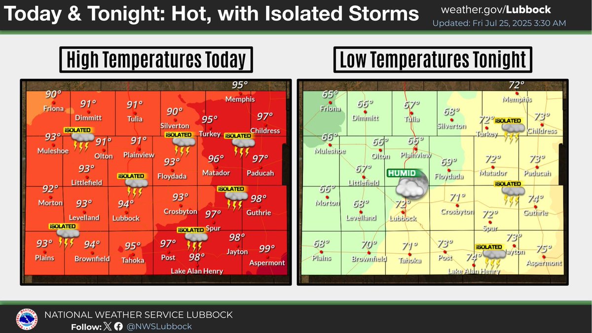
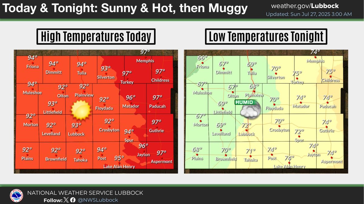
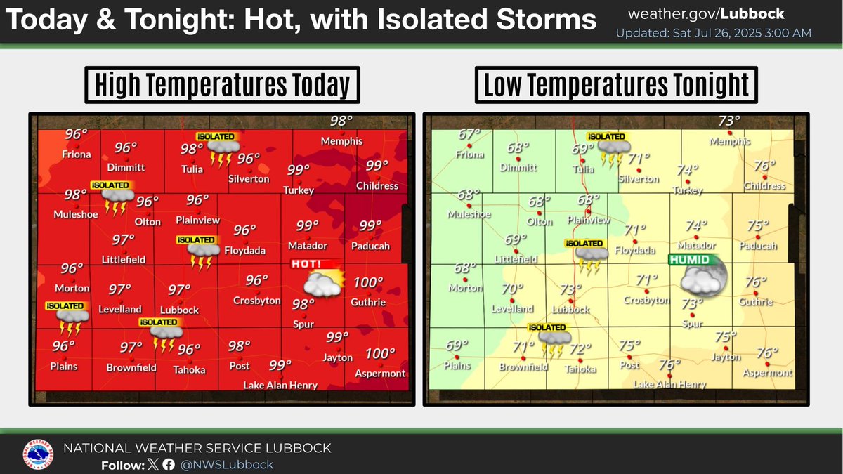
Hot temperatures are expected once again today, with isolated thunderstorms developing this afternoon across portions of the Caprock and Rolling Plains. Storm chances will diminish by the late evening hours, with another muggy and warm night to follow. #lubwx #txwx
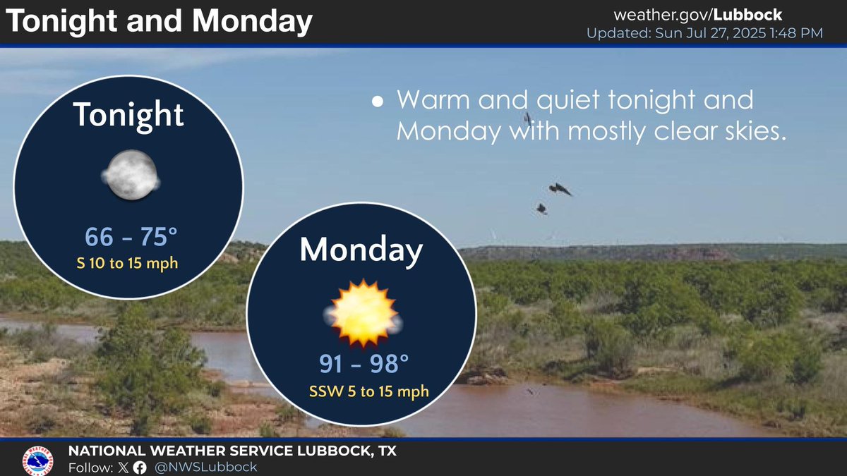
Tonight will be warm with lows in the mid 60s to mid 70s under mostly clear skies. It will be hot once again Monday with highs approaching 100 off the Caprock. #lubwx #txwx
Hot and sunny conditions are expected today, with a south wind at 10-15 mph. The southerly breeze will persist into tonight, with conditions becoming muggy once again after dark. #lubwx #txwx
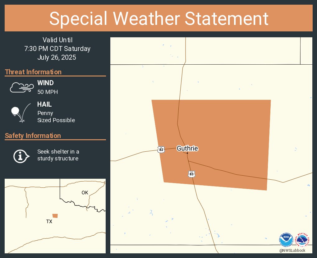
A special weather statement has been issued for Guthrie TX until 7:30 PM CDT
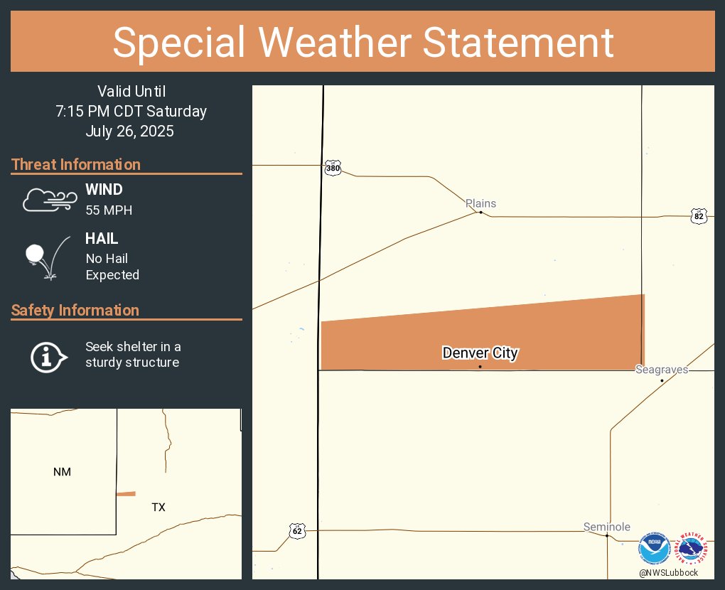
A special weather statement has been issued for Denver City TX until 7:15 PM CDT
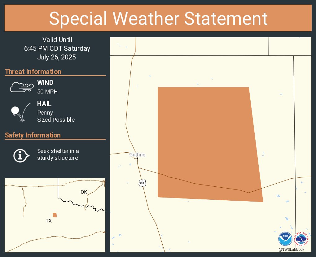
A special weather statement has been issued for King County, TX until 6:45 PM CDT
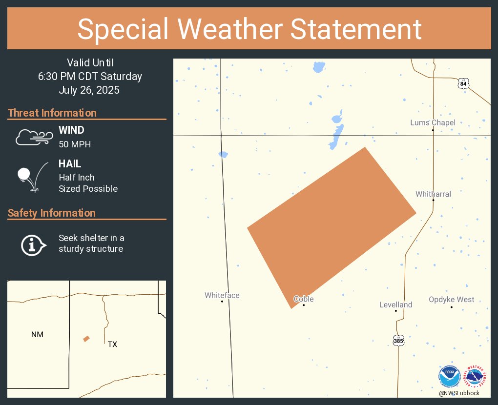
A special weather statement has been issued for Hockley County, TX until 6:30 PM CDT
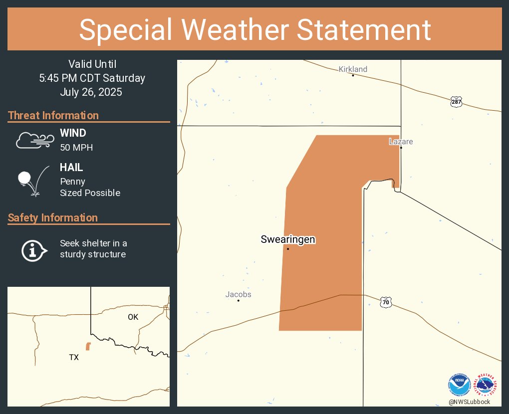
A special weather statement has been issued for Swearingen TX until 5:45 PM CDT
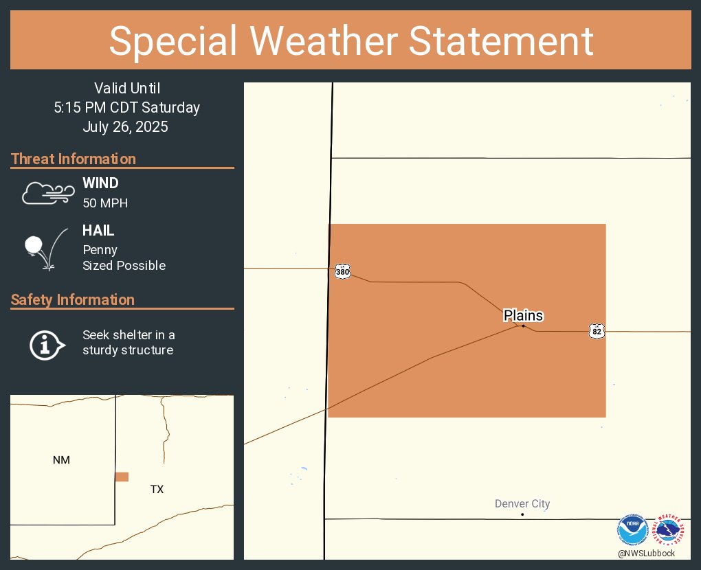
A special weather statement has been issued for Plains TX until 5:15 PM CDT
A special weather statement has been issued for Dougherty TX and Elton TX until 5:00 PM CDT

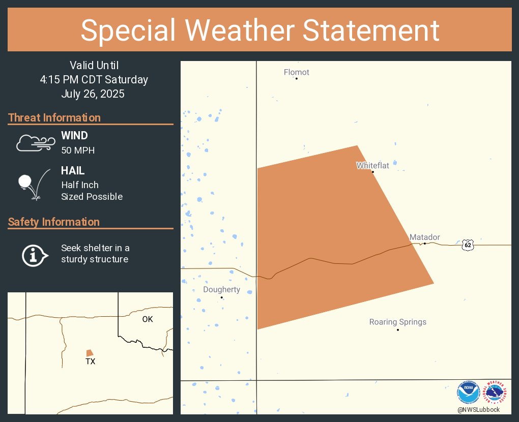
A special weather statement has been issued for Motley County, TX until 4:15 PM CDT
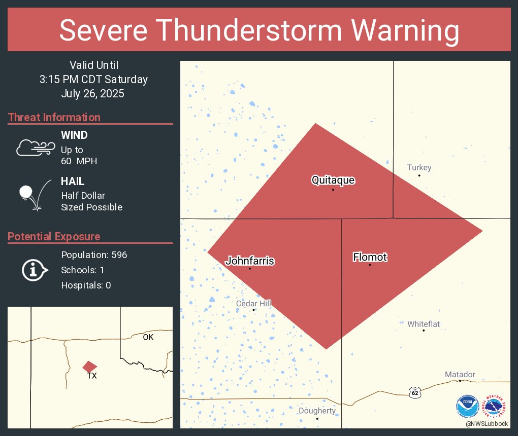
Aviso de Tormenta Severa incluye Quitaque TX, Flomot TX, Johnfarris TX hasta las 3:15 PM CDT

Severe Thunderstorm Warning including Quitaque TX, Flomot TX and Johnfarris TX until 3:15 PM CDT
Isolated showers and thunderstorms are possible tonight for areas on the Caprock. Storm chances diminish after sunset and conditions will remain dry overnight through Sunday. Sunday will be another hot one with temperatures in the 90s. #lubwx #txwx

Hot temperatures are expected today, as temperatures will soar into the middle-upper 90s to even the triple-digits for some locales. Isolated thunderstorms will be possible this afternoon and evening, mainly on the Caprock. The severe weather threat is low. #lubwx #txwx
Aviso de Tormenta Severa incluye Northfield TX hasta las 6:45 PM CDT
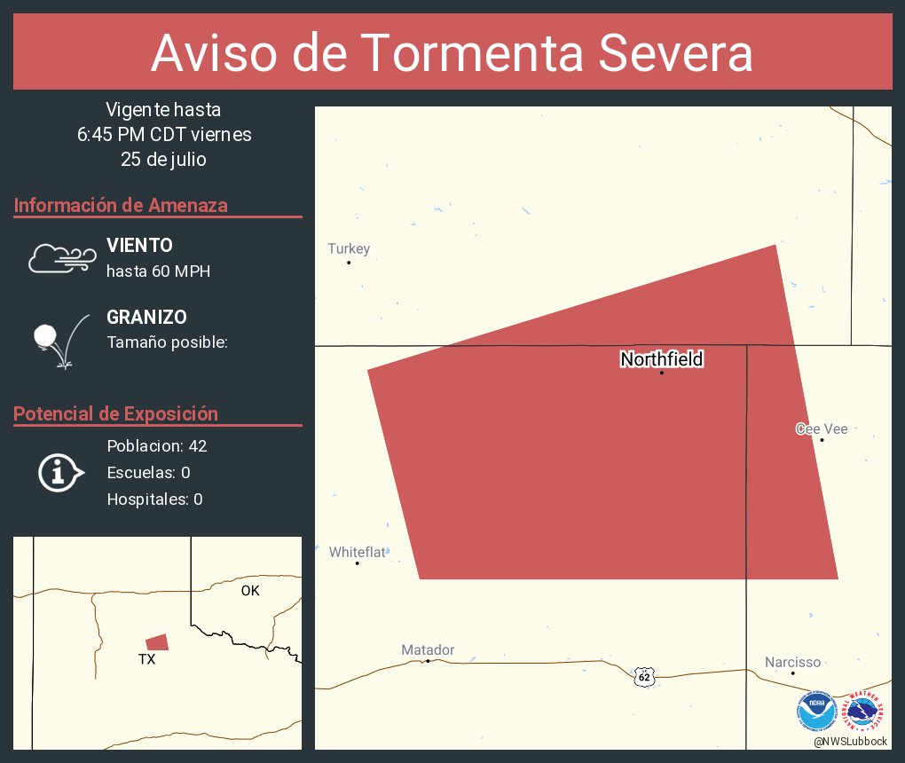
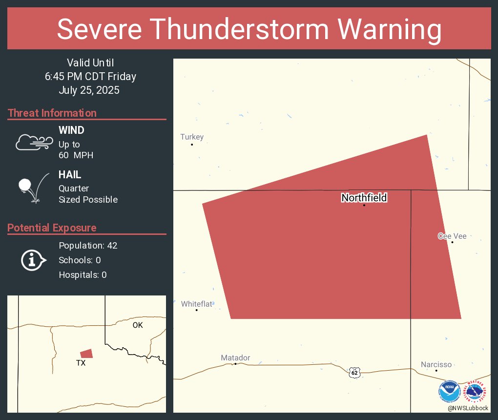
Severe Thunderstorm Warning including Northfield TX until 6:45 PM CDT
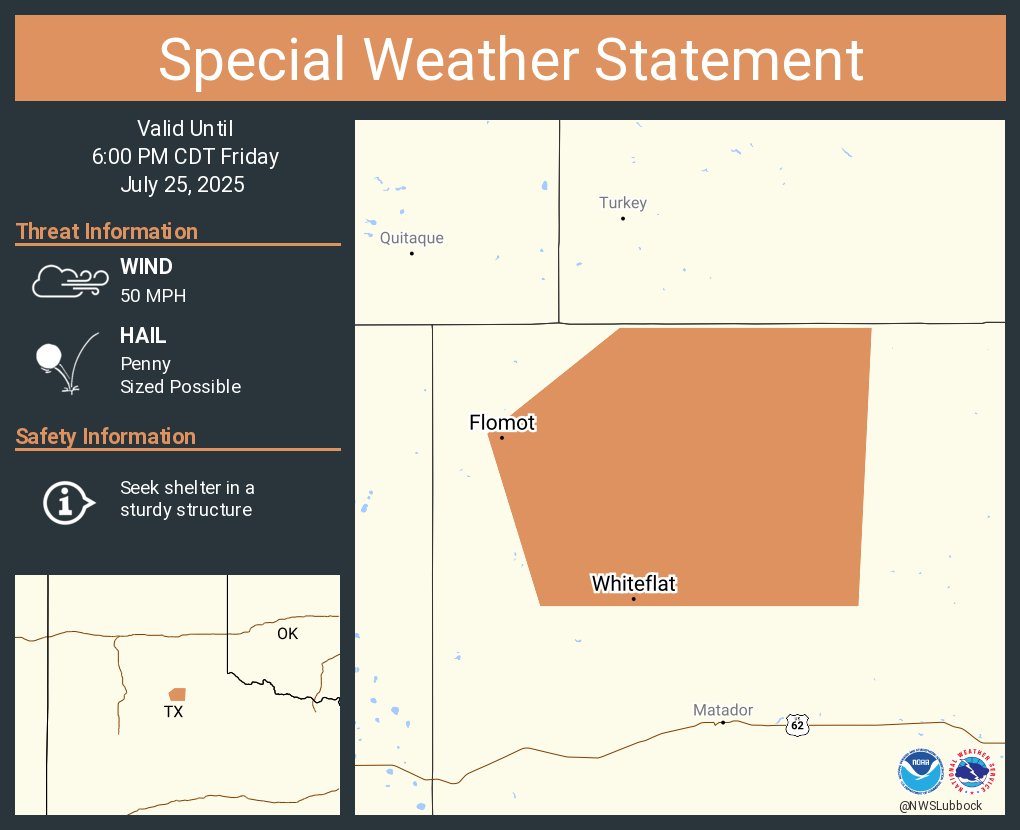
A special weather statement has been issued for Flomot TX and Whiteflat TX until 6:00 PM CDT
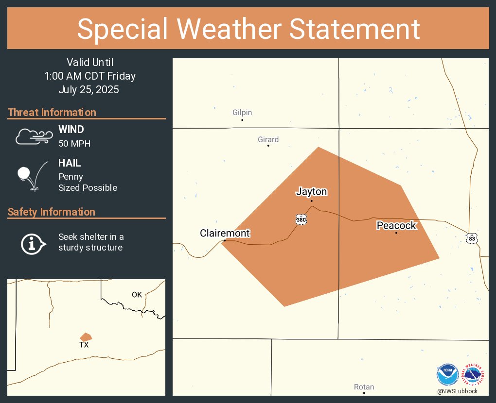
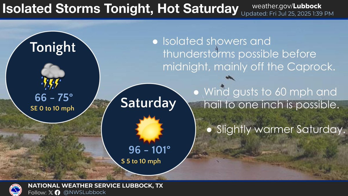
Isolated showers and thunderstorms are possible tonight before midnight, the best chances being off the Caprock. Some storms could be strong to severe with winds to 60 mph and hail to one inch in diameter. Saturday will be hot with highs in the 90s to around 100. #lubwx #txwx
A special weather statement has been issued for Jayton TX, Clairemont TX and Peacock TX until 1:00 AM CDT