NWS Kansas City
@NWSKansasCity
This is the official twitter account for the National Weather Service in Kansas City/Pleasant Hill, MO. Details: http://weather.gov/nws_x
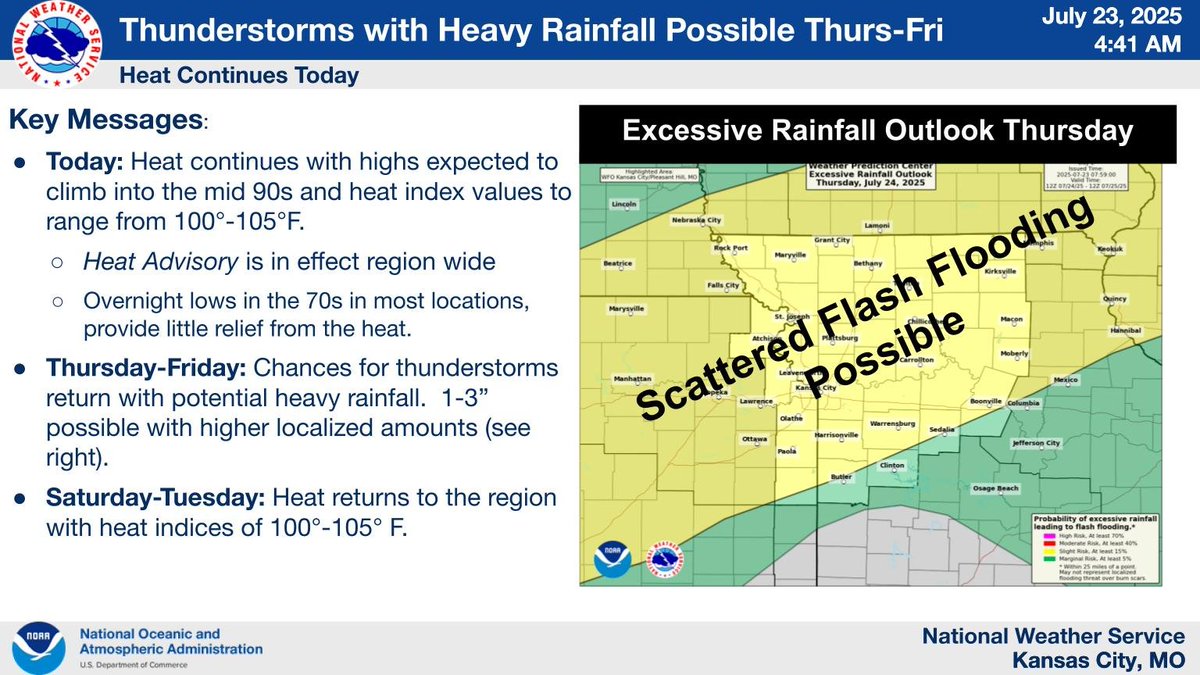
The heat is expected to continue today with heat indices of 100-105 F. A cold front is expected to drop into the region tonight creating the potential for thunderstorms Thursday. While severe weather is not expected with these storms, they will be capable of producing heavy rain
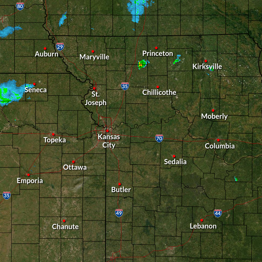
Isolated showers and t-storms are forming across far northern MO. These storms are moving NE lingering thru sunset. They may bring some relief from the heat until the sun comes back out. Otherwise, hot and humid conditions continue tomorrow. Broader t-storm chances return THU.
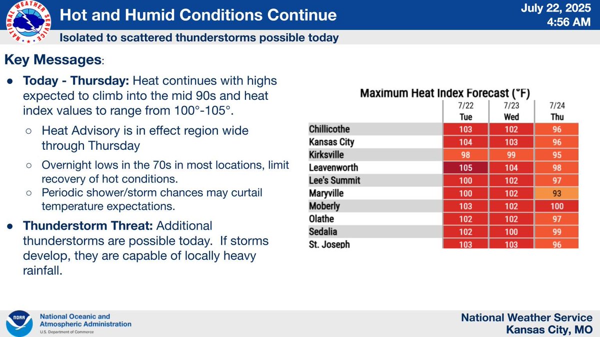
Heat and humidity is expected to lead to heat indices of 100-105 F this afternoon across the region. A heat advisory is in effect through Thursday. There is a chance for thunderstorms again today. If the storms develop, they would be capable of heavy rainfall.
Thunderstorms have moved through much of the region with storms continuing mainly along the I-29 corridor. Isolated areas of heavy rainfall remain possible. We have received reports of active flooding around the region. Please do not enter any flooded areas.
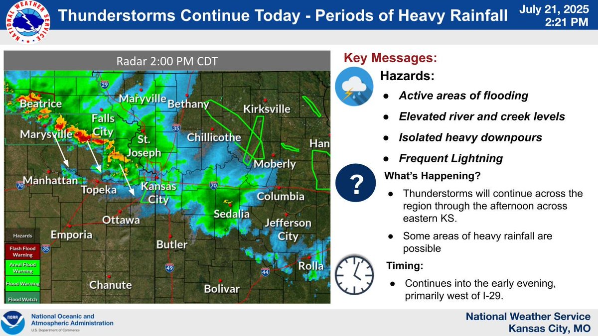
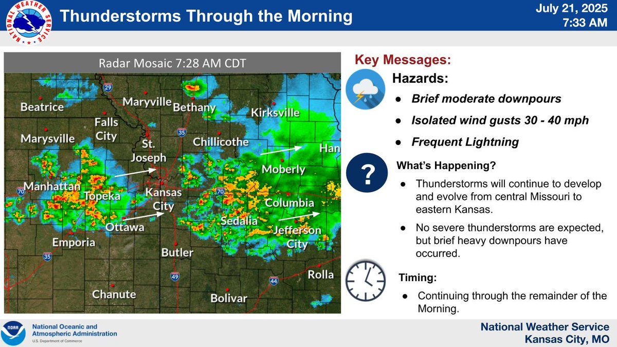
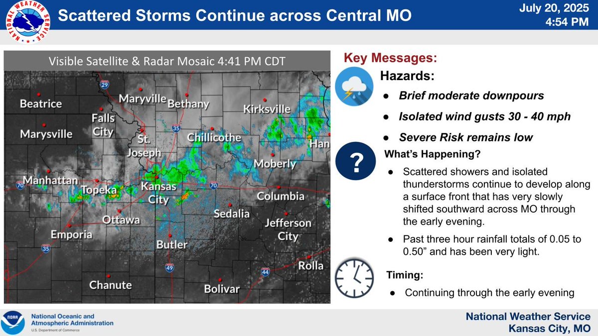
Thunderstorms continue across the region and will persist through the afternoon. Locally heavy rainfall is the greatest concern along with flooding of streets, creeks/streams, and low lying areas. #mowx #kswx #KC
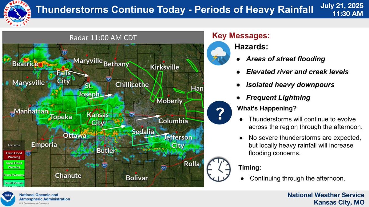
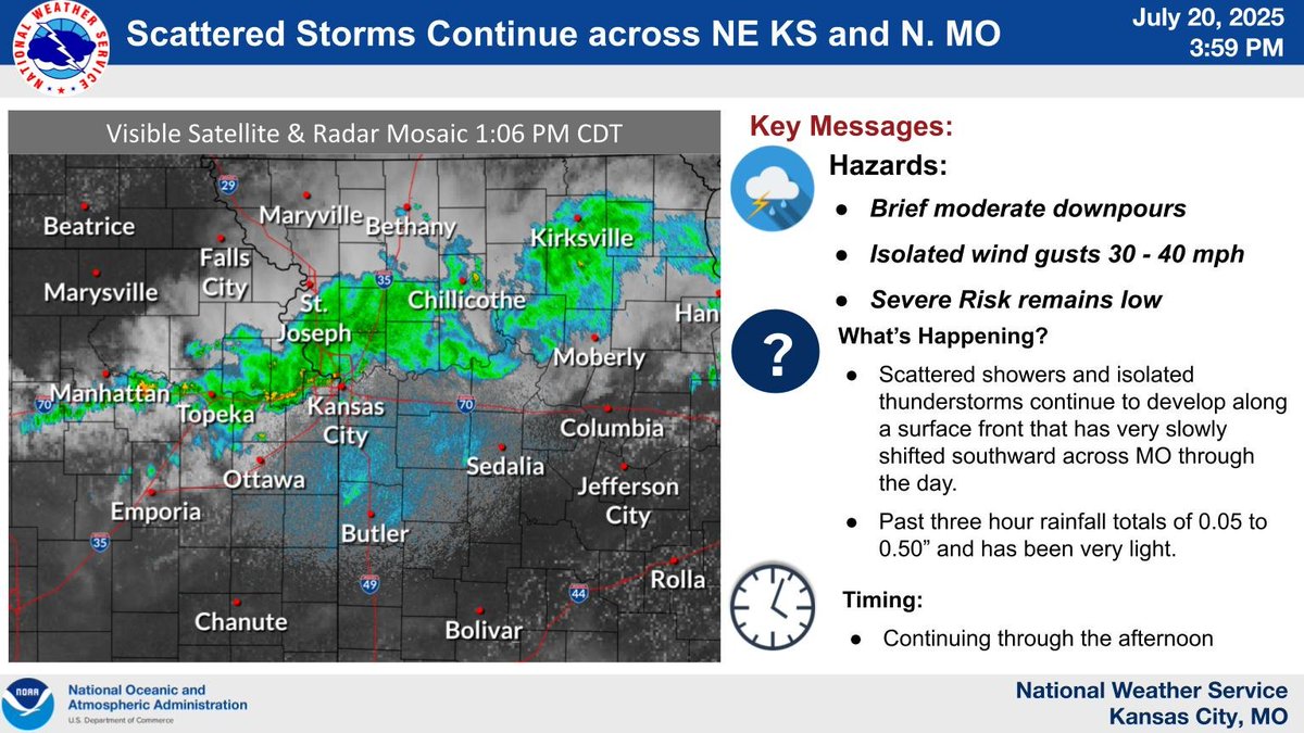
Thunderstorms continue across the region this morning and look to persist into the afternoon. Locally heavy rainfall is the greatest concern and could result in increased flooding concerns. #mowx #kswx #KC
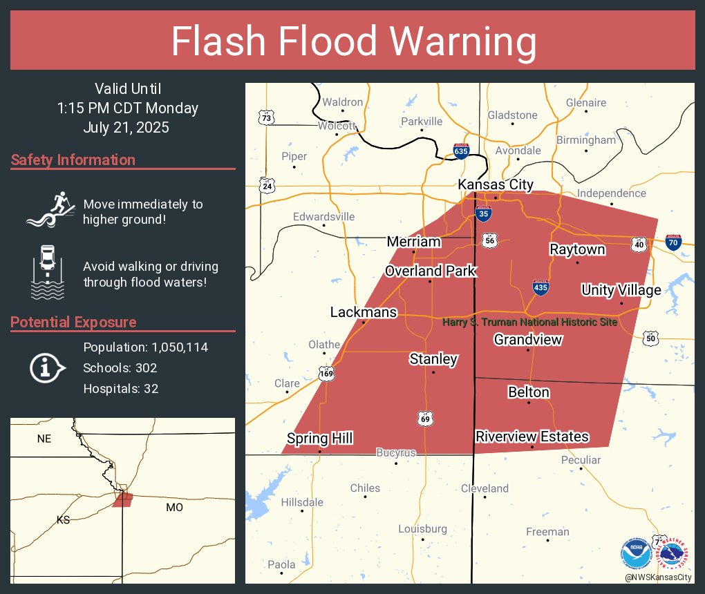
Flash Flood Warning including Kansas City MO, Overland Park KS and Lenexa KS until 1:15 PM CDT
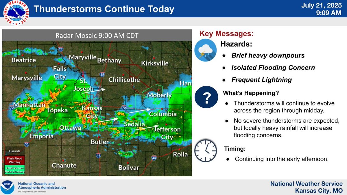
Scattered thunderstorms continue from eastern Kansas into central Missouri. Brief heavy downpours, and wind gusts to 40 mph are possible. The risk for severe thunderstorms remains very low. These storms are expected to persist into midday. #mowx #kswx
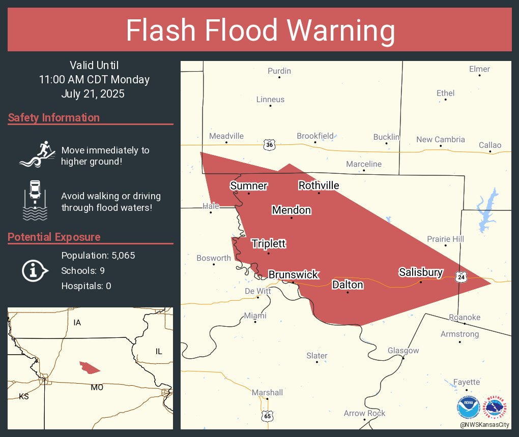
Flash Flood Warning including Salisbury MO, Brunswick MO and Keytesville MO until 11:00 AM CDT
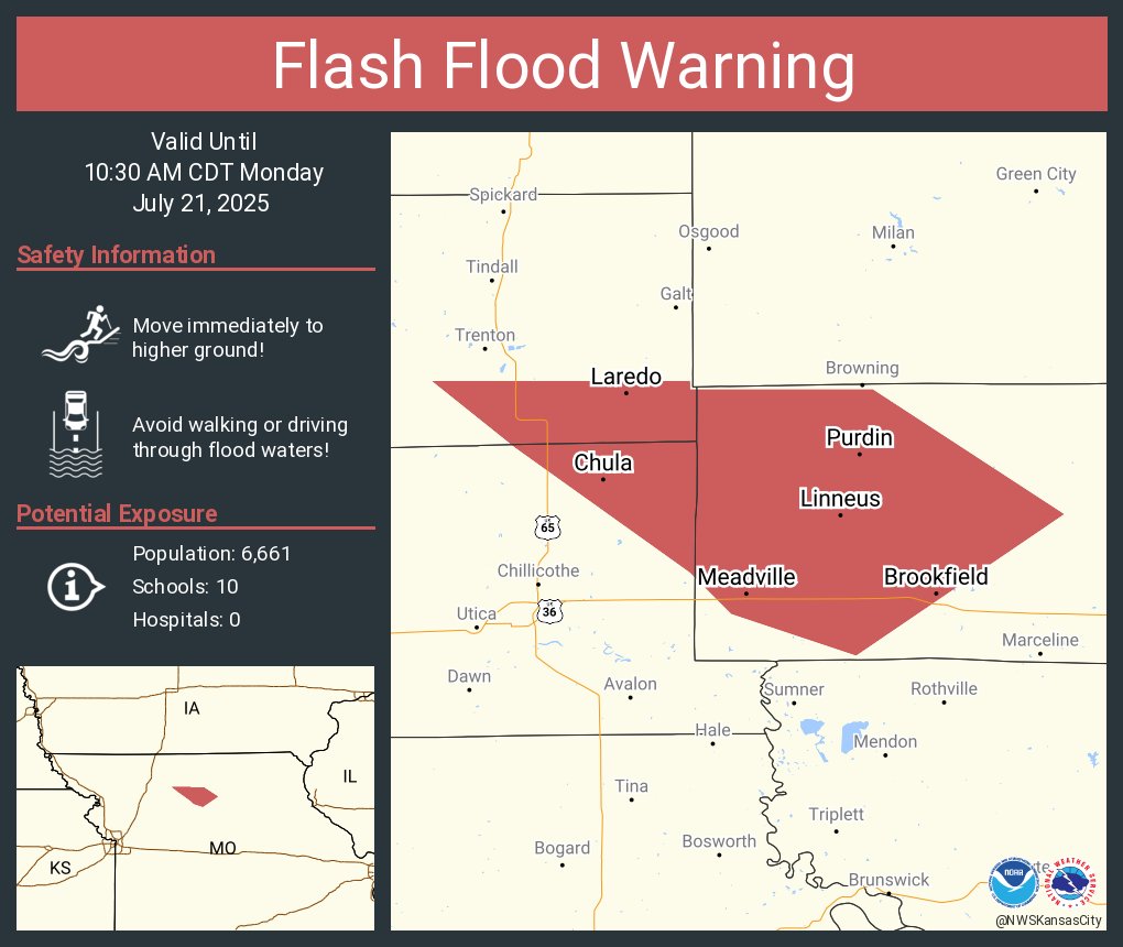
Flash Flood Warning including Brookfield MO, Meadville MO and Laclede MO until 10:30 AM CDT
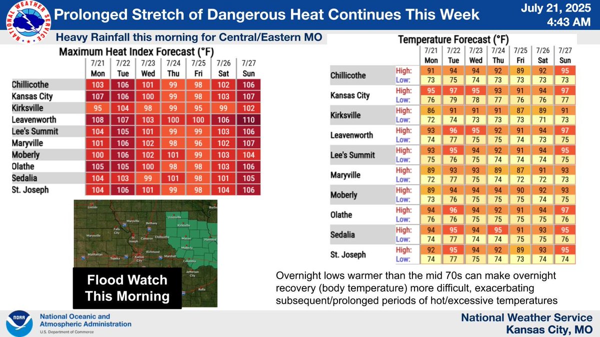
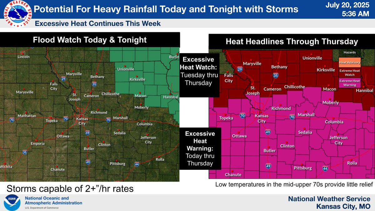
Flooding is likely across central Missouri this morning. Hot and humid conditions are expected to continue throughout much of the upcoming week, with head indices of 100-110 F.
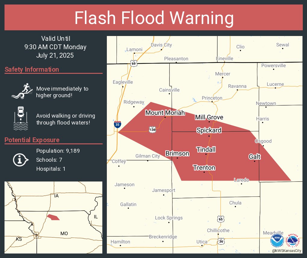
Flash Flood Warning including Trenton MO, Spickard MO and Galt MO until 9:30 AM CDT
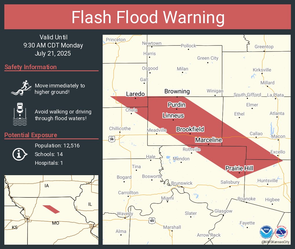
Flash Flood Warning including Brookfield MO, Marceline MO and Bucklin MO until 9:30 AM CDT
Scattered showers and isolated thunderstorms continue to develop and move eastward through the early evening. Severe risk remains low, but brief periods of moderate rainfall and gusty winds to 40 mph remain possible. #mowx #kswx.
Scattered showers and isolated thunderstorms continue to develop and move eastward through the afternoon as the front slowly shifts southward. Severe risk remains low, but brief periods of moderate rainfall and gusty winds to 40 mph remain possible. #mowx #kswx.
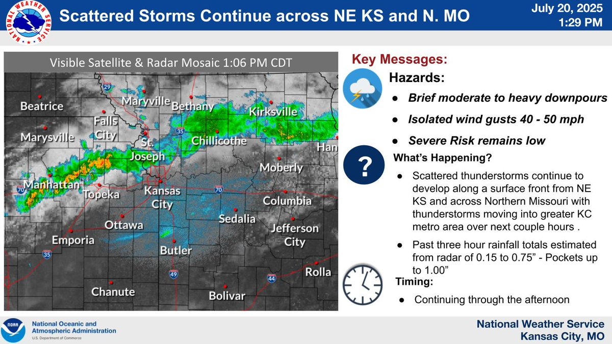
Thunderstorms persist from NE Kansas across N. Missouri and are expected to continue through the afternoon. Severe risk remains low, but brief periods of heavy rainfall and gusty winds to 40 mph are possible. Will slowly shift southward across the KC Metro area. #mowx #kswx
9:45 AM Radar: Scattered thunderstorms will continue through the late morning across northern #Missouri and northeastern #Kansas. Activity to the west is looking like it could reach the #KC Metro area by Noon to 1 PM. Brief heavy downpours and gusty winds possible. #kswx #mowx
Very warm and muggy conditions are expected to fuel thunderstorms today and tonight. Storms will be most numerous north of I-70, and will be capable of producing heavy rainfall. A food watch is in effect for portions of eastern Missouri.
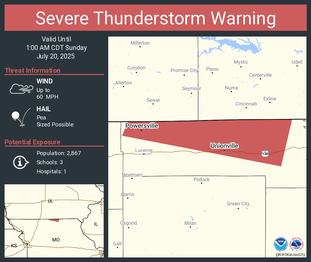
Severe Thunderstorm Warning including Unionville MO and Powersville MO until 1:00 AM CDT
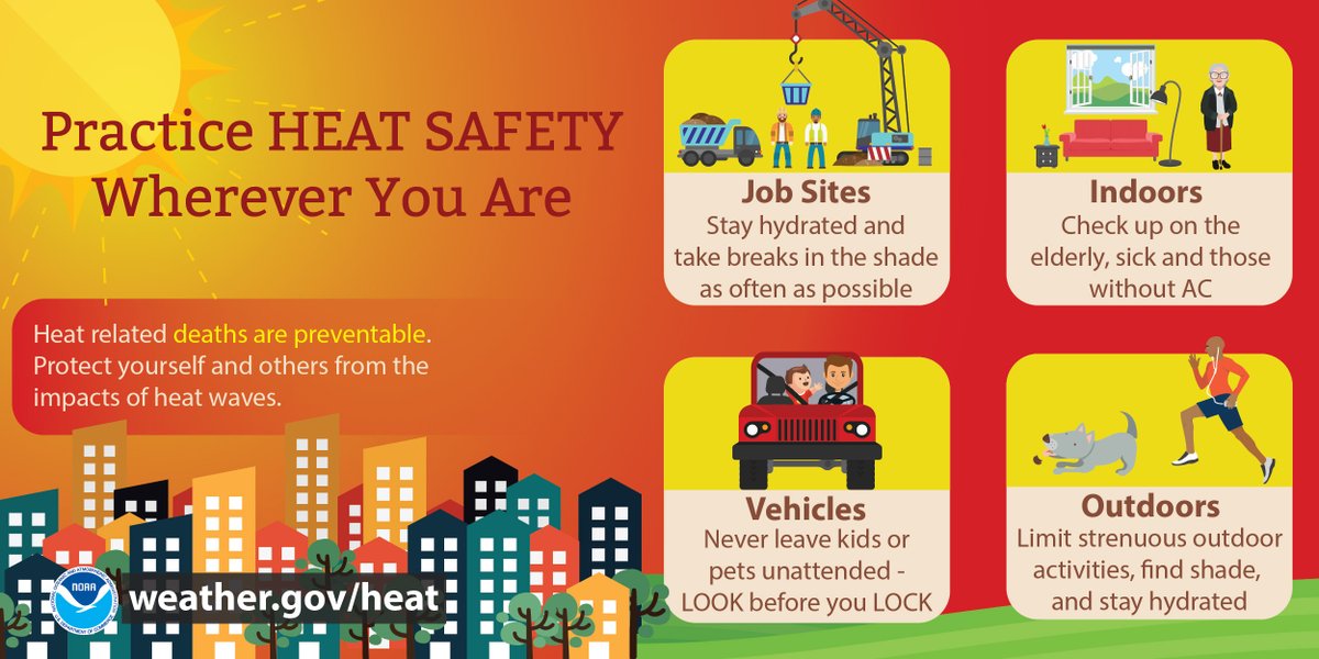
Scattered storms with heavy rainfall & gusty winds are moving across far northern MO. Some localized flooding is possible. Dangerously hot & humid conditions continue for the next several days. Highs ~100°F with heat indices of 100°F-110°F expected. Please practice heat safety.