NWS Hastings
@NWSHastings
Official X account for the National Weather Service Hastings. Details: http://weather.gov/nws_x
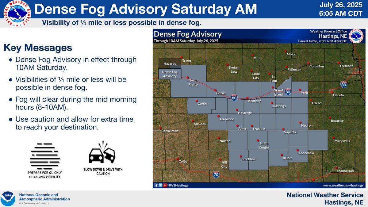
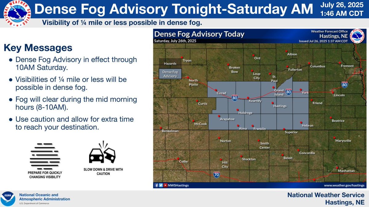
A Dense Fog Advisory has been issued for several counties across south central Nebraska through 10am Saturday. Visibilities have fallen below one mile and are expected to continue to fall through the night. Those needing to travel are encouraged to use caution. #kswx #newx
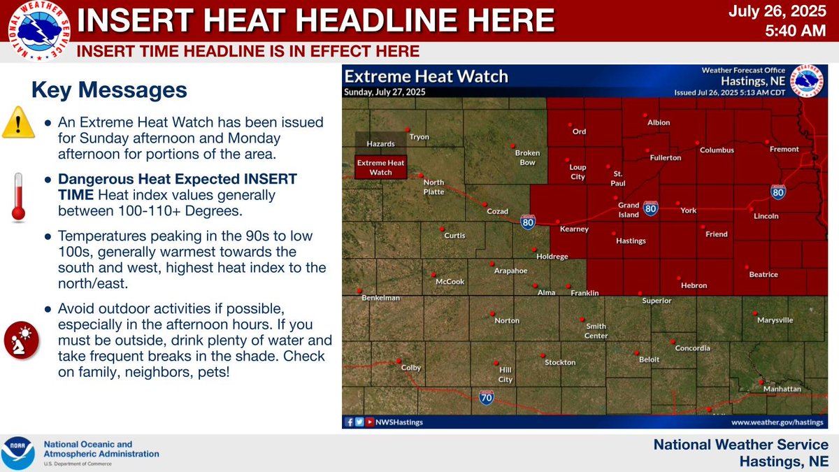
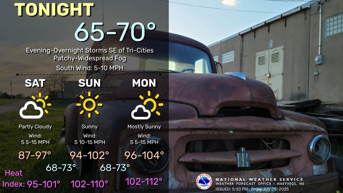
An Extreme Heat Watch has been issued for central and eastern Nebraska for Sunday afternoon. Temperatures will be in the 90s and low 100s. Heat index values will range from around 100 to 110 degrees. Monday values will range from 100 to 115 degrees. #kswx #newx

An Extreme Heat Watch has been issued for central and eastern Nebraska for Sunday afternoon. Temperatures will be in the 90s and low 100s. Heat index values will range from around 100 to 110 degrees. Monday values will range from 100 to 115 degrees. #kswx #newx
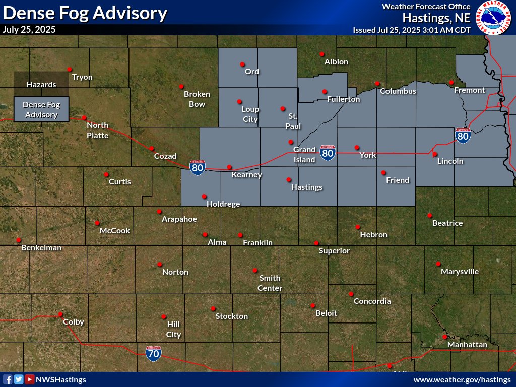
A Dense Fog Advisory has been issued for several counties across south central Nebraska through 10am Saturday. Visibilities have fallen below one mile and are expected to continue to fall through the night. Those needing to travel are encouraged to use caution. #kswx #newx
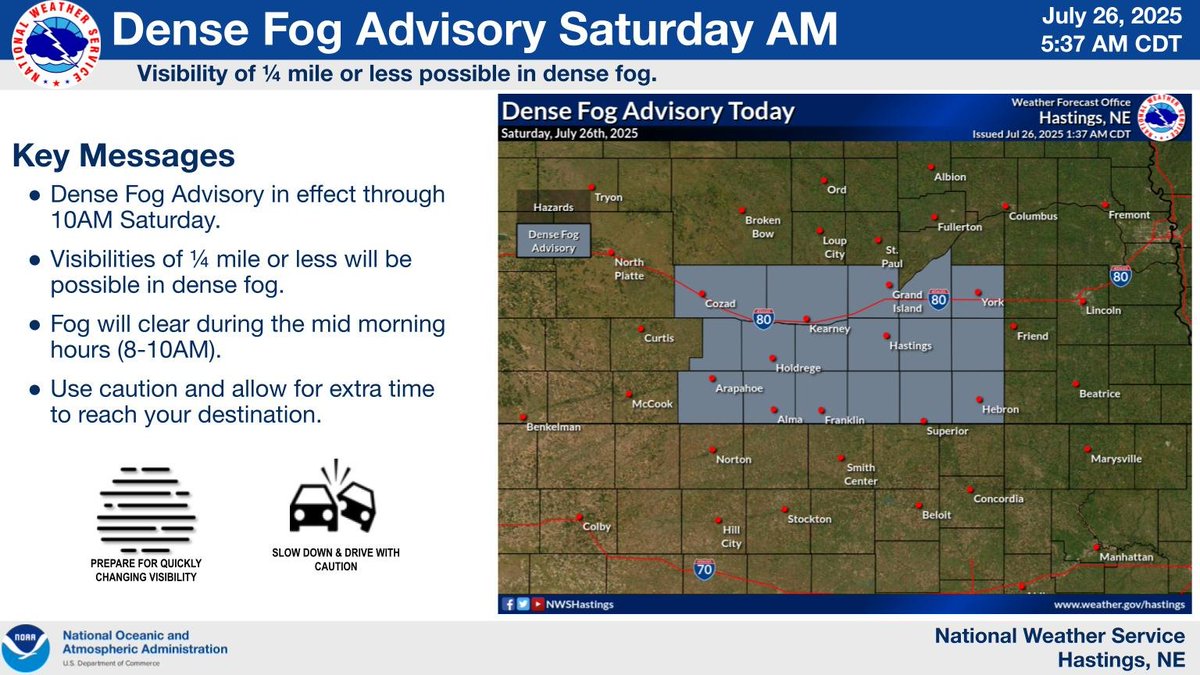
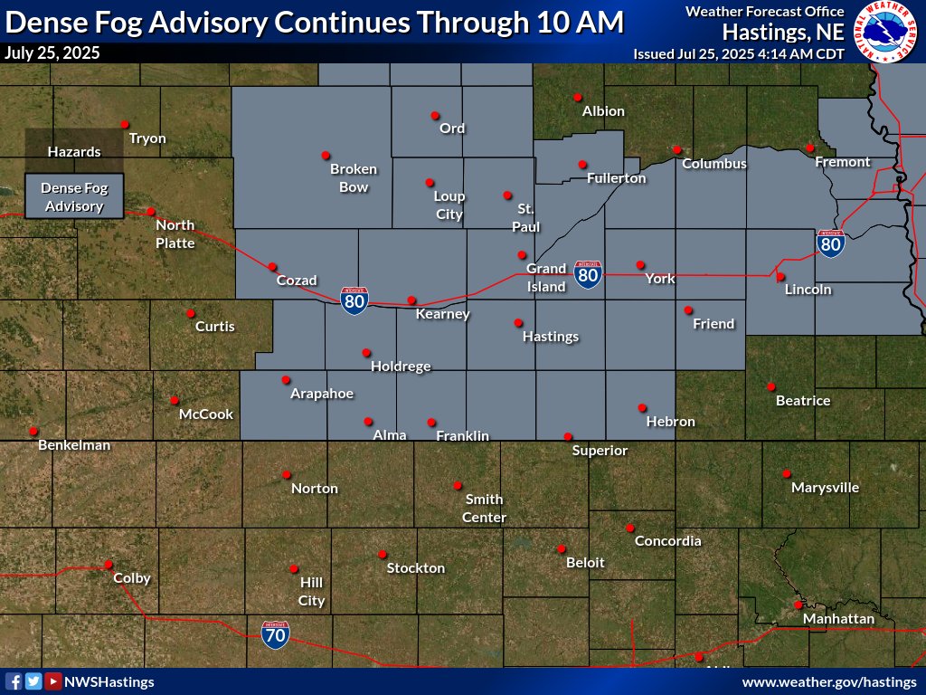
A Dense Fog Advisory has been issued for several counties across south central Nebraska through 10am Saturday. Visibilities have fallen below one mile and are expected to continue to fall through the night. Those needing to travel are encouraged to use caution. #kswx #newx
Scattered storms are possible into the overnight hours across Southeast portions of the area. Patchy to widespread fog is possible overnight into Saturday morning. Heat arrives this weekend into early next week with heat index values over 100 degrees. #NEwx #KSwx
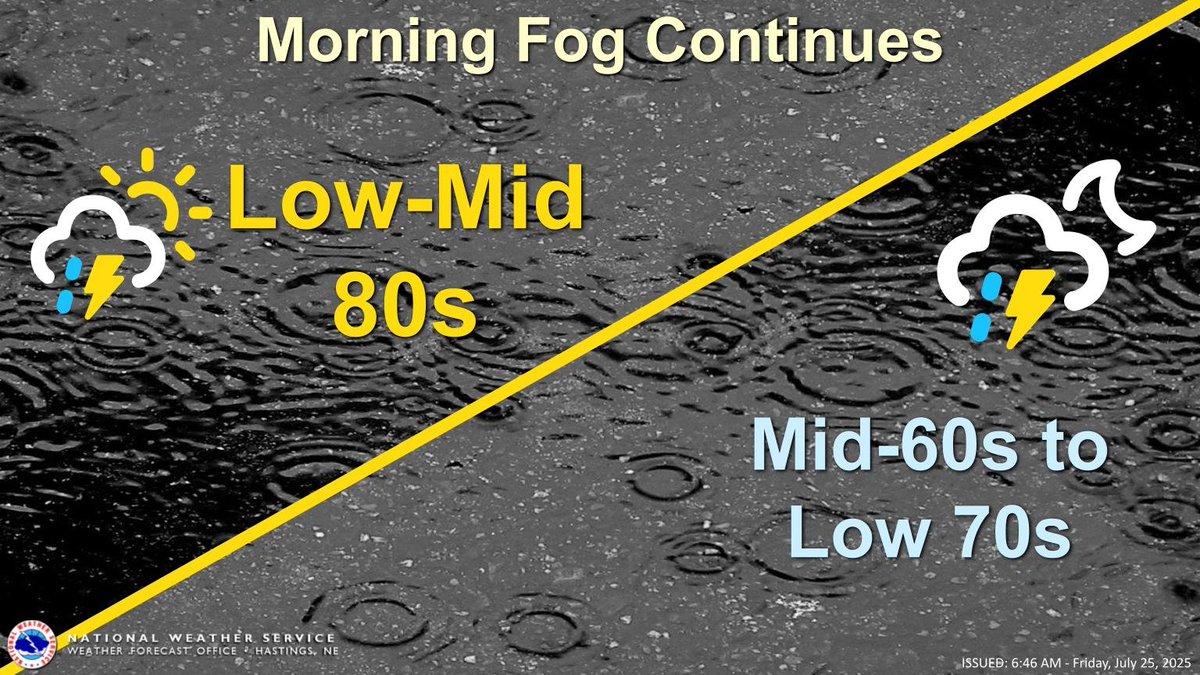
Fog, dense at times, continues across south central Nebraska this morning. Expect significant reductions to visibility. A Dense Fog Advisory remains in effect until 10am. There is a 20-40% chance of showers and storms for the southeastern part of the area. #kswx #newx
The Dense Fog Advisory has been expanded to include the rest of our Nebraska counties. Expect visibilities falling to around or below one quarter mile through mid-morning. Use caution if traveling this morning. #newx
A Dense Fog Advisory has been issued for the counties shaded in gray through 10AM Tuesday. Visibilities at or below one quarter mile will be possible. Use caution if you must travel this morning.
Lows tonight in the 60s and 70s with thunderstorms possible (15-45%) across southeastern portions of the area. Thunderstorm chances continue Friday with highs in the 80s. Hot weather returns by Sunday as heat index values climb over 100 degrees. #NEwx #KSwx

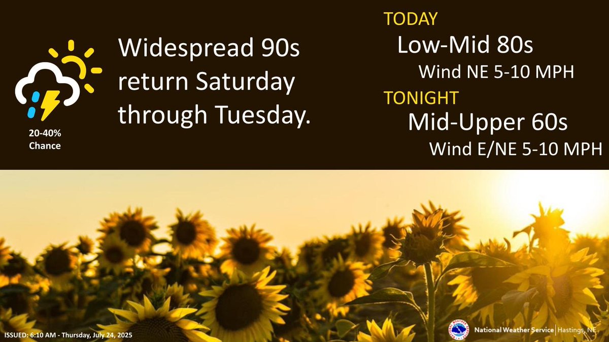
Shower and thunderstorm chances continue today. Expect cooler temps today and tomorrow with highs in the 70s and 80s. The heat returns Saturday through Tuesday, with highs in the 90s to low 100s. #kswx #newx
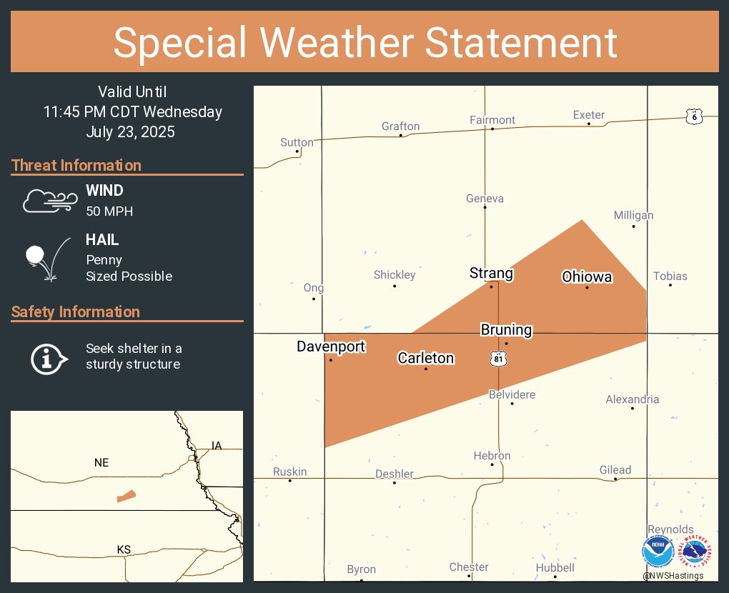
A special weather statement has been issued for Davenport NE, Bruning NE and Ohiowa NE until 11:45 PM CDT
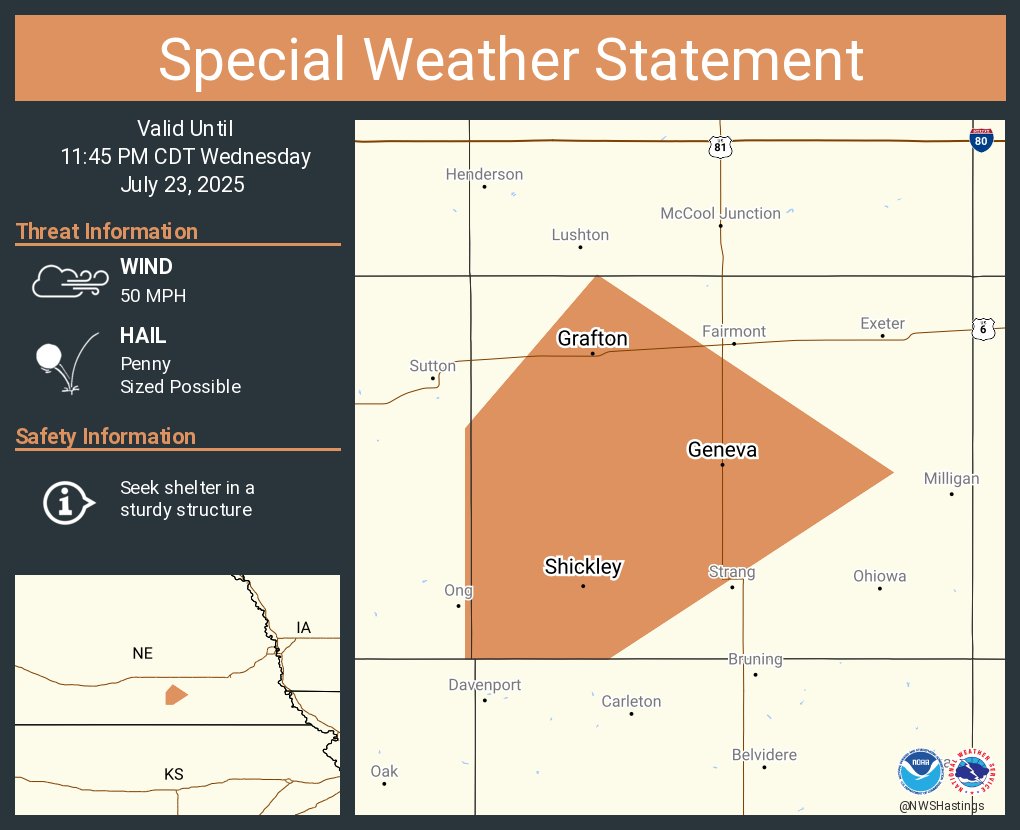
A special weather statement has been issued for Geneva NE, Shickley NE and Grafton NE until 11:45 PM CDT
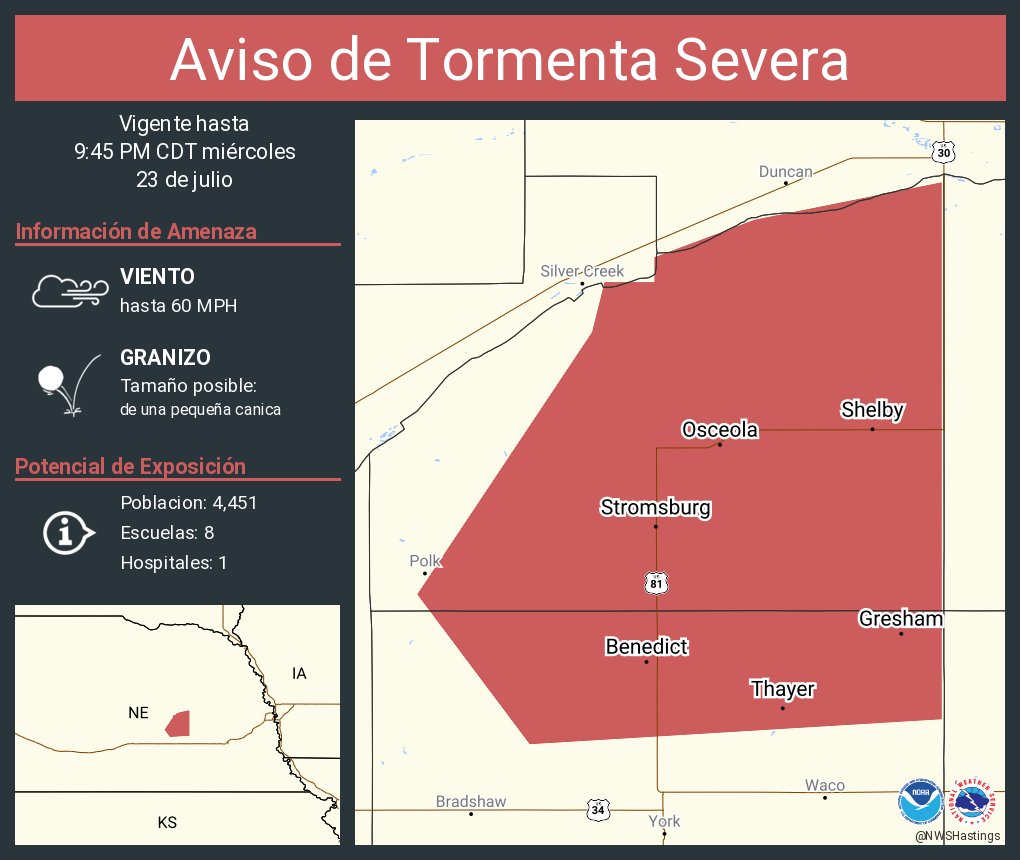
Aviso de Tormenta Severa continúa Stromsburg NE, Osceola NE, Shelby NE hasta las 9:45 PM CDT
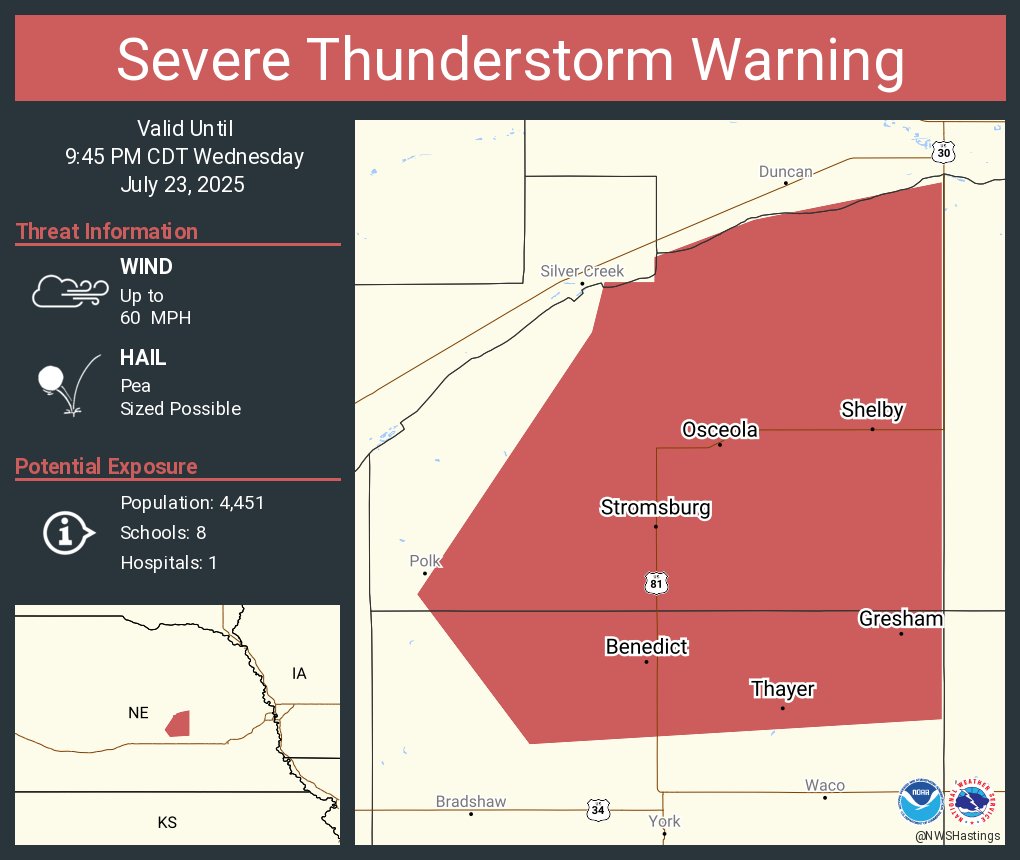
Severe Thunderstorm Warning continues for Stromsburg NE, Osceola NE and Shelby NE until 9:45 PM CDT
Aviso de Tormenta Severa incluye Stromsburg NE, Osceola NE, Shelby NE hasta las 9:45 PM CDT

Severe Thunderstorm Warning including Stromsburg NE, Osceola NE and Shelby NE until 9:45 PM CDT
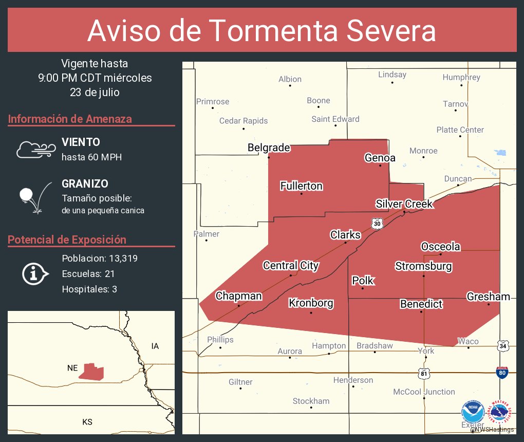
Aviso de Tormenta Severa continúa Central City NE, Fullerton NE, Stromsburg NE hasta las 9:00 PM CDT
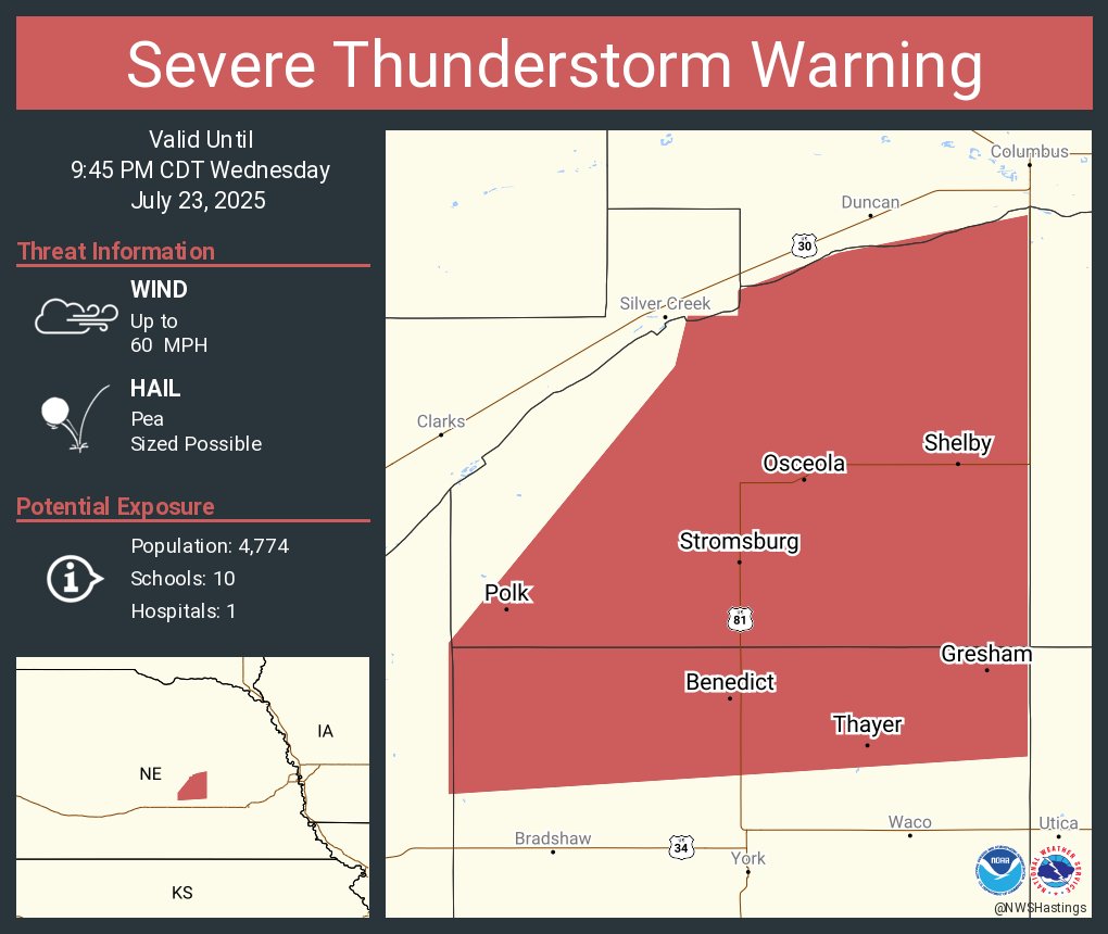
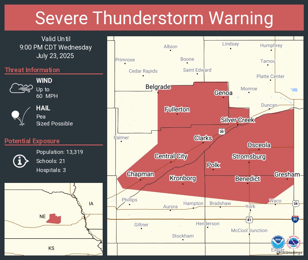
Severe Thunderstorm Warning continues for Central City NE, Fullerton NE and Stromsburg NE until 9:00 PM CDT
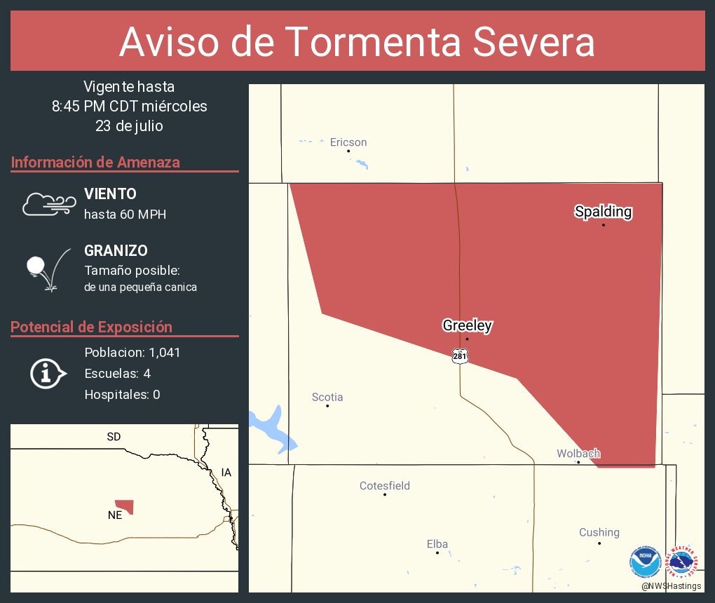
Aviso de Tormenta Severa continúa Spalding NE, Greeley NE hasta las 8:45 PM CDT