NWS Green Bay
@NWSGreenBay
Official X account for the National Weather Service Green Bay. Details: https://www.weather.gov/nws_x
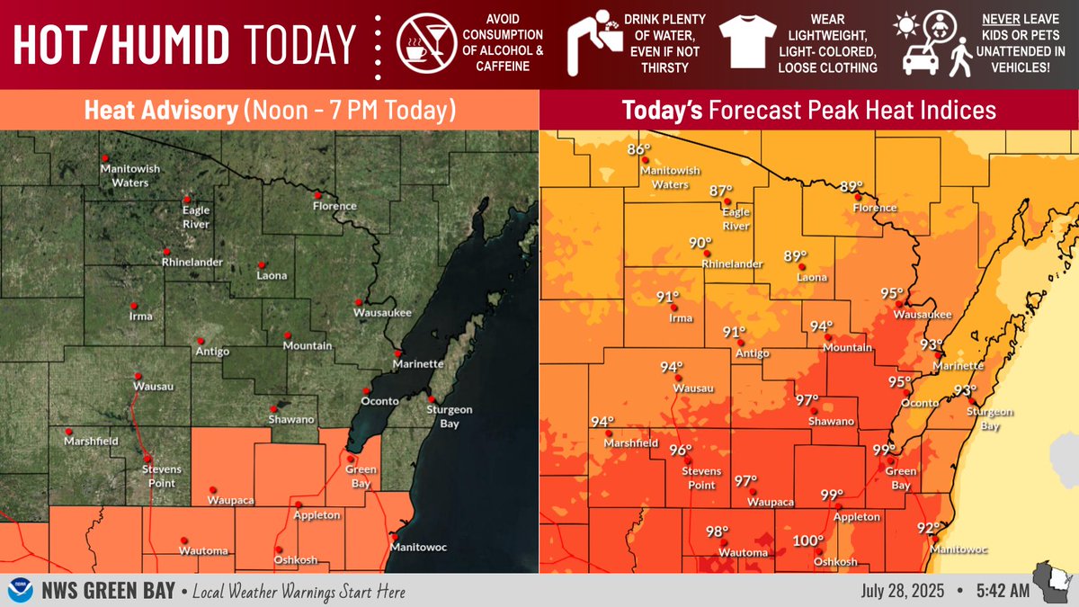
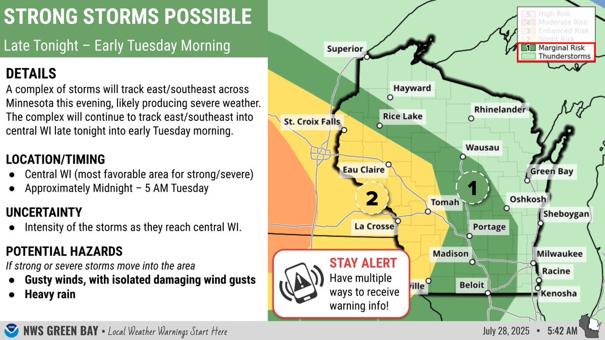
🥵 Another hot & humid day is expected. Heat Advisories are in effect for east-central WI. ⛈️ Overnight, a storm complex will track E/SE from MN into central WI. If the storms maintain their intensity as they enter the area, damaging winds are possible. Stay weather aware! #wiwx
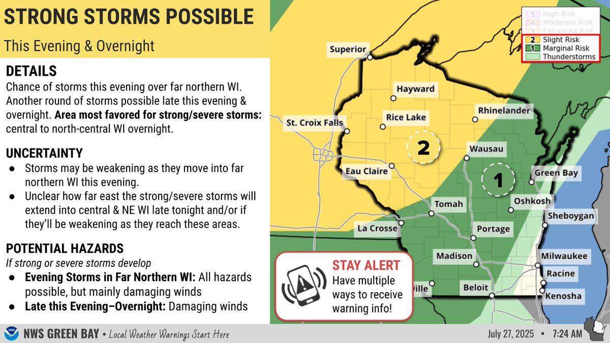
⛈️Strong/severe storms possible this evening across far northern WI & another round possible late this evening-overnight from central to north-central WI. Much uncertainty remains with both storm chances! 🥵Hot & humid today & Mon with heat indices nearing or exceeding 100! #wiwx
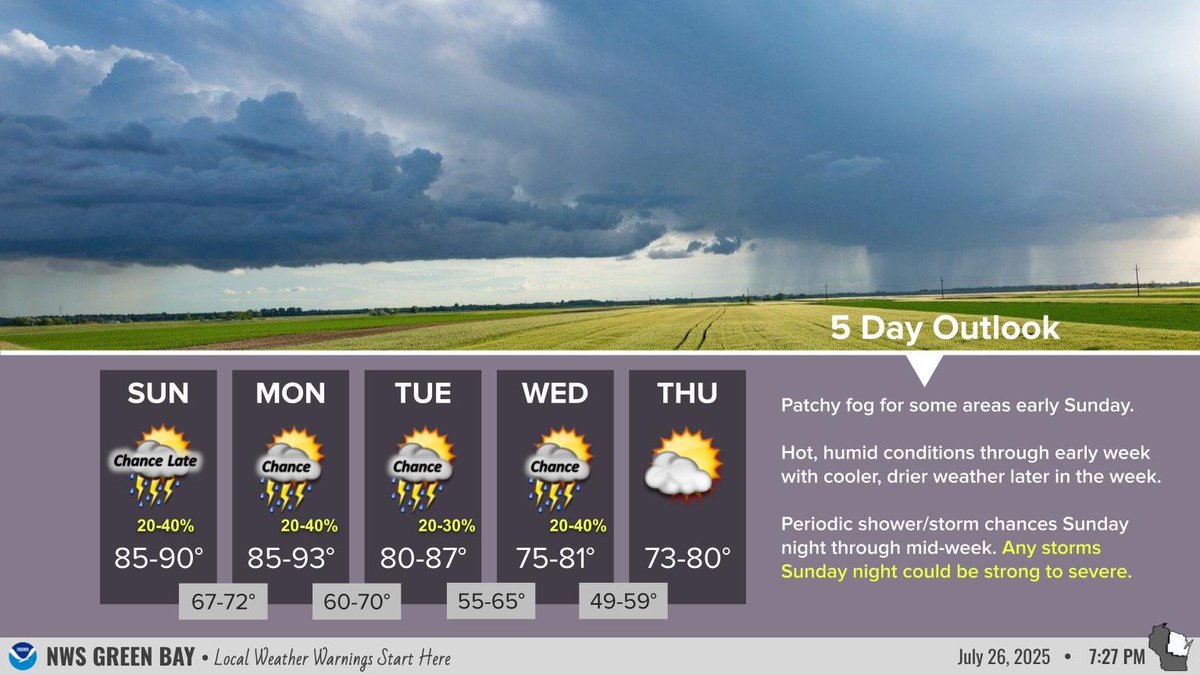
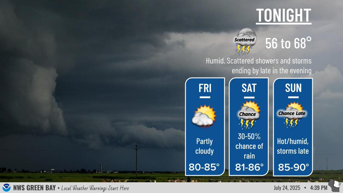
Patchy fog may develop late tonight with hot/humid conditions Sunday/Monday. Low to medium (20-40%) chances of storms Sunday night into mid-week will give way to drier and cooler weather for later in the week. Any storms Sunday night could be strong.
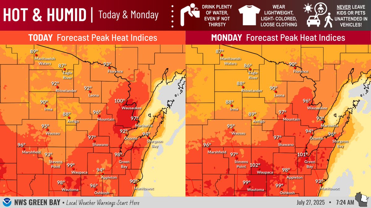
🥵 Hot & humid weather returns Sun & Mon w/heat indices nearing or potentially exceeding 100°! Take the necessary precautions if you have plans to be outside! ⛈️ Sun night is the main focus for any strong/severe potential, but details are uncertain. Monitor for updates! #wiwx
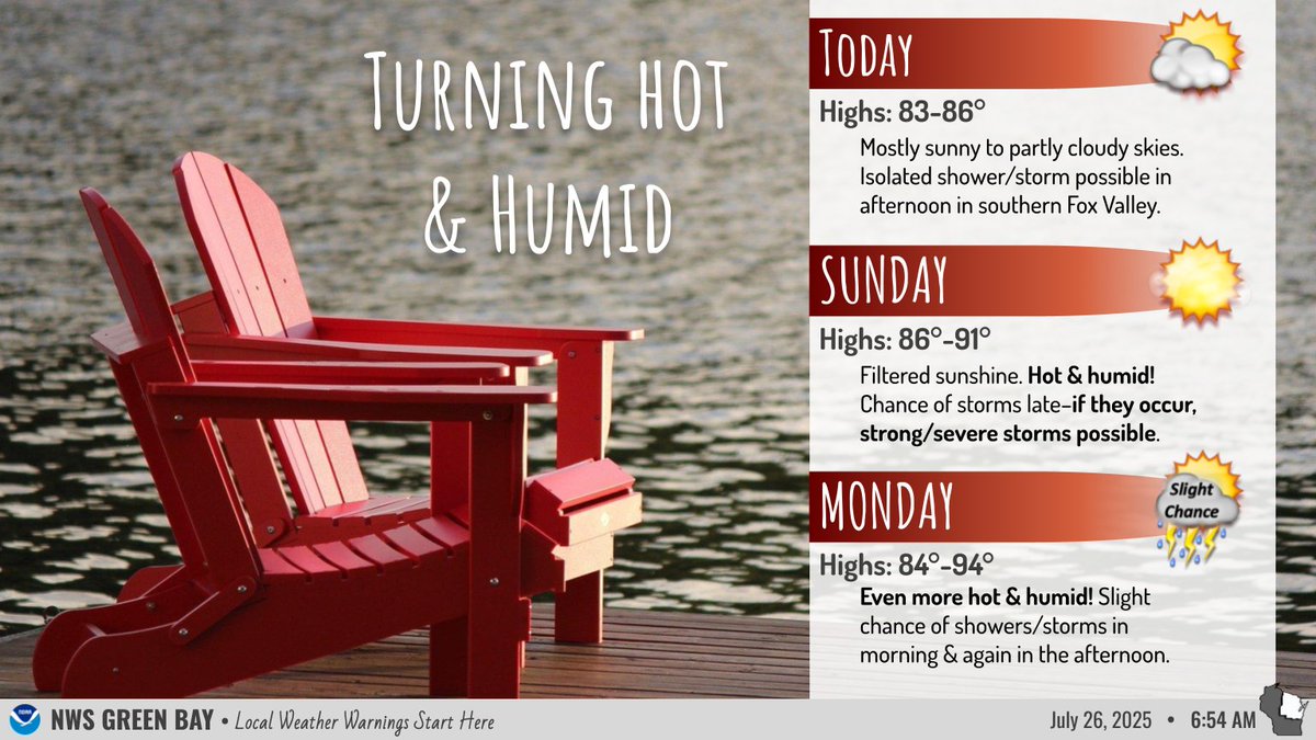

Increasing heat and humidity should be expected this weekend, with heat indices rising into the 90s Sunday afternoon.

Increasing heat and humidity should be expected this weekend, with heat indices rising into the 90s Sunday afternoon.
😶🌫️ Although it will be less humid today, wildfire smoke will spread across the region resulting in poor air quality. ⛈️ Multiple chances for storms through Monday, with the highest chance Sunday night into Monday. 🥵 Hot & humid conditions return Sunday & Monday. #wiwx

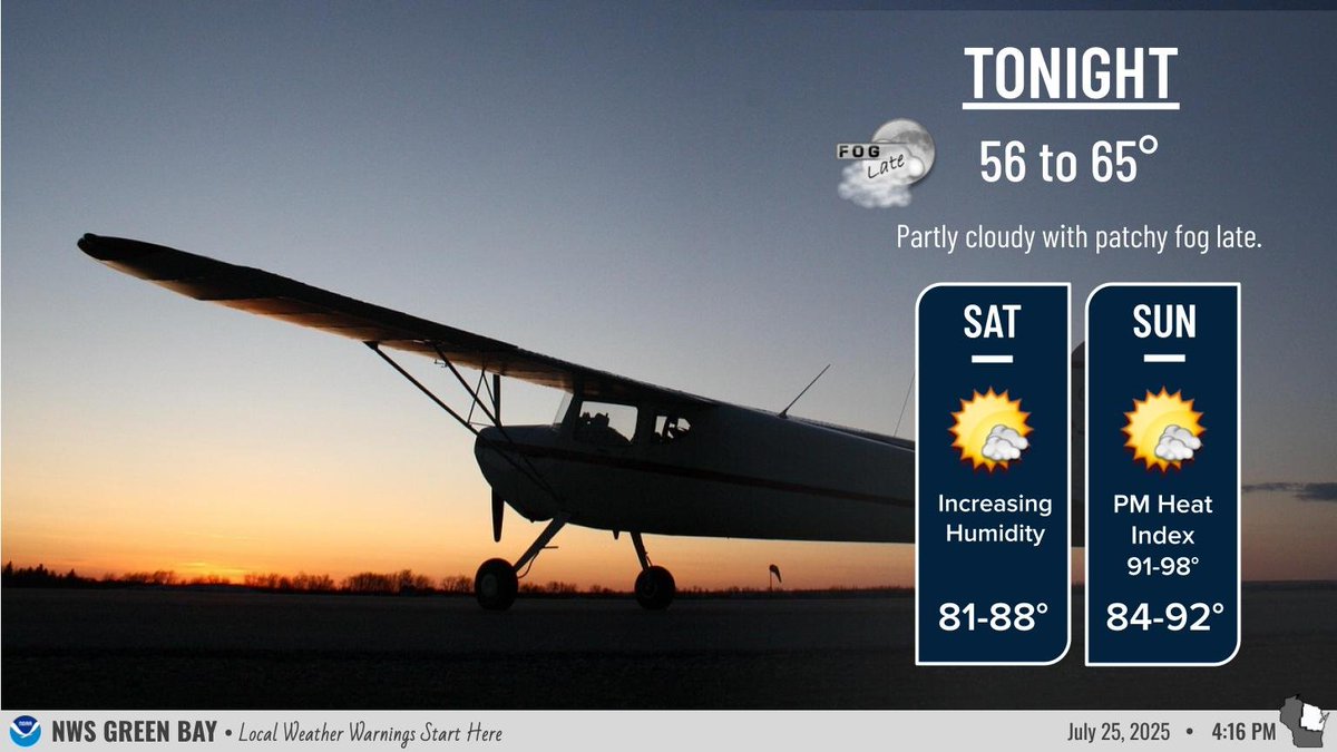
The rest of the night will be quiet. Patchy fog will likely develop after midnight. After a brief reprieve, heat and humidity return on Sunday with mid to upper 90s heat indices and storm chances. #wiwx
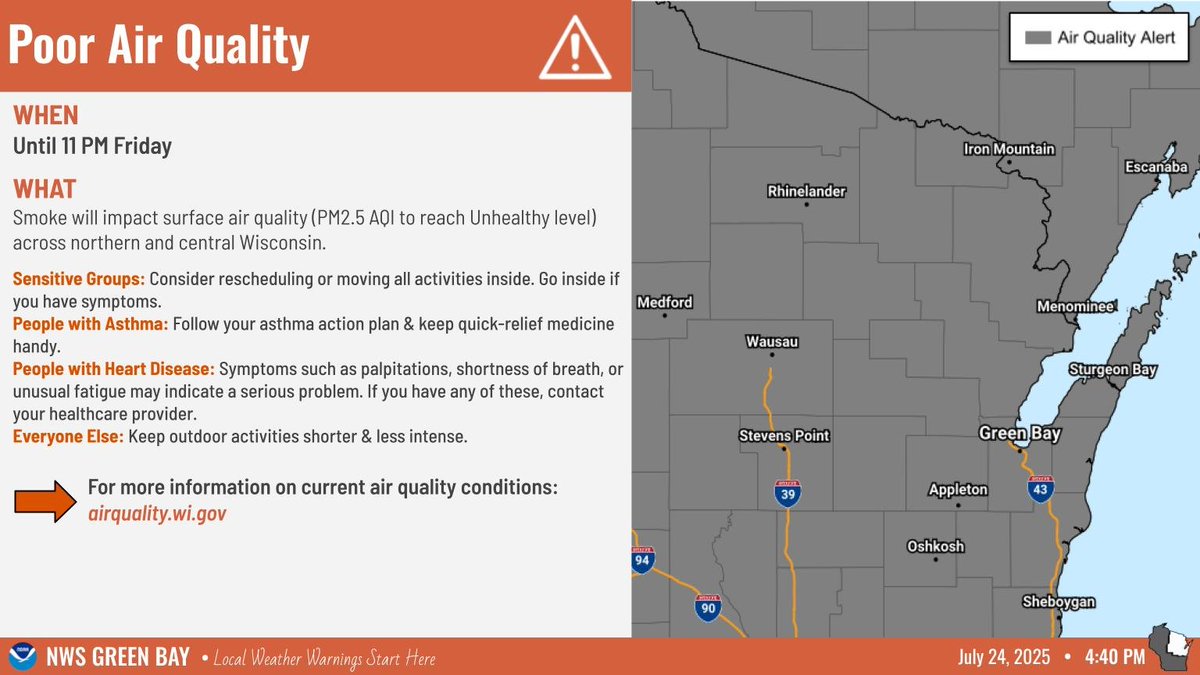
An Air Quality Advisory has been issued until 11 pm Friday, but primarily for Friday due to smoke from fires in Canada becoming surface based and causing some air quality concerns for sensitive groups. #wiwx
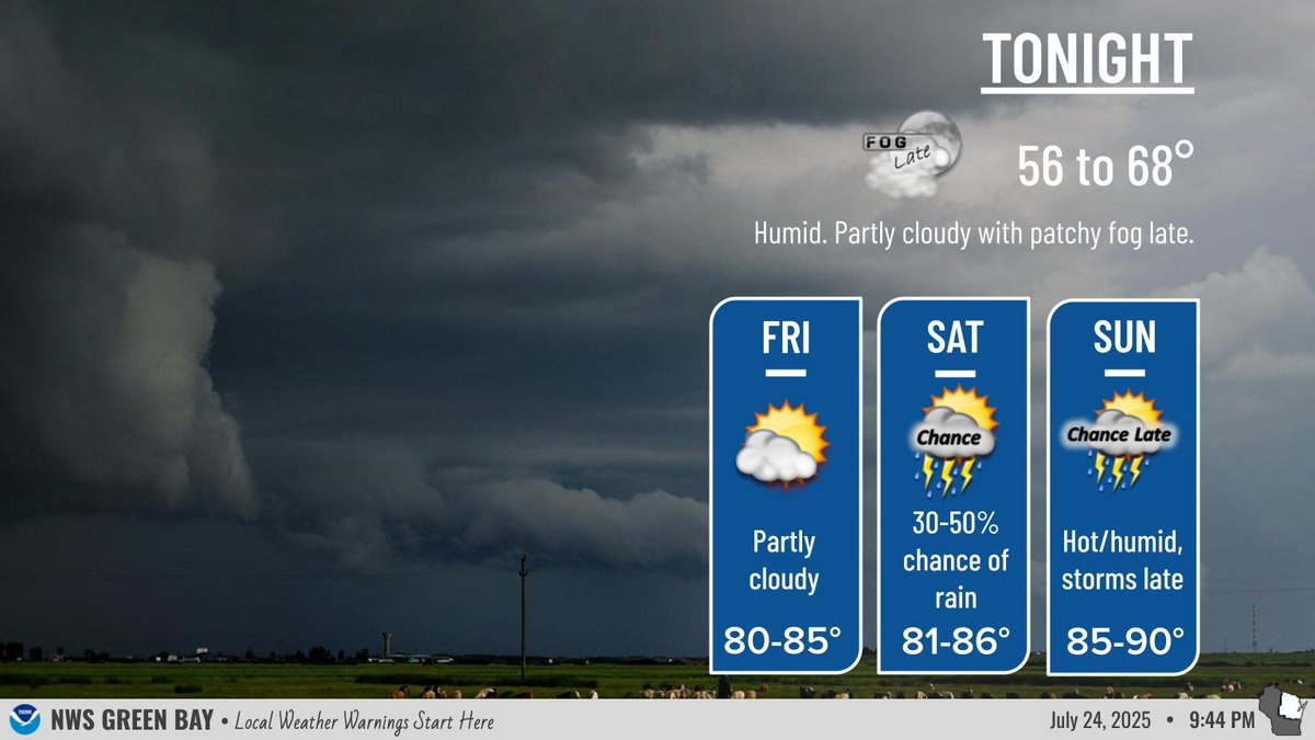
Expect scattered thunderstorms (50-60% chance) over central and northeast Wisconsin through the early evening. Activity should diminish for most by midnight. After a brief reprieve, heat and humidity return on Sunday with mid to upper 90s heat indices and storm chances. #wiwx
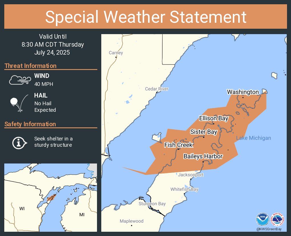
A special weather statement has been issued for Sister Bay WI, Ephraim WI and Baileys Harbor WI until 8:30 AM CDT
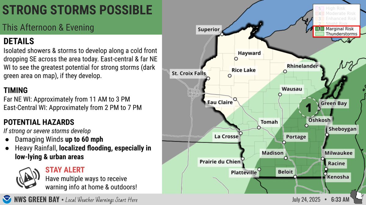
Isolated showers & storms are expected throughout the day, but there will be a period this afternoon/evening when a few of the storms may become strong & produce damaging winds & heavy rainfall, mainly in east-central & far NE WI. Have multiple ways to receive warning info! #wiwx
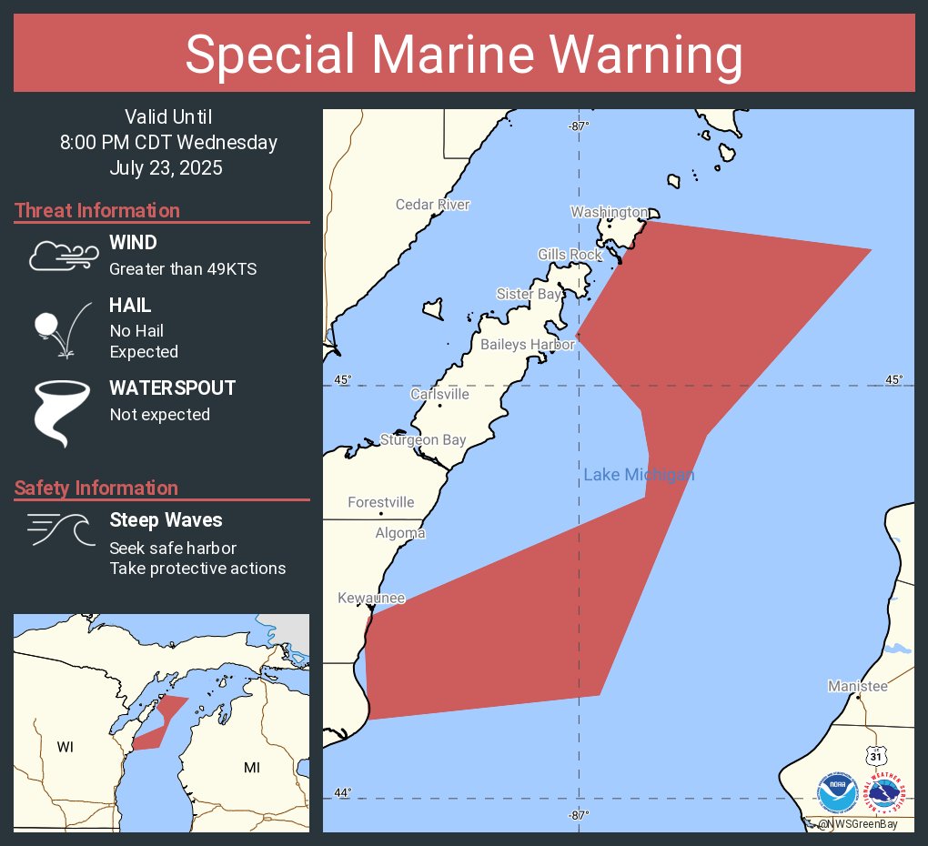
Special Marine Warning continues for the Lake Michigan from Sturgeon Bay to Two Rivers WI 5NM offshore to Mid Lake, Lake Michigan from Rock Island Passage to Sturgeon Bay WI 5NM offshore to mid lake and Rock Island Passage to Sturgeon Bay WI until 8:00 PM CDT
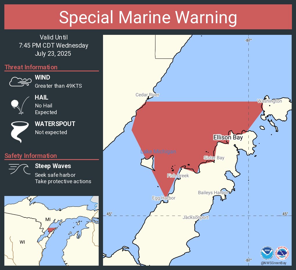
Special Marine Warning including the Green Bay south of line from Cedar River to Rock Island Passage and north of a line from Oconto WI to Little Sturgeon Bay WI until 7:45 PM CDT
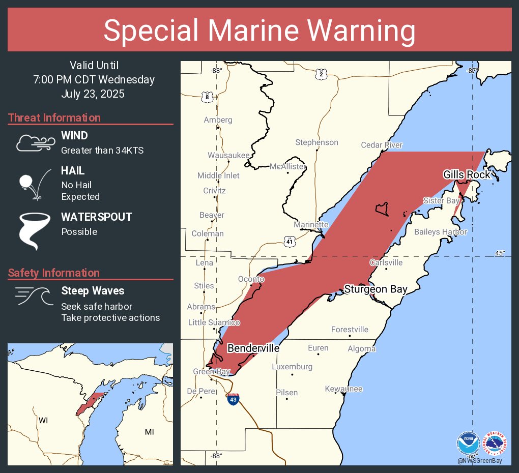
Special Marine Warning continues for the Green Bay south of line from Cedar River to Rock Island Passage and north of a line from Oconto WI to Little Sturgeon Bay WI and Rock Island Passage to Sturgeon Bay WI until 7:00 PM CDT

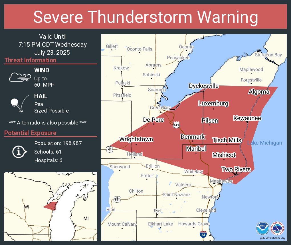
Severe Thunderstorm Warning including De Pere WI, Bellevue WI and Allouez WI until 7:15 PM CDT
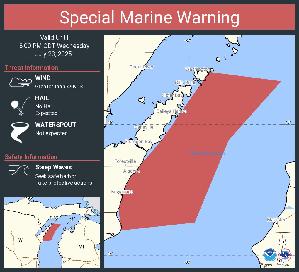
Special Marine Warning including the Lake Michigan from Sturgeon Bay to Two Rivers WI 5NM offshore to Mid Lake, Lake Michigan from Rock Island Passage to Sturgeon Bay WI 5NM offshore to mid lake and Rock Island Passage to Sturgeon Bay WI until 8:00 PM CDT
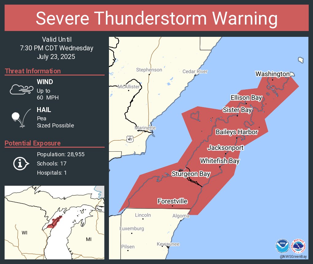
Severe Thunderstorm Warning including Sturgeon Bay WI, Sister Bay WI and Forestville WI until 7:30 PM CDT
Special Marine Warning continues for the Green Bay south of line from Cedar River to Rock Island Passage and north of a line from Oconto WI to Little Sturgeon Bay WI and Rock Island Passage to Sturgeon Bay WI until 7:00 PM CDT
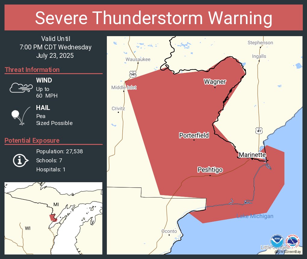
Severe Thunderstorm Warning including Marinette WI, Peshtigo WI and Porterfield WI until 7:00 PM CDT