
NWS Grand Rapids
@NWSGrandRapids
Official Twitter account for the National Weather Service Grand Rapids, Michigan. Details: http://weather.gov/nws_x
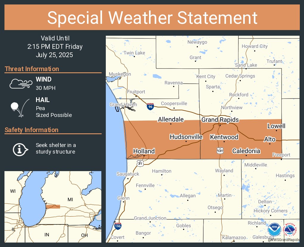
A special weather statement has been issued for Grand Rapids MI, Wyoming MI and Kentwood MI until 2:15 PM EDT
Take a look at the forecast for the beach this weekend. The swim risk threat looks low, outside of thunderstorms that could pop up. #wmiwx

A special weather statement has been issued for Lake County, MI until 12:00 AM EDT

Strong to Severe Storms are moving through central Lower Michigan this evening, including southern Jackson County. Let us know if you see any severe weather.

Severe Thunderstorm Warning including Jackson MI, Vandercook Lake MI and Michigan Center MI until 8:15 PM EDT

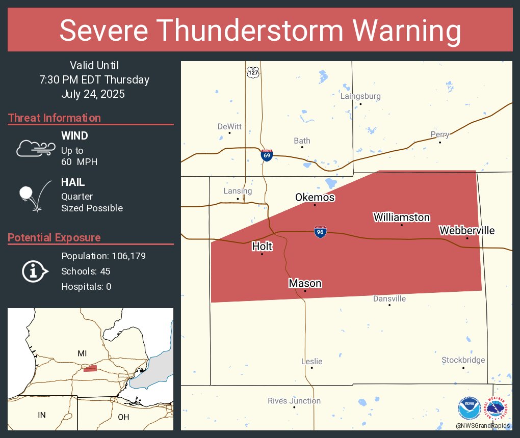
Strong to Severe Storms are moving through central Lower Michigan this evening, including the Holt and Lansing areas. Let us know if you see any severe weather.

Severe Thunderstorm Warning including Holt MI, Okemos MI and Mason MI until 7:30 PM EDT
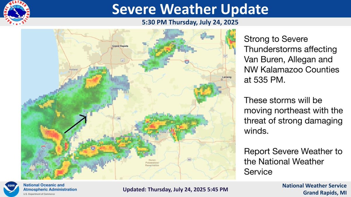
Strong to Severe Storms are moving through southwest Lower Michigan this evening. Let us know if you see any severe weather.
Severe Thunderstorm Warning including Kalamazoo MI, Westwood MI and Eastwood MI until 6:30 PM EDT

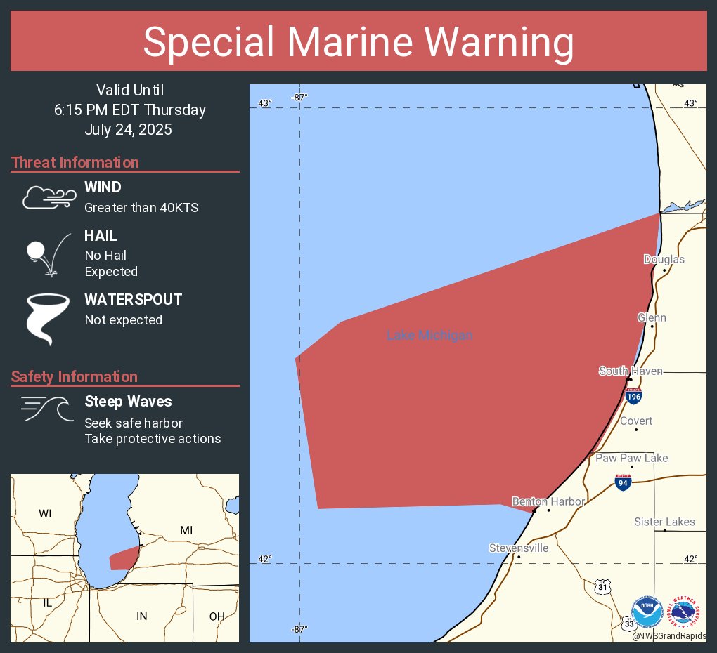
Special Marine Warning continues for the Lake Michigan from South Haven to Holland MI 5NM offshore to Mid lake, Lake Michigan from St Joseph to South Haven MI 5NM offshore to Mid Lake, St Joseph to South Haven MI and South Haven to Holland MI until 6:15 PM EDT

Severe Thunderstorm Warning including South Haven MI, Paw Paw MI and Hartford MI until 6:00 PM EDT

A special weather statement has been issued for Saint Johns MI, Ovid MI and Elsie MI until 5:15 PM EDT

Special Marine Warning continues for the Lake Michigan from South Haven to Holland MI 5NM offshore to Mid lake, Lake Michigan from St Joseph to South Haven MI 5NM offshore to Mid Lake, St Joseph to South Haven MI and South Haven to Holland MI until 6:15 PM EDT

Special Marine Warning including the Lake Michigan from South Haven to Holland MI 5NM offshore to Mid lake, Lake Michigan from St Joseph to South Haven MI 5NM offshore to Mid Lake, St Joseph to South Haven MI and South Haven to Holland MI until 6:15 PM EDT
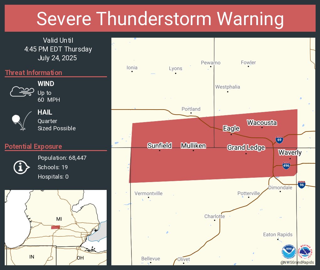
Severe Thunderstorm Warning including Waverly MI, Grand Ledge MI and Wacousta MI until 4:45 PM EDT
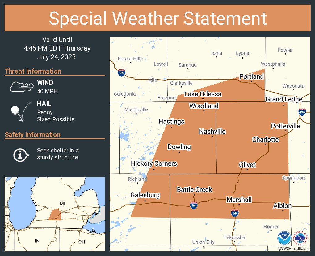
A special weather statement has been issued for Battle Creek MI, Charlotte MI and Albion MI until 4:45 PM EDT
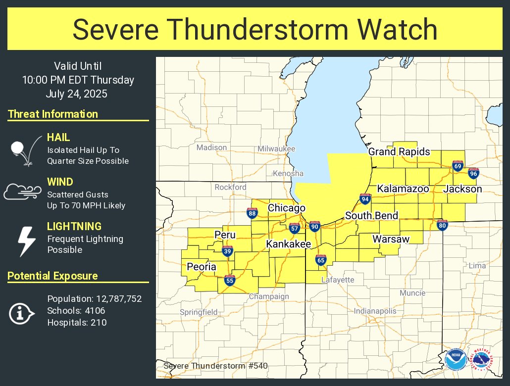
A severe thunderstorm watch has been issued for parts of Illinois, Indiana and Michigan until 10 PM EDT
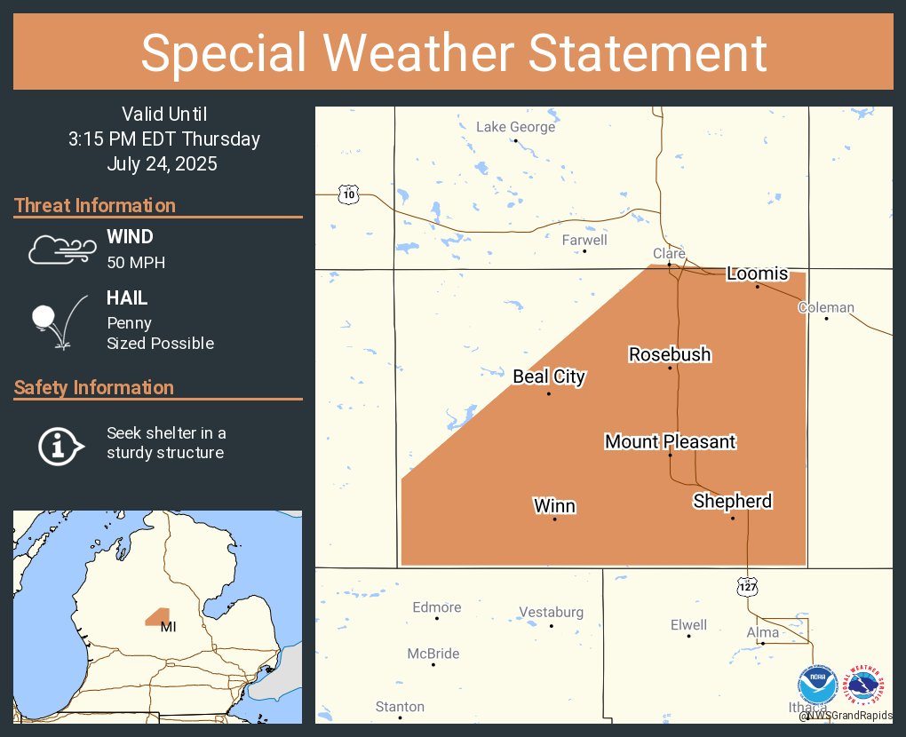
A special weather statement has been issued for Mount Pleasant MI, Shepherd MI and Rosebush MI until 3:15 PM EDT
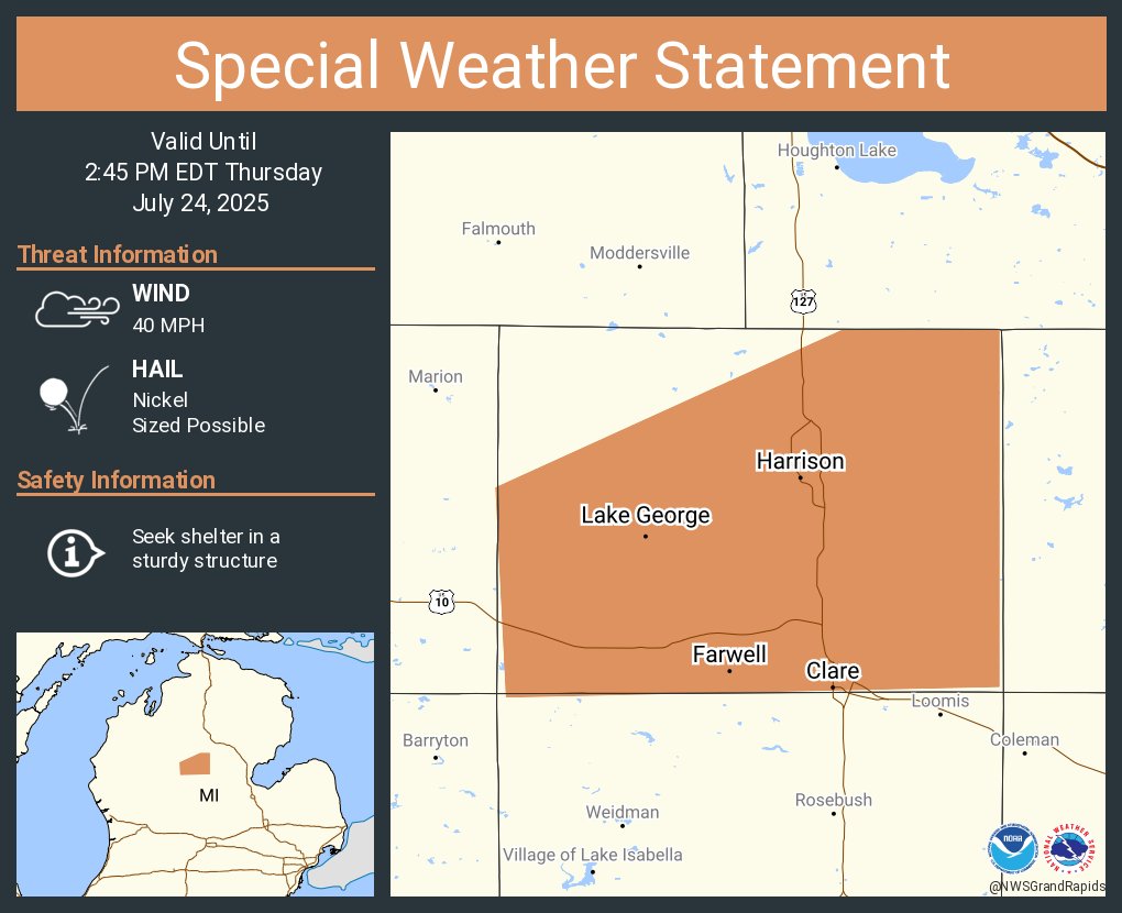
A special weather statement has been issued for Clare MI, Harrison MI and Farwell MI until 2:45 PM EDT
Storms will fire this p.m.. with 2pm to 9pm is the main threat time frame. Some storms may reach severe levels with damaging winds being the main threat. Torrential rain is also possible which could bring on short duration flooding due to a tropical airmass. #wmiwx
