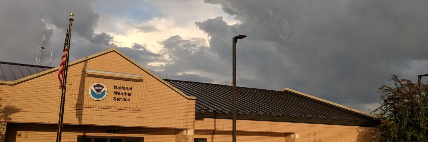
NWS Grand Forks
@NWSGrandForks
Official Twitter account for the National Weather Service Grand Forks. Details: http://weather.gov/nws_x
Severe t-storms are possible overnight. The primary hazards include hail up to the size of ping pong balls and damaging wind gusts to 60 mph. An isolated tornado cannot be ruled out. #NDwx #MNwx

Severe t-storms are possible starting this afternoon, with better chances this evening and overnight. The primary hazards include hail up to the size of ping pong balls and damaging wind gusts to 60 mph. An isolated tornado cannot be ruled out. #NDwx #MNwx

A special weather statement has been issued for Beltrami MN, Nielsville MN and Greenview MN until 4:15 PM CDT

A special weather statement has been issued for Grandin ND and Gardner ND until 2:45 PM CDT

There is a 1 of 5 risk for severe thunderstorms Friday afternoon and evening. Hazards could include hail up to 1 inch in diameter, as well as wind gusts to 60 mph. #NDwx #MNwx

There is a level 1 out of 5 marginal risk for severe thunderstorms across parts of eastern North Dakota and northwest Minnesota Friday afternoon and evening. Hazards could include hail up to 1 inch and wind gusts to 60 mph along with frequent lightning. #NDwx #MNwx

There is a 1 of 5 risk for severe thunderstorms across parts of eastern North Dakota and northwest Minnesota Friday afternoon and evening. Hazards could include hail up to 1 inch in diameter and wind gusts to 60 mph. #NDwx #MNwx

Strong to severe thunderstorms are possible today in portions of west central Minnesota late this morning through early afternoon. Today's strongest storms could produce large hail, damaging wind gusts, and an isolated tornado. #NDwx #MNwx

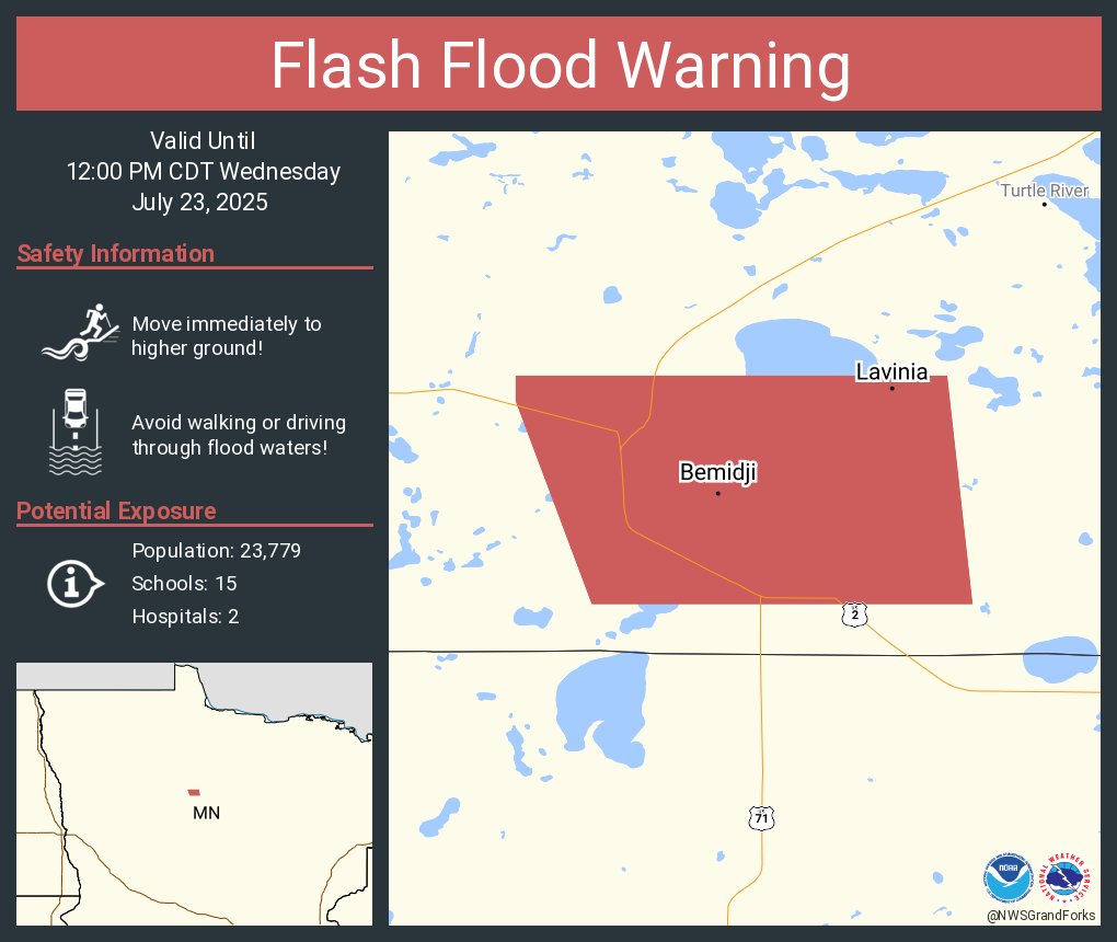
Flash Flood Warning including Bemidji MN and Lavinia MN until 12:00 PM CDT
Severe Thunderstorm Warning including Norcross MN until 8:30 PM CDT

Severe thunderstorms this evening into the overnight. All severe hazards will be possible, including tornadoes, hail up to 2 inches in size and winds to 70 mph. Make sure to stay weather aware today, and have multiple ways to receive watches and warnings. #NDwx #MNwx

A special weather statement has been issued for Wadena MN, New York Mills MN and Henning MN until 1:15 PM CDT

A special weather statement has been issued for Elbow Lake MN, Ashby MN and Dalton MN until 5:45 AM CDT

Severe thunderstorms are forecasted late today into tonight. All severe hazards will be possible, including tornadoes, hail up to 2 inches in size and winds to 70 mph. Make sure to stay weather aware today, and have multiple ways to recieve watches and warnings. #NDwx #MNwx

A severe thunderstorm watch has been issued for parts of Minnesota, North Dakota and South Dakota until 5 AM CDT

Isolated to scattered severe t-storms are possible Tuesday afternoon through the overnight hours. Hazards could include damaging wind gusts to 70 mph, hail up to 2 inches in diameter, and possibly a few tornadoes. #NDwx #MNwx

Another round of severe t-storms is possible Tuesday afternoon through the overnight hours. Hazards could include damaging wind gusts to 70 mph, hail up to 2 inches in diameter, and possibly a few tornadoes. #NDwx #MNwx

A special weather statement has been issued for Fergus Falls MN, Elbow Lake MN and Hoffman MN until 5:30 AM CDT

Severe Thunderstorm Warning including Wahpeton ND, Breckenridge MN and Hankinson ND until 5:15 AM CDT

A special weather statement has been issued for Lisbon ND, Hankinson ND and Gwinner ND until 4:30 AM CDT
