NWS Detroit
@NWSDetroit
Official Twitter account for the National Weather Service Detroit/Pontiac. Details: https://www.weather.gov/nws_x
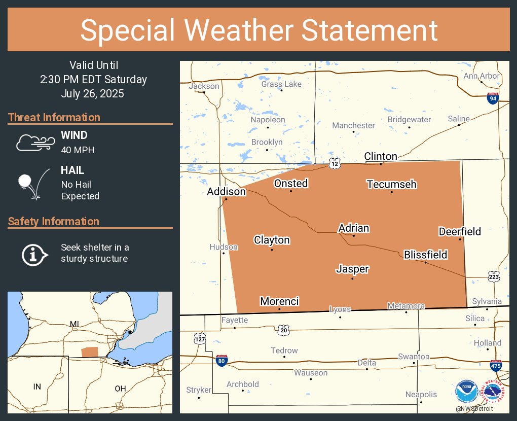
A special weather statement has been issued for Adrian MI, Tecumseh MI and Blissfield MI until 2:30 PM EDT
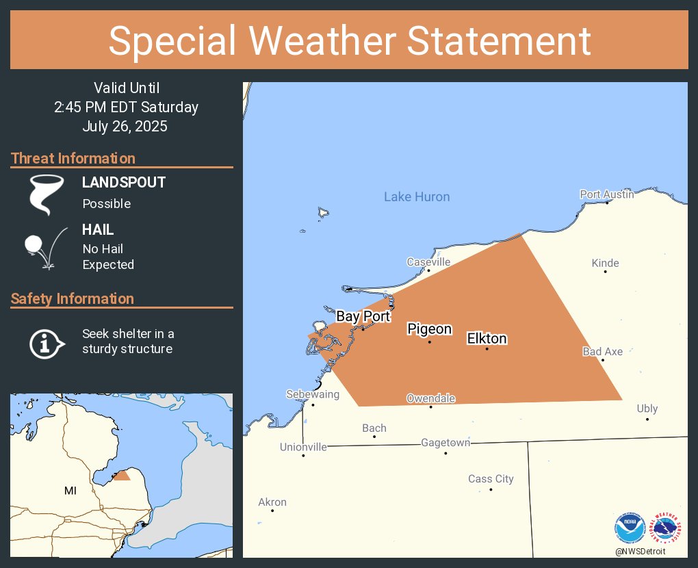
A special weather statement has been issued for Pigeon MI, Elkton MI and Bay Port MI until 2:45 PM EDT
Isolated severe thunderstorms and a slight risk of excessive rainfall are possible today. #miwx

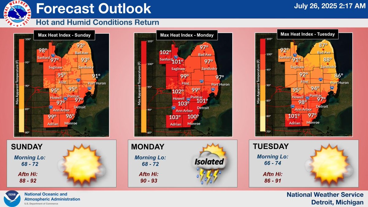
Hot and humid conditions will return Sunday and persist into Tuesday. Cooler air will begin to arrive from the north Tuesday into Wednesday. #miwx
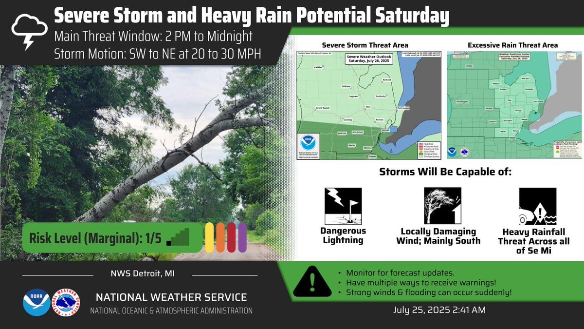
There is a slight chance for severe weather and heavy rain on Saturday. #miwx
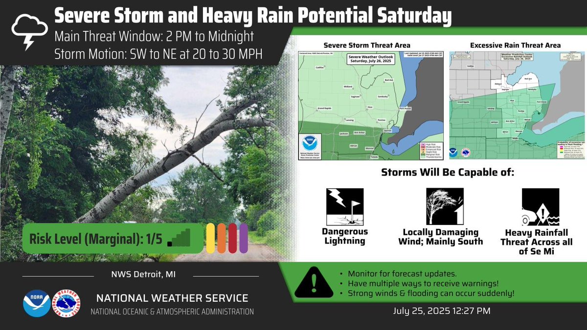
There is a slight chance for severe weather and heavy rain on Saturday. #miwx

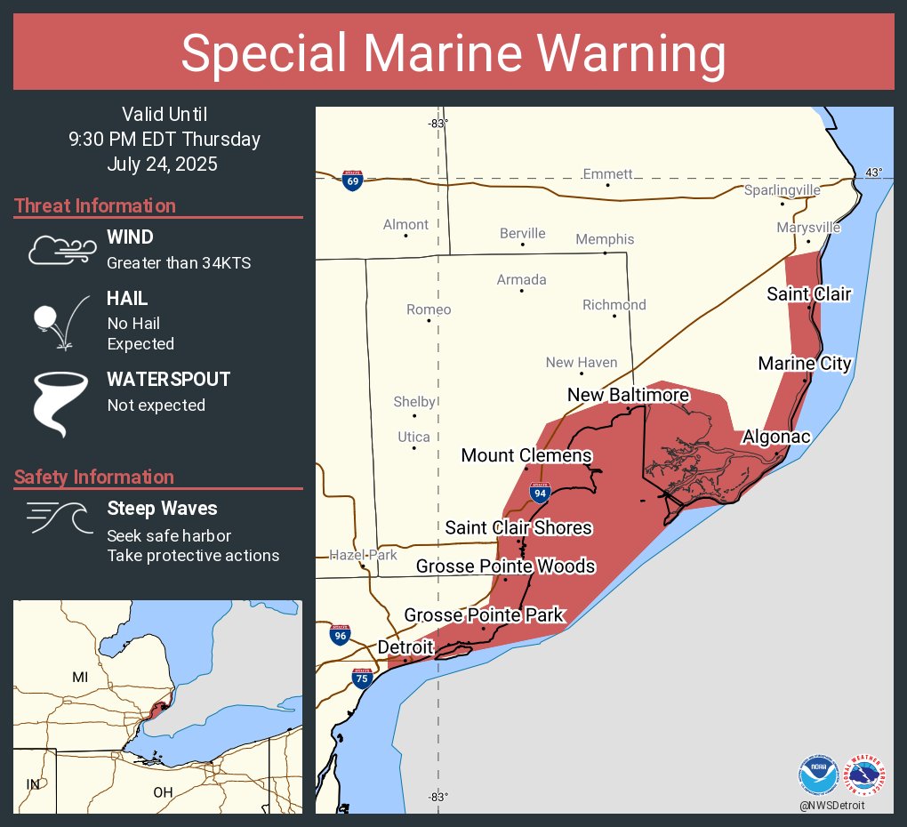
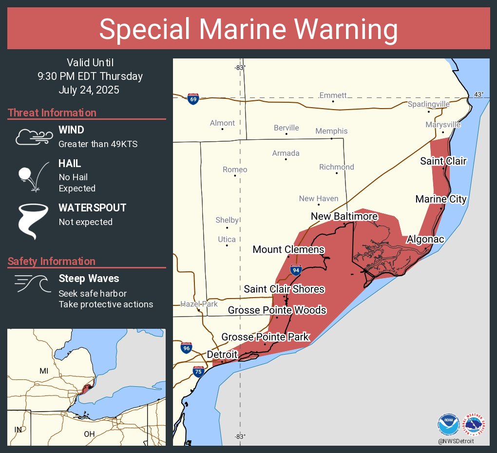
Special Marine Warning continues for the Lake St. Clair Open Lake (U.S. Portion) and St. Clair River until 9:30 PM EDT
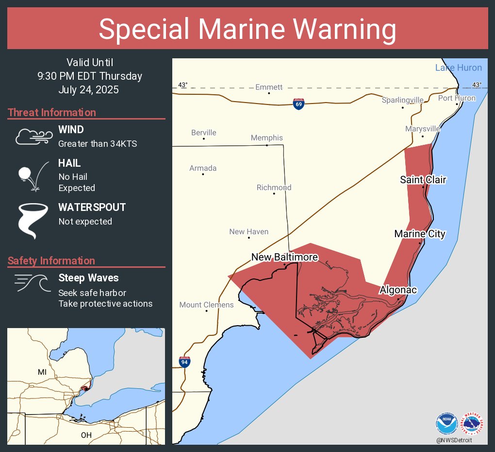
Special Marine Warning continues for the Lake St. Clair Open Lake (U.S. Portion), Detroit River and St. Clair River until 9:30 PM EDT
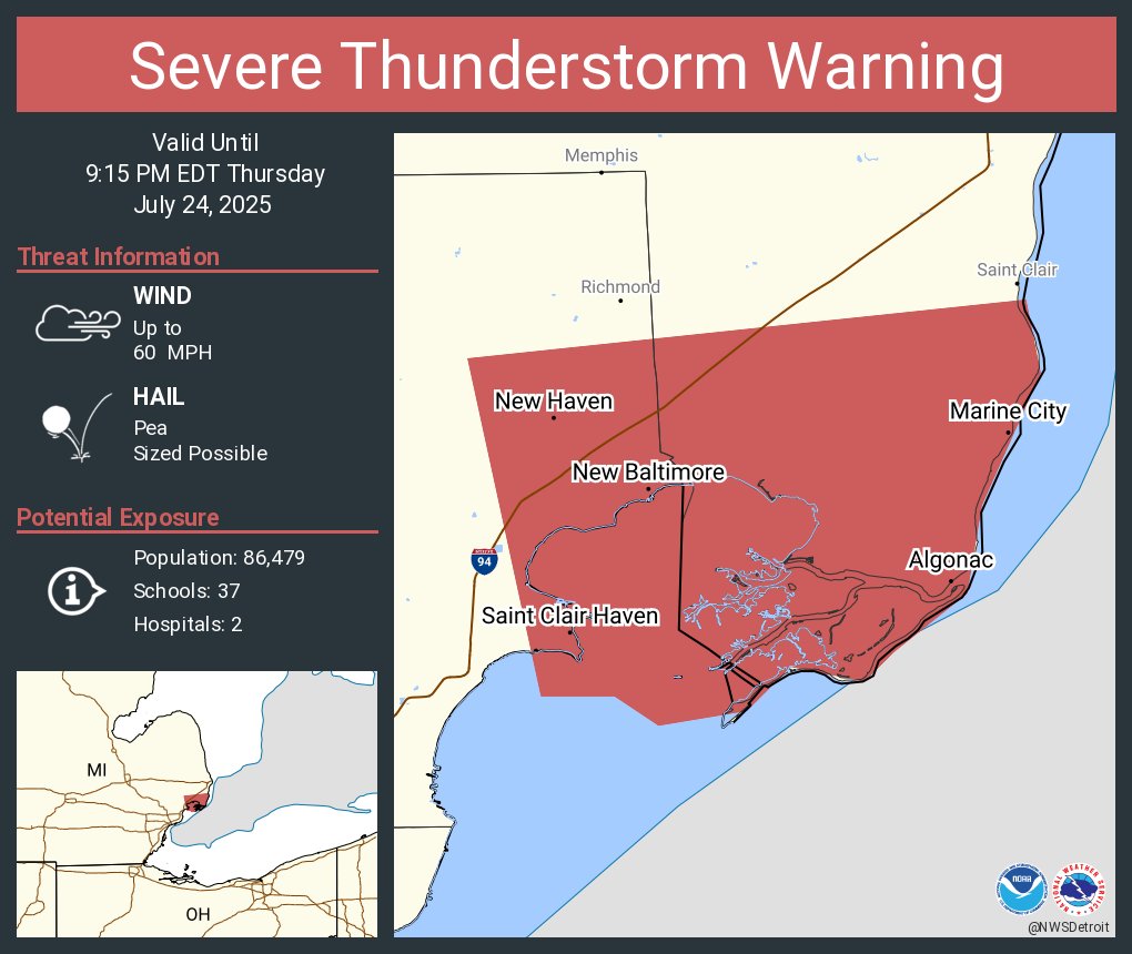
Severe Thunderstorm Warning including New Baltimore MI, New Haven MI and Marine City MI until 9:15 PM EDT
Special Marine Warning including the Lake St. Clair Open Lake (U.S. Portion), Detroit River and St. Clair River until 9:30 PM EDT
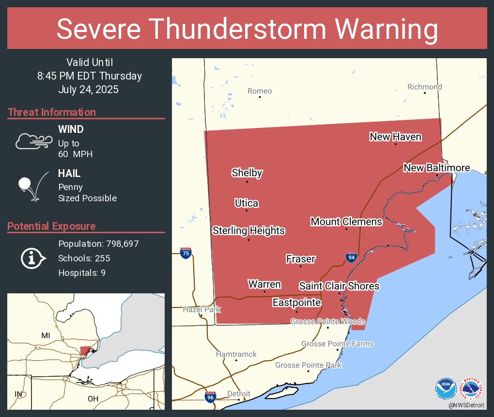
Severe Thunderstorm Warning including Warren MI, Sterling Heights MI and Saint Clair Shores MI until 8:45 PM EDT
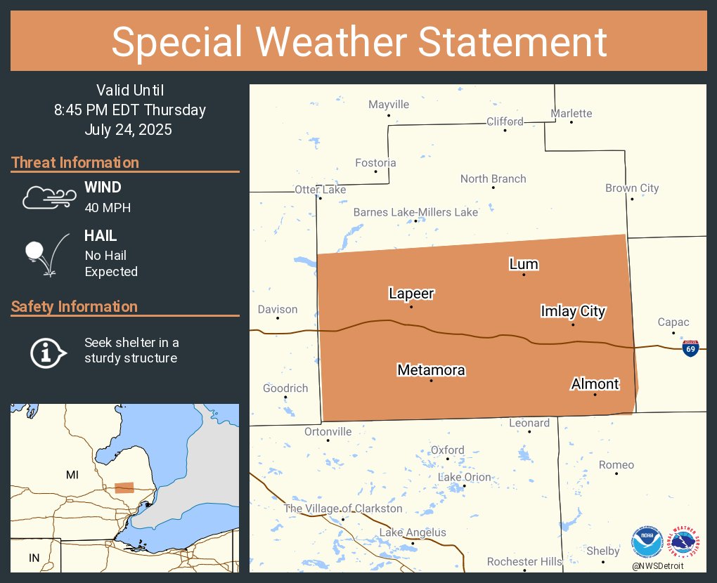
A special weather statement has been issued for Lapeer MI, Imlay City MI and Almont MI until 8:45 PM EDT
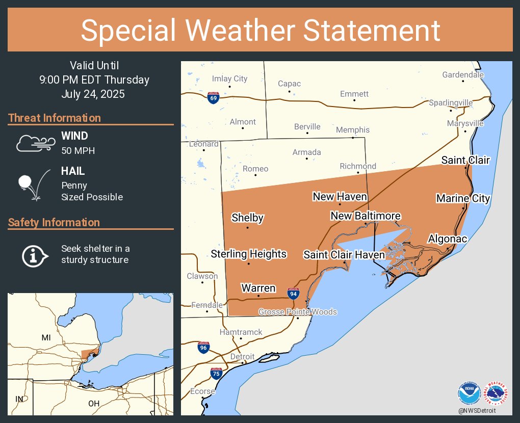
A special weather statement has been issued for Warren MI, Sterling Heights MI and Saint Clair Shores MI until 9:00 PM EDT
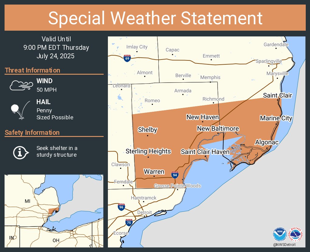
A special weather statement has been issued for Warren MI, Sterling Heights MI and Saint Clair Shores MI until 9:00 PM EDT

A special weather statement has been issued for Warren MI, Sterling Heights MI and Saint Clair Shores MI until 9:00 PM EDT
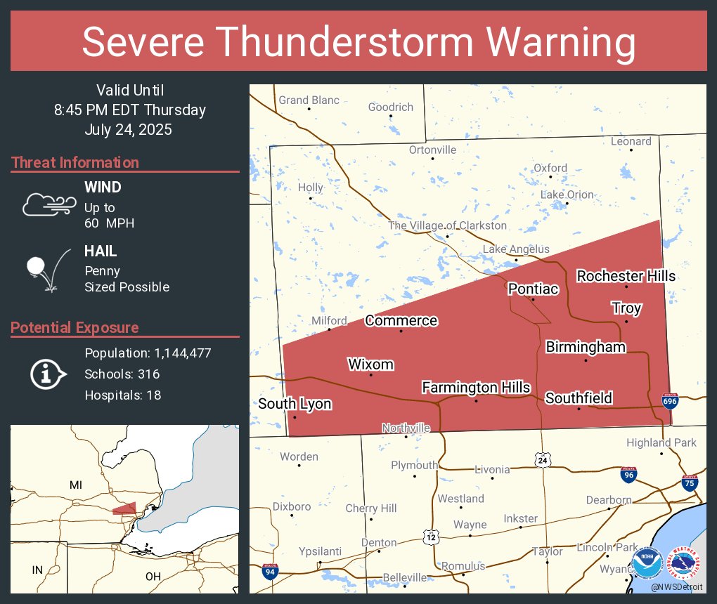
Severe Thunderstorm Warning including Troy MI, Farmington Hills MI and Southfield MI until 8:45 PM EDT
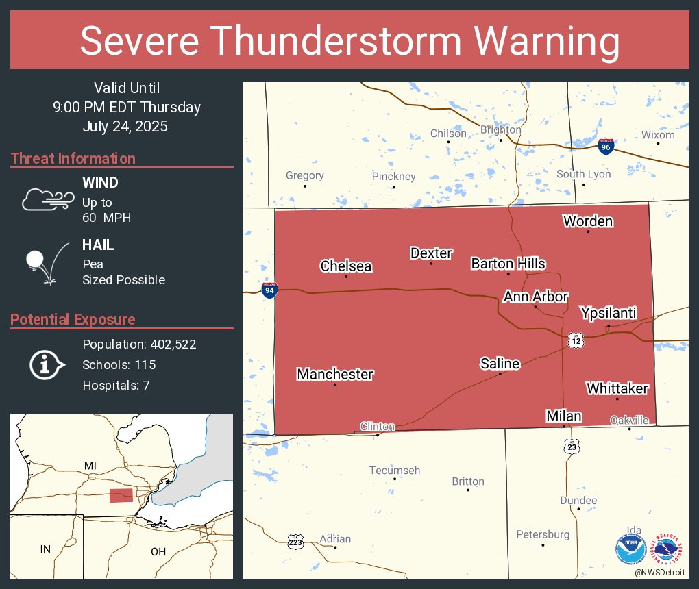
Severe Thunderstorm Warning including Ann Arbor MI, Ypsilanti MI and Saline MI until 9:00 PM EDT
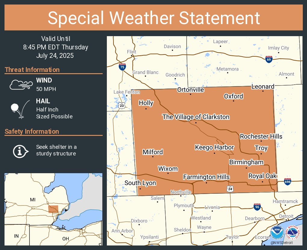
A special weather statement has been issued for Troy MI, Farmington Hills MI and Southfield MI until 8:45 PM EDT
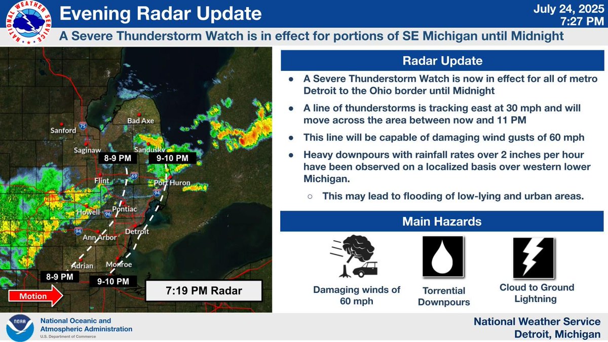
A Severe Thunderstorm Watch is now in effect for portions of SE Michigan. Wind gusts to 60 mph will be possible as a line of storms tracks through the area at ~35 mph between now and 11 PM. #miwx