NWS Charleston, WV
@NWSCharlestonWV
Official Twitter account for the National Weather Service office in Charleston, WV. Details: http://weather.gov/twitter
A cold front slipping south of the area tonight was ushering in cooler and drier air. Highs Tuesday will be near normal with abundant sunshine and comfortable humidity. The dry weather holds through Thursday, but the heat and humidity build. #WVWx #OHWx #KYWx #VAWx
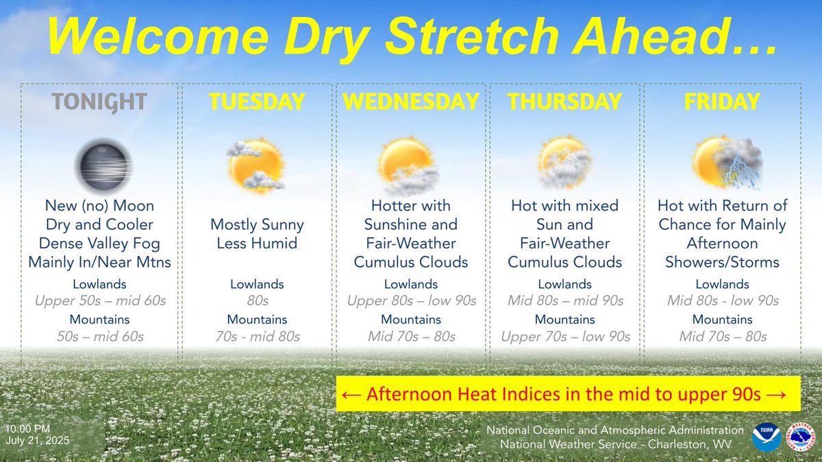
Tonight will be cool and dry again with comfortable humidity. However, the heat and humidity will build through midweek, and after dry weather holds through Thursday, the chance for mainly afternoon and evening showers and storms returns to end the week. #WVWx #OHWx #KYWx #VAWx
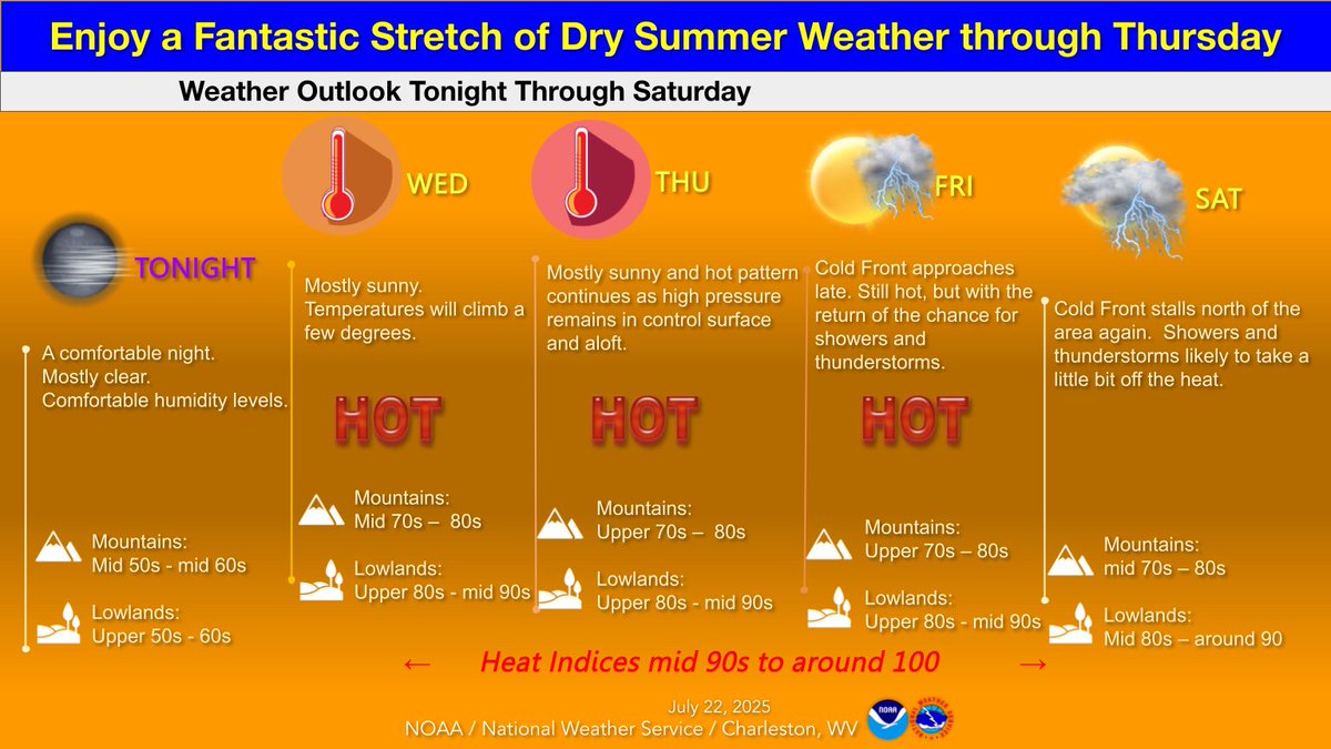
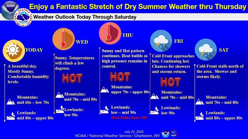
Enjoy a stretch of summer weather from Today through Thursday. By Thursday, the heat builds as high pressure remains in control. Heat Index values may reach the 100 degree during the afternoon. Stay alert for changing conditions and the potential for strong storms on Friday.
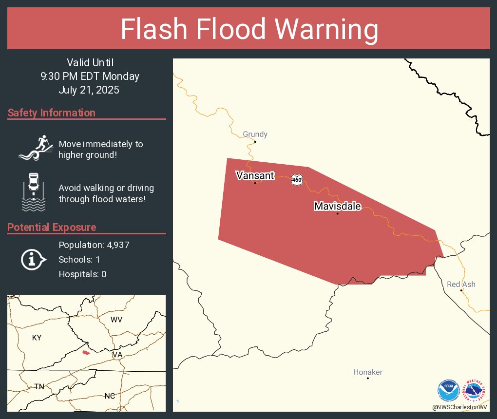
Flash Flood Warning including Vansant VA and Mavisdale VA until 9:30 PM EDT
The Flood Watch for Flash Flooding has been trimmed further as the threat continues to shift south. With soggy soils from the recent rain, heavier showers or almost any thunderstorm could lead to local Flash Flooding this afternoon into this evening across the south. #WVWx #VAWx
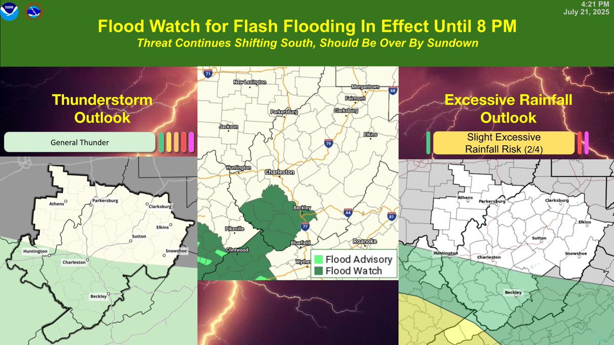
Overall, the heavy rainfall shifts south today, but southwest VA and southern WV will still remain under the gun once again. A flash flood watch is in effect until 8 PM tonight for counties where the highest confidence for flooding will be. #WVWX #kywx #OHwx #vawx
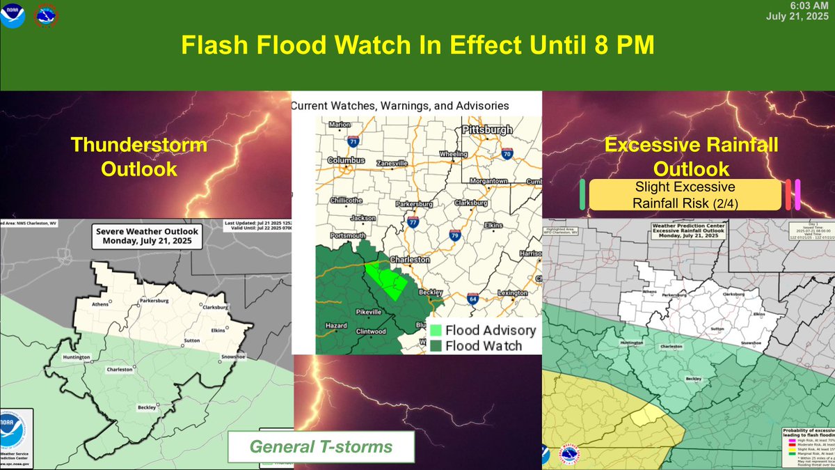
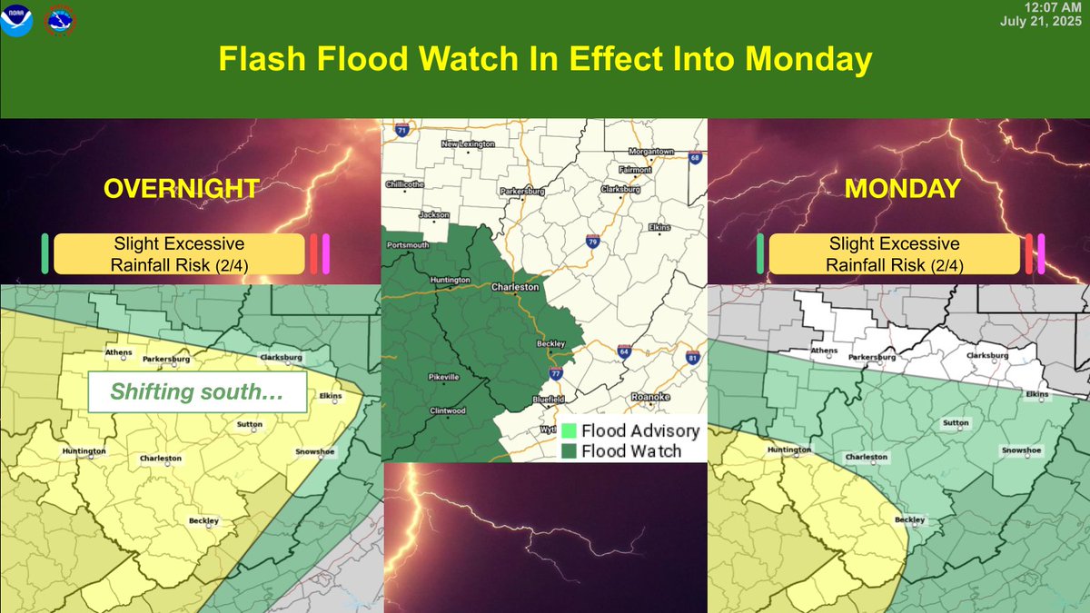
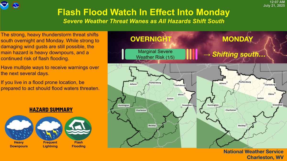
A Flash Flood Watch remains In Effect overnight into Monday for southern portions of the area, as the strong, heavy thunderstorm threat shifts south. While strong to damaging wind are still possible, the main hazard is a continued risk of flash flooding. #WVWx #OHWx #KYWx #VAWx
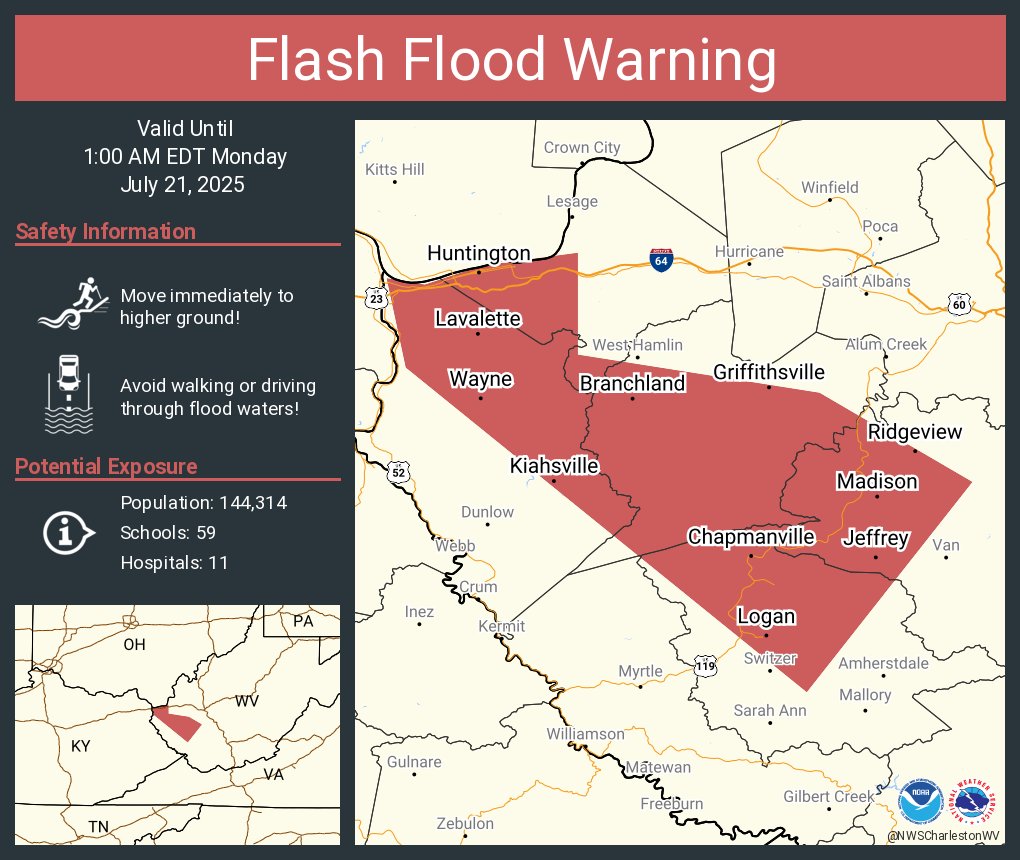
Flash Flood Warning continues for Huntington WV, Barboursville WV and Kenova WV until 1:00 AM EDT
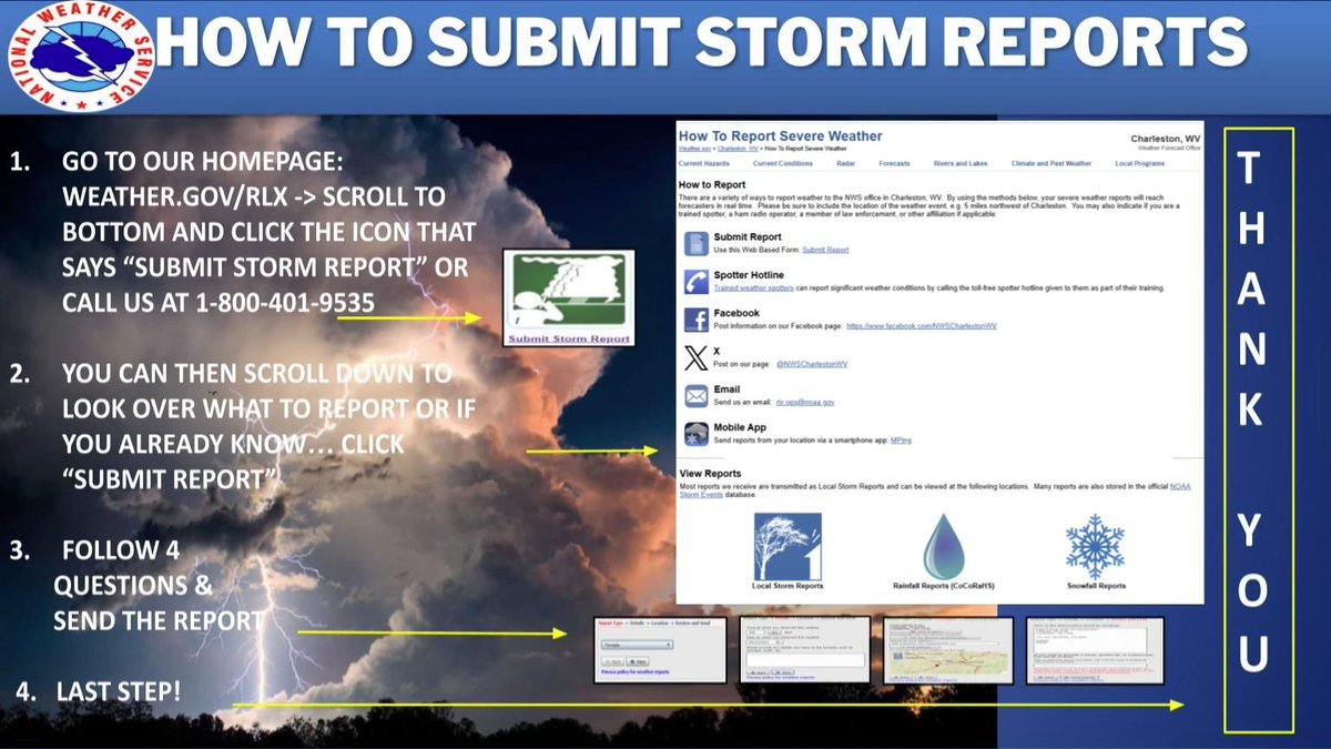
We are looking for reports of severe weather from this evening (both flooding and wind damage). If you observed any flooding or damage from winds (trees down), please feel free to comment below. Please include your location and time of report, along with a picture if possible.
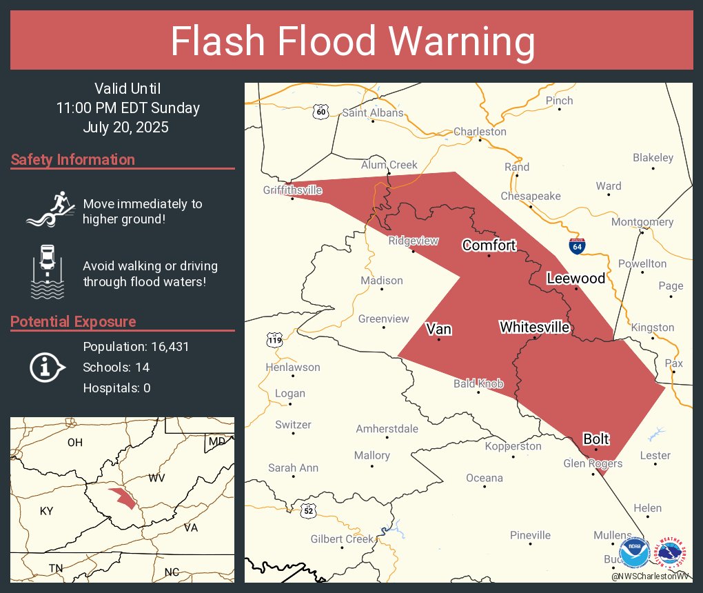
Flash Flood Warning including Bolt WV, Whitesville WV and Comfort WV until 11:00 PM EDT
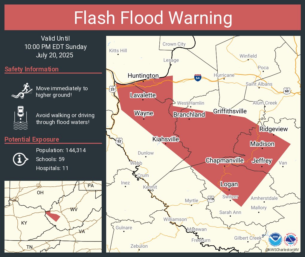
Flash Flood Warning including Huntington WV, Barboursville WV and Kenova WV until 10:00 PM EDT
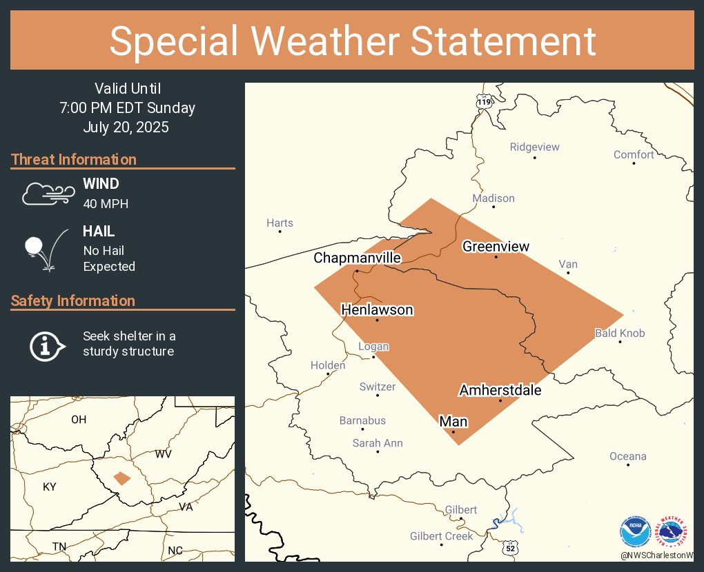
A special weather statement has been issued for Chapmanville WV, Man WV and Kistler WV until 7:00 PM EDT
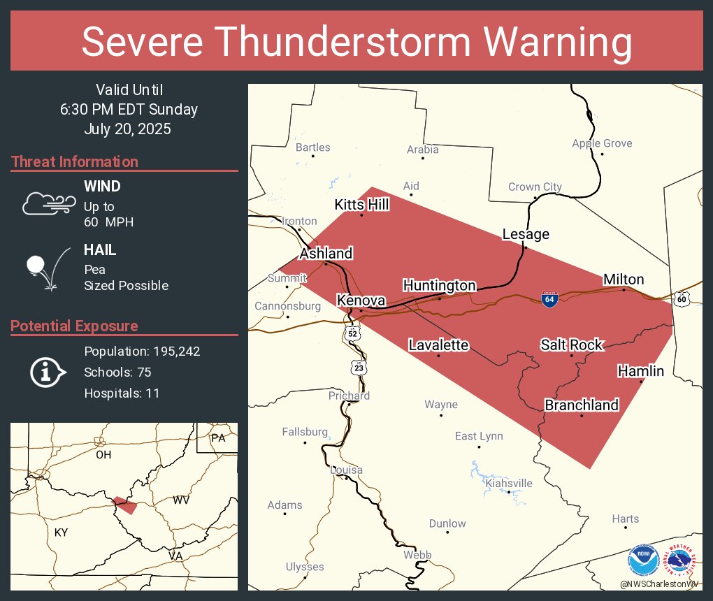
Severe Thunderstorm Warning including Huntington WV, Ashland KY and Westwood KY until 6:30 PM EDT
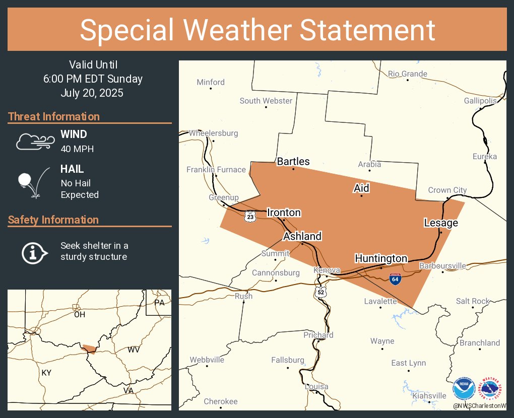
A special weather statement has been issued for Huntington WV, Ashland KY and Ironton OH until 6:00 PM EDT
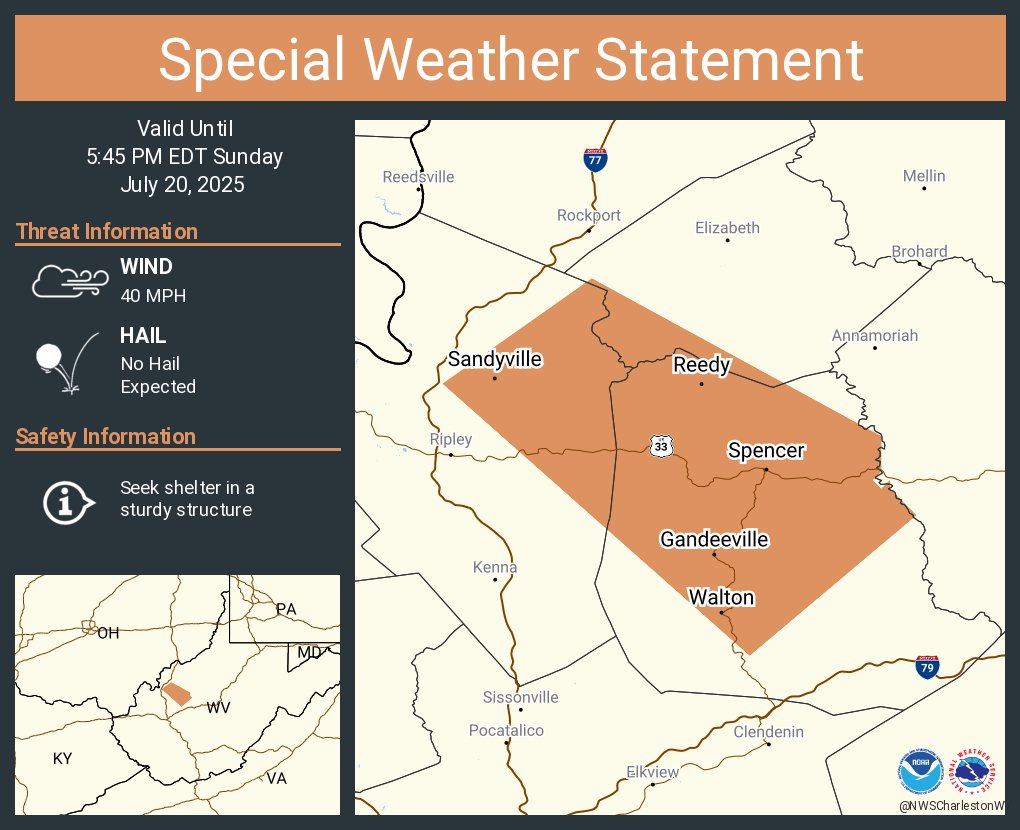
A special weather statement has been issued for Spencer WV, Reedy WV and Sandyville WV until 5:45 PM EDT
A special weather statement has been issued for Flatwoods KY, Russell KY and Raceland KY until 5:45 PM EDT
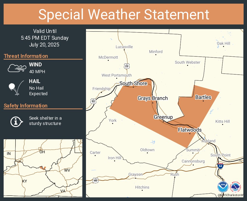
A special weather statement has been issued for Flatwoods KY, Russell KY and Raceland KY until 5:45 PM EDT

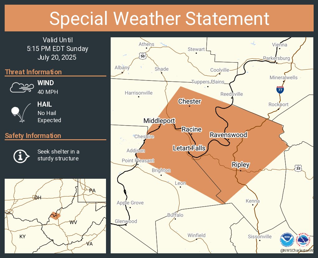
A special weather statement has been issued for Ravenswood WV, Ripley WV and Middleport OH until 5:15 PM EDT