NWS Cleveland
@NWSCLE
Official X Account for National Weather Service Cleveland, Ohio. Details: https://www.weather.gov/nws_x
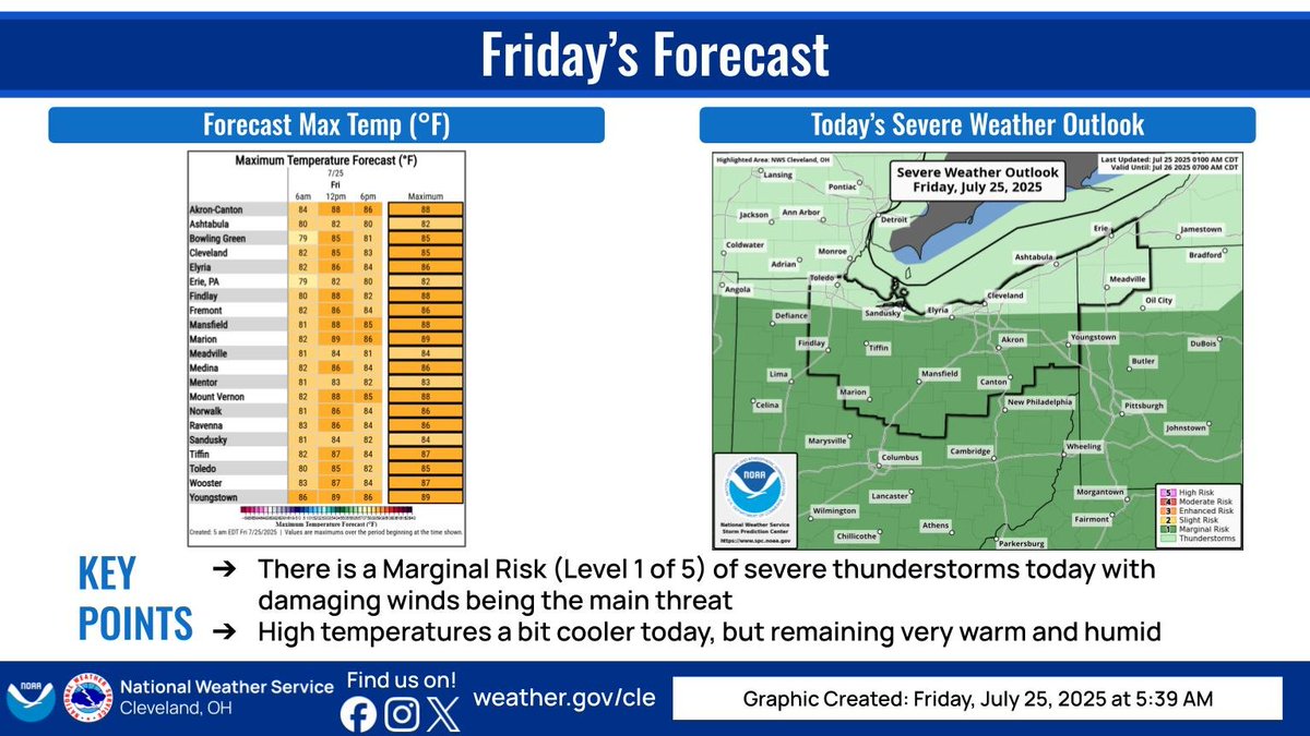
More showers/storms expected today, but after the morning convection exits, there should be a lull for most locations before activity picks up again later this afternoon and evening. Could see some isolated water issues and wind issues. Remaining very warm and humid. #ohwx #pawx
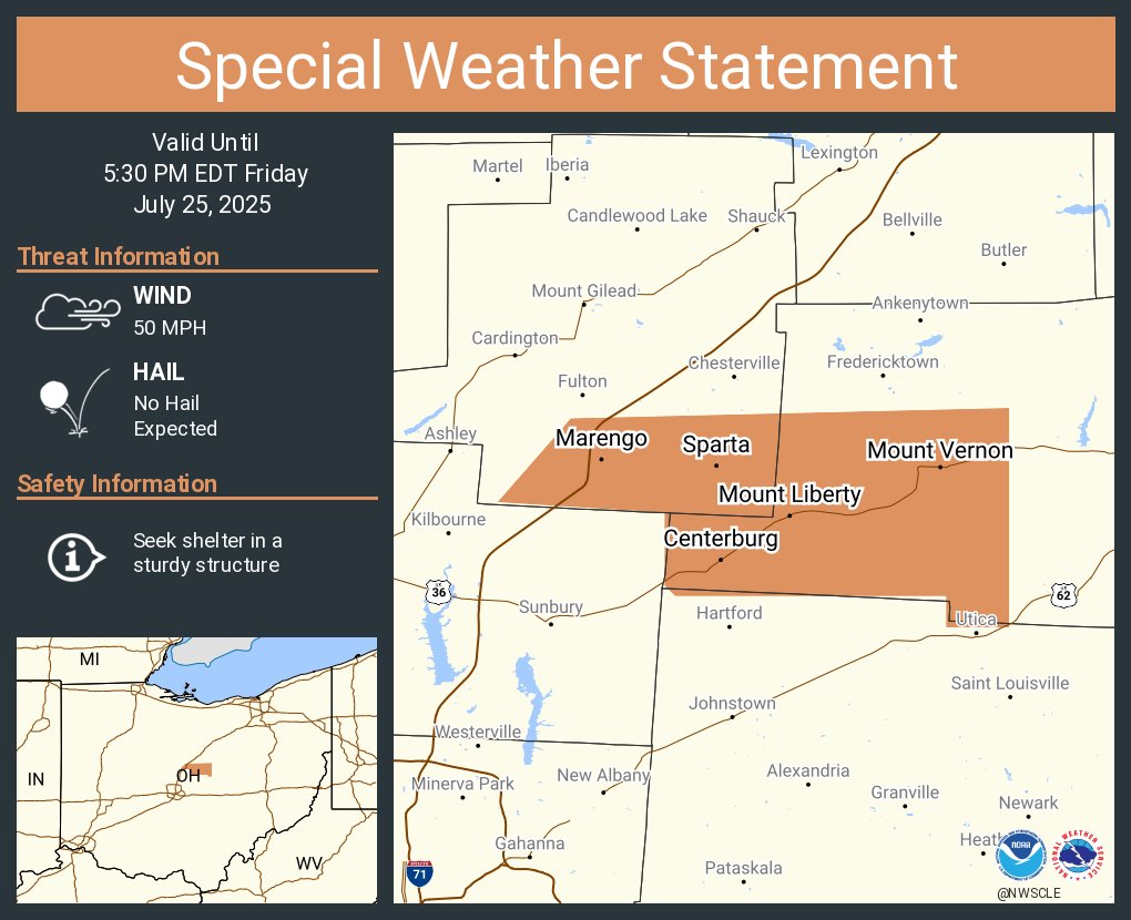
A special weather statement has been issued for Mount Vernon OH, Centerburg OH and Marengo OH until 5:30 PM EDT
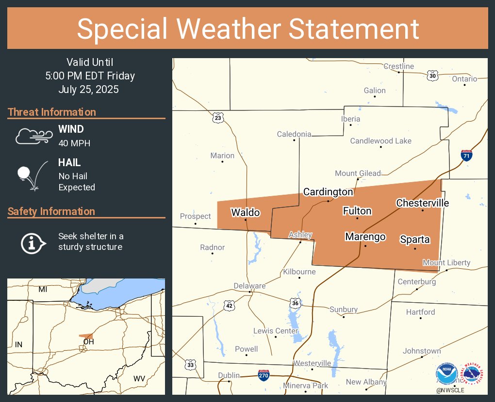
A special weather statement has been issued for Cardington OH, Marengo OH and Waldo OH until 5:00 PM EDT
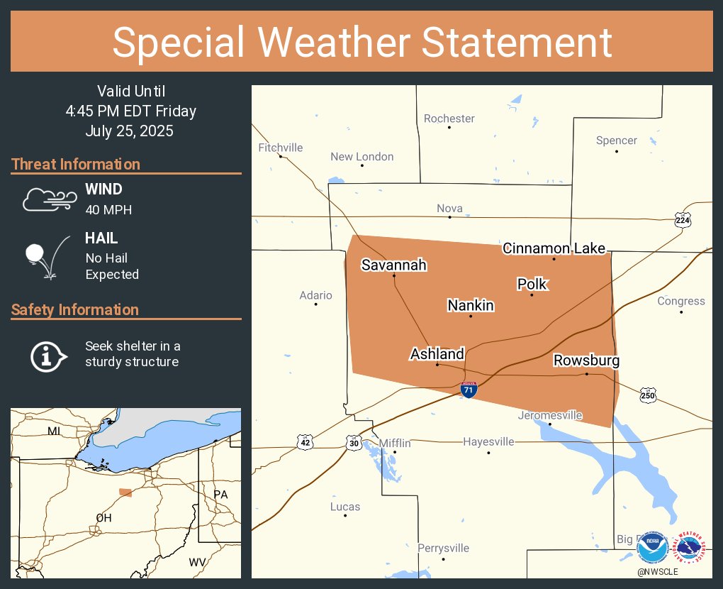
A special weather statement has been issued for Ashland OH, Cinnamon Lake OH and Savannah OH until 4:45 PM EDT
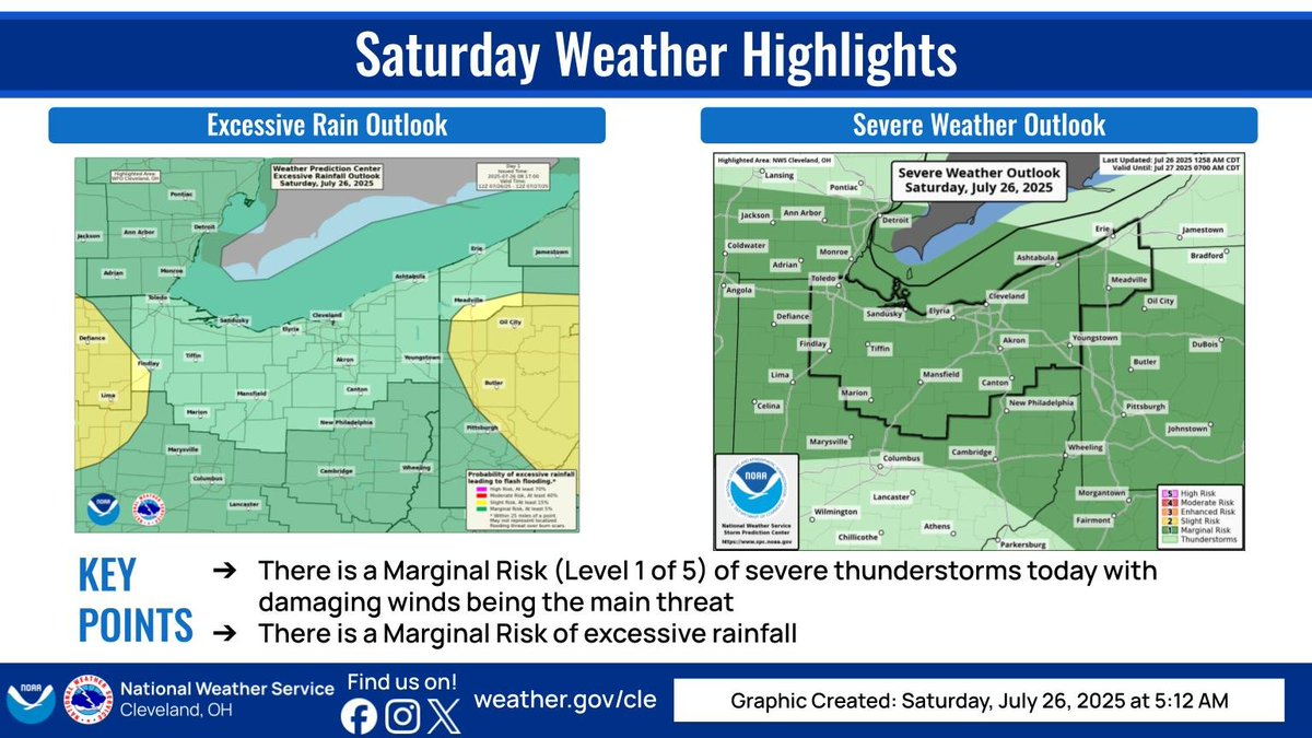
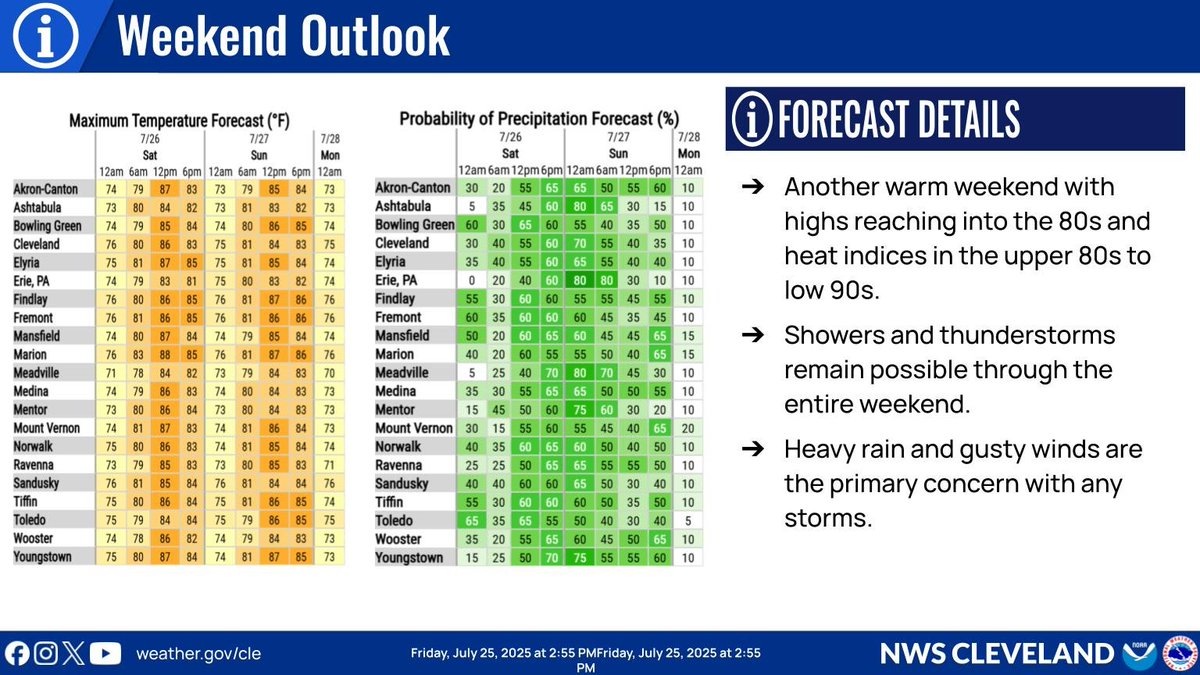
The heat with the potential for showers and thunderstorms stick around for much of the weekend. Gusty winds and heavy rainfall will be the primary concern with any storms that develop. #ohwx #pawx
A bit cooler today, but still very warm and humid. Waves of isolated to scattered showers and storms throughout the day today should be expected. #ohwx #pawx
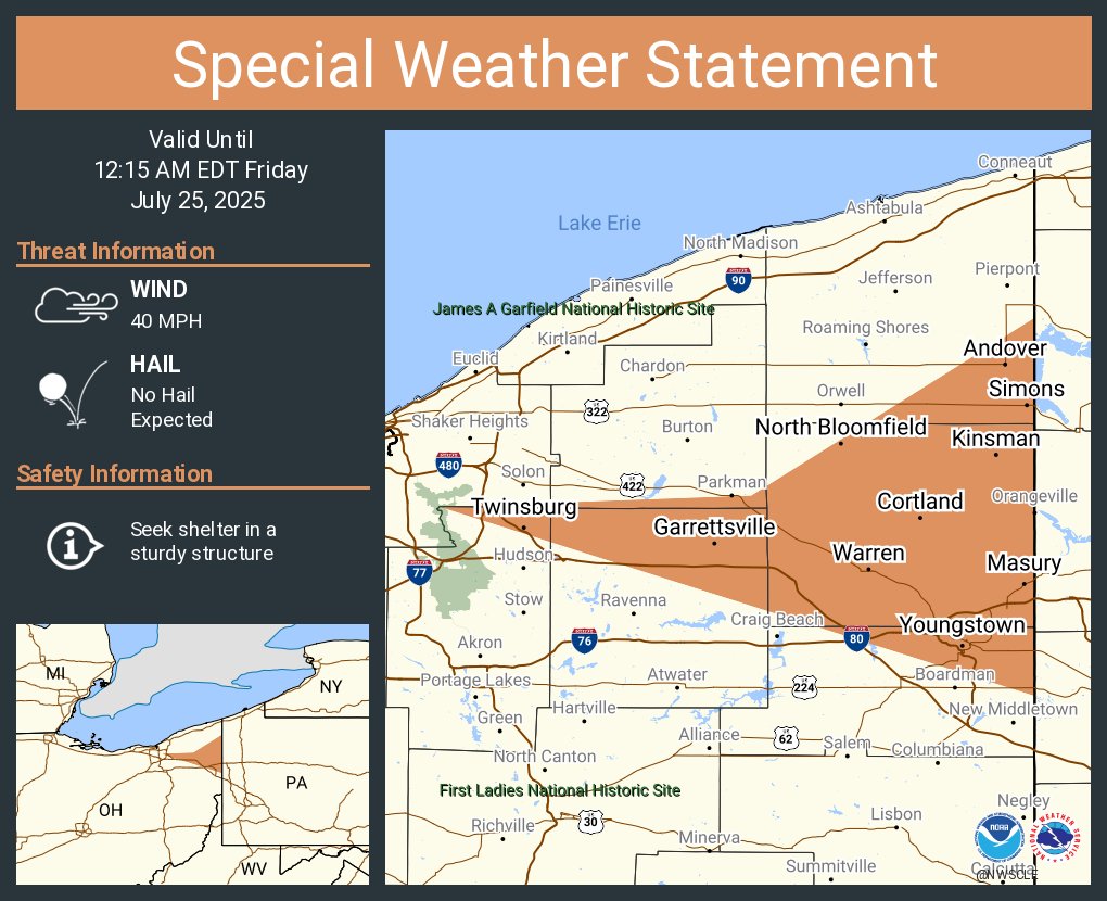
A special weather statement has been issued for Youngstown OH, Warren OH and Austintown OH until 12:15 AM EDT
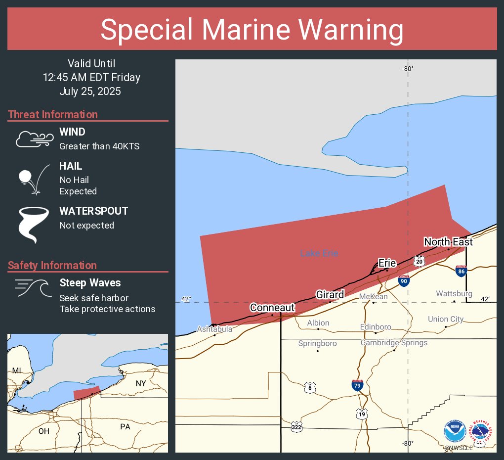
Special Marine Warning including the Conneaut OH to Ripley NY beyond 5 nm off shoreline to US-Canadian border, Geneva-on-the-Lake to Conneaut OH beyond 5 nm off shoreline to US-Canadian border, Conneaut OH to Ripley NY and Geneva-on-the-Lake to Conneaut OH until 12:45 AM EDT
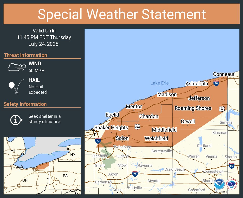
A special weather statement has been issued for Euclid OH, Mentor OH and Cleveland Heights OH until 11:45 PM EDT
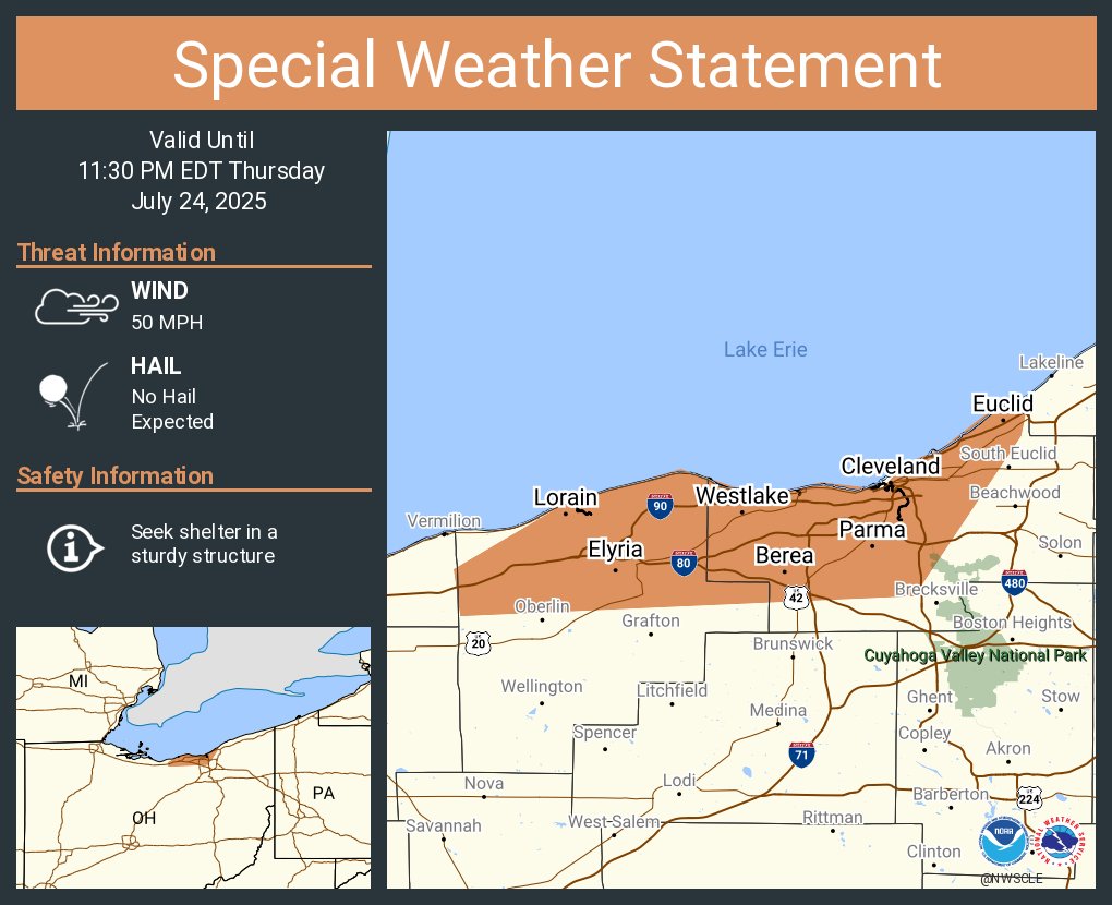
A special weather statement has been issued for Cleveland OH, Parma OH and Lorain OH until 11:30 PM EDT
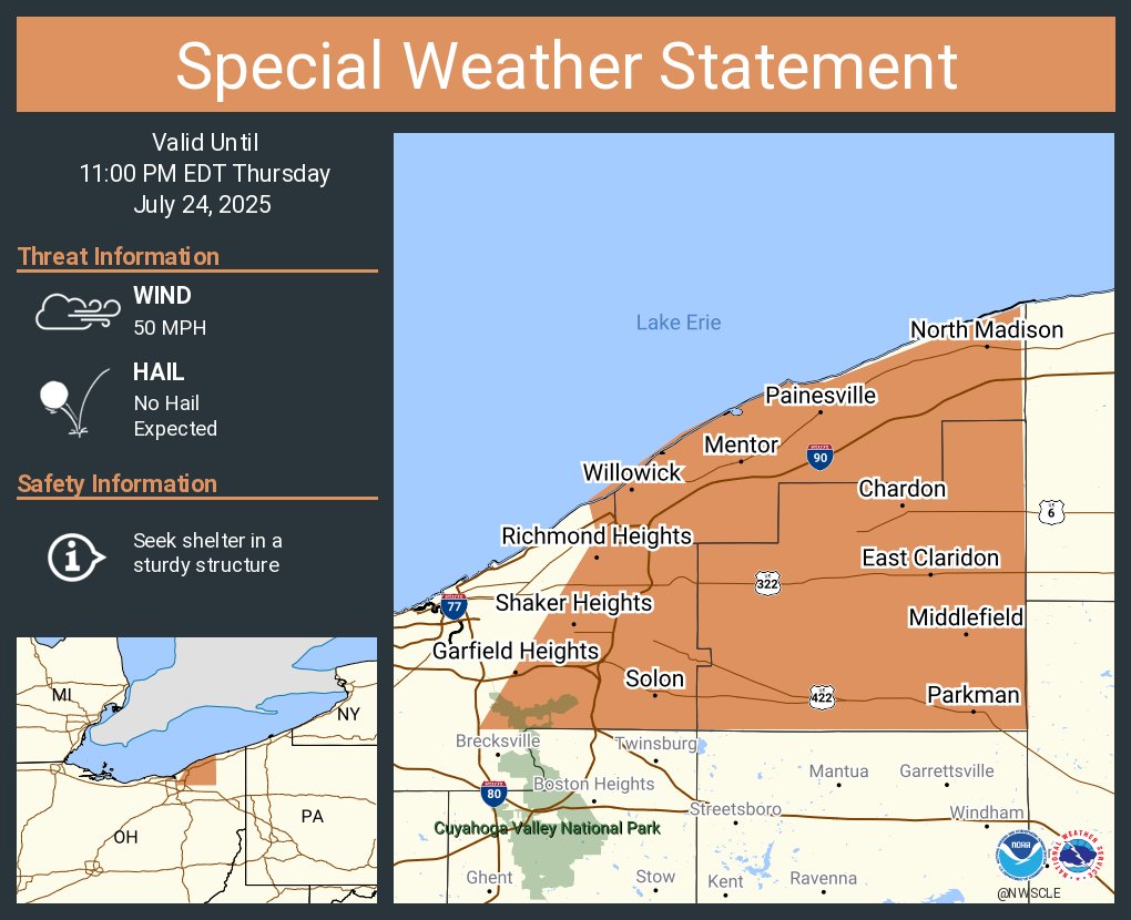
A special weather statement has been issued for Mentor OH, Garfield Heights OH and Shaker Heights OH until 11:00 PM EDT
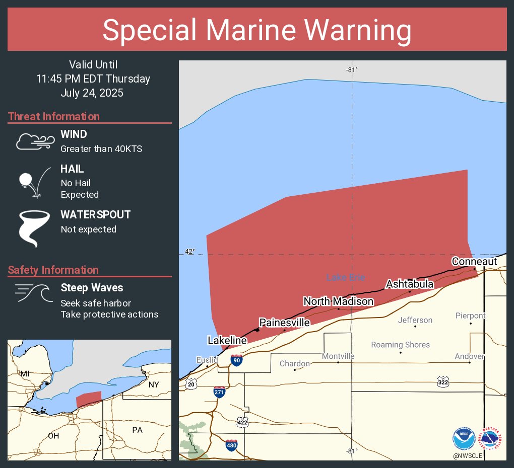
Special Marine Warning including the Willowick to Geneva-on-the-Lake OH beyond 5NM off shoreline to US-Canadian border, Geneva-on-the-Lake to Conneaut OH beyond 5 nm off shoreline to US-Canadian border and Willowick to Geneva-on-the Lake OH until 11:45 PM EDT
A special weather statement has been issued for Fremont OH, Bellevue OH and Clyde OH until 10:30 PM EDT

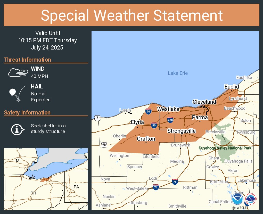
A special weather statement has been issued for Cleveland OH, Parma OH and Elyria OH until 10:15 PM EDT
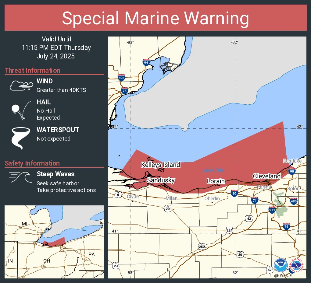
Special Marine Warning including the Avon Point to Willowick OH beyond 5 nm off shoreline to US-Canadian border, Vermilion to Avon Point OH beyond 5 nm off shoreline to US-Canadian border, Reno Beach to The Islands OH and The Islands to Vermilion OH until 11:15 PM EDT
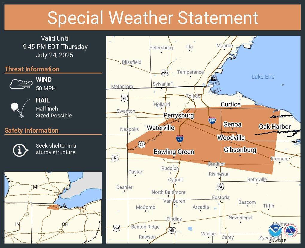
A special weather statement has been issued for Bowling Green OH, Perrysburg OH and Maumee OH until 9:45 PM EDT
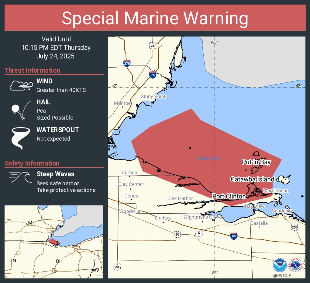
Special Marine Warning including the Reno Beach to The Islands OH, Reno Beach to The Islands OH beyond 5NM off shoreline to US-Canadian border and Detroit River Lt. to Maumee Bay OH to Reno Beach OH beyond 5NM offshoreline to US-Canadian border until 10:15 PM EDT
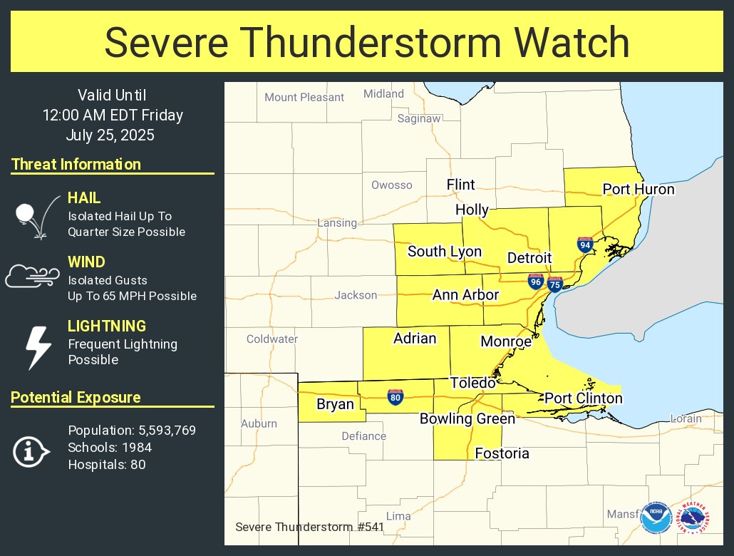
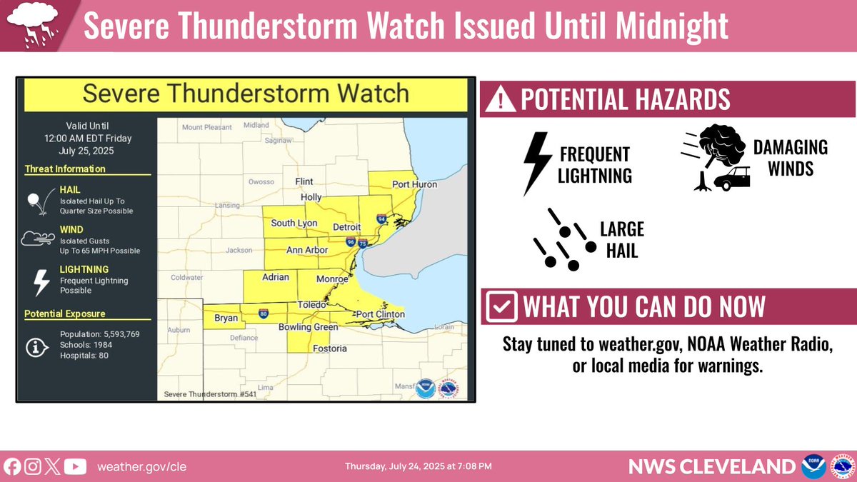
A Severe Thunderstorm Watch has been issued until Midnight to account for the potential for gusty winds to persist through the Toledo area and Lake Erie islands as the line of thunderstorms moves east and weakens. #ohwx
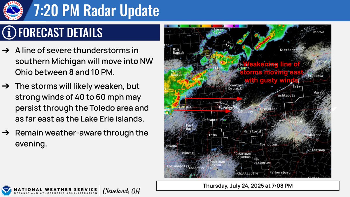
We are watching a line of severe storms in southern Michigan. These will move through NW Ohio between 8 & 10 PM. Weakening is expected, but given the organization of the line, gusty winds of 40-60 mph may persist through the Toledo area & as far E as the Lake Erie islands. #ohwx
A severe thunderstorm watch has been issued for parts of Michigan and Ohio until 12 AM EDT