NWS Anchorage
@NWSAnchorage
Official Twitter account for the National Weather Service Anchorage. Details: http://weather.gov/twitter #AKwx #Alaska #AK #Anchorage
A hydrologic outlook has been issued for the Copper River Basin in light of expected rainfall from Tuesday into Wednesday. Rainfall amounts of 1 to 3 inches will be possible. For more information visit weather.gov/afc #akwx
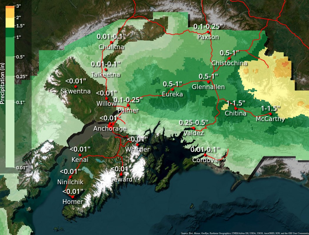
The forecast across the Copper River Basin thru tomorrow remains wet. Expect rain chances to increase later this afternoon and evening, becoming widespread by early tomorrow with the passage of a vigorous trough. Isolated rainfall amounts of 1 to 2 inches will be possible. #akwx
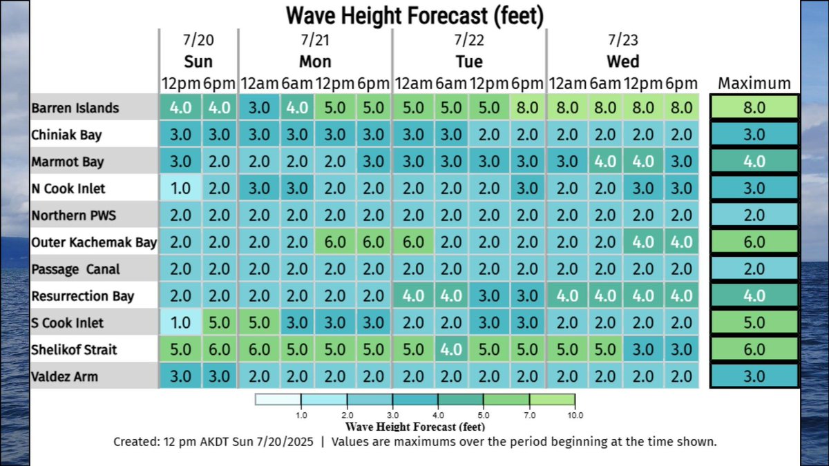
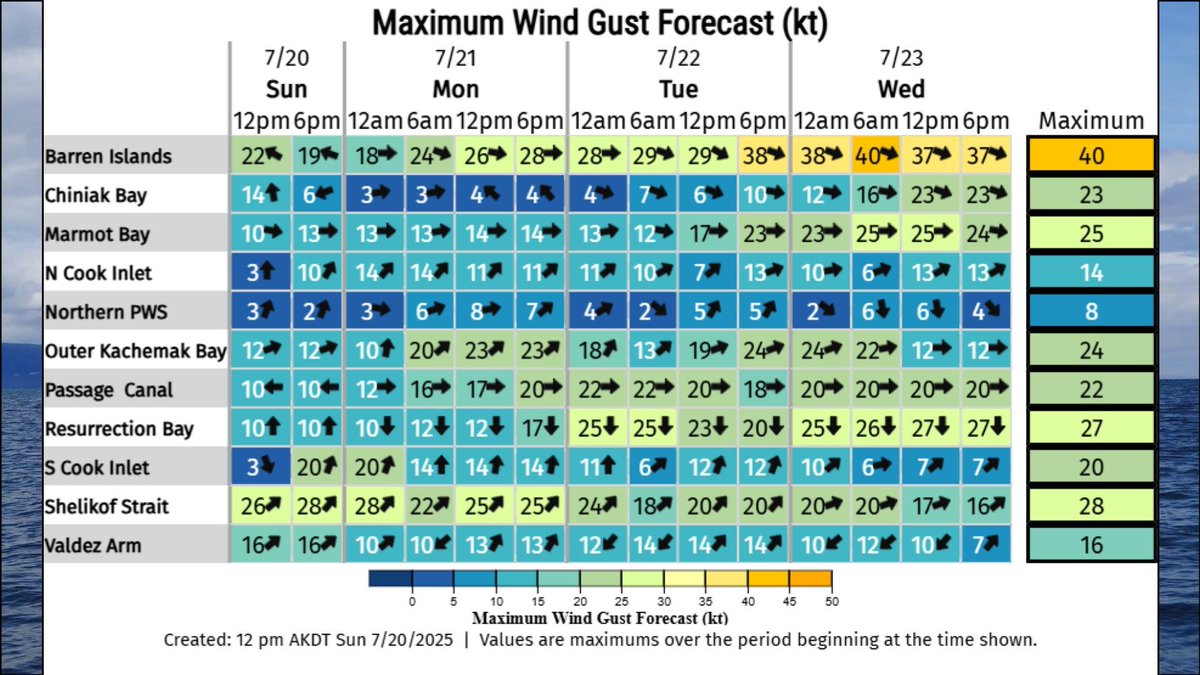
Good afternoon Southcentral! We've updated our wind and wave forecast for the next few days. Be sure to take a look if you plan on being out on the water or the coast. It's going to be gusty Tuesday into Thursday. #akwx
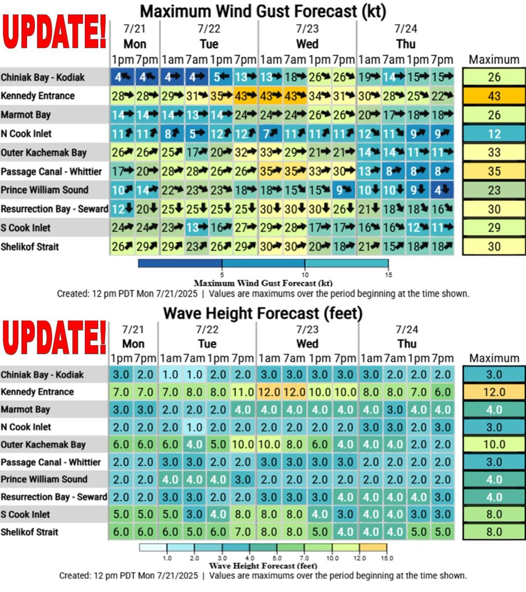
Gusty gap winds make a return to Southcentral Monday through the middle of next week. If you're fishing or will be out on the water here is a look at the current winds and wave heights forecast. #akwx
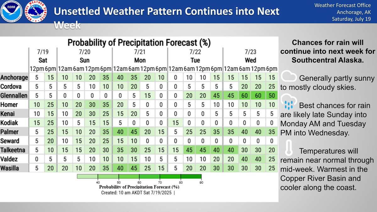
Chances for rain continue across Southcentral through mid week. The best chances will be Sun PM into Mon AM and Tue PM through Wed.
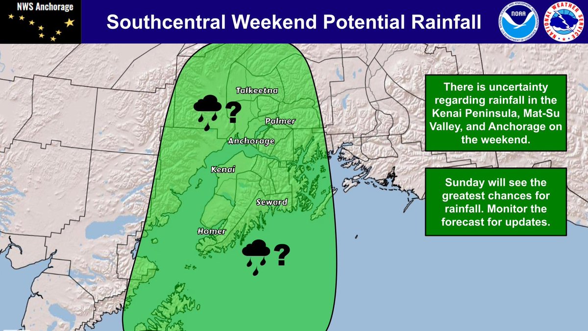
There is uncertainty regarding rainfall in the Kenai Peninsula, Mat-Su Valley, and Anchorage on the weekend. Sunday will see the greatest chances for rainfall. Monitor the forecast for updates.
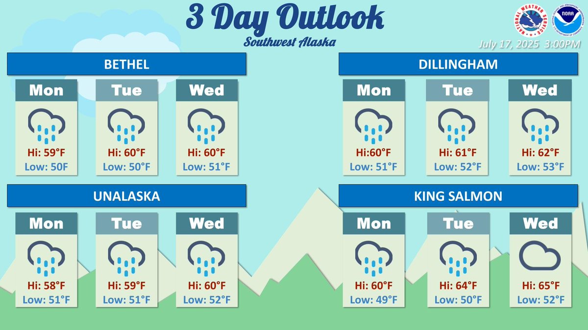
3 day outlook for various cities in Southwest Alaska. Widespread rainfall is expected for the weekend in Southwest Alaska as an active pattern sets up.
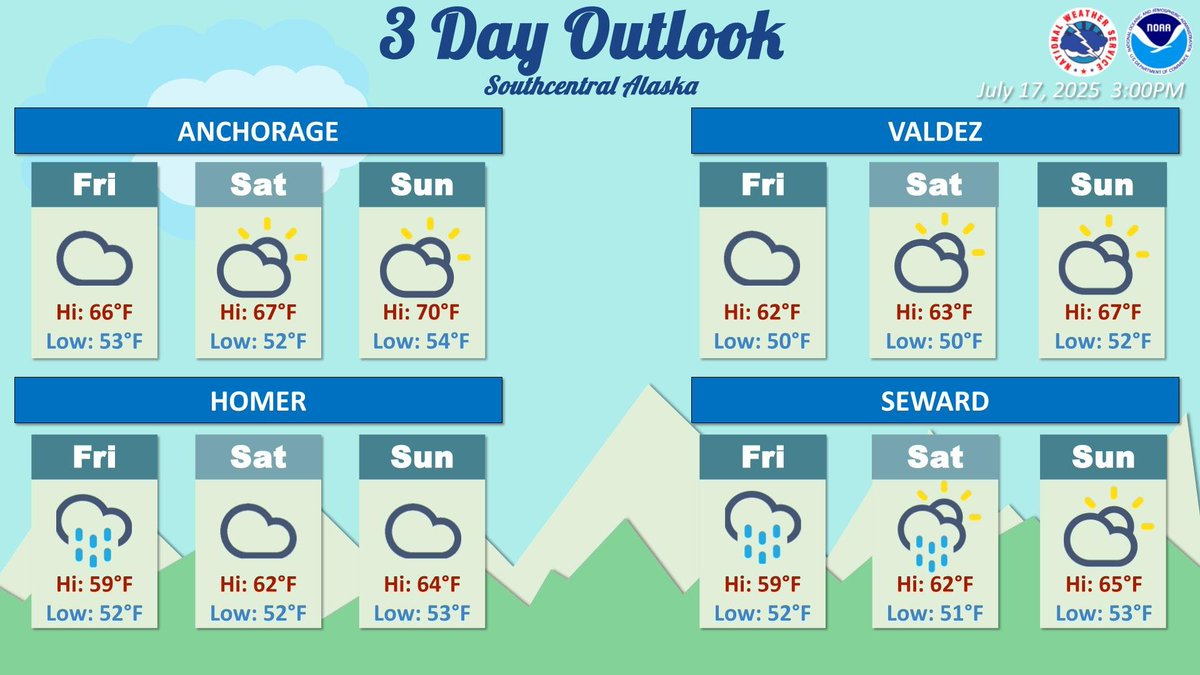
3 day outlook for various locations in Southcentral Alaska. Southcentral will see some rainfall on Friday which transitions into a mix of sun and clouds over the weekend.
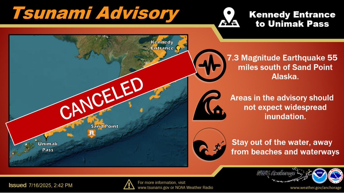
The Tsunami Advisory is canceled. Some areas may see small sea level changes from Kennedy Entrance to Unimak Pass.
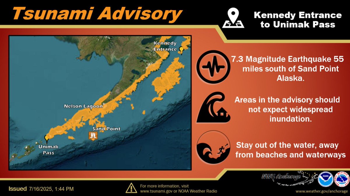
A Tsunami Advisory has been issued for the Alaska Peninsula areas from the Kennedy Entrance to Unimak Pass. Cities included are Cold Bay, Sand Point, and Kodiak. We can say with reasonable confidence that the Kenai Peninsula Borough locations will not see impacts.
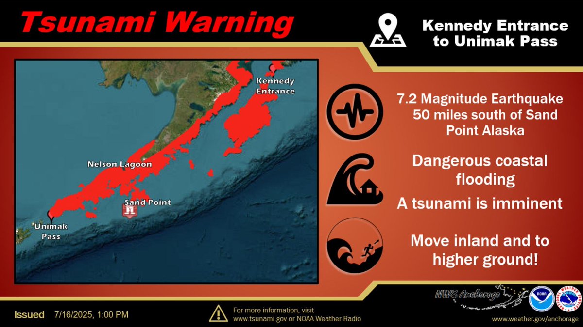
A Tsunami Warning has been issued for the Alaska Peninsula areas from the Kennedy Entrance to Unimak Pass. Cities included are Cold Bay, Sand Point, and Kodiak. We can say with reasonable confidence that the Kenai Peninsula Borough locations will not see impacts.
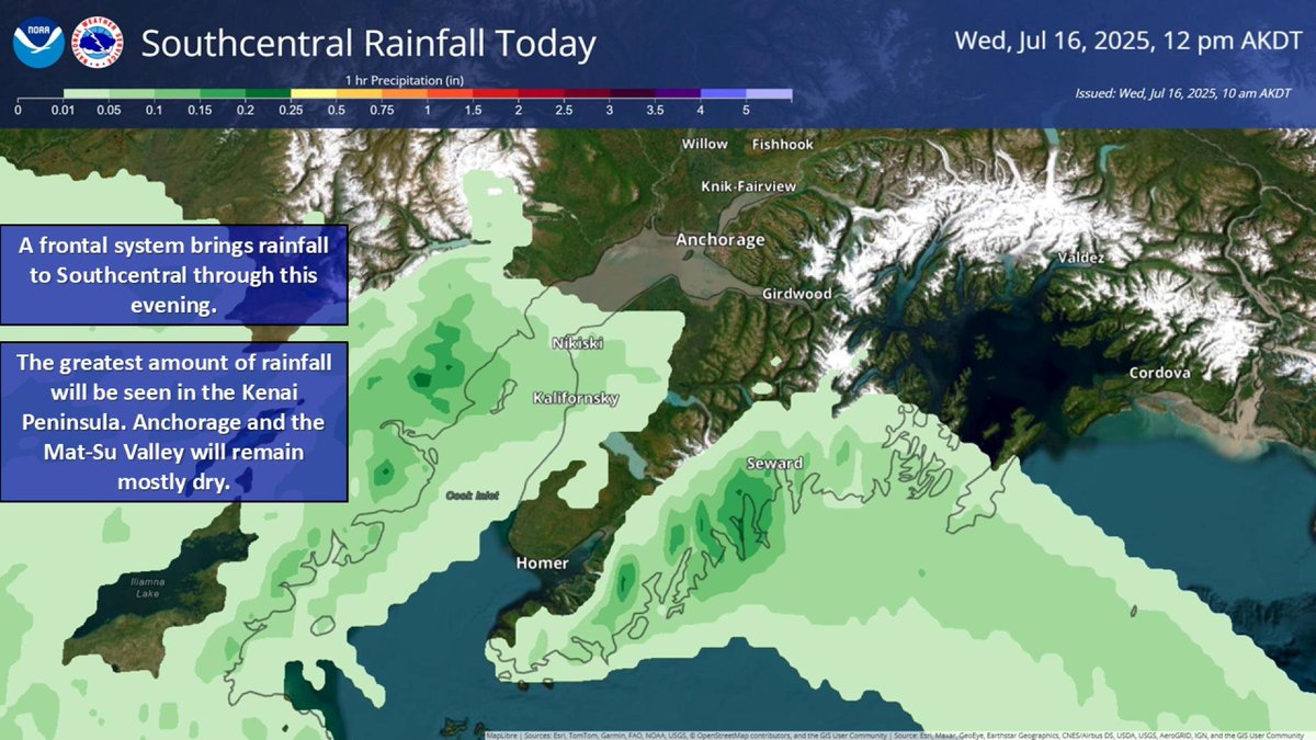
A frontal system brings rainfall to Southcentral through this evening. The greatest amount of rainfall will be seen in the Kenai Peninsula. Anchorage and the Mat-Su Valley will remain mostly dry.
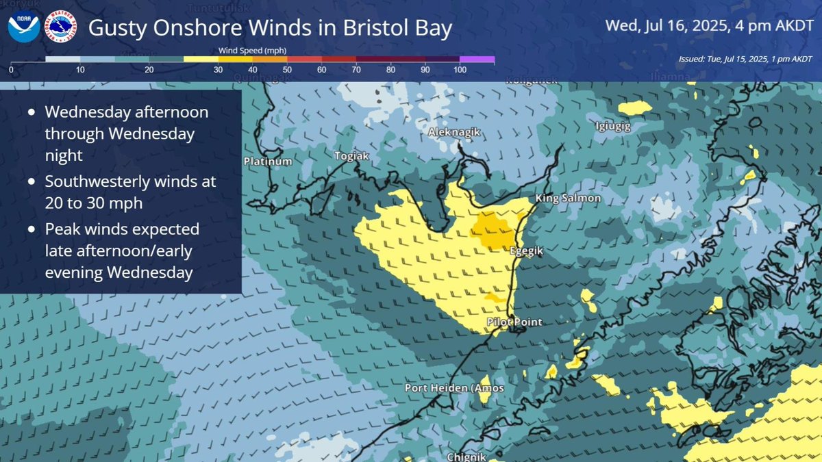
Strong southwesterly winds are expected in Bristol Bay from Wednesday afternoon through Wednesday night. Winds will range from 20 to 30 mph, with wave heights of 3 to 5 feet. The strongest winds are anticipated late Wednesday afternoon into early evening. #akwx
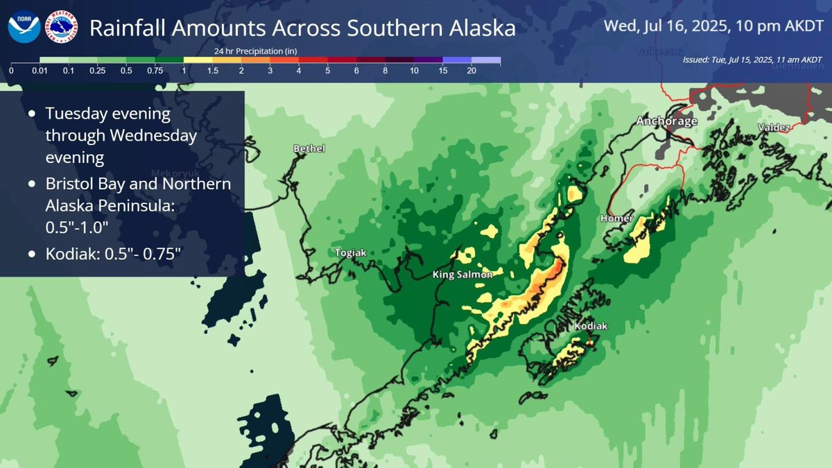
A North Pacific low brings rain to SW and SC Alaska through midweek. Heaviest rain (up to 1+ inch) is expected for the Northern Alaska Peninsula and Bristol Bay. A fast-moving front will bring rain to Kodiak Island and E. Kenai Peninsula Tue night through Wed afternoon. #AKwx
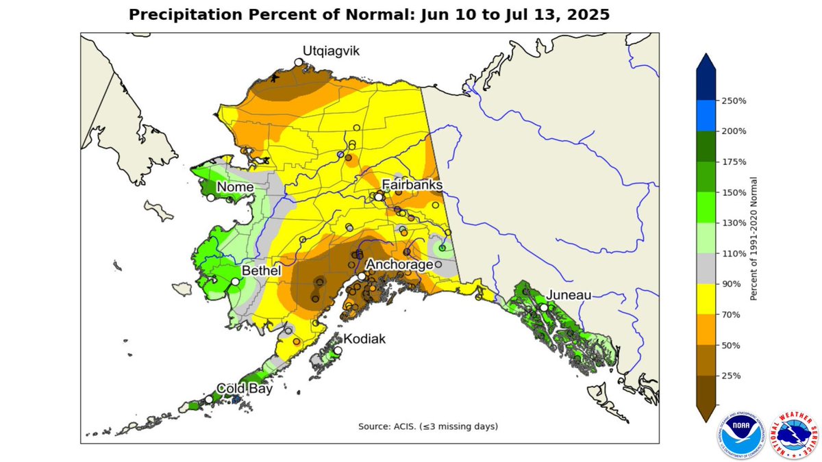
The past month has been unusually dry across Southcentral and Interior SW Alaska, with many areas seeing just 25% or less of normal rainfall. Meanwhile, parts of coastal SW saw above-average rain. A shift in the upcoming weather pattern could bring more active weather. #akwx
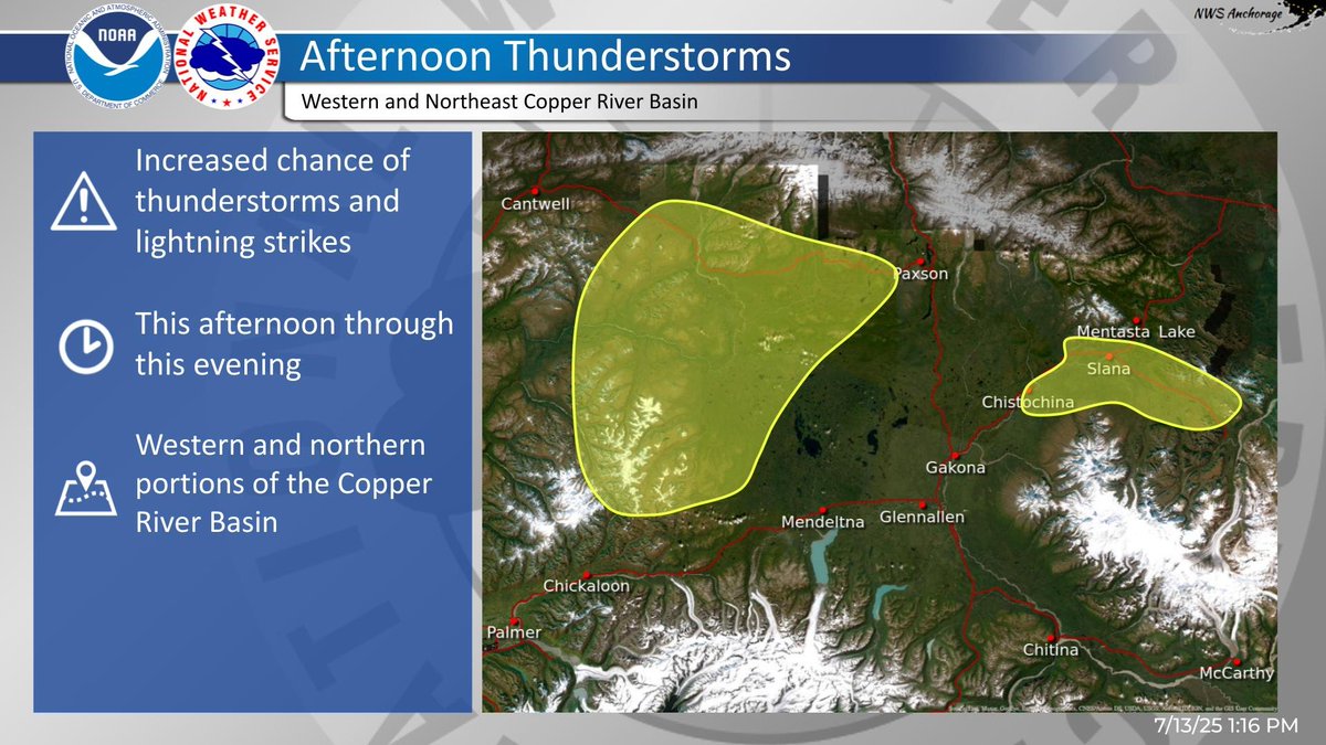
Showers and isolated thunderstorms are expected to develop this afternoon through this evening across the Talkeetna Mountains and in the western and northern portions of the Copper River Basin. Head over to weather.gov/afc for more info! #akwx
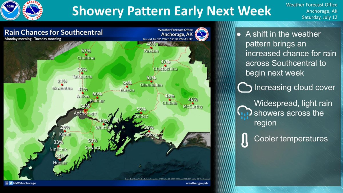
Cloudy skies, cooler temperatures, and a chance for rain returns to Southcentral to begin the workweek. Southerly flow promotes widespread light rain showers across the area Monday into Tuesday. #akwx
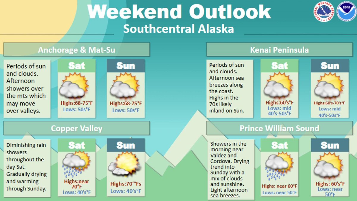
A mixture of sun and clouds are expected over the weekend. Showers will diminish over the Copper Basin early Sunday but some may develop over the Talkeetnas and Chugach each afternoon. Seasonal temperatures are expected with some sea breezes on coastal areas.
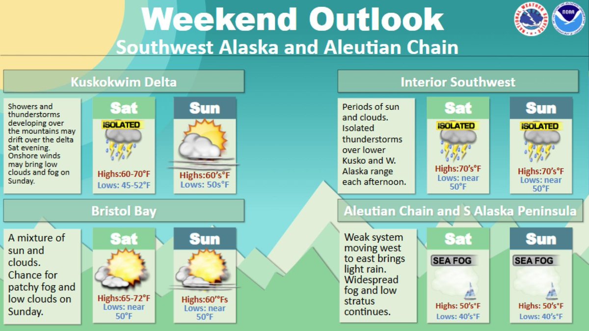
Warm, but seasonable temperatures are expected across Southwest Alaska and the Bering Sea this weekend. There's a chance for isolated thunderstorms around the Kuskokwim River and Delta, as well as near the western Alaska Range. Fog and low stratus will persist over the Bering.
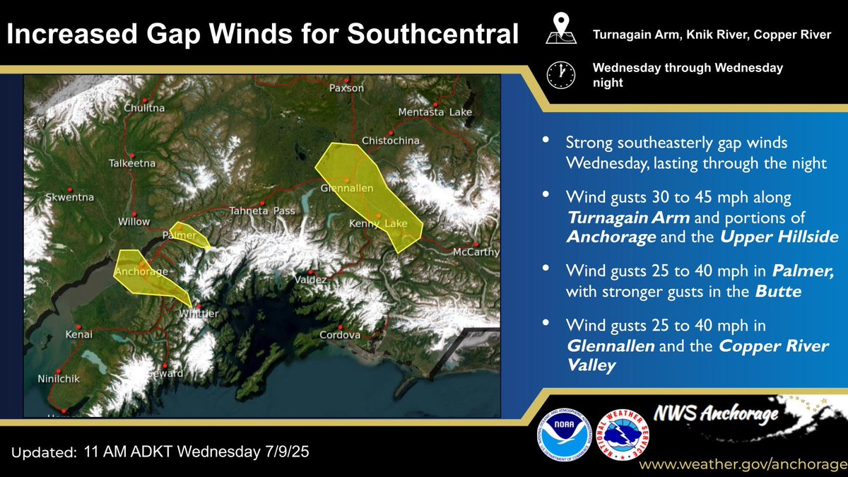
Tightening pressure gradients will produce strong southeasterly gap winds today through tonight. See the graphic and head to weather.gov/afc for more details! #akwx