NWS Albuquerque
@NWSAlbuquerque
Official X account for the Albuquerque National Weather Service. Details: https://www.weather.gov/nws_x
6:12 PM MDT Storms across the Central Highlands are slowly developing westward into to the Estancia Valley. Rainfall rates of 1 to 3 inches an hour could result in localized minor flooding on I-40 and surrounding area highways. #NMwx
5:05 PM MDT Showers and thunderstorms will continue to increase across central New Mexico through the early evening with heavy downpours and isolated areas of flash flooding developing.
8:18 PM MDT Moderate to heavy rain from thunderstorms are moving into the South Fork and Salt burn scars. Given that the South Fork burn scar received some rain earlier this evening, a Flash Flood Warning has been issued for the burn scars. Watch for potential debris flows! #NMwx
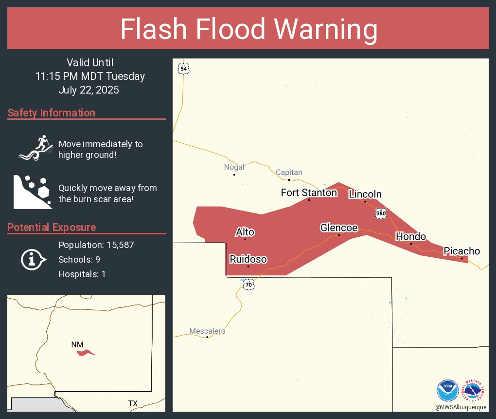
Aviso de Inundación Repentina incluye Ruidoso NM, Ruidoso Downs NM, Hollywood NM hasta las 11:15 PM MDT
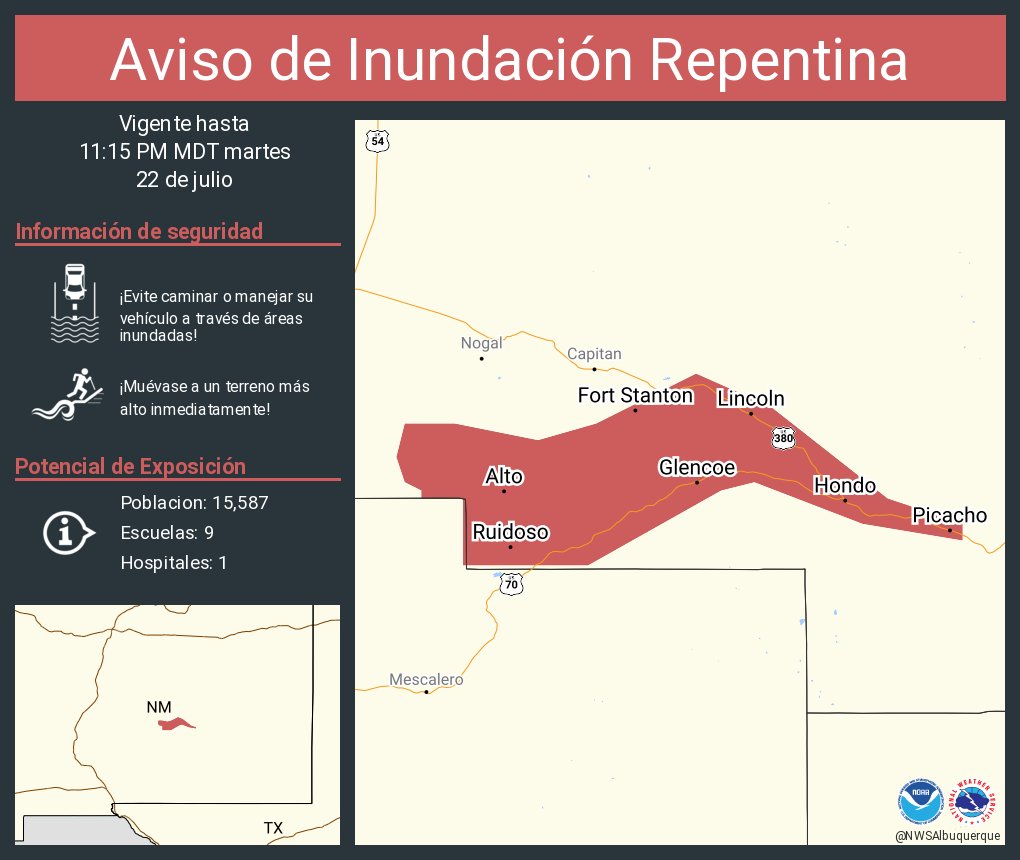
Flash Flood Warning including Ruidoso NM, Ruidoso Downs NM and Hollywood NM until 11:15 PM MDT
Minor flooding is also being reported at southern San Pedro, Zuni, and Gibson in southeast ABQ. #NMwx
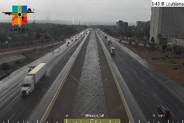
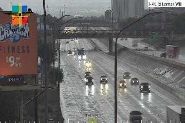
Heavy rainfall across southeast ABQ towards Canuel is resulting in fast flowing water in the Flood Control Channel between the east and westbound lanes of I-40. Heavy rainfall has also resulted in minor flooding along the side of I-40 at Lomas. #NMwx
Heavy rainfall across southeast ABQ towards Canuel is resulting in fast flowing water in the Flood Control Channel between the east and westbound lanes of I-40. Heavy rainfall has also resulted in minor flooding along the side of I-40 at Lomas. #NMwx
#WPC_MD 0782 affecting Central New Mexico, #nmwx, wpc.ncep.noaa.gov/metwatch/metwa…
6:40 PM MDT🚨Flash Flood Warning has been issued for southeast ABQ and South Valley. A quick half an inch to an inch of rain will result in flooding of arroyos and ditches. STAY OUT OF THE ARROYOS! #NMwx
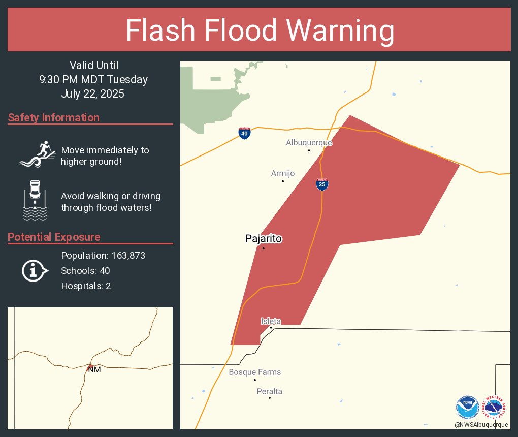
Aviso de Inundación Repentina incluye Los Padillas NM, Pajarito NM hasta las 9:30 PM MDT
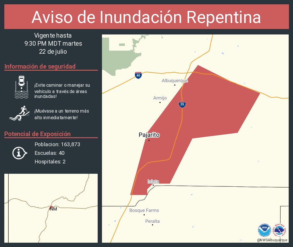
Flash Flood Warning including Los Padillas NM and Pajarito NM until 9:30 PM MDT
6:32 PM MDT: Heavy rainfall rates of 2 to 4 inches an hour are falling across southeast Albuquerque. This will result in minor flooding in localized areas and rapidly flowing water in arroyos and ditches. #NMwx
5:51 PM Outflow boundaries are moving through the Albuquerque metro and spawning some thunderstorms over the city. Gusty winds and heavy rainfall will be the main threats. Drive cautiously on your commute back home. #nmwx
Storms may continue into the later evening hours tonight. Heavy rainfall may cause to fast rises in arroyos. More afternoon thunderstorms are forecast tomorrow, with heavy rainfall once again being the main threat. Conditions get drier and warmer heading into the weekend. #nmwx


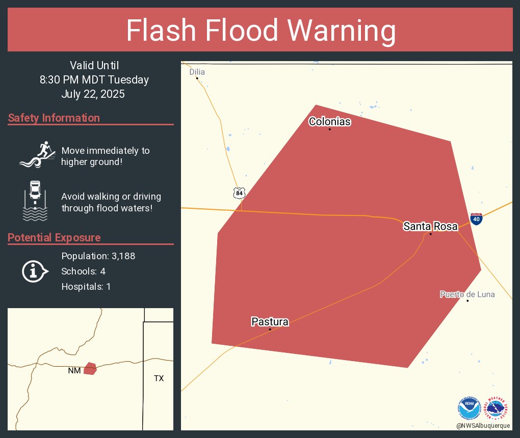
Aviso de Inundación Repentina incluye Santa Rosa NM, Pastura NM, Colonias NM hasta las 8:30 PM MDT
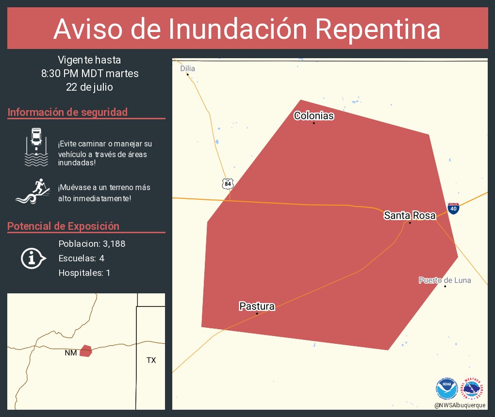
Flash Flood Warning including Santa Rosa NM, Pastura NM and Colonias NM until 8:30 PM MDT
Aviso de Inundación Repentina incluye Sandoval County, NM hasta las 4:00 PM MDT
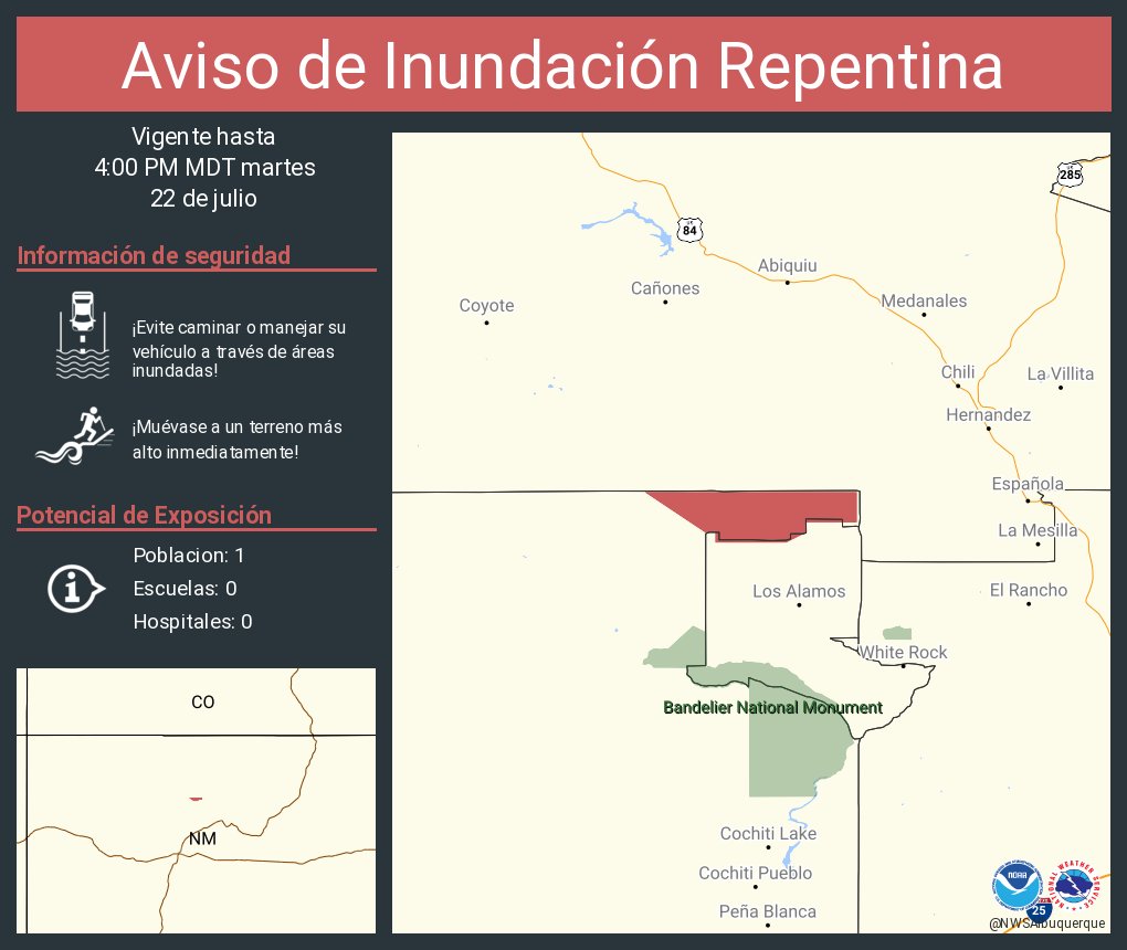
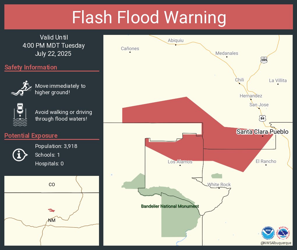
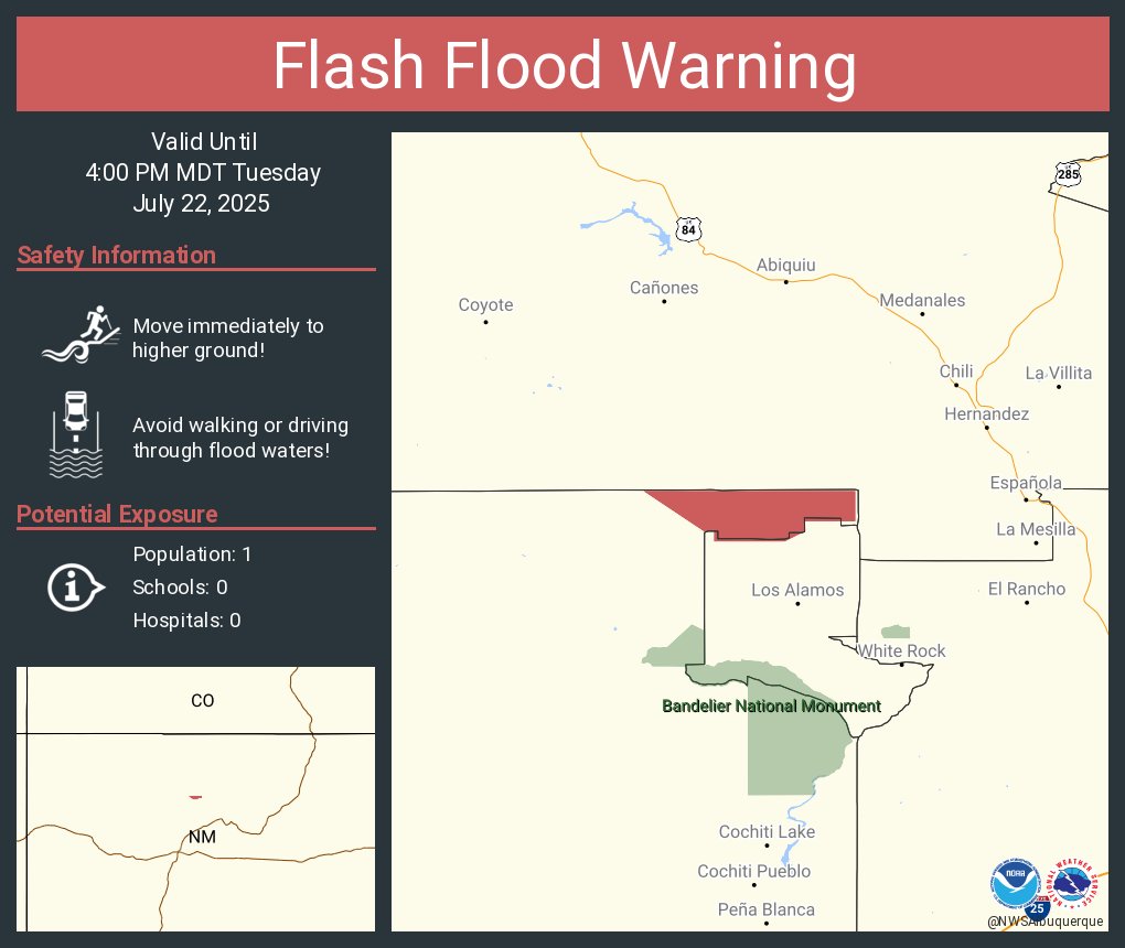
Flash Flood Warning including Los Alamos County, NM, Sandoval County, NM until 4:00 PM MDT
Aviso de Inundación Repentina incluye Santa Clara Pueblo NM hasta las 4:00 PM MDT
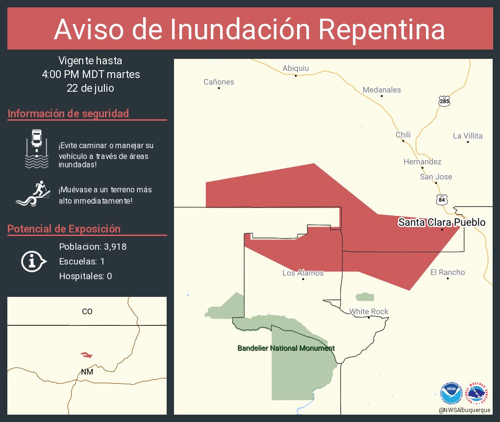
Flash Flood Warning including Santa Clara Pueblo NM until 4:00 PM MDT