North MS Storm Chasers 🌪🇺🇸
@NMSCAS
North Mississippi Storm Chasers & Spotters. Social Media. Primary spotter network for local media, with working relations with multiple emergency agencies.
We would like to announce that we can now accept your tax-deductible donations. We currently offer 3 ways: 1. Visit our website and click donate. (link in bio) 2. Text NMSC to 53555 3. Visit givebutter.com/Y3o6N9 Your donation supports us during the storm season and some…
From follower Taylor Baker during today's storms in Iuka. @matt_laubhan @maggyejoWX @NWSMemphis #mswx


A MODERATE risk is in effect in our Day 1 Excessive Rainfall Outlook. More details: go.usa.gov/cu3Dw
Big things happening!! Hello Mississippi Live Weather 👋🏼
Impressive rainshaft of our Greenville/TecIno @hazcams . Watch live at hazcams.com/station/greenv… #mswx @NWSJacksonMS

Flash Flood Warning for Colbert and Lauderdale County in AL until 3:00am Thursday. NMSCAS Online: nmscas.org #alwx
This afternoon in Holmes County, from follower Sharon Kent. @NWSJacksonMS #mswx


Potential gustnado earlier from our Aberdeen Skycam! @NWSJacksonMS @matt_laubhan @spann
Earlier this evening via our Caledonia in Lowndes County as storms rolled in. #mswx @spann @weswyattweather @NWSJacksonMS @matt_laubhan @ABC24Memphis @hazcams
Flash Flood Warning for Grenada County in MS until 5:30pm Friday. NMSCAS Online: nmscas.org #mswx
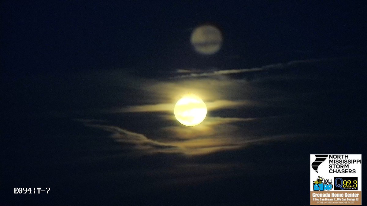
Buck Full Moon tonight on our @WONAFM95 Winona Skycam and our B100 Grenada East Skycam. #mswx @NWSJacksonMS @matt_laubhan

Mississippi LIVE Weather - Live at 6 x.com/i/broadcasts/1…
To add a little more context to this, one thing to remember is that hi-res model forecasts in the summer can be prone to more error. Why? One reason is that the atmospheric processes which form storms is more unpredictable compared to fall/winter time setups.
NWS Radars don't predict storms, they're observational tools only. It's similar to how a rain gauge doesn't make a forecast, it only tells us what's going on. Many different weather apps out there ingest NWS radar data, then merge the observational data into model forecasts.
🎆 Version 4 is here — just in time for the 4th! Track storms smarter and faster than ever with: 📱 iOS + Android Apps ⚡ New lightning tools 📍 Camera bearings 📢 Alerts And so much more. WEB: hazcams.com IOS APP: apps.apple.com/us/app/hazcams… ANDROID APP:…
Video of a landspout this evening in Bolivar County/Cleveland, MS area. From follower Cade McCain.. @matt_laubhan @NWSJacksonMS #mswx
It's official!! Say hello to Gabe!! x.com/i/broadcasts/1…
