North Georgia Weather Command
@NGAWXCommand
Reliable weather discussion and forecast page for North Georgia. Daily weather posts and discussions. Degreed Meteorologist. ALERTS: http://Ngawxalerts.vercel.app
There are a lot of weather blog pages for north Georgia which are great, but I wanted to create a group that would not fearmonger or click-bait the community to get likes and clout - or create wishful forecasts that don’t align with reality.
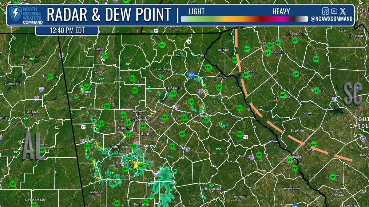
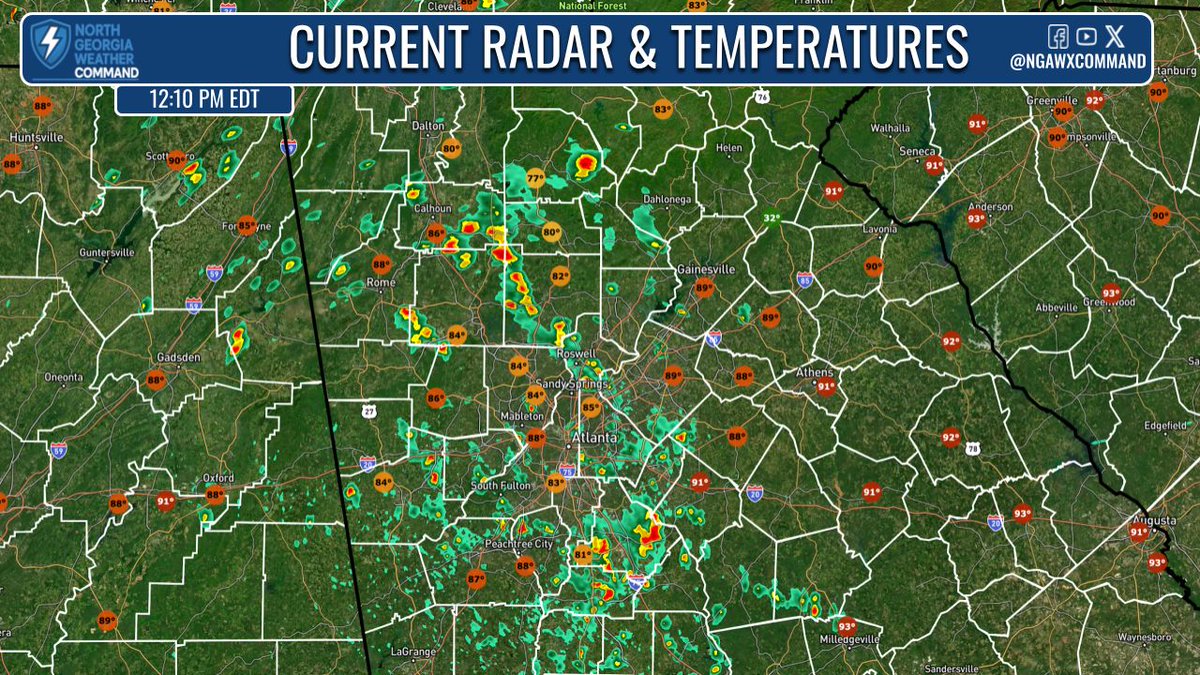
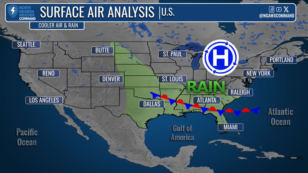
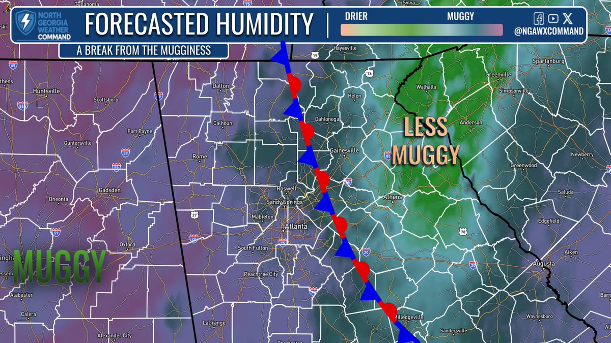
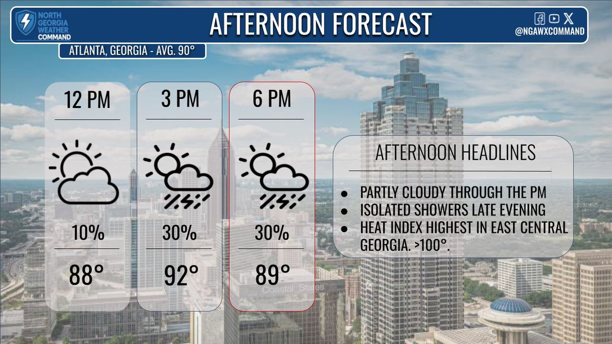
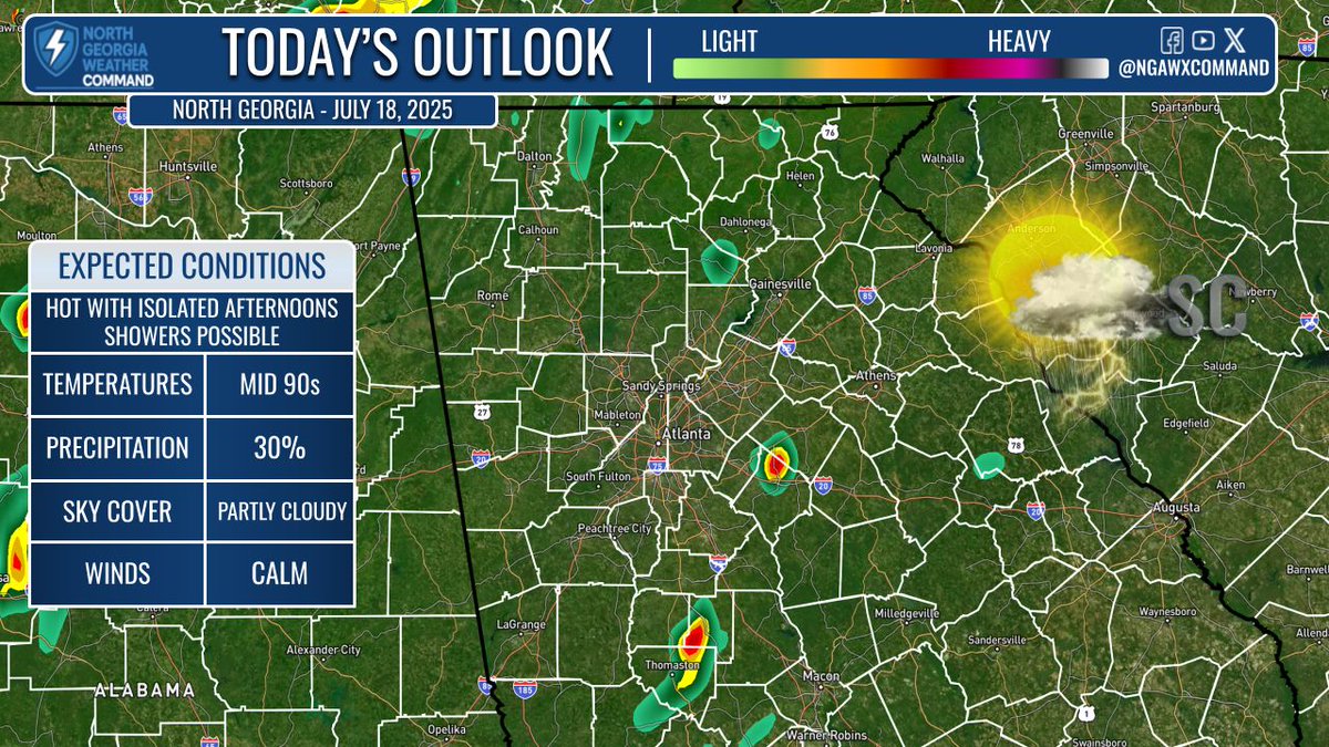
SHOWERS DEVELOPING: Showers mainly to the west and south of #Atlanta but a few isolated showers across Northeast #Georgia too. Dew points will begin to fall through the afternoon - areas east of the tan line already getting a break from the stickiness. #gawx
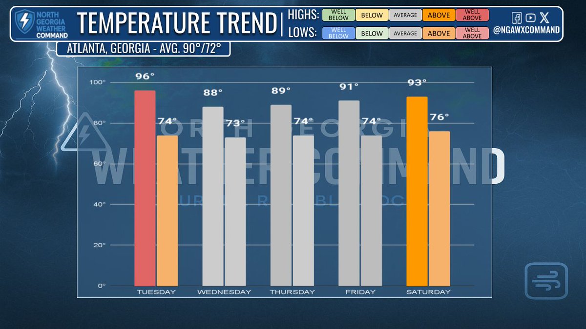
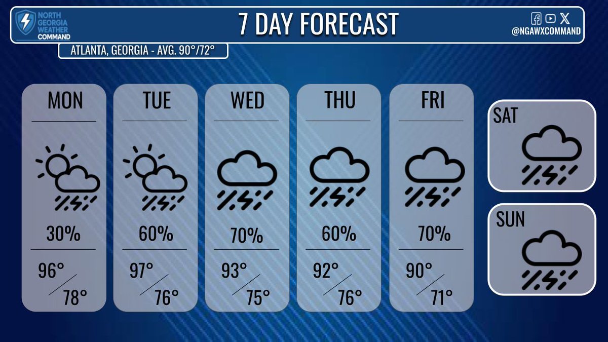
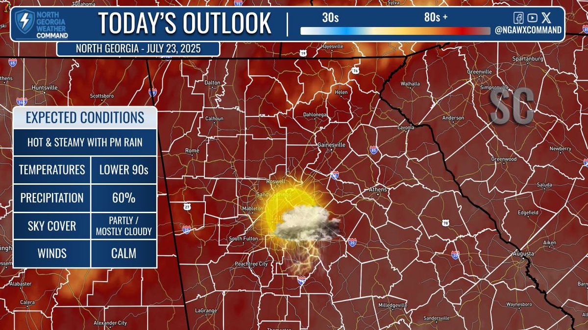
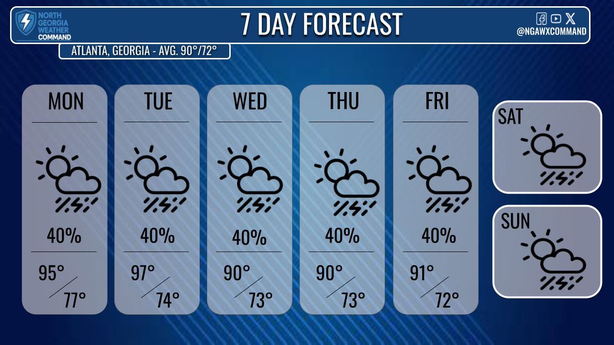
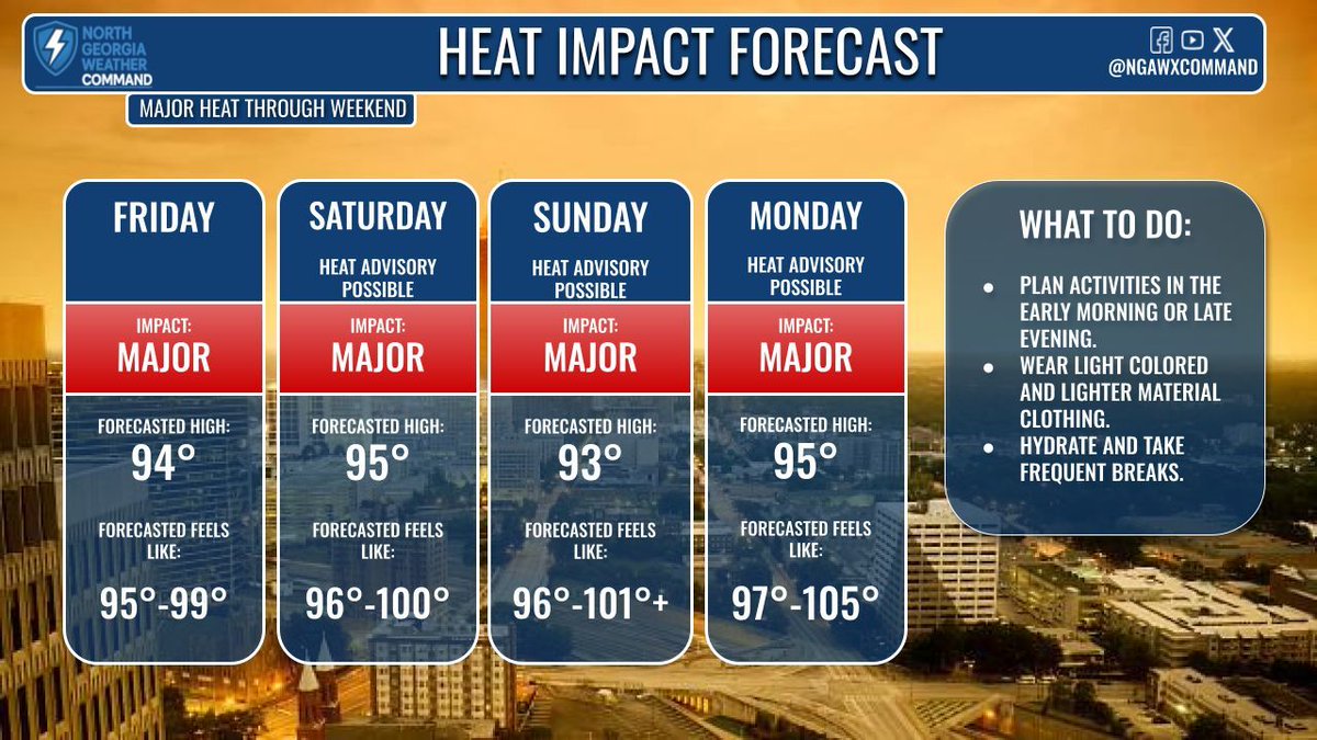
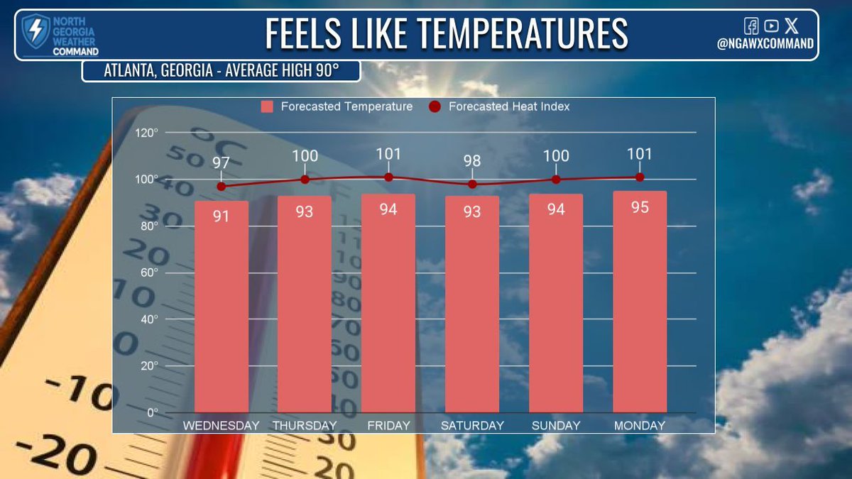
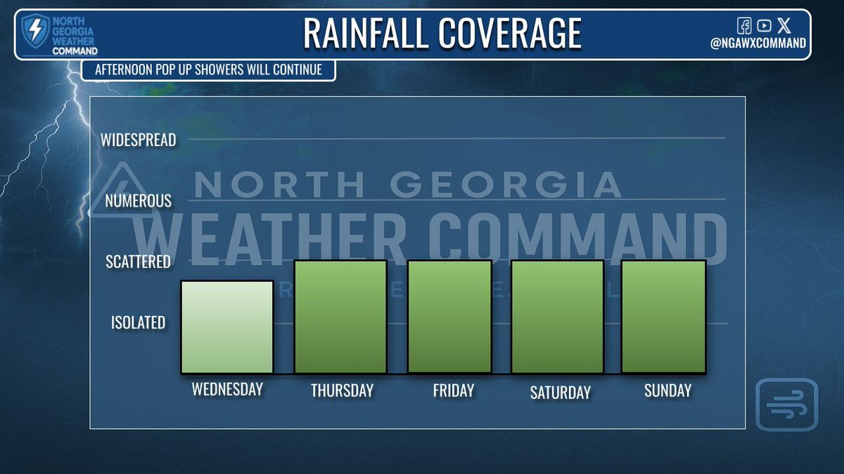
A BREAK FROM THE HEAT?: Highs in the mid-90s today with a Heat Advisory south of #Atlanta. An isolated PM shower is possible, mainly east. Rain chances increase Wed/Thu (60%), keeping temps near average. Extreme heat returns this weekend into next week. #gawx #heatwave
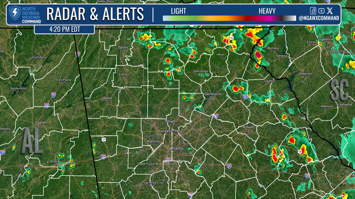
SHOWERS POPPING UP: PM showers starting to pop up across North #Georgia. Temps mainly in the upper 80s and low 90s now - but a break from the heat if you're under a shower. Heat Advisory remains in effect until 8PM this evening. #gawx #Atlanta
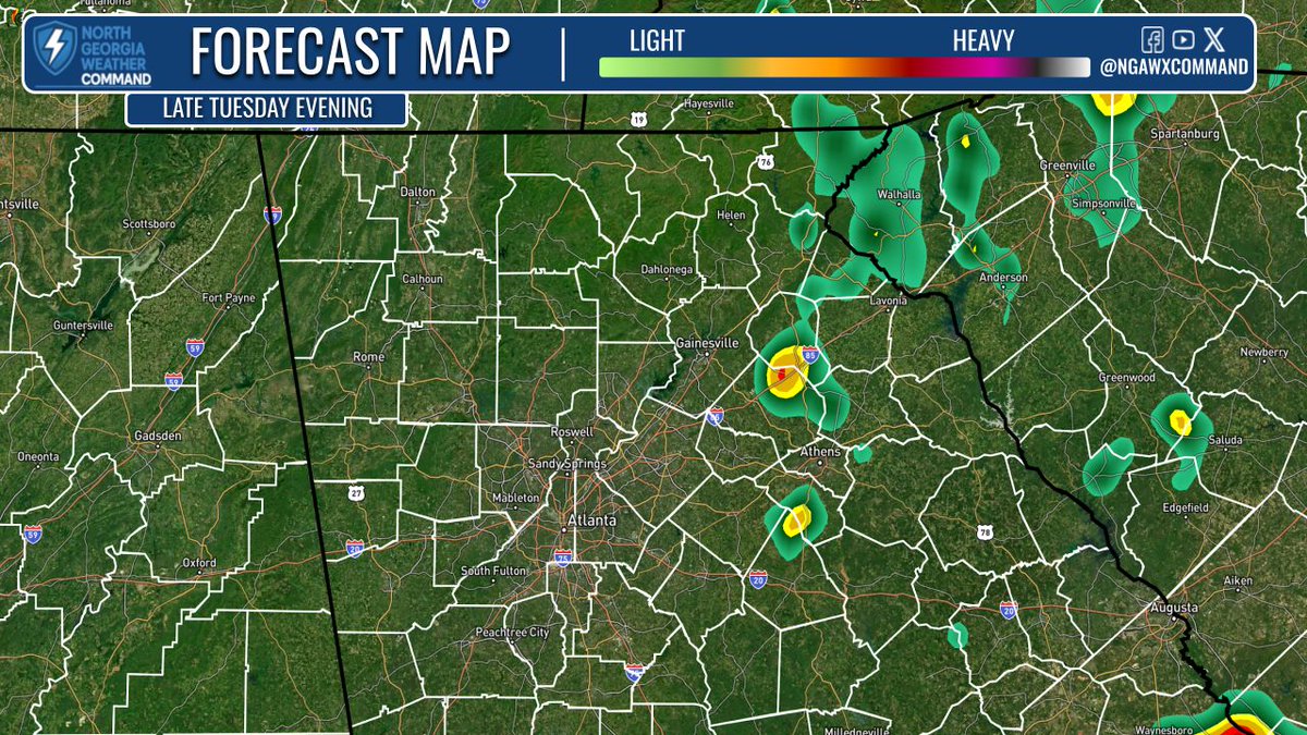
PM SHOWERS: Showers across North Georgia and parts of eastern Georgia this afternoon. No severe alerts in effect at this time, but heavy rain and gusty winds are possible with any downpours that move through your area. A brief relief from the heat! #gawx #Georgia
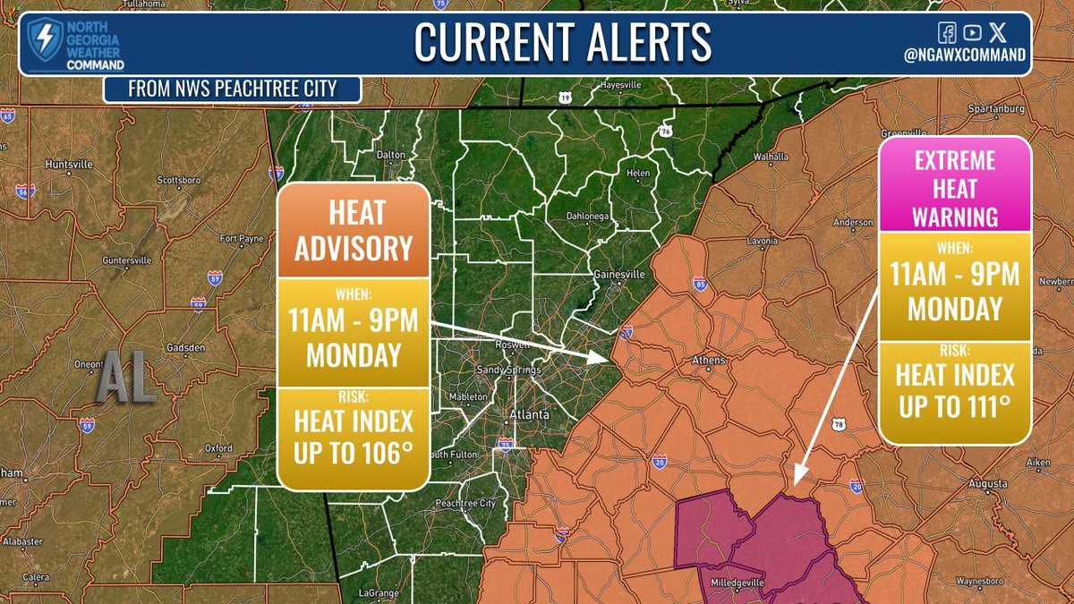
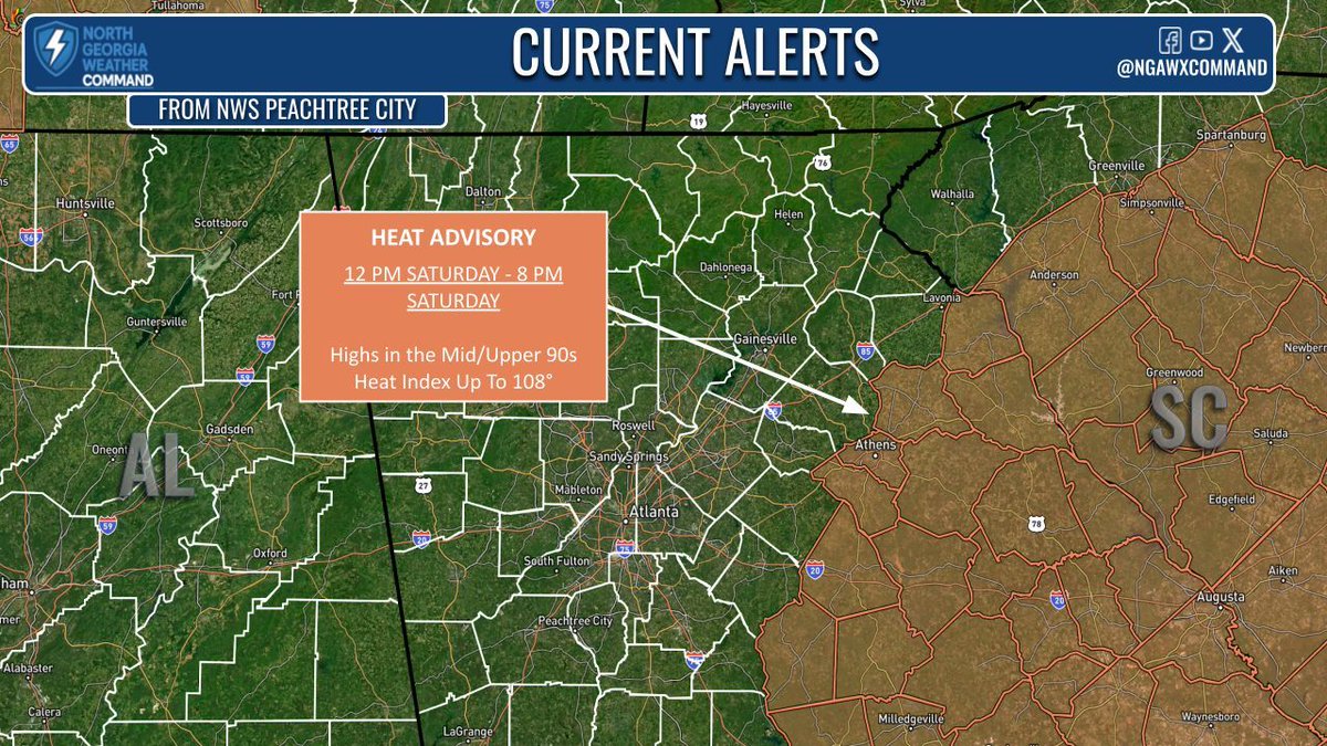
PATTERN CHANGE: Heat Advisory (11AM–9PM) for East GA & Excessive Heat Warning for SE GA—heat index 100°+. Downbursts w/ 40–50 mph winds possible Tue/Wed. Cooler temps & 1–2” rain arrive by Thursday as a cold front moves in. Stay safe in the extreme heat! #gawx #Atanta #Georgia
AFTERNOON HEAT: Highs in the 90s now with heat index values in the 100s. Heat advisory for the PM today and again tomorrow. Extreme Heat Warning for Lake Country Monday too. Little relief from the heat overnight with warm lows and little rainfall until late week. #gawx #Georgia
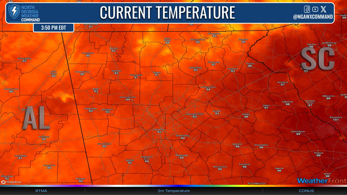
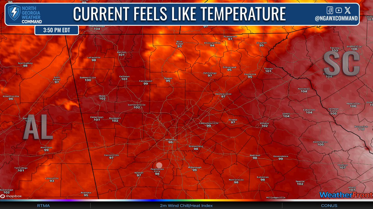
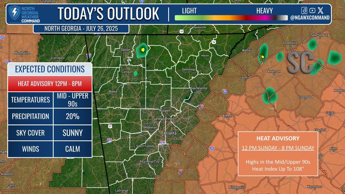
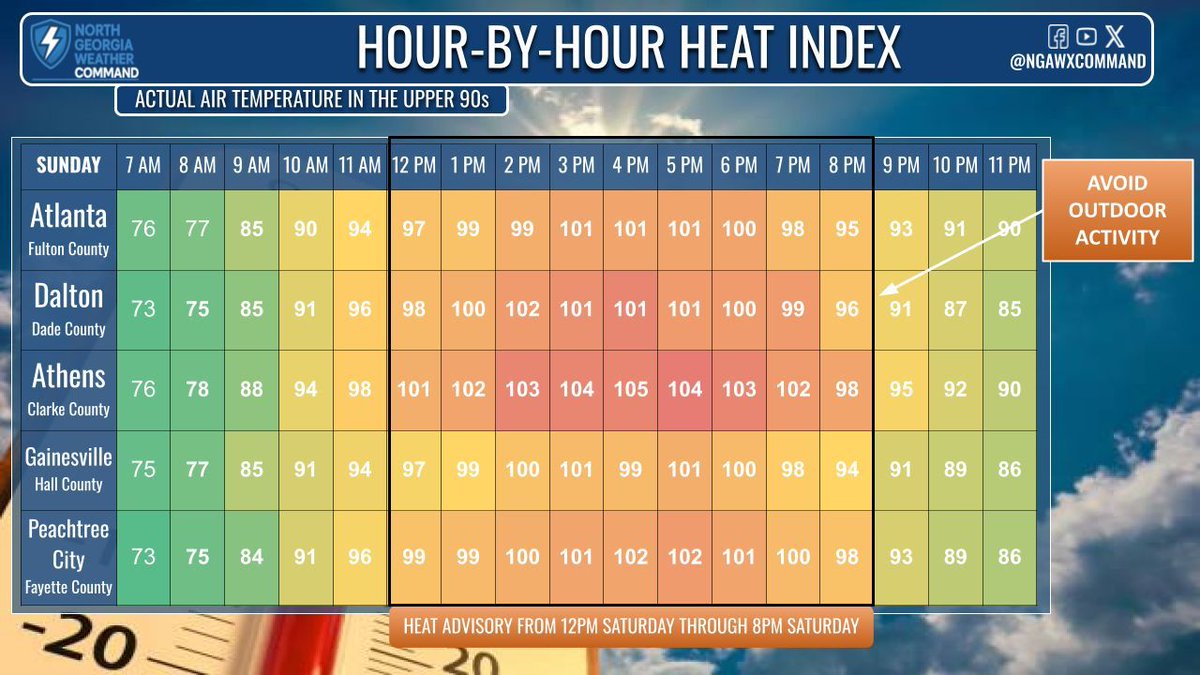
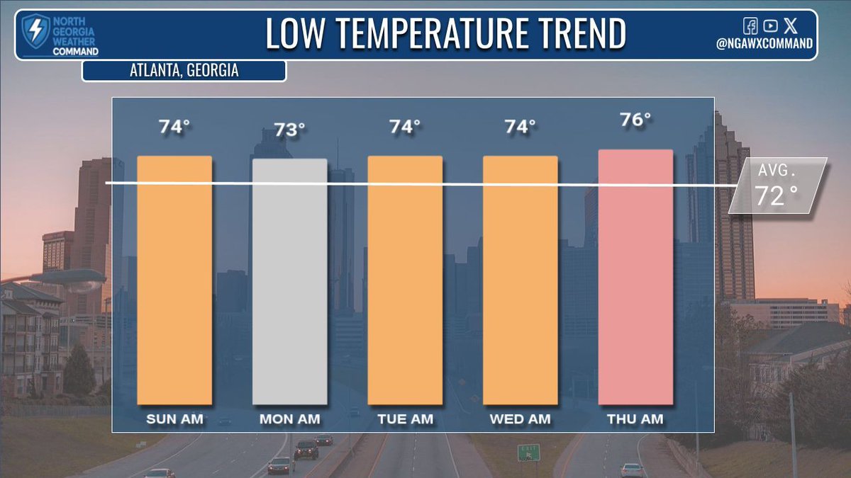
EXTREME HEAT: Highs in the mid-90s (mnts.) & upper 90s (south/east GA), hottest near Lake Country. Heat Advisory in effect 12–8 PM Sunday. Lows stay muggy in the mid/upper 70s. Only a 10% rain chance until midweek—cooler mid-80s possible by late next week! #gawx #Atlanta
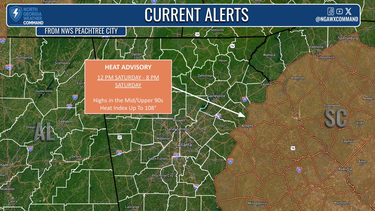
HEAT ADVISORY: Highs today will climb to the mid-90s, and with ample moisture, heat index values will climb to the upper 90s and in some spots the triple digits. The National Weather Service has issued a heat advisory for portions of east central Georgia until 8PM. #gawx
WEEKEND HEAT: A heat advisory has been issued for portions of east-central Georgia, with temperatures in the mid-90s and feels-like temperatures in the triple digits. Drink plenty of fluids, find some cool air, and wear lighter clothes to beat the heat. #gawx #Georgia #heatwave
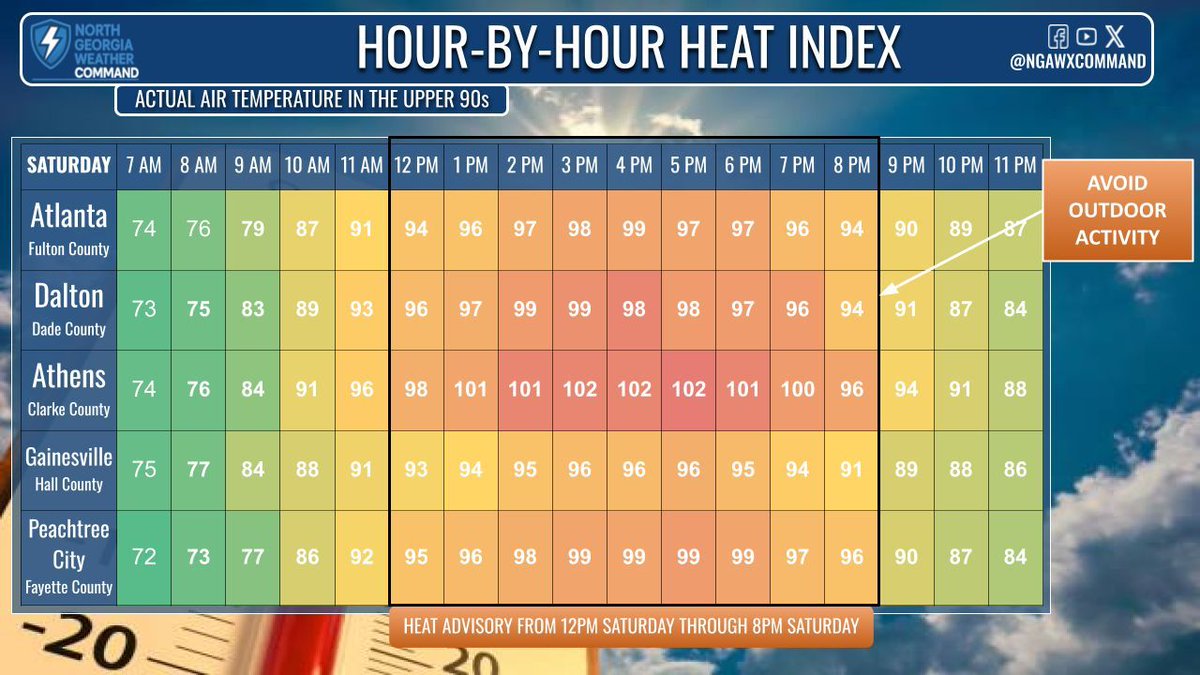
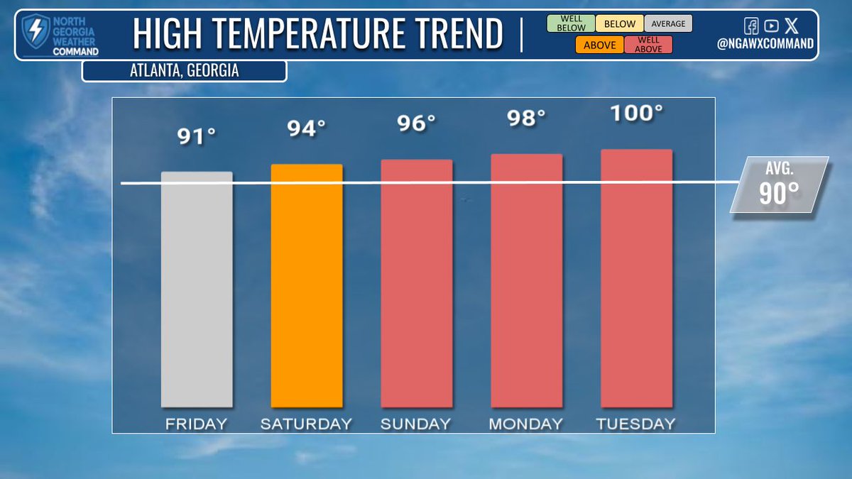
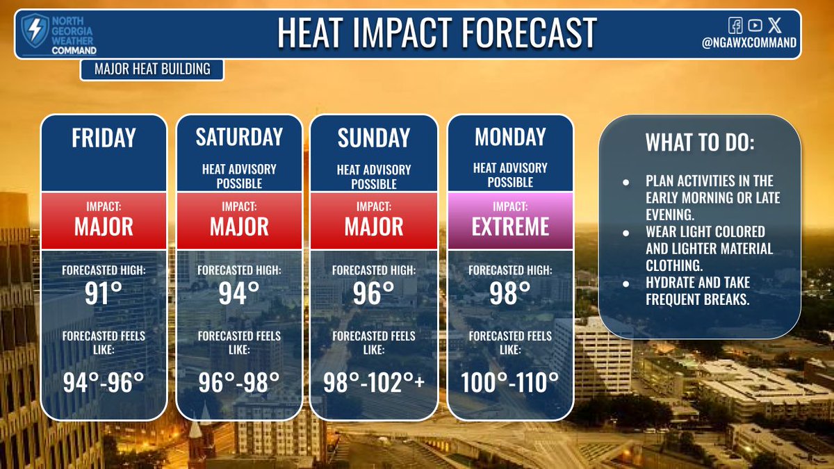
UNBEARABLE HEAT: Temps climb to mid-90s Saturday, upper 90s Sunday. Humidity returns with heat index near 100°. Triple-digit highs possible next week. Heat alerts likely this weekend—stay hydrated, avoid outdoor activity during peak heat, and take precautions. #gawx
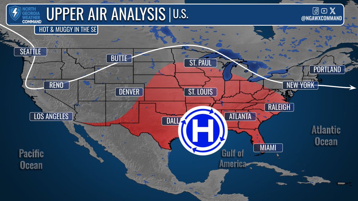
HEAT DOME: Extreme heat builds this weekend into next week. A high-pressure ridge moving from the Atlantic into the Gulf will pull tropical air into the South. Highs in the upper 90s, heat index near 110°—dangerous heat expected across the region. #gawx #Atlanta #heatwave
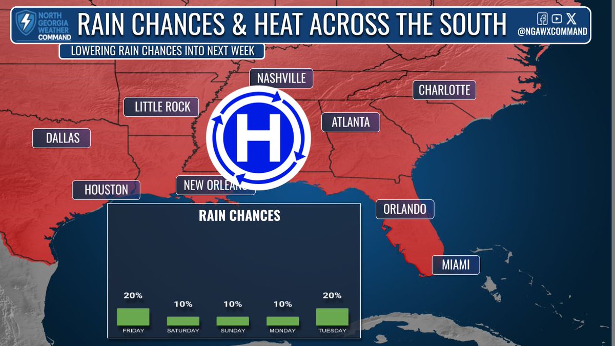
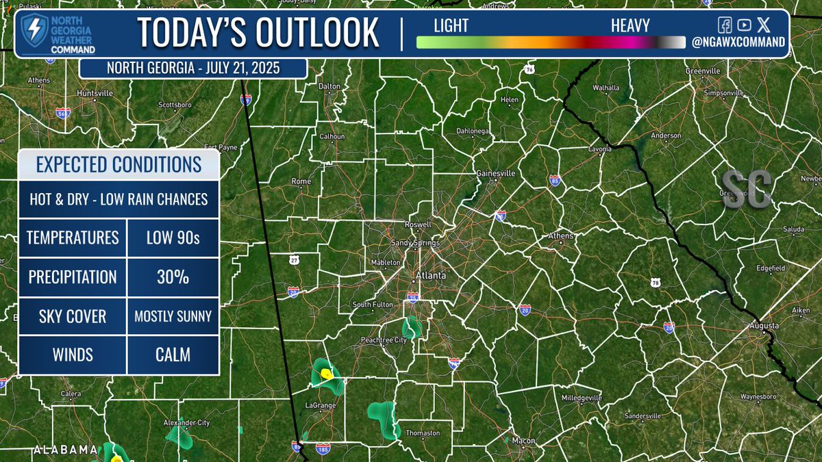
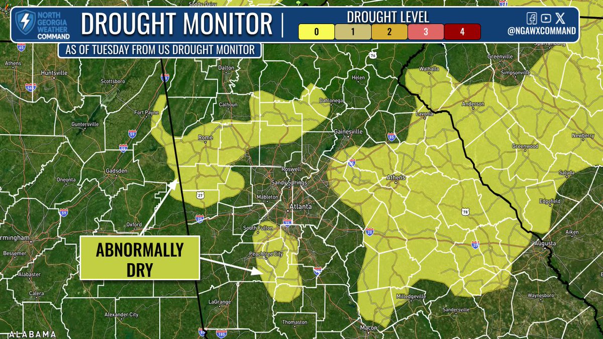
HOT & DRY: Temps climb into the 90s today with lower rain chances. A stray shower is possible south of #ATL. Much of North #GA is now “abnormally dry” and drought may develop next week. Early signs point to upper 90s, possibly 100°+ with heat indices near 110° next week. #gawx
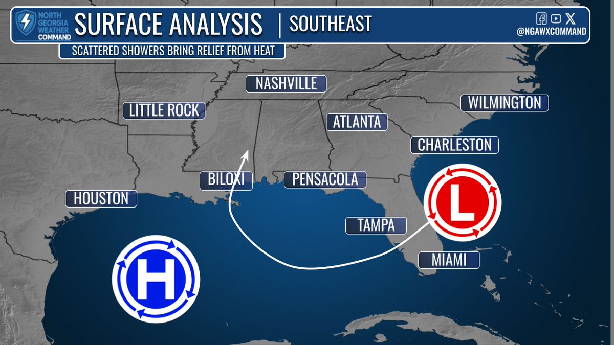
MORE COMFORTABLE: Drier air moves in this afternoon and sticks around through Thursday. It’s tied to a stalled front over North GA, shown by lighter greens/tans on the map. By late Thursday into Friday, the front lifts north and humidity returns to end the week. #gawx
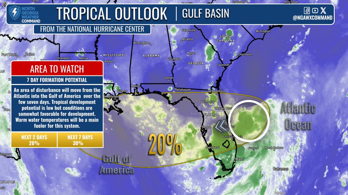
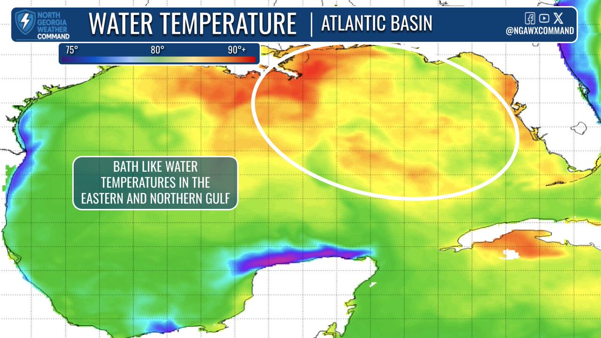
DRIER AIR: Temps reach upper 80s to low 90s today despite morning clouds. PM storms may drift west—an unusual motion—due to a backdoor cold front. NE #GA gets drier briefly. Watching the Gulf for possible tropical dev. (20% chance) with rain & rough surf possible. #gawx #Atlanta
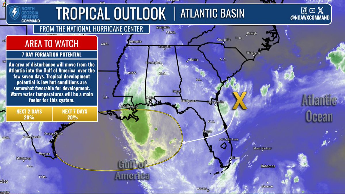
HEAT ADVISORY: Extreme heat continues with highs in the mid to upper 90s & heat index values near 110°. A Heat Advisory is in effect today. Some PM storms with brief heavy rain. Tropics being monitored—no land threat at this time. #gawx #Georgia alerts: ngawxalerts.vercel.app

EXTREME HEAT: Highs in the 90s today with the heat index climbing to the low 100s by Monday and Tuesday. Isolated rain chances Sunday but becoming more scattered early in the week. #gawx #Atlanta

CRANKING UP THE HEAT: Highs in the 90s and ample moisture thanks to a high pressure will keep feels like temps near advisory level and probably at advisory criteria by the end of the weekend. Isolated showers through the weekend and better rain chances on Monday. #gawx #Atlanta
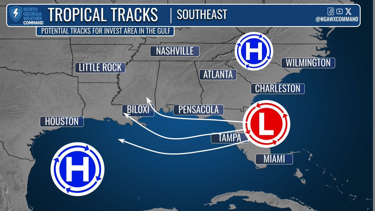
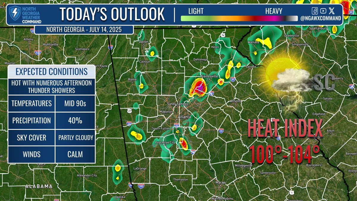
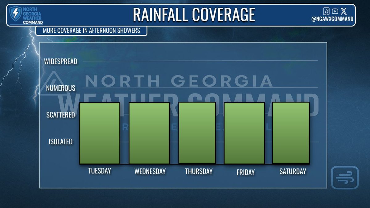
HEAT & THE TROPICS: Highs continue to be above average with heat index values again near/reaching triple digits. Scattered PM showers with localized flooding, lightning, & gusty winds possible. Watching the three potential tracks the system moving into the Gulf could take. #gawx
STEAMY & PM SHOWERS: Highs in the mid-90s again with heat index values near or right above 100°. More coverage of scattered PM showers will help reduce the heat by the afternoon and evening hours. #gawx #Georgia #Atlanta All Alerts: ngawxalerts.vercel.app
TROPICAL CHECK: A check on the tropics with a system to watch in the Atlantic that is expected to move into the Gulf. My thoughts so far here: facebook.com/NorthGAWXComma… More info for #Georgia later in the week #HurricaneSeason2025 #gawx