Mike Thomas
@MikeTFox5
@Fox5DC Evening Meteorologist. Forecast & Graphics Production lead. Former forecasting expert @CommodityWX. DeMatha & Penn State Alumni
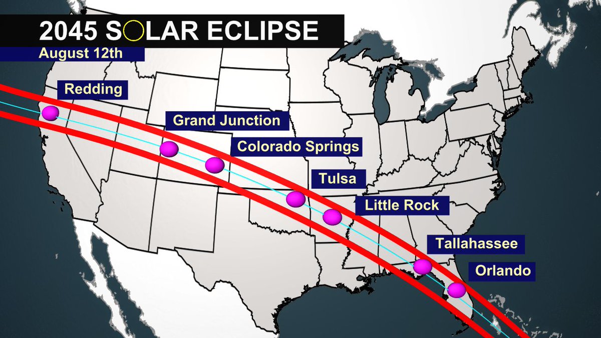
Most expensive Disney World ticket ever...coming August of 2045!

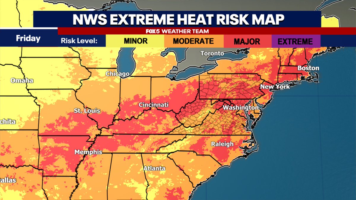
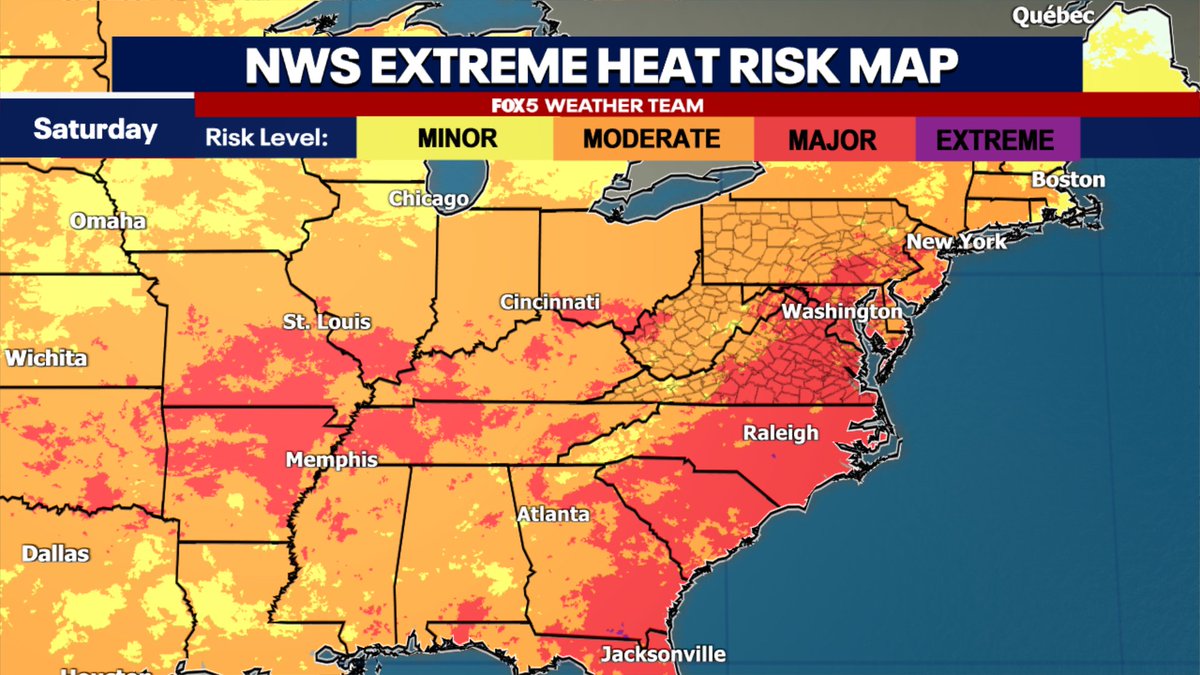
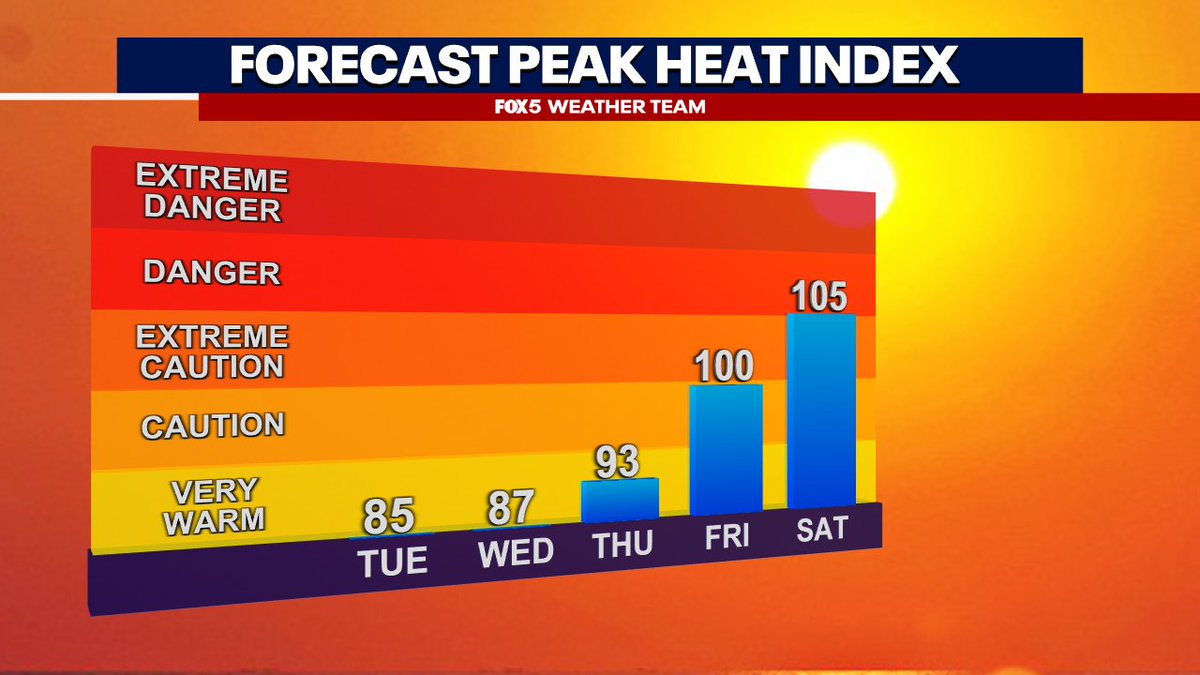
NWS heat risk at category 3 of 4 "major" for both Friday & Saturday. Likely going to be heat advisory level heat around the DC region both days at heat index values above 105°F seem possible. 🔥 Plan ahead to keep yourself cool! 🌡️
Very comfortable next couple of days here in the DC region. But...and I do HATE to day this...don't get used to it. Another heat wave on the way to end the week :(
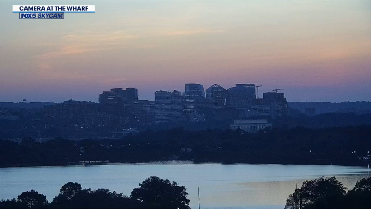
Beautiful July sky over Rosslyn, VA this evening! The sun is now setting before 8:30pm! ☀️
Northwest flow gives us a much needed humidity (and storm) break the front half of the workweek, before another "heat ridge" builds across the South during the end of the week. It will be feeling like 100°+ AGAIN this weekend, so enjoy the next few days!
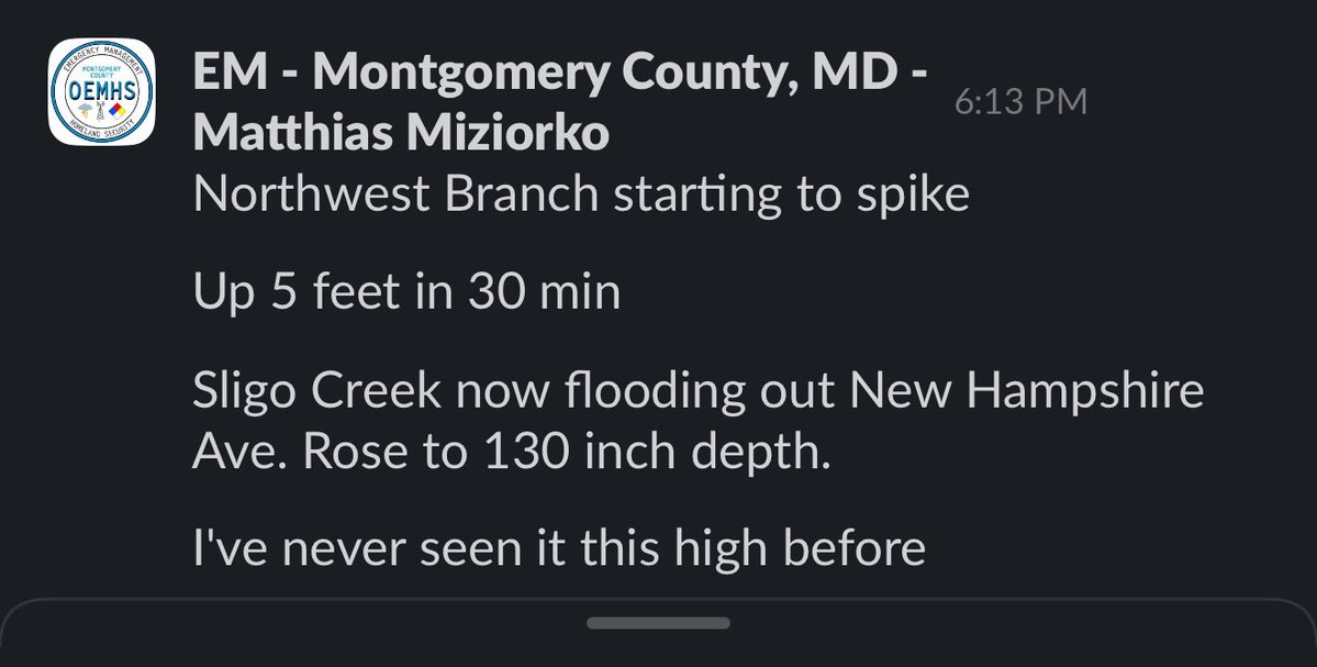
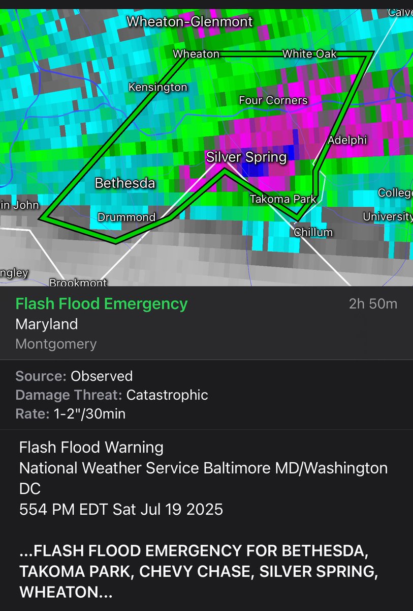
It’s never good when you see an Emergency Manager say “I’ve never seen <the river> that high before” Dangerous condition out there just north of downtown. Take it seriously. Flood emergency’s are no joke!
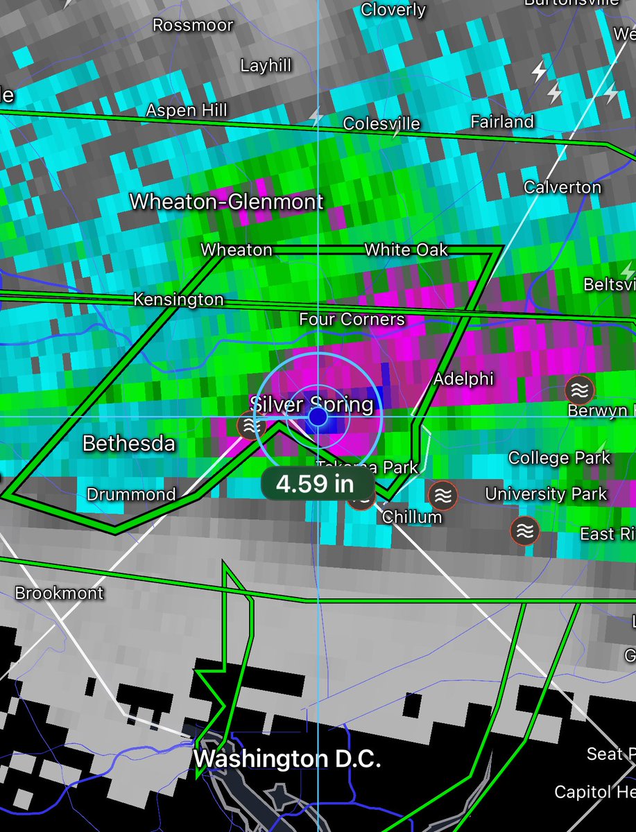
Rare FLASH FLOOD EMERGENCY issued for the Silver Spring area around Montgomery County where radar estimates more than 4.5” of rain has fallen. Avoid this area until the storm passes for safety as travel is likely to be treacherous and dangerous! ⛈️
Portions of Beltway urban flooding @montgomerycomd @MDSHA
Training thunderstorms leading to multiple reports of Flash Flooding and water rescues on the northern half of the Beltway as heavy downpours soak the region. 🌧️
Training thunderstorms leading to multiple reports of Flash Flooding and water rescues on the northern half of the Beltway as heavy downpours soak the region. 🌧️
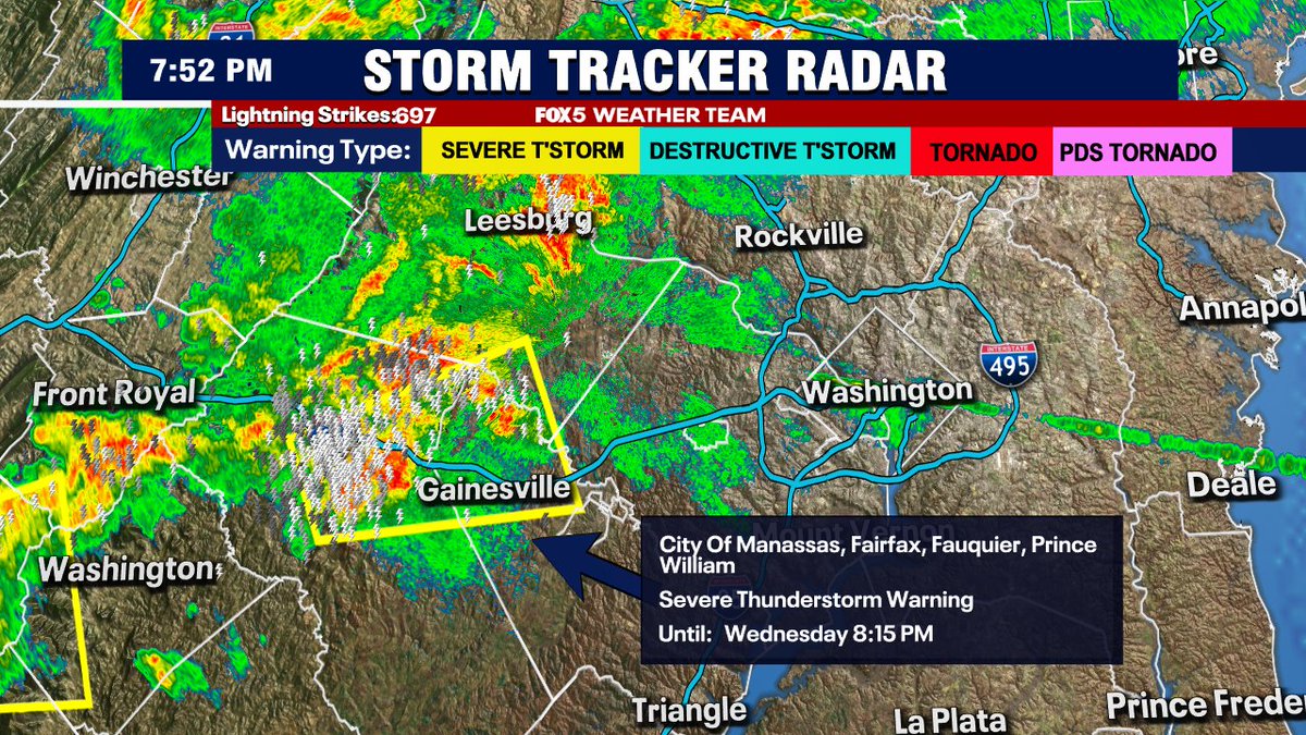
Severe thunderstorm warnings have all expired around DC but heavy thunderstorms continue across Northern Virginia with multiple Flash Flood warnings issued. Heaviest cells are in southern Fauquier and Prince William counties.
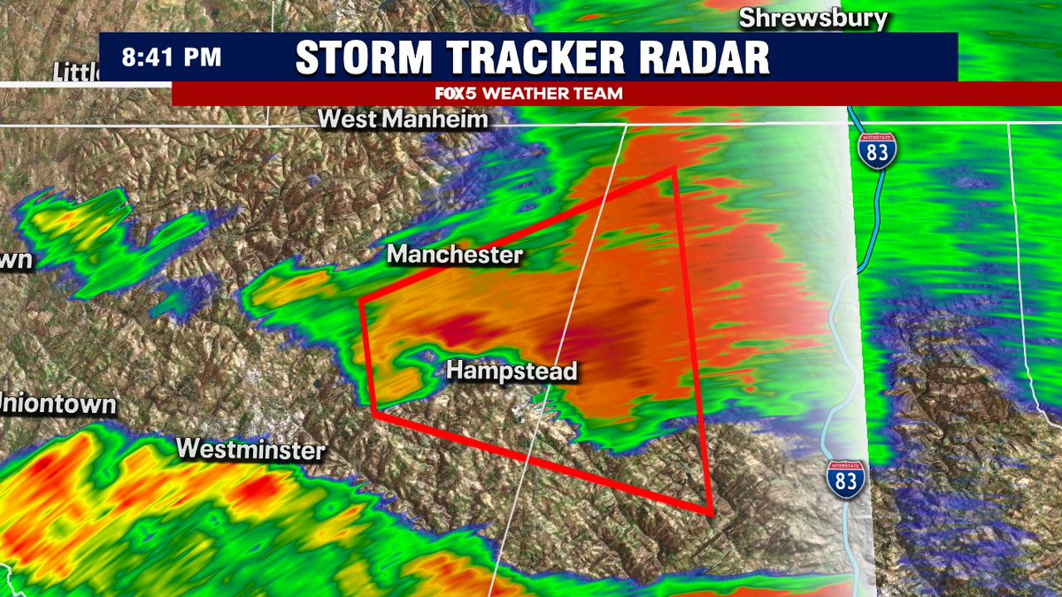
Nice little hook on the tornado warning cell in northern Carroll county. About to pass right over Hampstead before crossing into northern Baltimore County. Folks up there be safe! Seek shelter until the storm has passed.
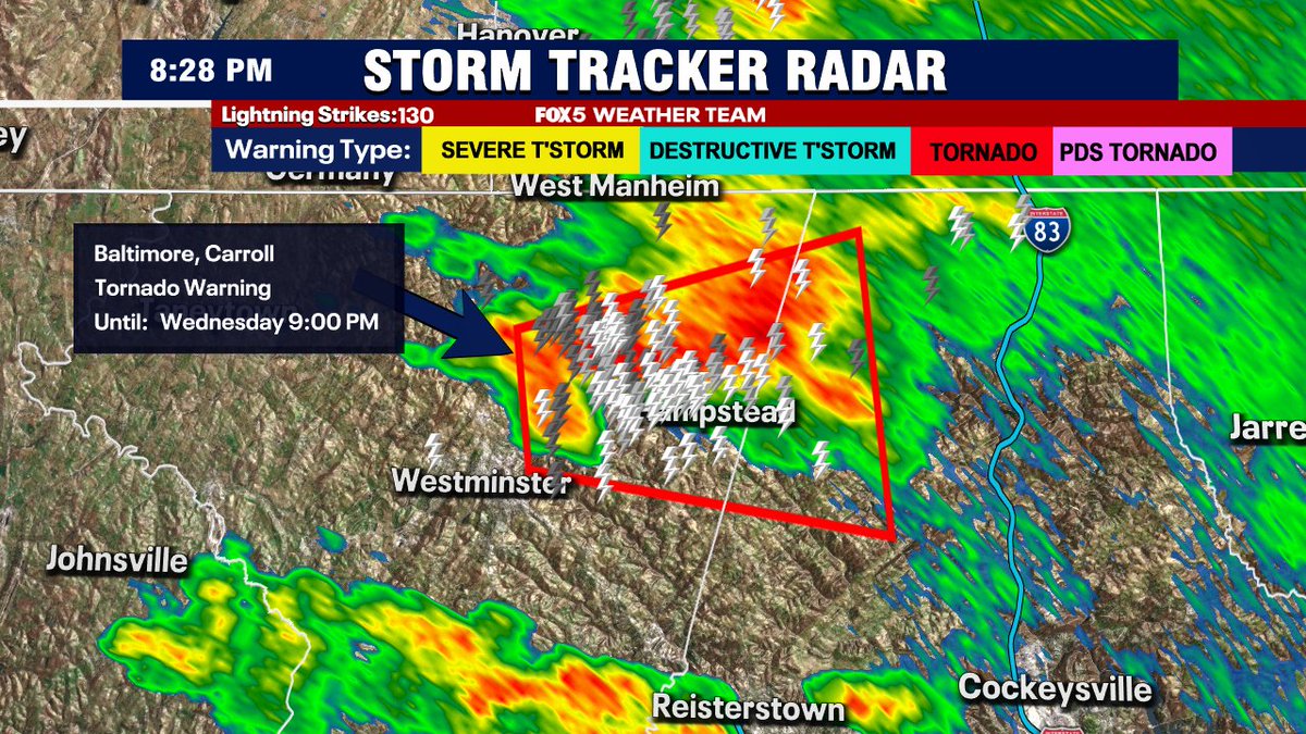
New Tornado Warning up for northern Carroll County in northern Maryland for radar detected rotation. Folks up that way be safe and seek shelter until this storm has passed.
Add northeast Fauquier, western Prince William to the list of counties under severe thunderstorm warnings. If this cell continues, Fairfax and DC will be next up.
Cell in northern Loudoun County gets the "Considerable" designation (winds to 70mph possible) while the storm entering northern Fauquier gets the Tornado Possible designation. Weather getting active west of town early this evening!
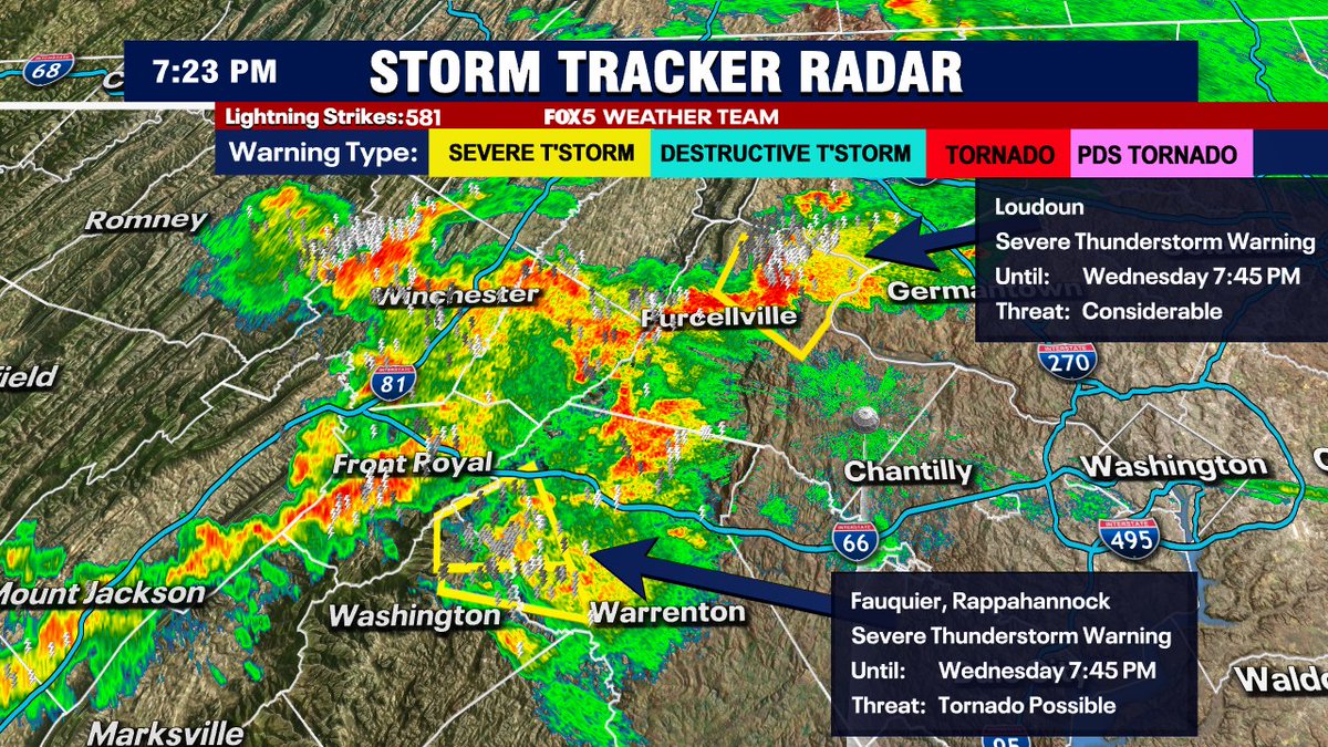
Heavy storms coming together in Virginia near I-66 as earlier storm outflow (moving southeast) collides with prevailing southwesterly, moisture heavy winds off the blue ridge. A couple severe thunderstorm warnings with it, including Loudoun & Fauquier counties. Be safe out there!
Here's how the latest guidance shows will progress this evening. Heavy downpours will be the primary concern, along with a lot of lightning in any storms that do fire. An isolated severe cell is possible, but not expecting major severe weather.
Scattered activity so far northwest of DC. Heavy cell approaching Hagerstown, MD has eclipsed 40,000 feet and has a considerable amount of lightning with it. Futurecast suggest the 6:30-8:30pm window is the best shot at storms in & around DC. It's crazy humid out there today.
While we wait for the MLB All-Star game to wrap here...looking at the tropics. Invest 93-L crossed over Florida today bringing some heavy tropical thunderstorms. It will continue to pester the Gulf Coast for much of this week, though it will likely struggle to intensify too much.
Many in our region lucked out with limited storms today, but the threat is back again tomorrow. Some early clouds break to sunshine...hot & very humid afternoon...scattered storms then fire as the day goes on. You know the drill! Marginal risk of severe in the yellow zone.
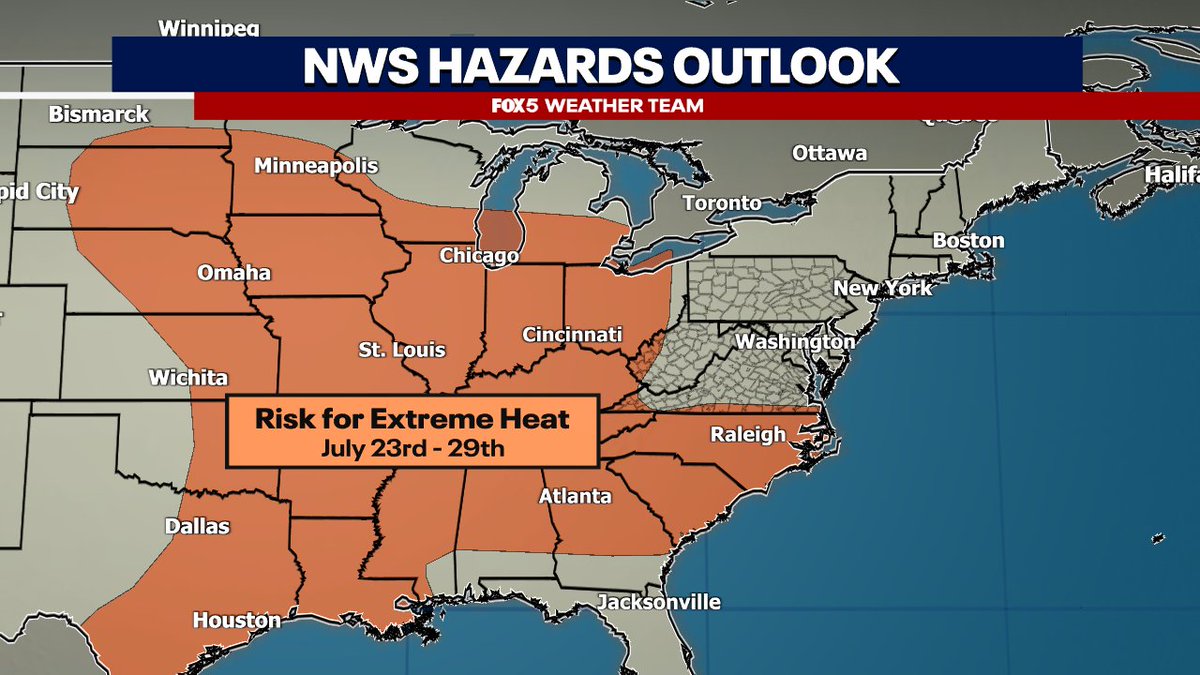
While humidity has been rough, high temps have been about seasonal in our region for much of July so far. Several models are suggesting this may change next week with the potential for a stronger heat wave in the East, mostly focused in the Midwest & South. CPC already as an…