African Maps
@MapsAfrican
Creating & curating African maps for media, education & corporate use. Licensing available | DM for custom map designs. IG/🪡: @mapsafrican | FB: AfricanMaps
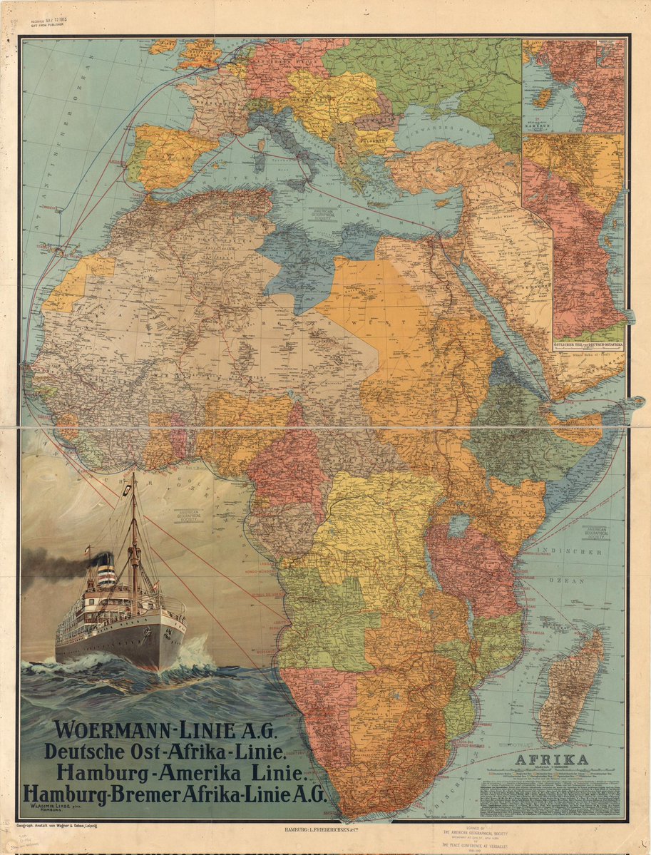
This 1914 map from the World Digital Library shows shipping routes connecting Germany to many parts of the African coast, including its coIonies at the time such as Togo, Cameroon, Southwest Africa (now Namibia), and East Africa (now Tanzania).
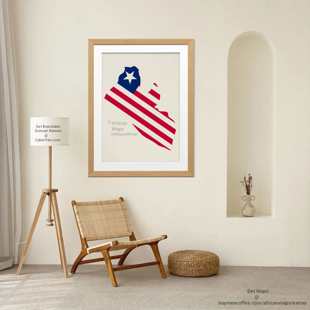
On this day, July 26, 1847, Liberia 🇱🇷 gained independence. It was formed by freed African Americans. Its flag is similar to that of the United States, and its capital, Monrovia, was named after President James Monroe. #LIB26
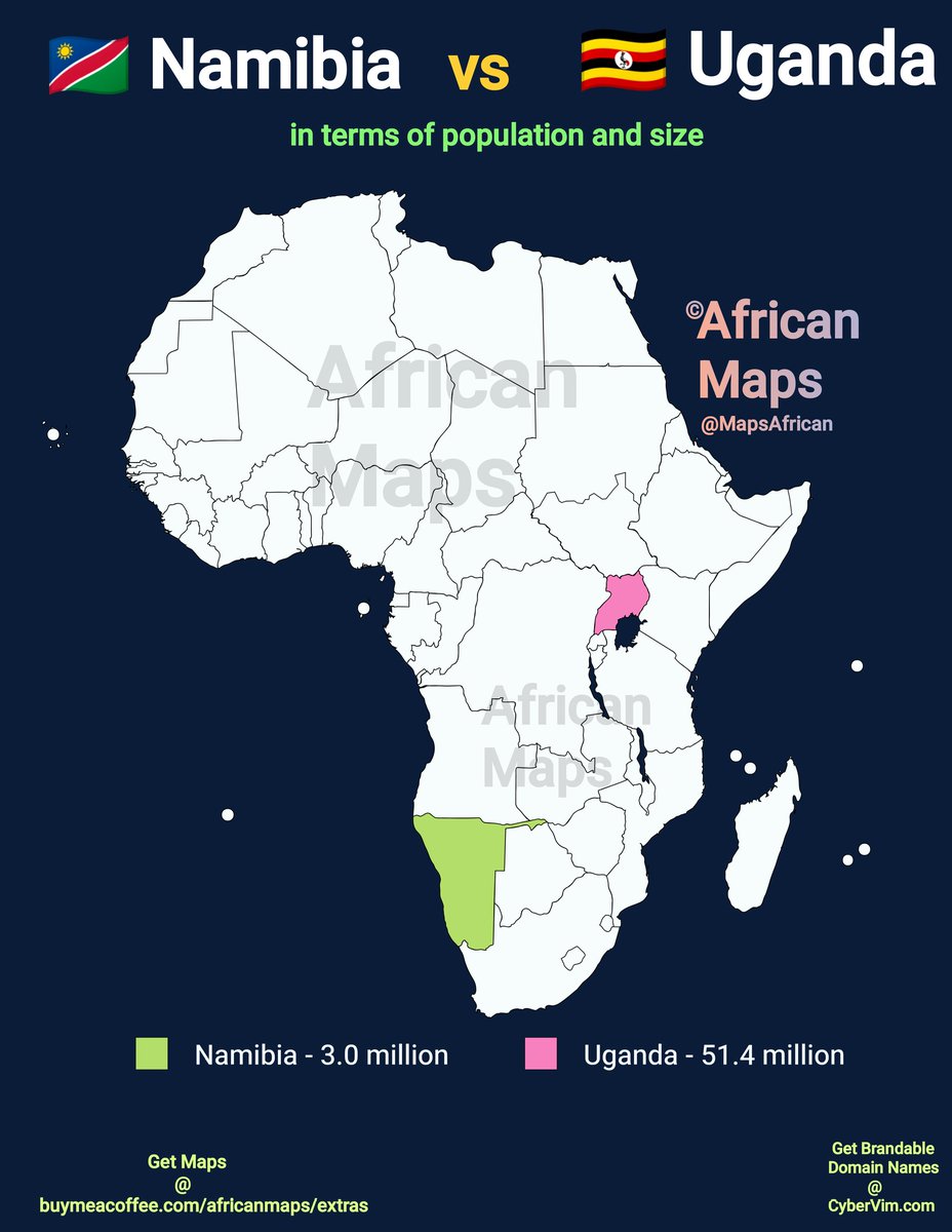
Fun Fact: Namibia 🇳🇦 is over 3 times bigger than Uganda 🇺🇬, but Uganda is over 16 times more populated.
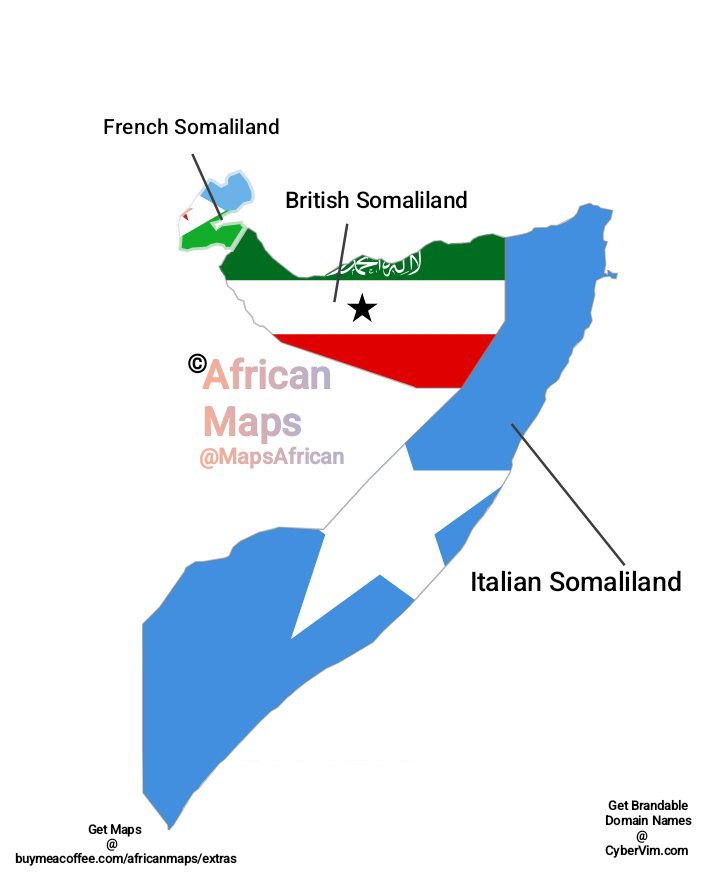
Before gaining independence, Djibouti 🇩🇯 was French Somaliland, Somalia 🇸🇴 was Italian Somaliland, and Somaliland was British Somaliland.


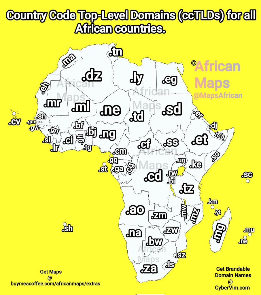
Benin 🇧🇯, Djibouti 🇩🇯, Burkina Faso 🇧🇫, and Cape Verde 🇨🇻 have the most unique domain extensions in the world. Map shows the country code top-level domains (ccTLDs) for all African countries.
Ever wondered how to travel from Ghana 🇬🇭 to Spain 🇪🇸 by road?
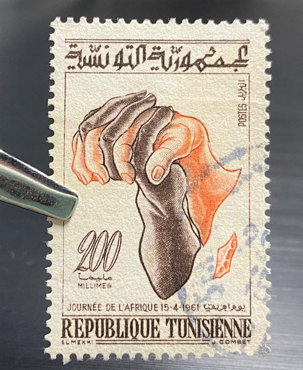
This 1961 Tunisian 🇹🇳 stamp marks Africa Day with two clasped hands forming Africa, symbolizing unity, anti-racism, decoIonization and Pan-African solidarity.
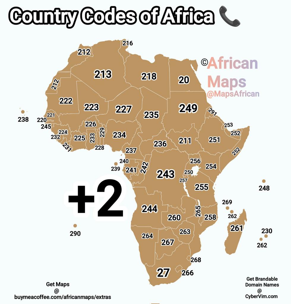
Country Codes of Africa. Rep your country's code in the comments.


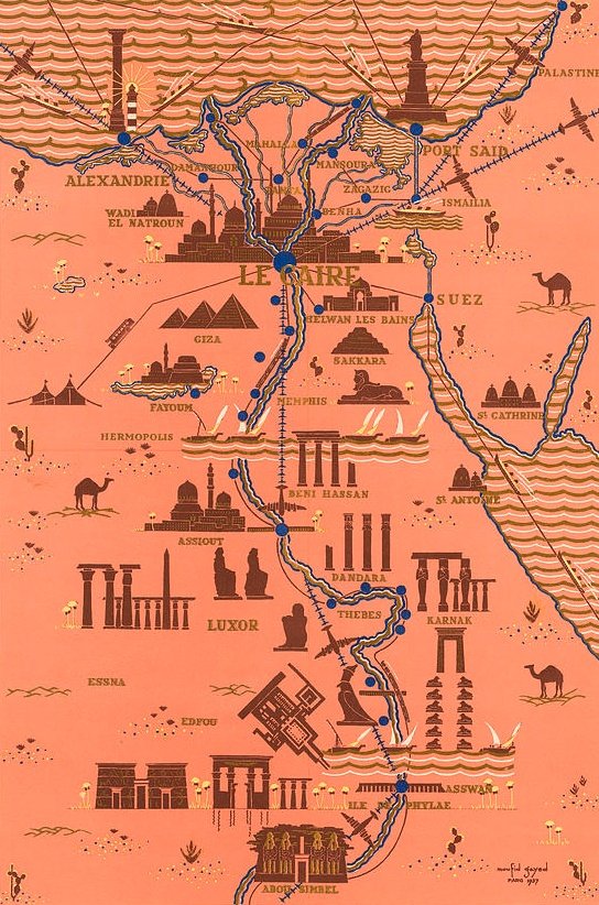
Antique Illustrated Map of Egypt 🇪🇬 showing monuments along the River Nile – Cairo, Luxor, Abu Simbel, etc.


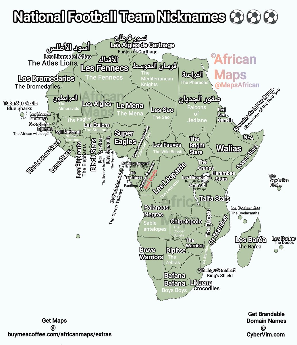
Nicknames of the National Football Teams of Every African Country. ⚽