
Kristen Cornett
@KristenRCornett
Meteorologist at @KMOV. Earth Science nerd. I ❤ travel. And 🐕. Ill-mannered commenters will be 🚫
First Alert...New Tornado Warning issued for Montgomery, Macoupin. Track the storms on radar at bit.ly/3v79dLm #FirstAlert4
First Alert...New Severe Storm Warning issued for Montgomery, Macoupin, Madison, Bond. Track the storms on radar at bit.ly/3v79dLm #FirstAlert4
First Alert...New Severe Storm Warning issued for St. Charles, Madison, Jersey, Macoupin, Calhoun, Lincoln. Track the storms on radar at bit.ly/3v79dLm #FirstAlert4
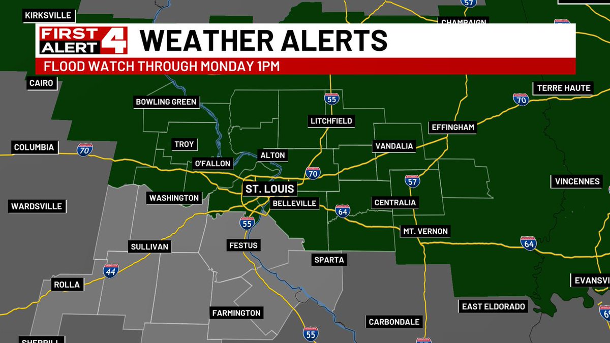
Heavy rain and storms are expected to increase in coverage tonight with increasing concerns for flash flooding. Storms tonight could produce 3-6" of rain in a short amount of time. In addition, multiple storms could move over the same location, producing even higher amounts.
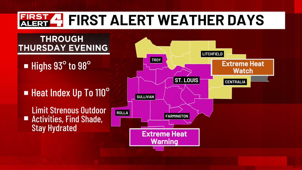
First Alert Weather Days extend out through Thursday as an Extreme Heat Warning is in effect until Thursday evening. Peak heat indices up to 110 degrees are possible, especially Tuesday - Thursday which may very well be the worst of it.
It's getting ready to get pretty awful outside. Stay well everybody.
First Alert...New Severe Storm Warning issued for St. Clair, Monroe. Track the storms on radar at bit.ly/3v79dLm #FirstAlert4
First Alert...New Severe Storm Warning issued for Clay, Richland, Jasper. Track the storms on radar at bit.ly/3v79dLm #FirstAlert4
First Alert...New Severe Storm Warning issued for Marion, Fayette. Track the storms on radar at bit.ly/3v79dLm #FirstAlert4
First Alert...New Severe Storm Warning issued for Fayette. Track the storms on radar at bit.ly/3v79dLm #FirstAlert4
First Alert...New Severe Storm Warning issued for Jersey, Lincoln, Calhoun, Greene. Track the storms on radar at bit.ly/3v79dLm #FirstAlert4
Hot & humid with daily rain and storm chances, mostly in the afternoons - early evenings. Next week looks a little drier...but hotter.
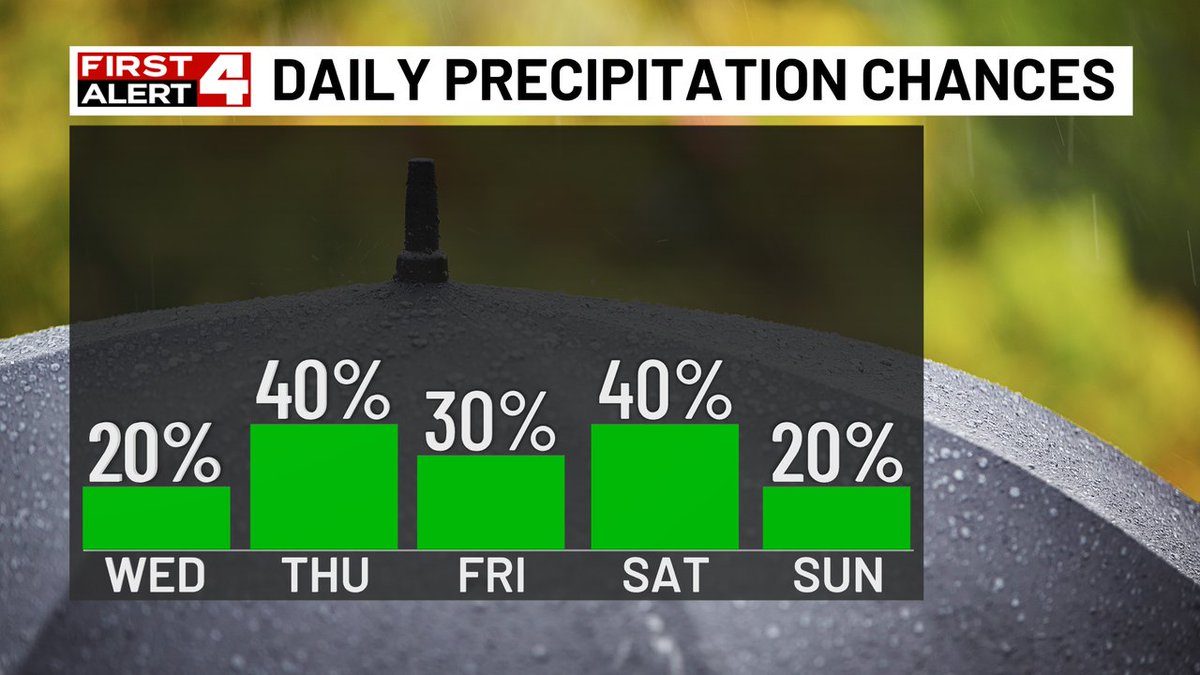
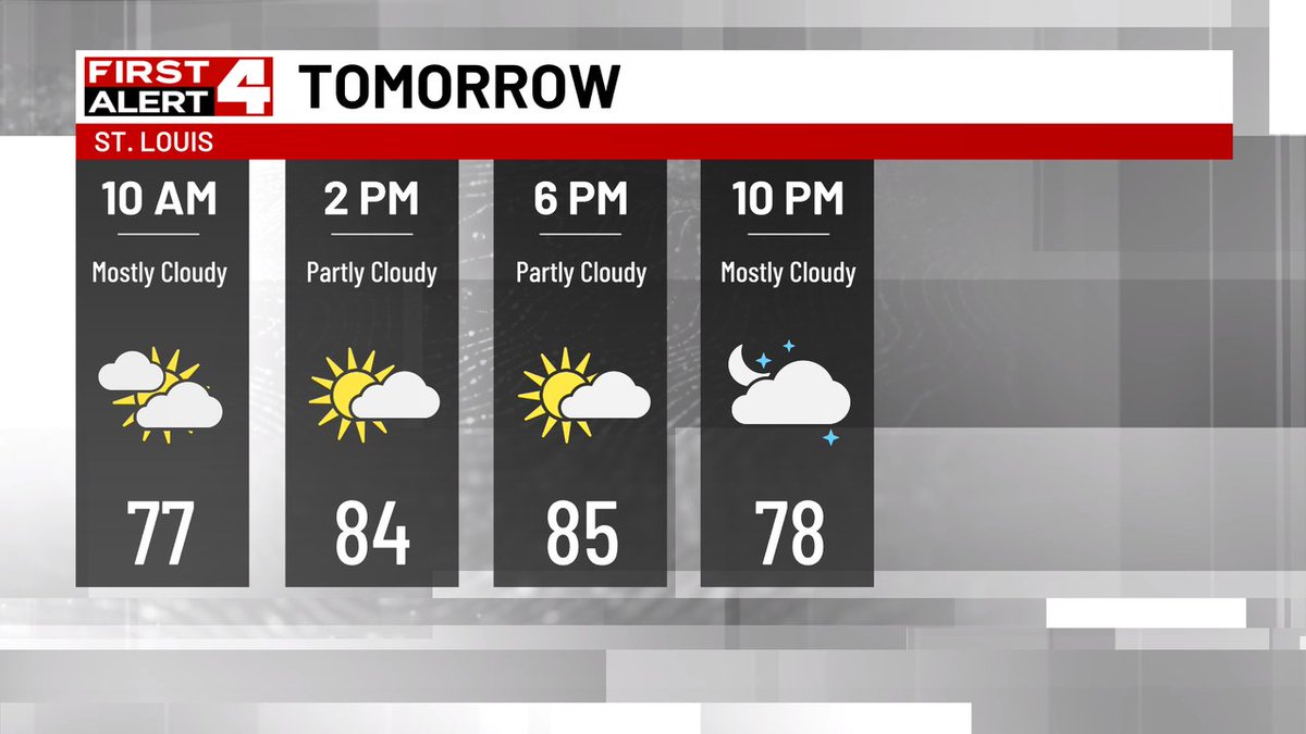
Monday looks to be a much drier day. Partly cloudy, warm and muggy. The only rain chances are over SE MO & S IL and sit only at 20%.
First Alert...New Severe Storm Warning issued for Richland, Clay, Jasper. Track the storms on radar at bit.ly/3v79dLm #FirstAlert4
First Alert...New Severe Storm Warning issued for Clay. Track the storms on radar at bit.ly/3v79dLm #FirstAlert4
First Alert...New Severe Storm Warning issued for Clay, Effingham. Track the storms on radar at bit.ly/3v79dLm #FirstAlert4
First Alert...New Severe Storm Warning issued for Marion. Track the storms on radar at bit.ly/3v79dLm #FirstAlert4
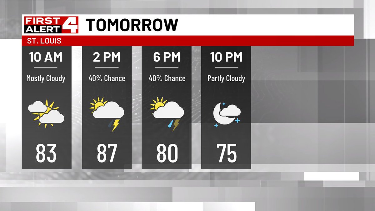
Scattered thunderstorms tomorrow, mainly during the afternoon and early evening, could bring heavy rain at times and gusty winds.
First Alert...New Severe Storm Warning issued for Pike, Pike, Greene, Audrain, Ralls, Calhoun. Track the storms on radar at bit.ly/3v79dLm #FirstAlert4
First Alert...New Severe Storm Warning issued for St. Charles, Lincoln, Calhoun. Track the storms on radar at bit.ly/3v79dLm #FirstAlert4