Kelly Foster
@Kelly_WPMI
Morning News Anchor/AMS & NWA Sealed Meteorologist Local 15 WPMI-TV Mobile, AL-Pensacola/Ft. Walton Beach, FL
Thank y'all for voting me 2017 Best Anchor in @LagniappeMobile I'm so honored!! @LOCAL15NEWS 💗✨

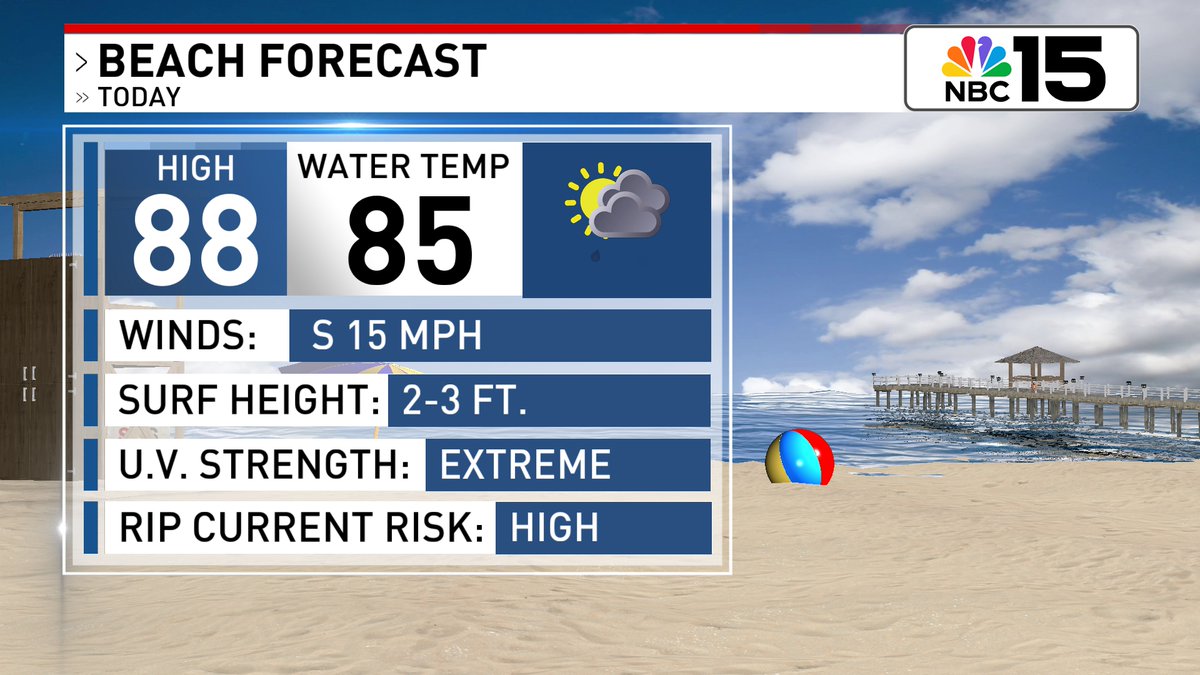
Beach & Marine forecasts for Saturday! @mynbc15 mynbc15.com/weather


Sct'rd storms Saturday with seasonal heat, then mostly dry skies and building heat by Sunday. At the beach, yellow flags are projected to fly this weekend. @mynbc15 mynbc15.com/weather


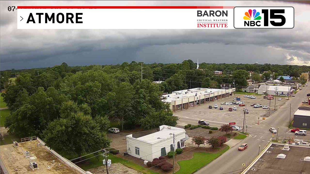
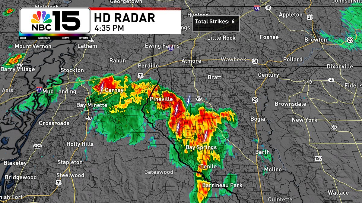
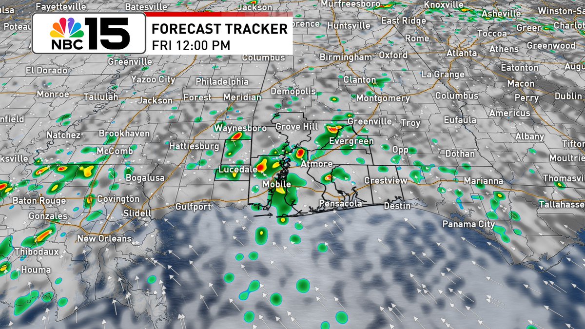
View of the storms near the Perdido River that are approaching Atmore from the south. @mynbc15 mynbc15.com/weather
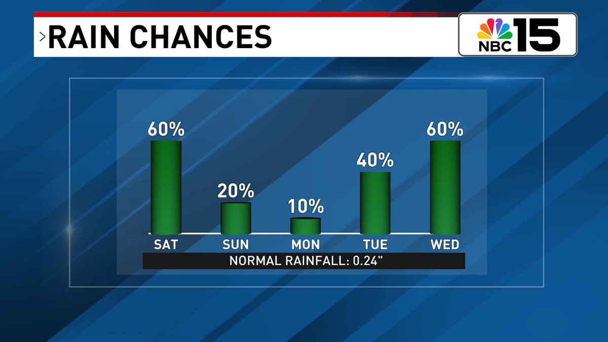
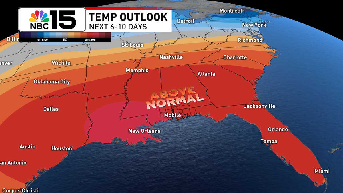
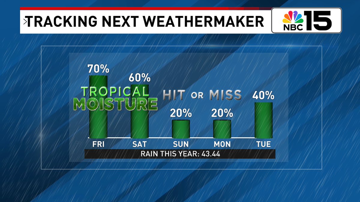
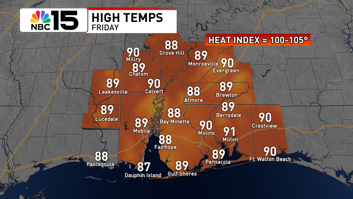
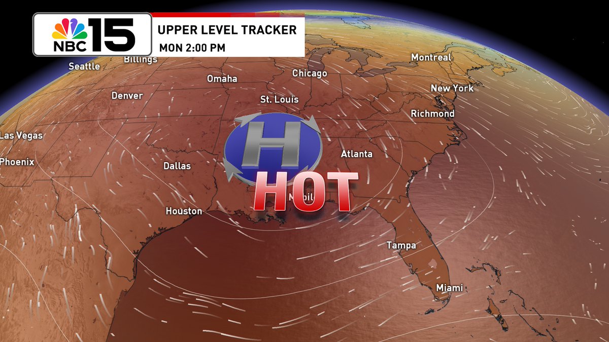
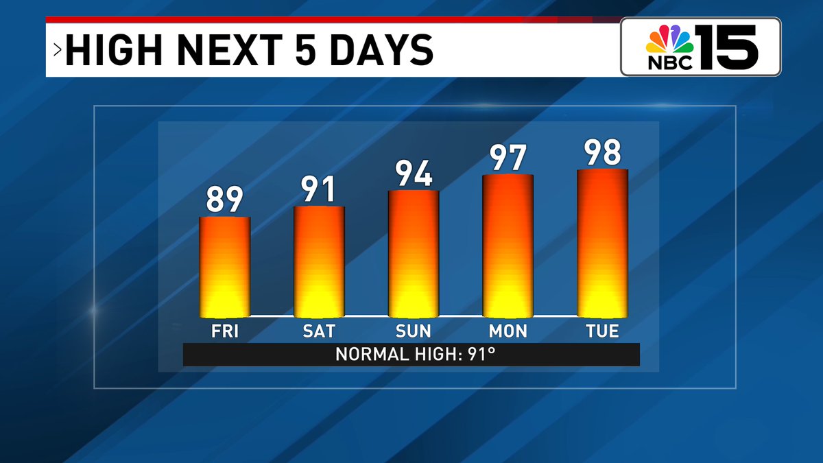
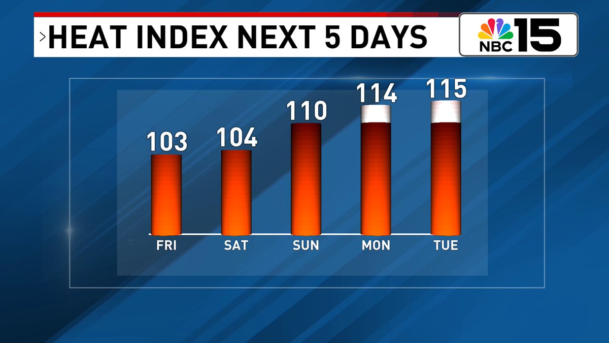
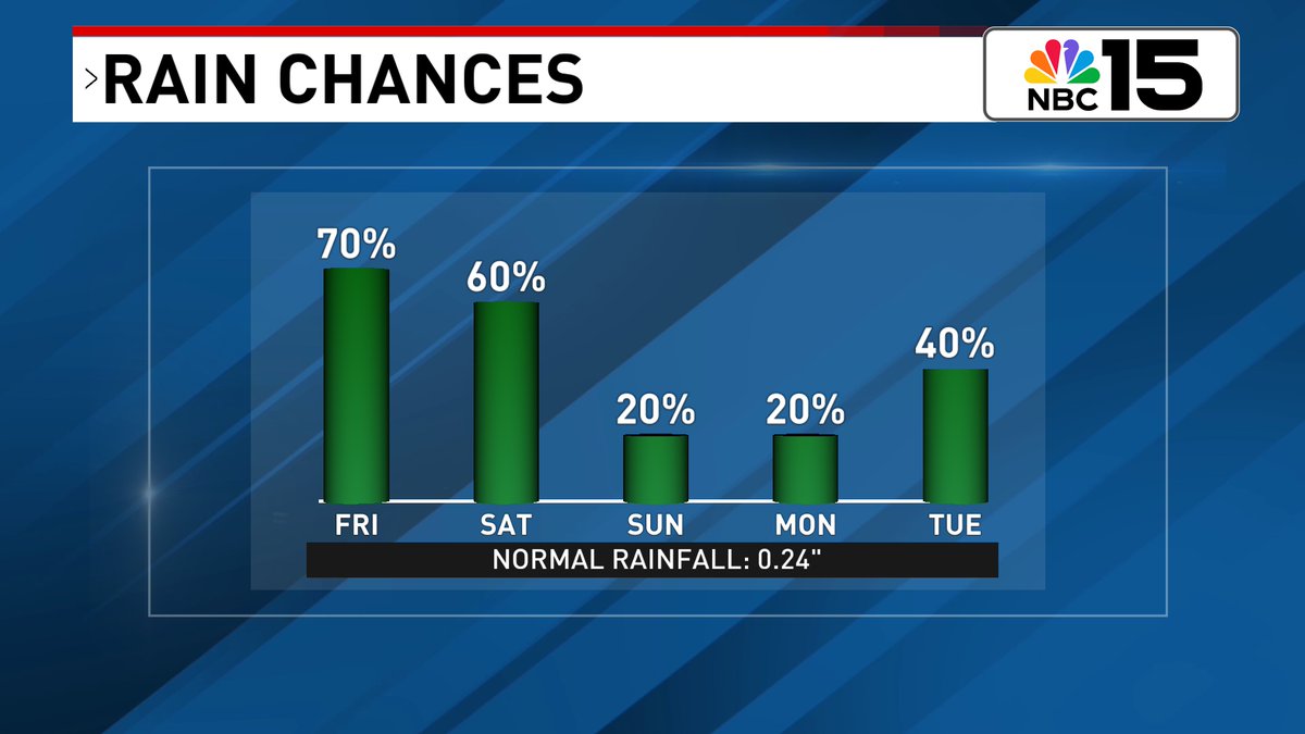
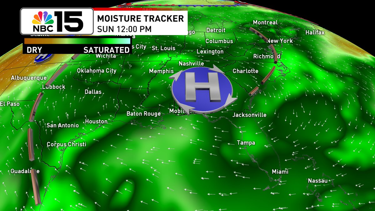
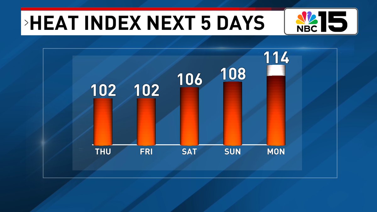
Lingering moisture will keep things a little unsettled for Saturday with sct'rd storms, but by Sunday high pressure builds in & the heat will be on 🔥. Monday & Tuesday will bring upper 90s (which will be close to records) and heat index values likely above 110° 🥵. @mynbc15
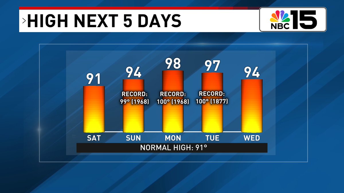

For the second half of the weekend into early next week expect sweltering heat 🥵♨🌡. Highs skyrocket into the mid to upper 90s with heat index values well over 110+ possibly up to 115 in spots. Check back for updates @mynbc15 mynbc15.com/weather


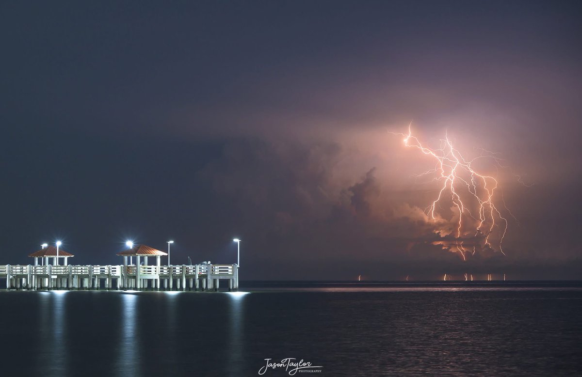
#GulfCoast summer nights ⚡️⚡️⚡️what a week it’s been! 📸 Jason Taylor @mynbc15 @ThomasGeboyWX @natwxdesk @NWSMobile @spann
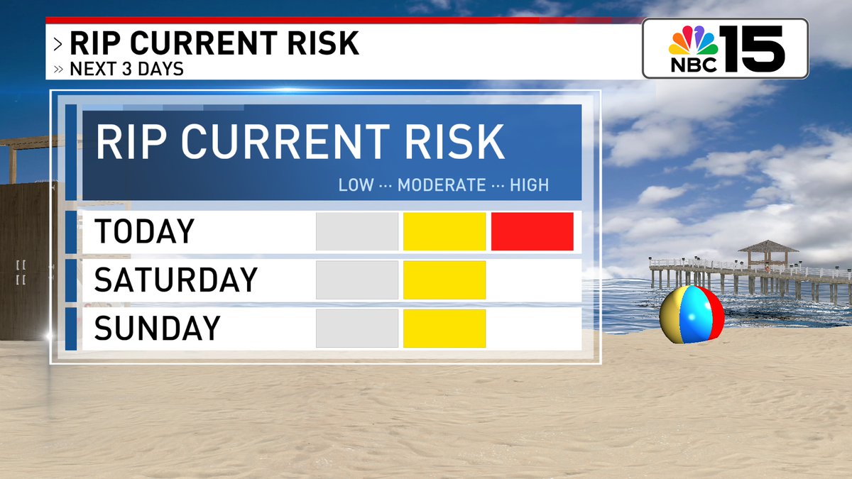
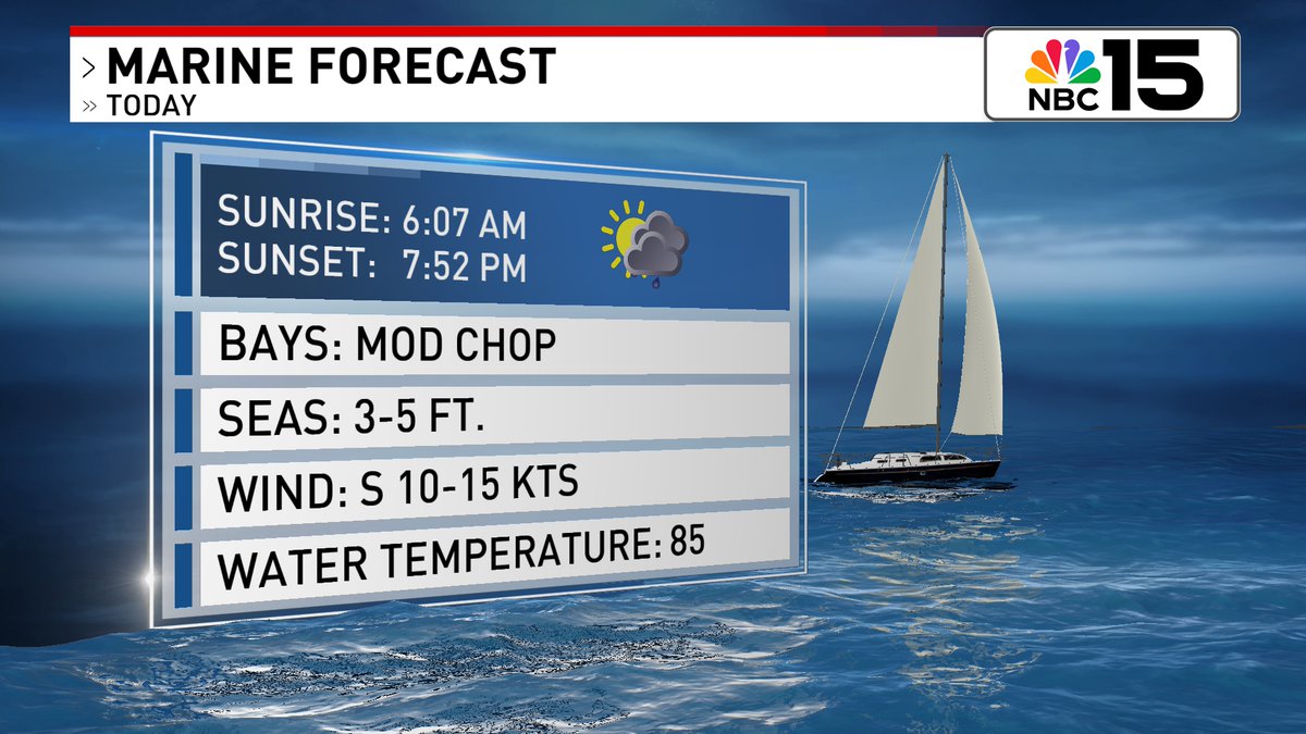
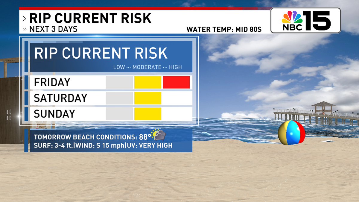
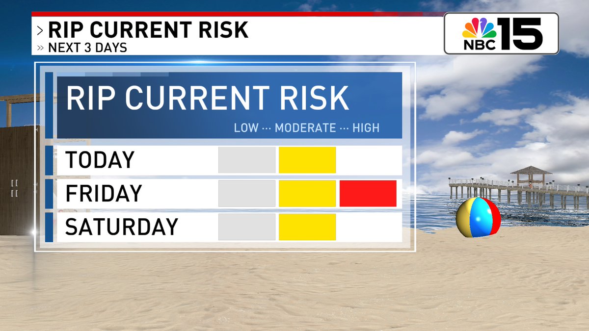
The rip current risk 🌊🏊 is HIGH today & moderate this weekend. Waves in the surf zone will be 2 to 3 feet & the UV forecast is EXTREME. Moderate Chop in bays & coastal waters with seas 3 to 5 feet with coastal storms in store @mynbc15 mynbc15.com/weather
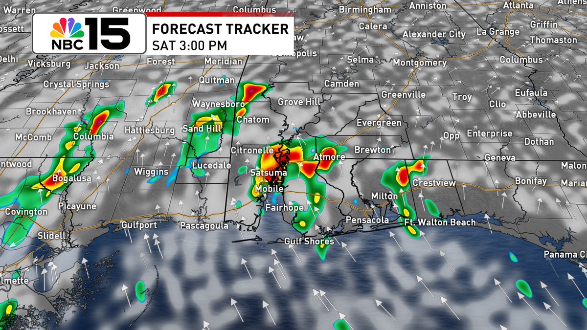
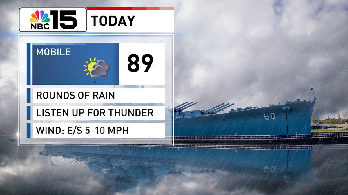
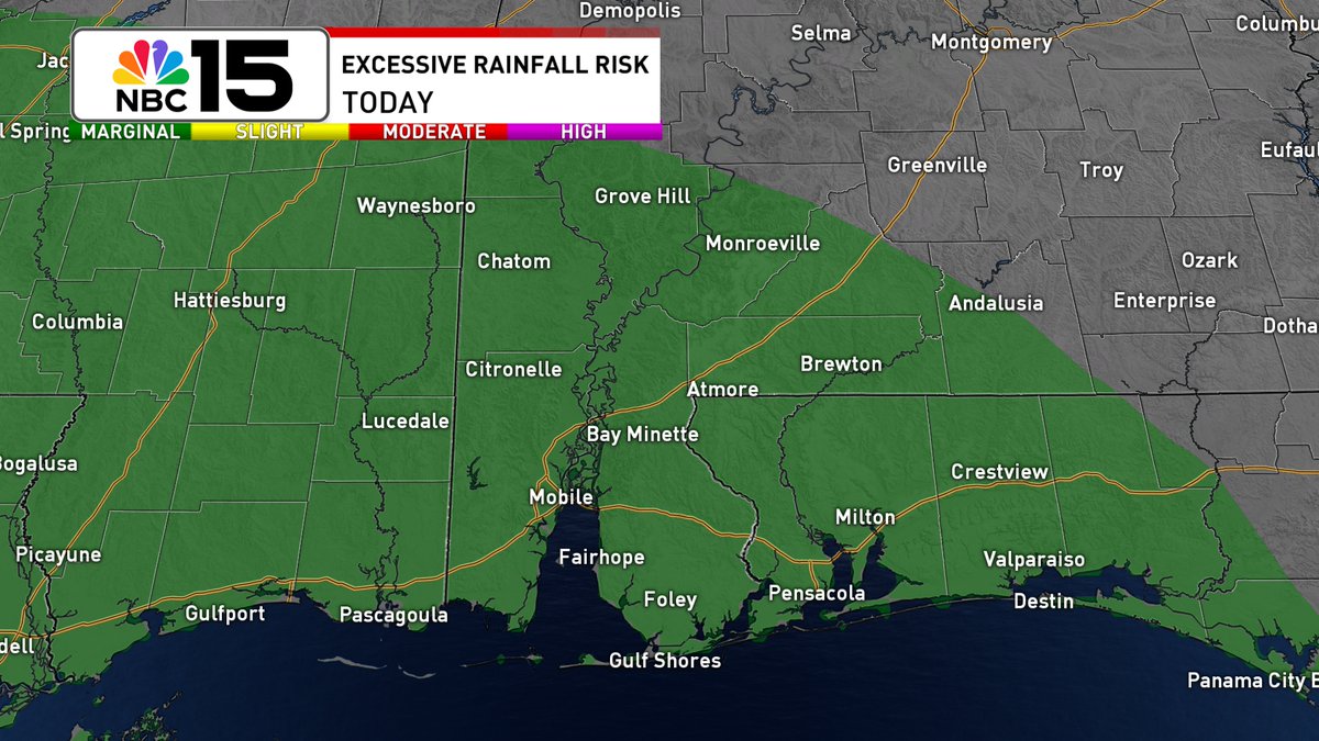
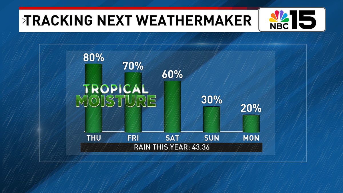
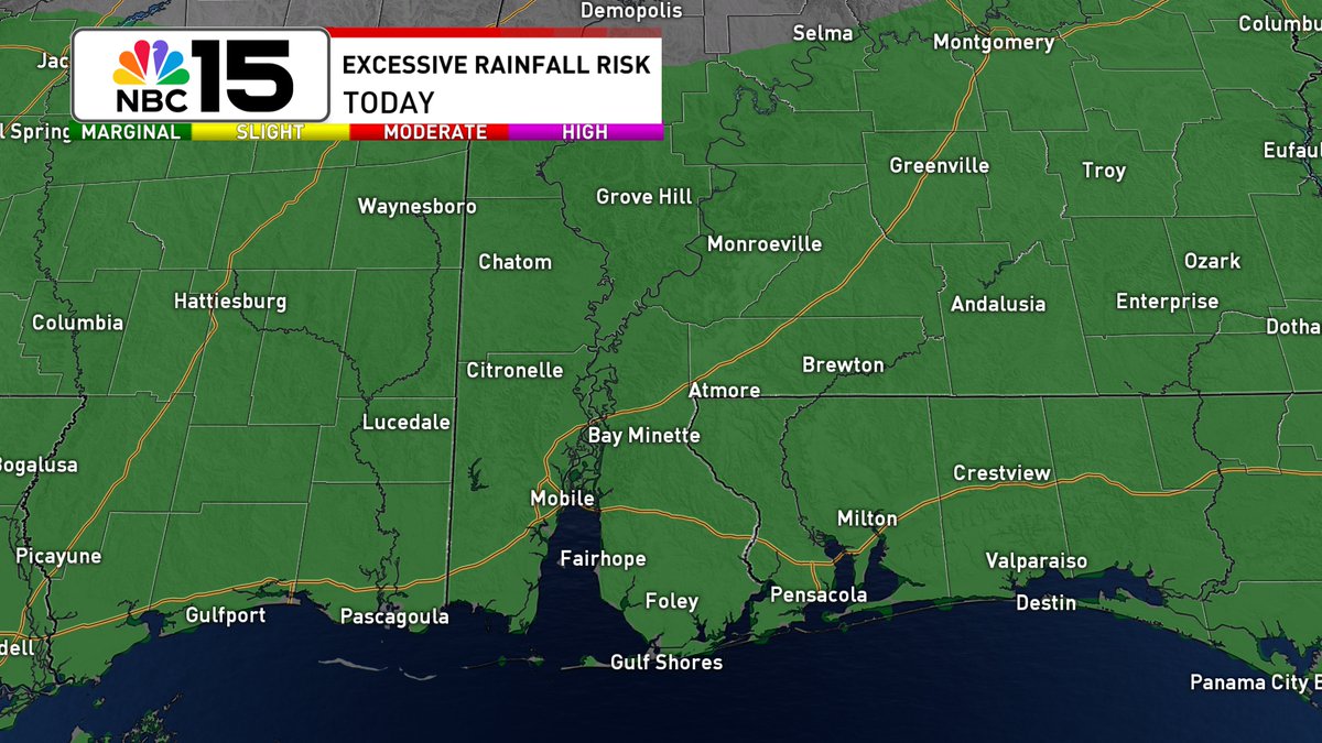
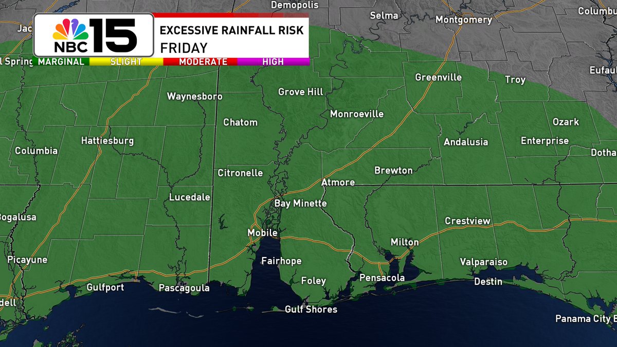
#TGIF everybody! Scattered showers & storms will be around 🌧☔with about a 2/3 chance wet weather finds you. Some storms will be capable of heavy rain. The NBC 15 area is under a marginal excessive rainfall risk that could lead to flash flooding @mynbc15 mynbc15.com/weather
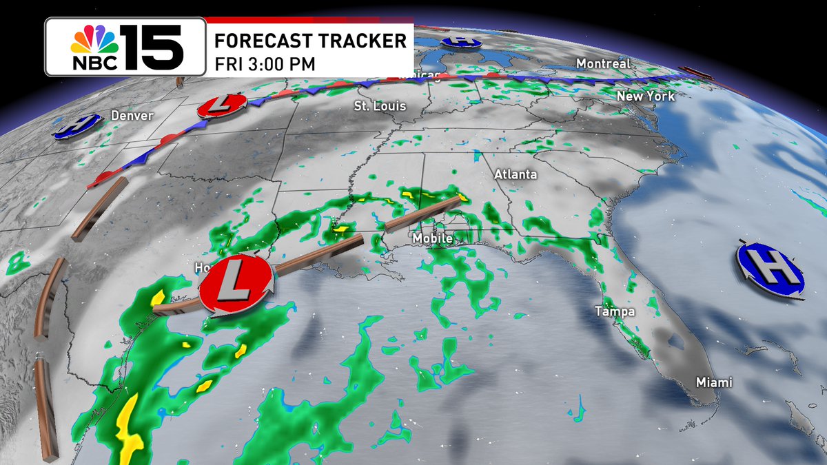
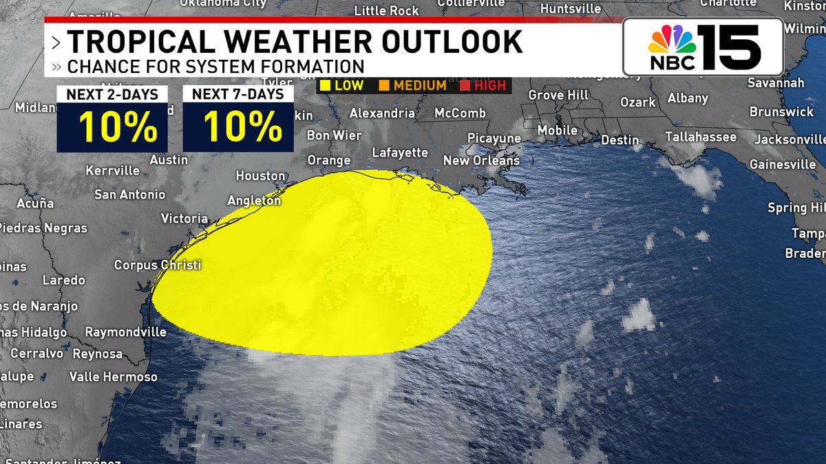
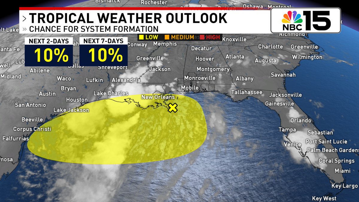
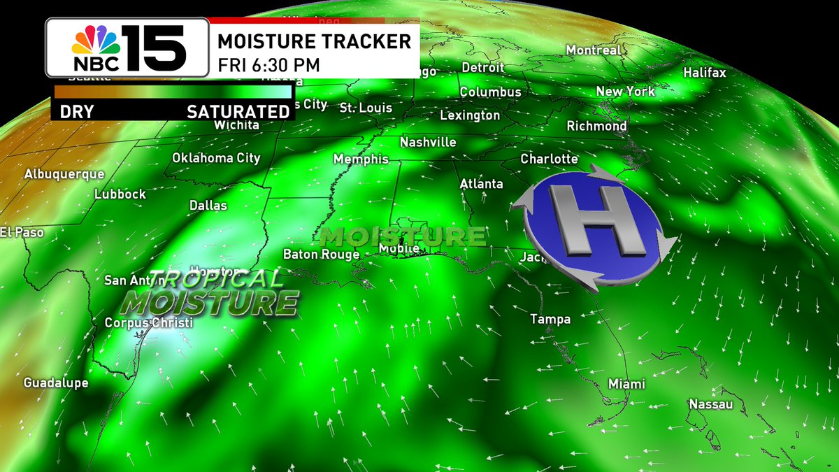
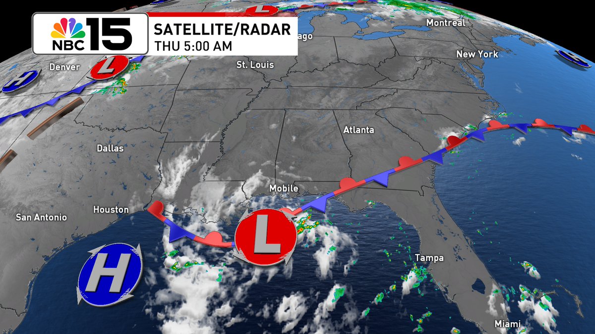
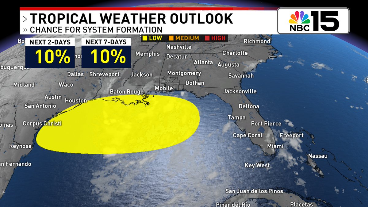
Low formation chance remains on this broad area of low pressure over the Gulf. Slow development is possible as it moves WNW but by this weekend, it shifts inland over SE Texas or W Louisiana @mynbc15 mynbc15.com/weather
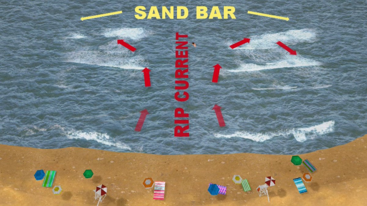
HEADS UP - High risk of rip currents expected along our beaches tomorrow! @mynbc15 mynbc15.com/weather

Still a low chance the disturbance moving across the northern Gulf develops. It will move into Texas this weekend. @mynbc15 mynbc15.com/weather
High rain chances will keep temps in check again tomorrow, however, as high pressure builds this weekend, so will the temps 🥵. By early next week, we'll see highs in the mid to upper 90s with heat index values that could approach 115° 🔥. @mynbc15 mynbc15.com/weather
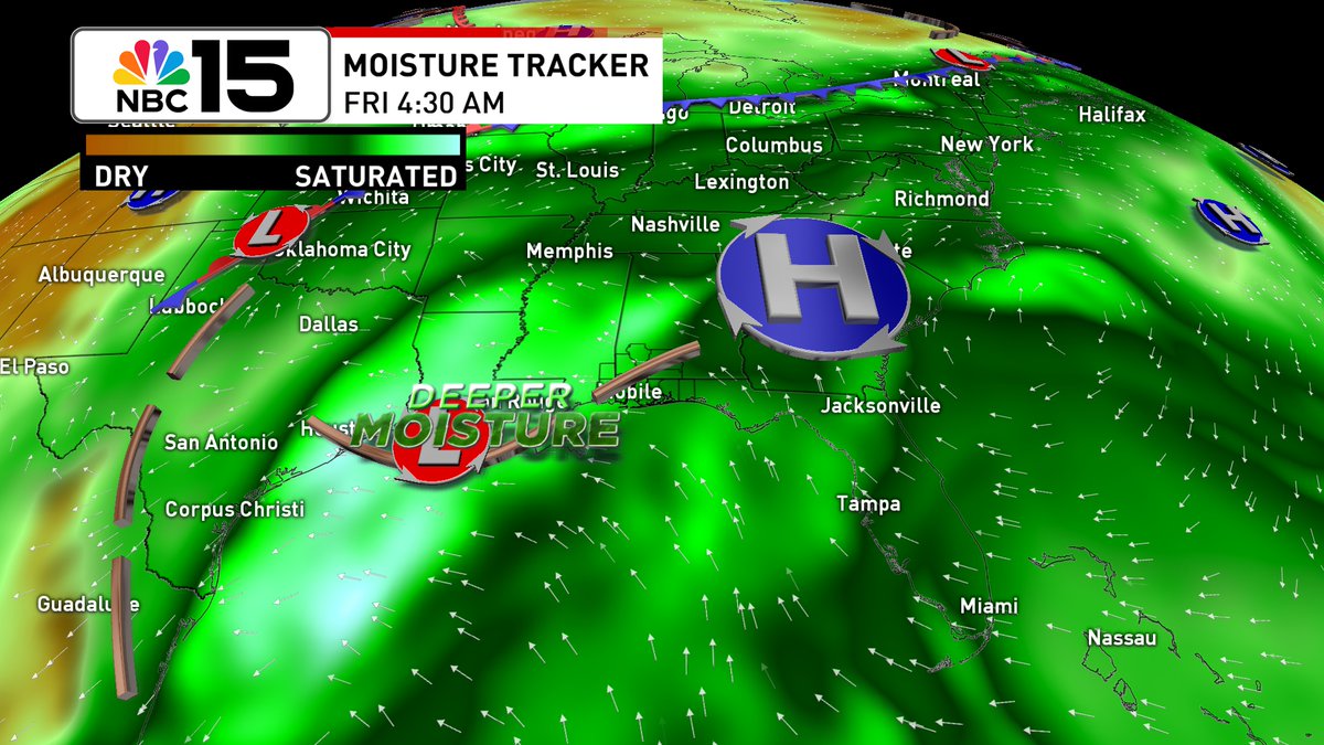
Lingering moisture will lead to high rain chances again to close out the workweek, but by the weekend we'll trend drier as high pressure builds back in. @mynbc15 mynbc15.com/weather
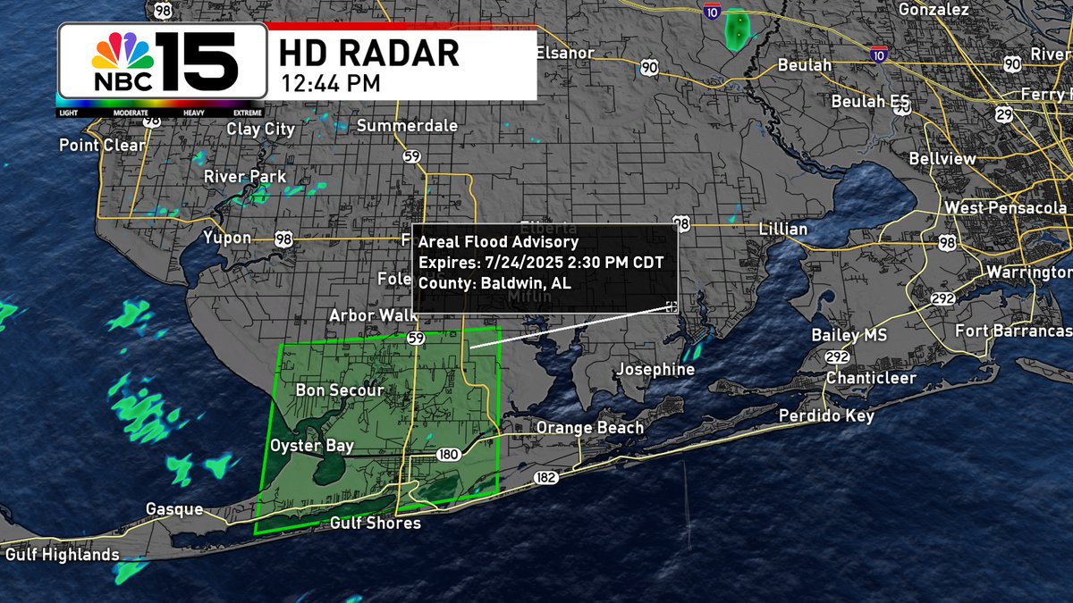
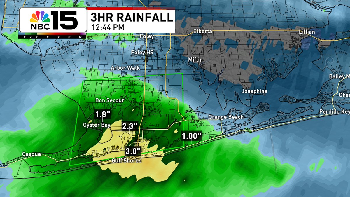
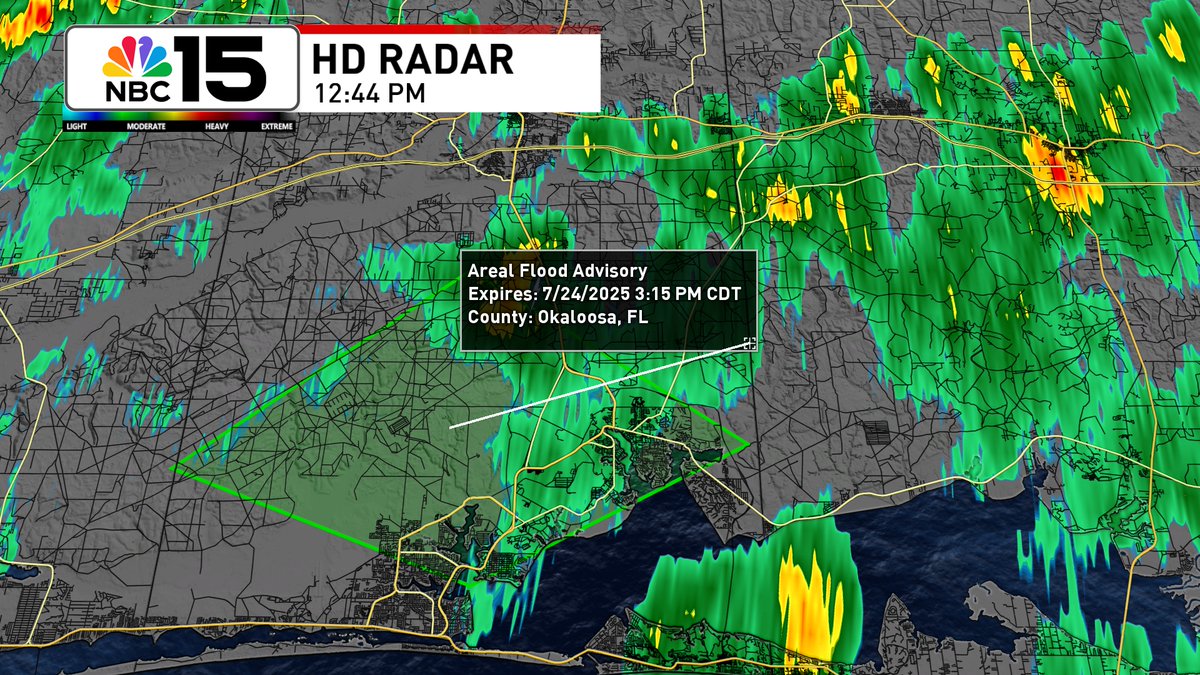
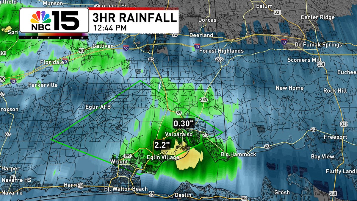
Flood Advisory is in effect for parts of S Baldwin County until 2:30PM. Bon Secour may experience flooding. Flood Advisory is also up in Okaloosa County until 3:15PM. Some locations impacted include Wright, Eglin AFB, Valparaiso, & Eglin Village @mynbc15 mynbc15.com/weather
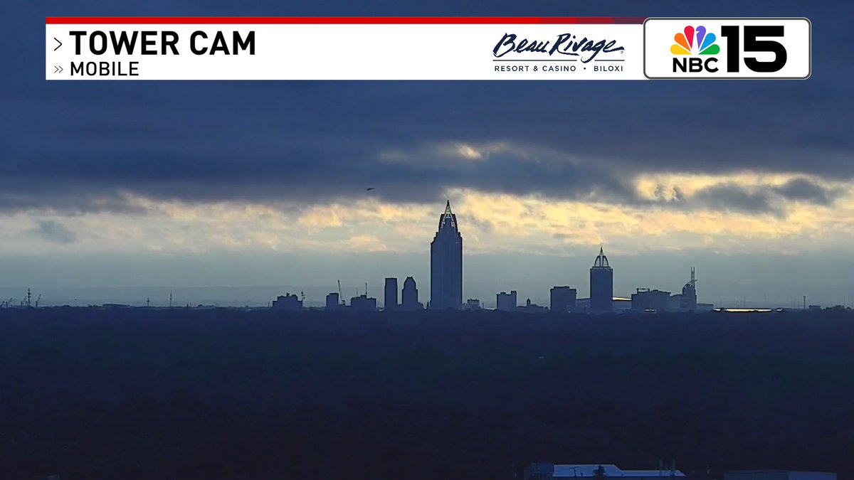
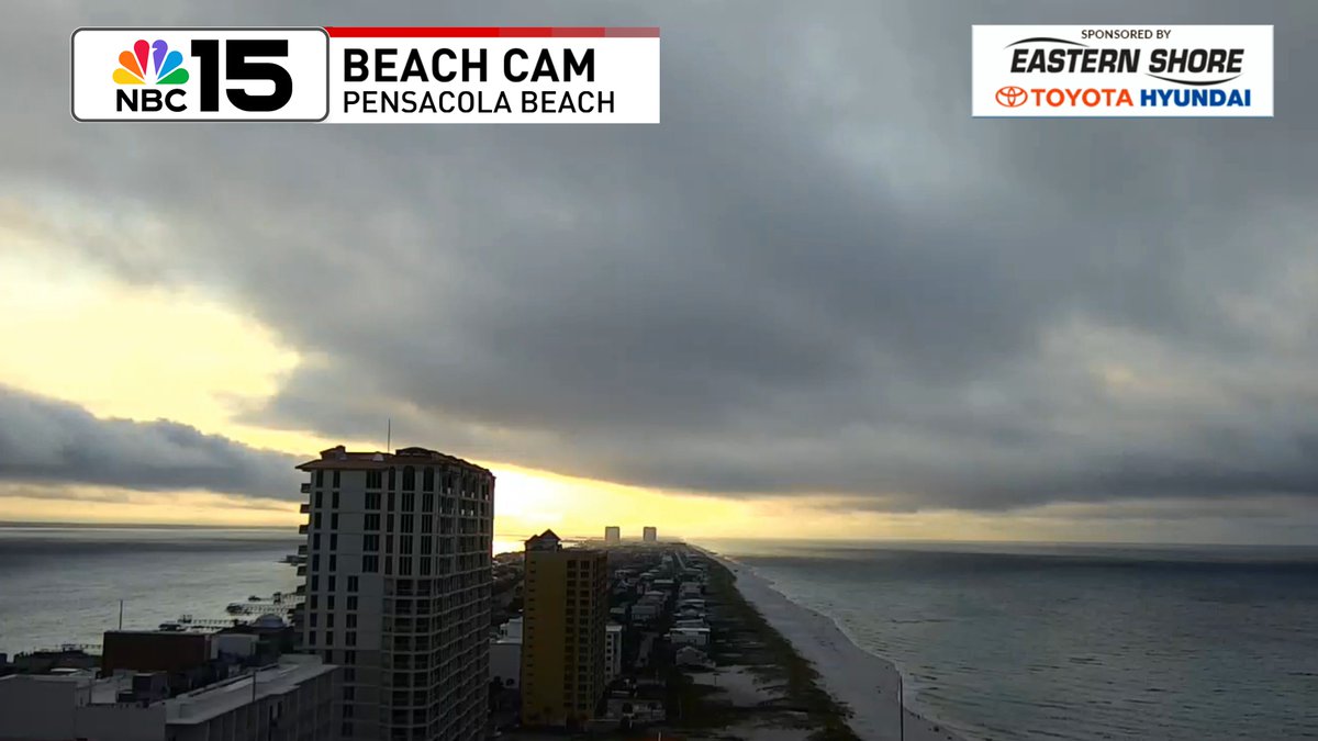
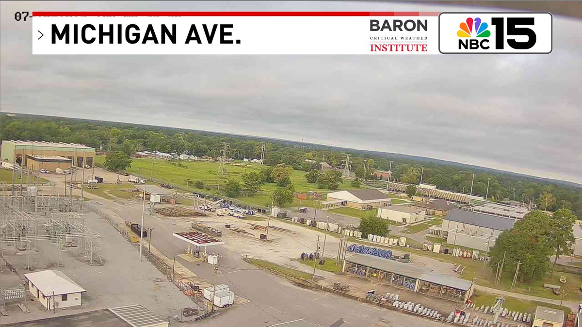
Happy Thursday Gulf Coast! Here are our views this morning from Mobile & Fairhope, #Alabama & Pensacola, #Florida. Clouds to start with rain action set to ramp up to 80% late day @mynbc15 mynbc15.com/weather

A trough of low pressure over the N Gulf is bringing us higher rain chances & a high rip current risk by Fri. It'll move W across the north-central & NE Gulf. It has a low formation chance & likely moves inland this weekend @mynbc15 mynbc15.com/weather
Rain chances 🌧☂80% today & 70% Fri as deep moisture moves from east to west across the N Gulf. Not all day wash-outs, but multiple waves of showers/storms. Level 1 excessive rainfall risk that could lead to flash flooding both days @mynbc15 mynbc15.com/weather
Don't look now 👀, but after our high rain chances to end the workweek, high pressure will build back in this weekend. By Monday highs will be back in the mid to upper 90s with heat index values that could exceed 110° 🥵. @mynbc15 mynbc15.com/weather

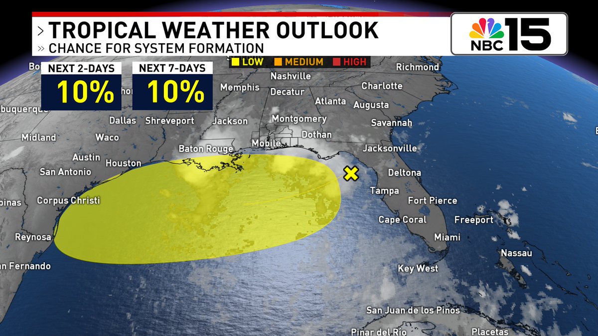
Still a low, 10% chance we see the disturbance that will be moving across the northern Gulf in the coming days develop. The rest of the Atlantic is quiet. @mynbc15 mynbc15.com/weather
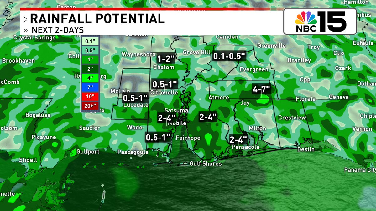
Over the next couple of days most in our area will likely see 0.5-2" of rain, but locally higher/lower amounts will be possible. Our in-house model suggests some isolated pockets could see 4-7" of rain. @mynbc15 mynbc15.com/weather