Justin Thompson-Gee
@JustinTGee
Christian. AM Meteorologist @CBS58. CBM. Emmy nominated. @ValpoU. New Yorker at heart.
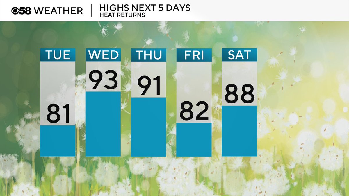
Back to average highs today in the low 80s then hot for the middle of the week before briefly dropping Friday then warming right back up for the weekend.
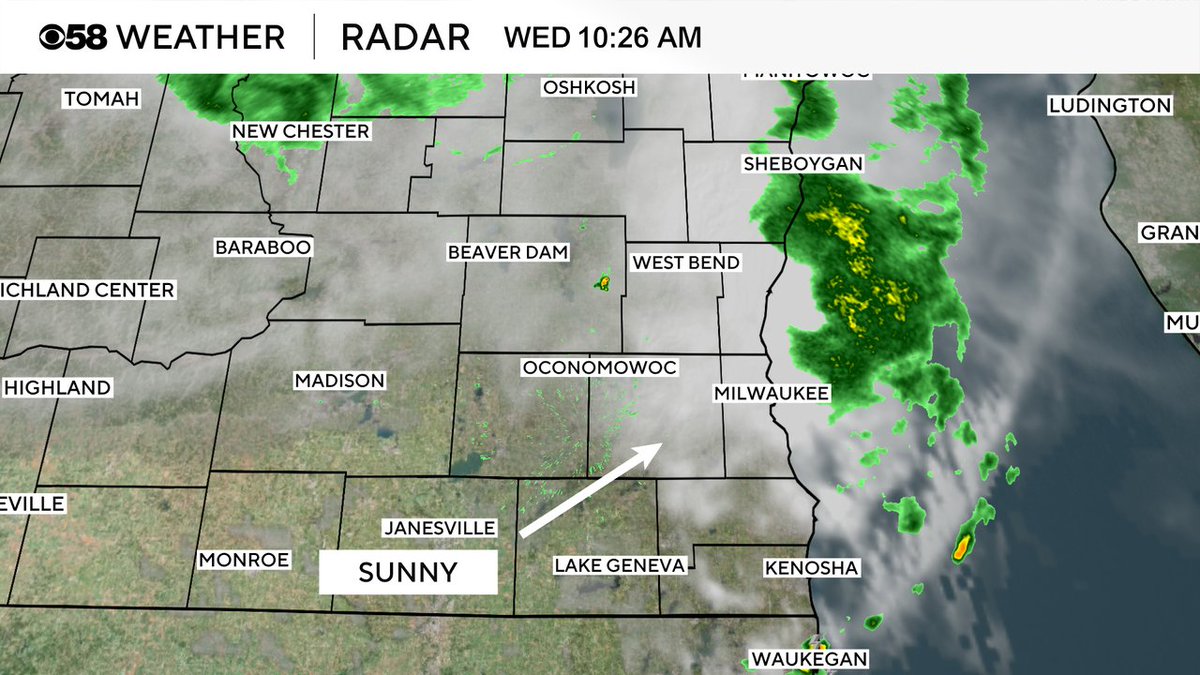
10:26 AM Radar: The downpours and storms from the morning are all done and now clouds are starting to clear from the southwest. The rest of the day will quickly become hot and steamy. Feels like temps are still projected to hit 100 in many areas.
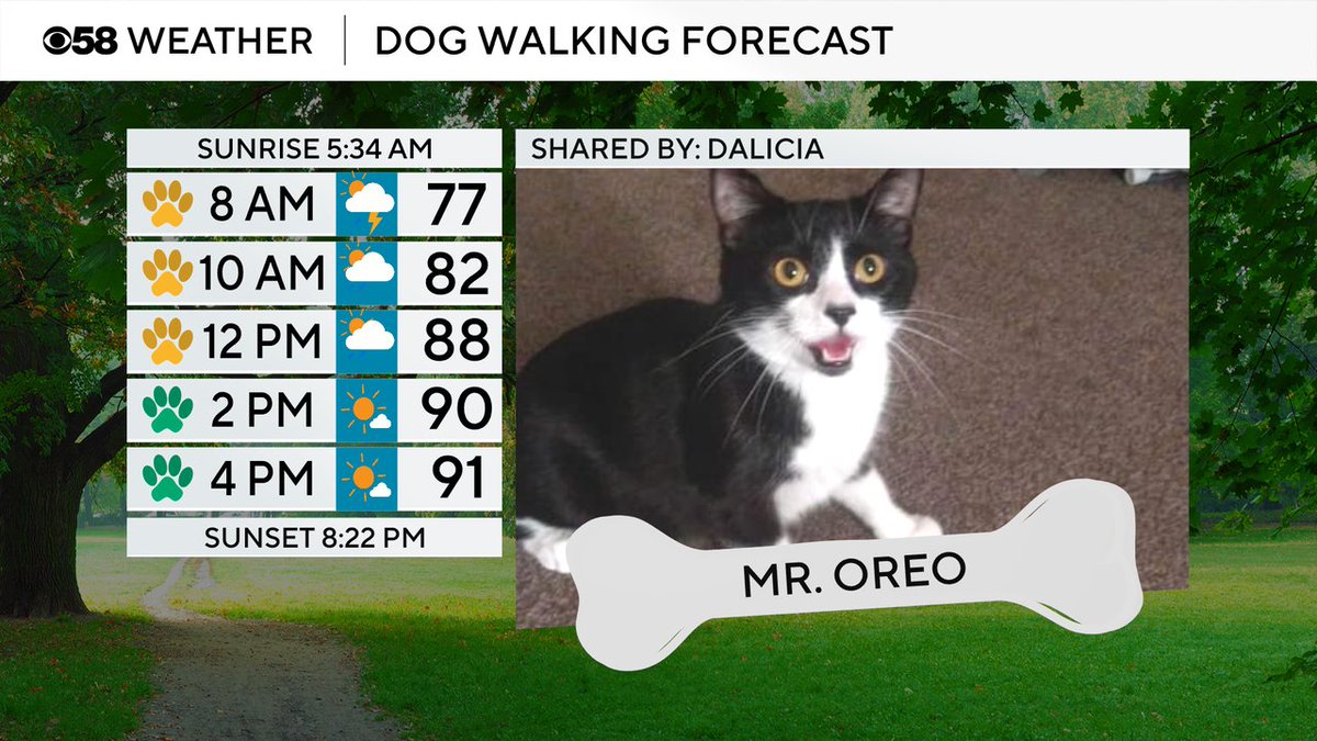
Mr. Oreo is our featured of the day! After the morning storms it's all about the heat and humidity with highs around 90 but feels like temps around 100.
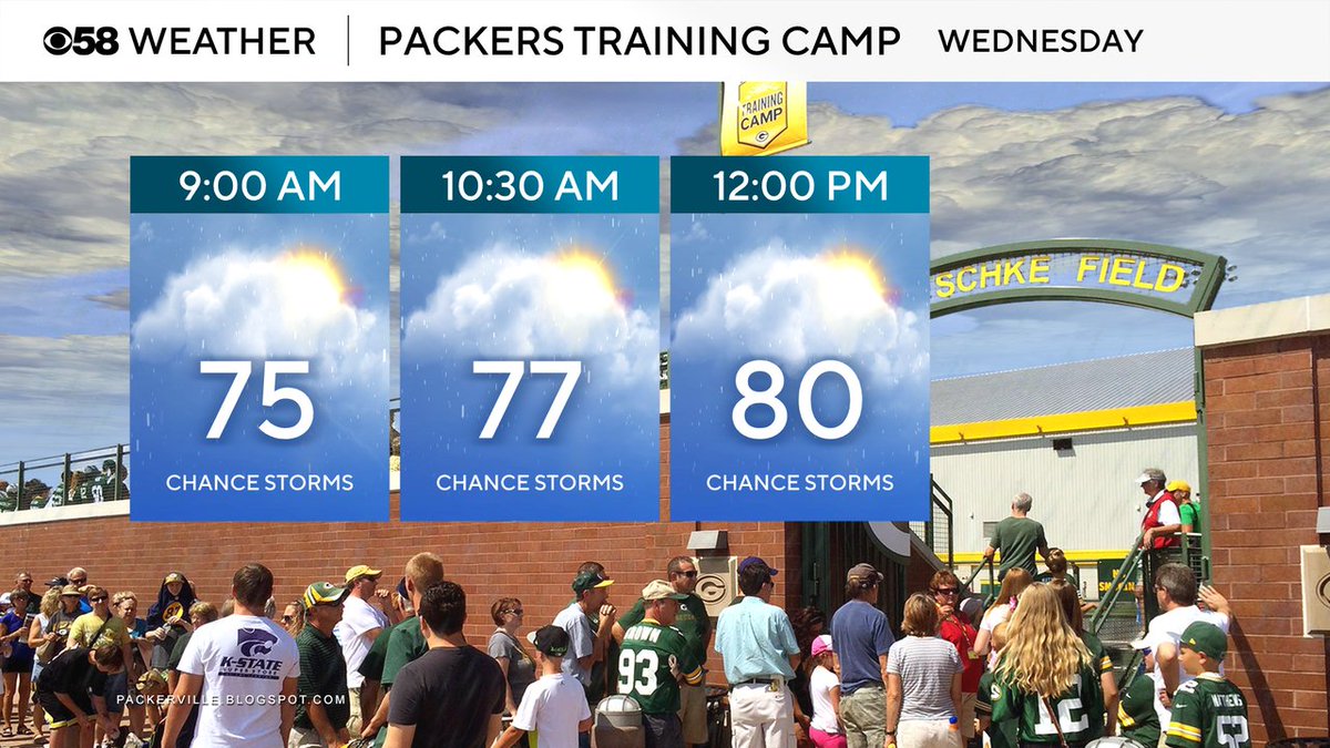
Going up to Green Bay for the start of Packers Training Camp? Unfortunately there's an off and on storm chance there most of the day but it's not as hot as the southern part of the start with temps at noon around 80 but still very humid.
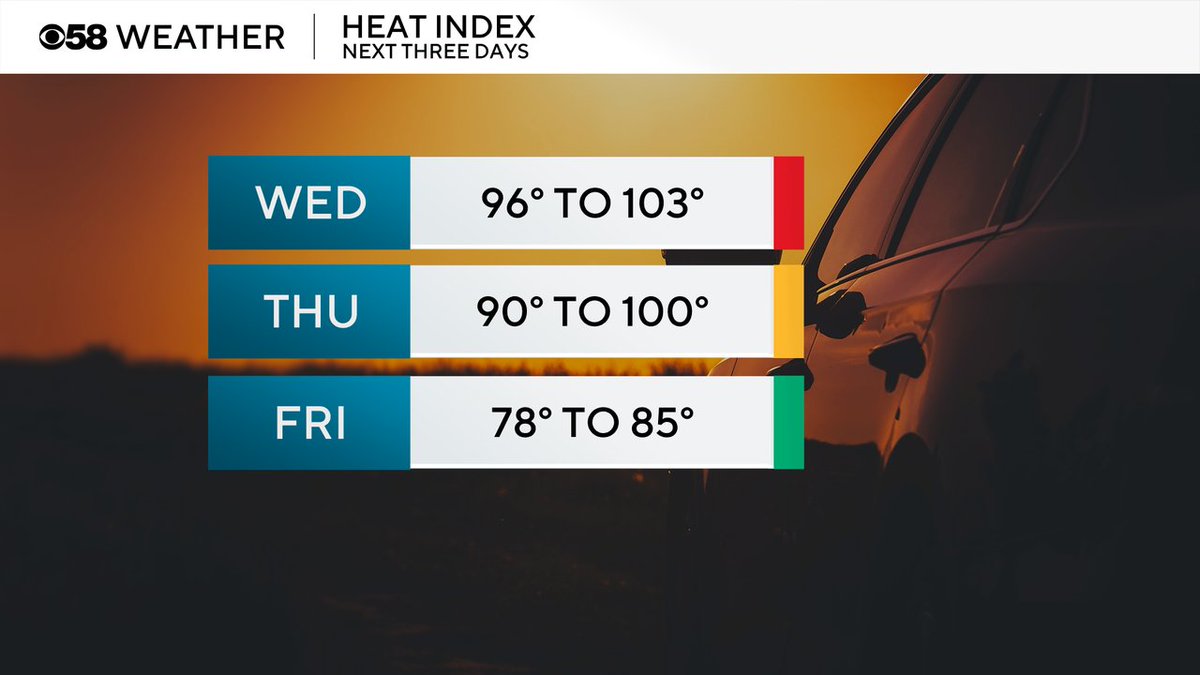
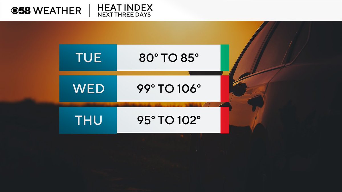
Today looks like the hottest day with feels like temps hovering in the upper 90s and low 100s. tomorrow looks a bit better with feels like temps in the 90s to around 100 then we get some brief relief on Friday.
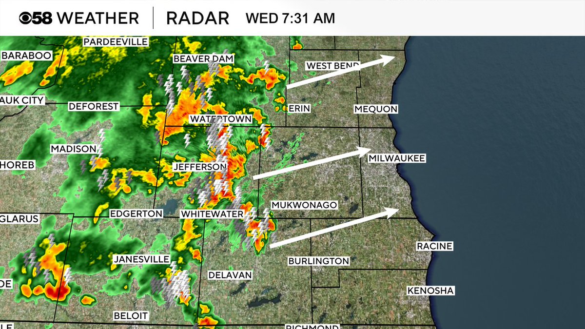
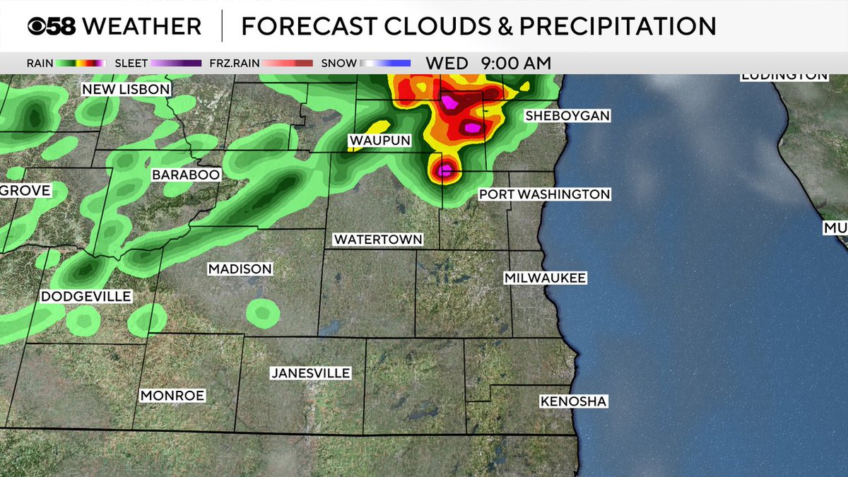
7:30AM Radar: It's a loud start to the day in Dodge & Jefferson County with lots of lightning & some heavy rain. Otherwise storms are "behaving" with not much or hail right now. These likely reach the Waukesha area in the next 30 minutes and MKE after that if they survive
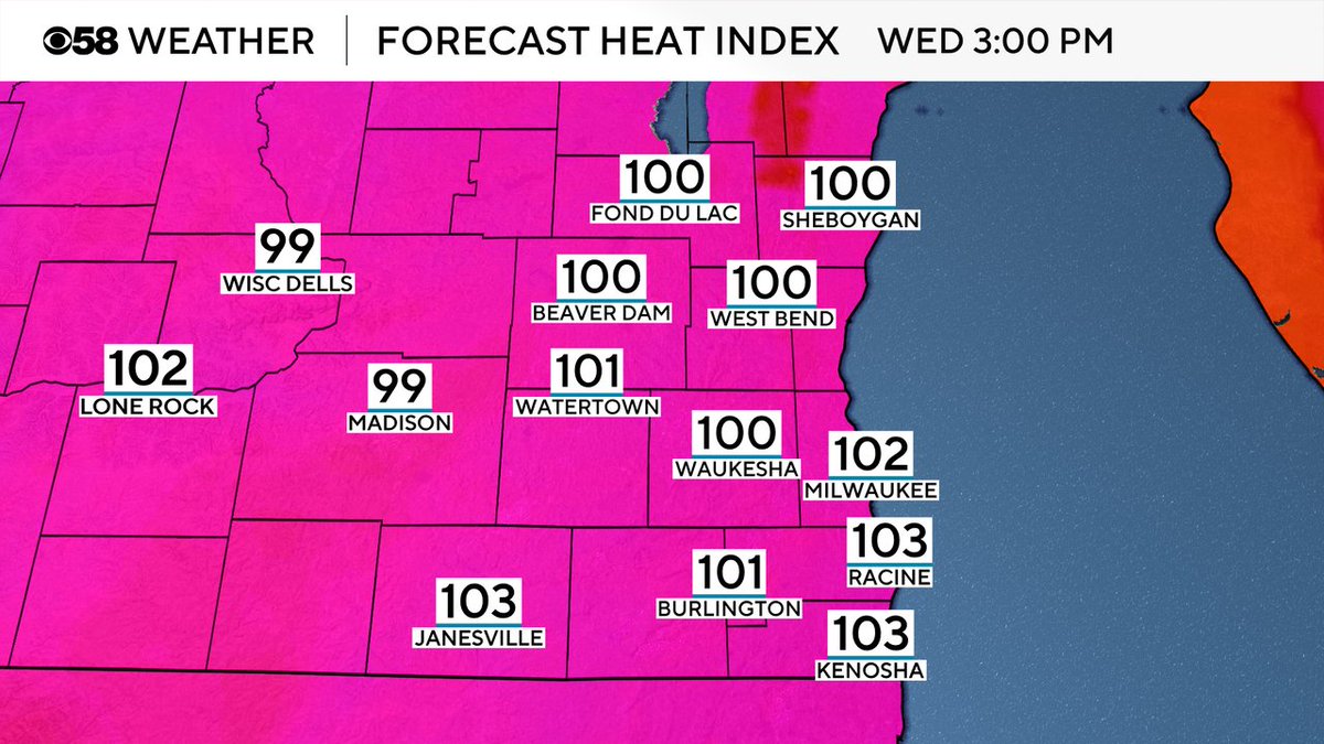
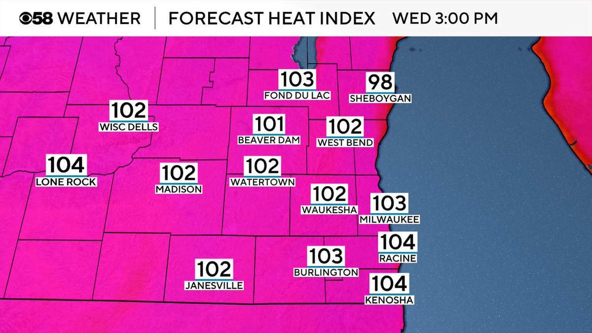
Heat index values get as warm as the low 100s on this Wednesday. Make sure to take breaks, drink plenty of water and find some air conditioning.
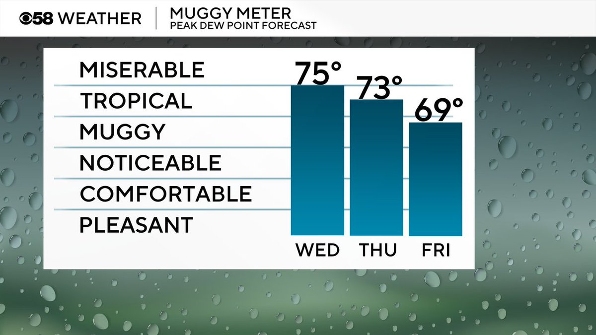
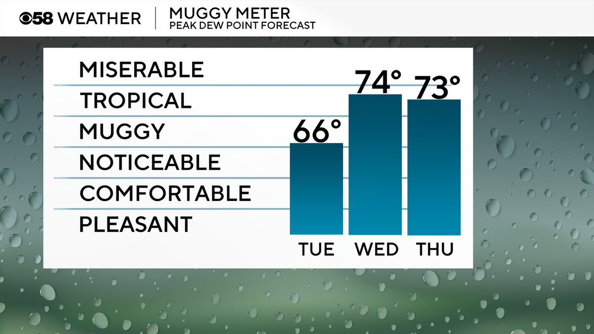
Today might be the most humid day of the year with dew points reaching the mid 70s. Still very humid on Thursday and even though temps drop Friday the humidity stays high.
Couple of hot days today and tomorrow with highs hovering around 90. Then we drop Friday with a lake breeze, Saturday isn't too bad in the 80s but the heat kicks back in to start next week with more 90s possible.

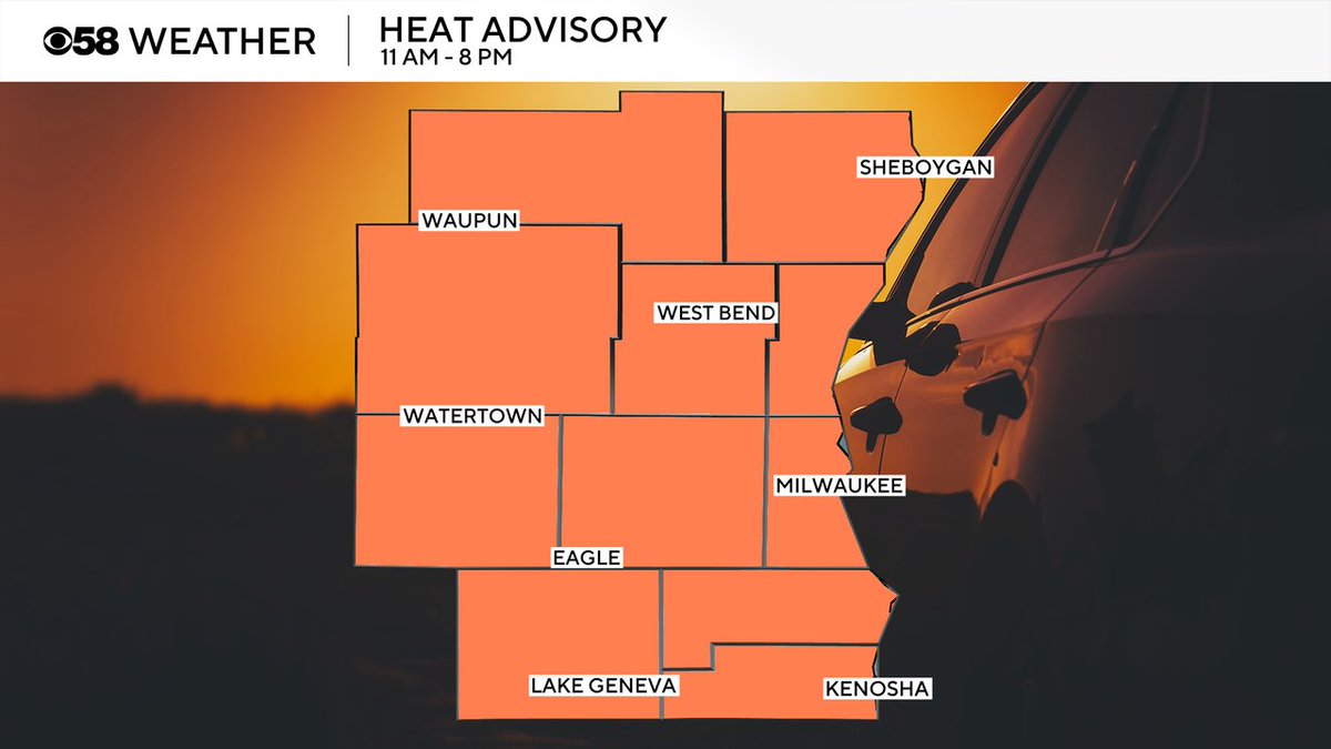
A Heat Advisory goes into effect at 11 AM for all of southeast Wisconsin until 8 PM. Currently there are no heat headlines for Thursday but an advisory could be issued for some counties later but overall feel like temps look more in check Thursday with the storms/clouds.
The big heat and humidity returns tomorrow with peak feels like temps reaching 100-105 degrees! Thursday looks pretty hot as well with heat index values around 100 or warmer. Storm chances, and associated clouds, both days could have an impact on our high temps.
Charlie is our featured pet today! A warmer day but not hot yet with highs around 80. Any chance for rain today has gone away so should be nice dry dog walks but becoming more muggy.

The chance for storms today (Tuesday) has almost completely gone away but a few storms are possible tonight into Wednesday morning. Best chances for a few storms are in northern counties where some of the storms could be strong.
No big concerns with heat today but that changes in a big way Wednesday and Thursday with feel like temps reaching close to 100 or warmer both days.
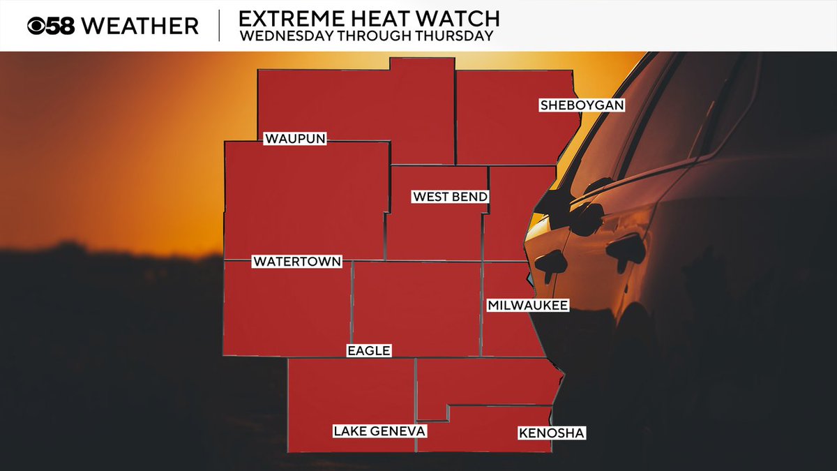
An Extreme Heat Watch remains in place from Wednesday morning through Thursday evening. Feels like temps could reach at least 100 and possibly above 105 those days. This watch will be replaced by either a heat advisory or heat warning later today.
The humidity is back today with dew points in the mid 60s but the big tropical-level humidity rolls back in Wednesday and Thursday!
Waking up to temps mostly in the 60s this morning. Highs today are a bit warmer around 80 with rising humidity. The rain chance for today has pretty much gone down to 0. There is now a slight chance for storms tomorrow morning.
The Air Quality Index was "unhealthy for all" in some counties this morning but has now improved as wildfire smoke overhead starts to dissipate. Still moderate to unhealthy for sensitive groups in many counties right now. Expect more improvements the rest of the day.

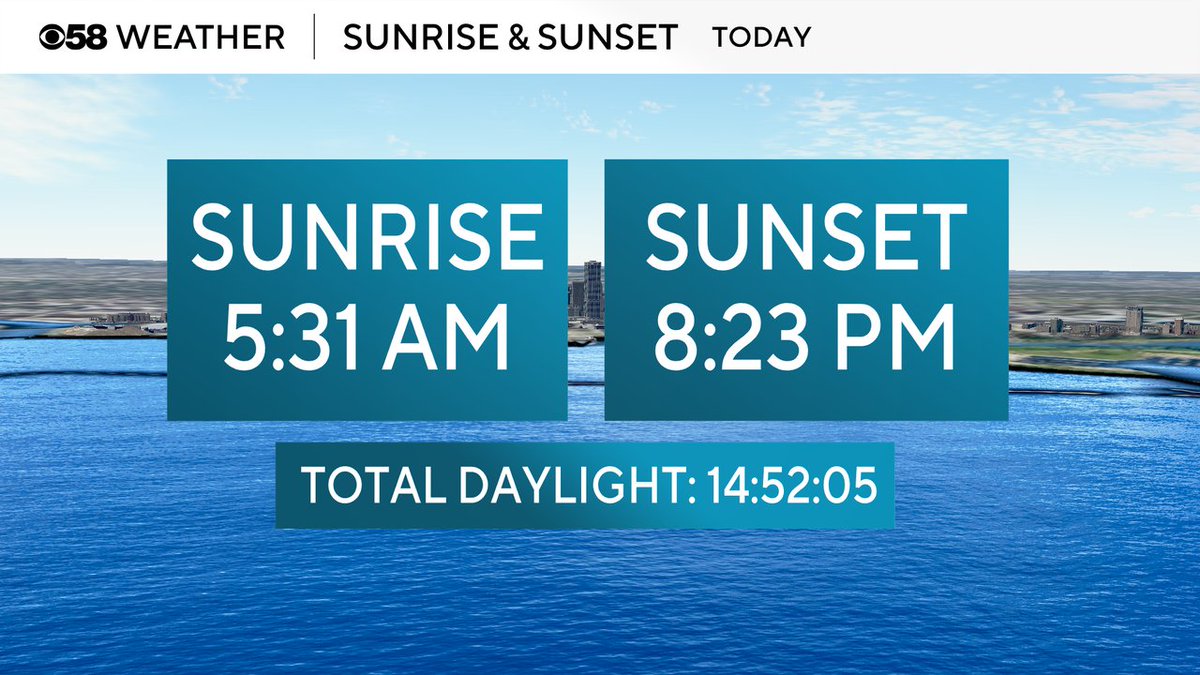
The sunrise is now after 5:30 AM and the sunset is a few minutes before 8:30 PM. Totally daylight is now under 15 hours and losing 1-2 minutes each day. Sorry....
Tanner is our featured pet today! A cool and comfy day with highs in the 70s lakeside and around 80 inland with a mix of sun and clouds and a touch of haze that gets better this afternoon.