Harvest
@HarvestProgram
@NASA's Global Food Supply & Agriculture Consortium est. 2017 Earth Data for Informed Ag Decisions (Tweets our own, for official NASA comms visit @NASAEarth)
The NASA Harvest newsletter is live! Highlights include: • 5 lessons on ag’s future with satellites & AI • 40 years of climate shifts in Senegal from space • Mapping Ukraine’s fields to aid food security 🌾 Read it here 👉conta.cc/3I8R0Y7

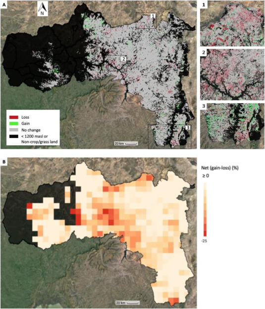
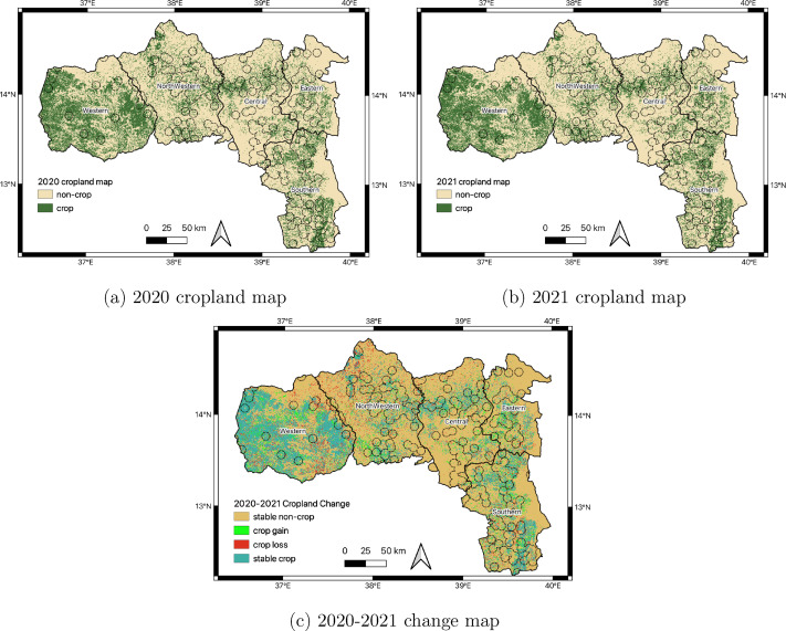
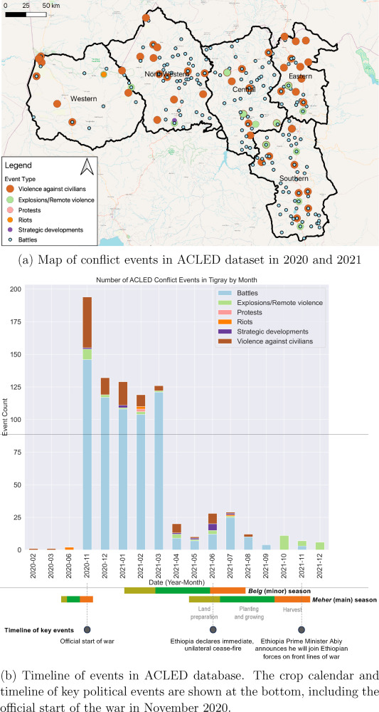
🌍🛰️ NASA Harvest is using satellite data to monitor crops in conflict zones like Tigray, Ethiopia — helping spot food shortages early and guide aid efforts. A powerful way space tech supports people on the ground. #FoodSecurity Read more: nasaharvest.org/news/monitorin…
Using satellite imagery, researchers are mapping unexploded ordnance in Ukraine’s conflict zones—helping identify hazards that threaten farmers and civilians. This work supports safer recovery and food security efforts. 🌾🛰️ Read more: nasaharvest.org/news/locating-…


🛰️ A new satellite-based tool is helping map Ukraine’s farmland in near real-time—crucial for food security during conflict 🌾. Learn how NASA Harvest and partners are using remote sensing to support global ag monitoring: nasaharvest.org/news/mapping-u…

🌍📡 🇸🇳New research maps 40 years of temperature and rainfall shifts in Senegal using earth observation satellites! A clearer view of regional patterns is helping support food security efforts. Full story here👉 nasaharvest.org/news/new-resea…
It’s hard to capture the full impact Brad Doorn has had on the world. Through his leadership at NASA, he championed the use of Earth science to improve ag & food security globally. His vision & dedication have shaped a better future for all of us. 👉nasaharvest.org/news/thank-you…
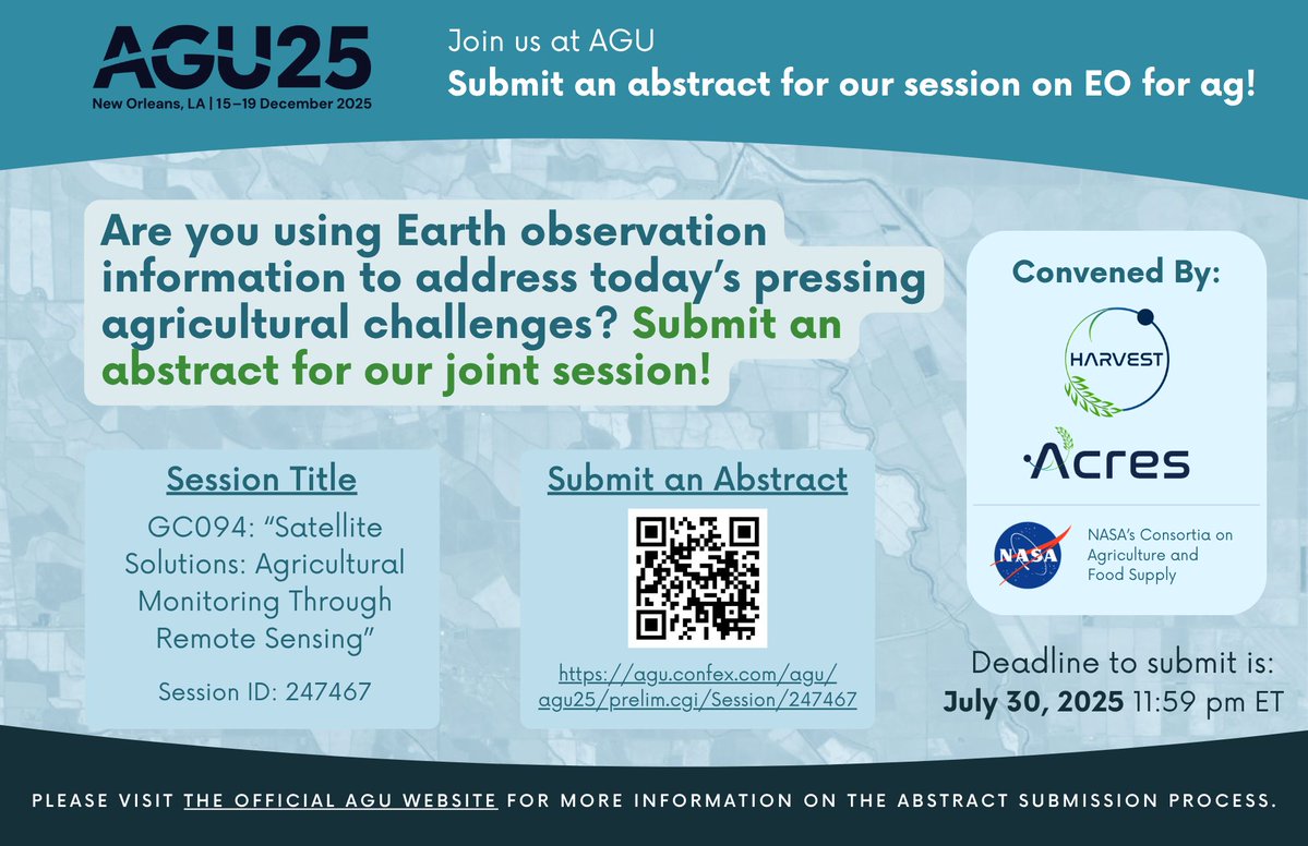
🚨 Reminder: Abstracts for our #AGU25 joint session with @AcresProgram on satellite-based ag monitoring are due July 30! Submit to GC094: “Satellite Solutions: Agricultural Monitoring Through Remote Sensing” 🌍🛰️ Submit here: agu.confex.com/agu/agu25/prel…
Registration is open for the 2025 NASA #SpaceApps Challenge! 🌍🚀💫 Join the largest annual global hackathon, choose from 450+ Local Events, and use open data from #NASA & 14 Space Agency Partners. Register today: bit.ly/3TwZnzl
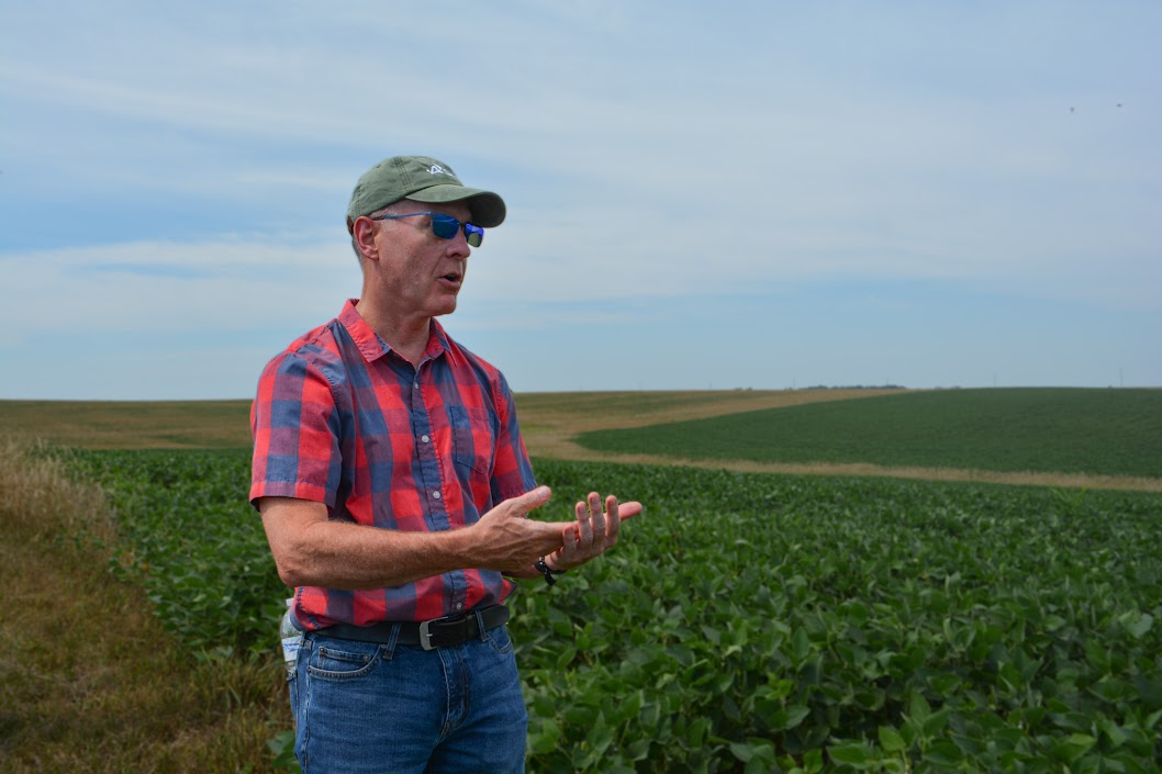
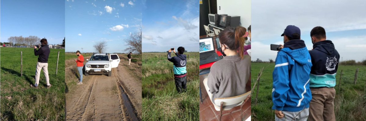
Exciting news! NASA Harvest & Argentina’s @Bolsadecereales are launching the 5th year of our high school program, empowering students and teachers with remote sensing, AI & fieldwork to boost digital agriculture across 🇦🇷. Learn more 👉 nasaharvest.org/news/nasa-harv…
🌱 In Oregon’s Harney Basin, declining groundwater threatens farms & ecosystems. 🚰 OpenET’s satellite data tracks water use basin-wide — empowering local plans to balance supply & demand for generations. 🌍 Learn more: etdata.org/openet-use-cas… #WaterFuture youtube.com/watch?v=ZhZfda…
Heading to #AGU25? Submit an abstract for our joint session with @AcresProgram! Join @NASA's ag consortia in showcasing the utility of #satellite data and tools to address today’s most pressing food security challenges from national to global scales. 🔗 agu.confex.com/agu/agu25/prel…

🔥🌡️ The eastern U.S. kicked off summer with sweltering heat and humidity in late June—heat dome conditions pushed temps to record highs! This NASA image shows just how intense it got. 🌞 Learn more: earthobservatory.nasa.gov/images/154475/…

The upcoming joint NASA-@isro #NISAR satellite will map farmlands from planting to harvest—detecting crop growth, soil moisture & plant health twice every ~12 days. 🛰️🌾🌽 Big boost for farming efficiency and food security! Learn more: nasa.gov/missions/nisar… #AgTech

El Niño’s Big Impact: Forecasting Crops Early 🛰️🌽 Thanks to models tracking El Niño, scientists can forecast maize & wheat yields before seeds are even planted. It’s a huge leap for farmers & food security. Learn more: blog.chc.ucsb.edu/?p=1493 #FoodSecurity

🌍🛰️ Satellite images can reveal floods, fires, cities, and crops—but only if you know what to look for. NASA shares 5 tips to help you interpret color, shape, shadows, and more in Earth imagery. Learn the tricks: earthobservatory.nasa.gov/features/Color…


🌍📡 A new tool from NASA Harvest—PRESTO—simplifies access to satellite data, making it easier for agricultural partners to support farmers with timely insights on crop health, weather, and more. Faster decisions, better outcomes. Learn more: nasaharvest.org/news/presto-a-…
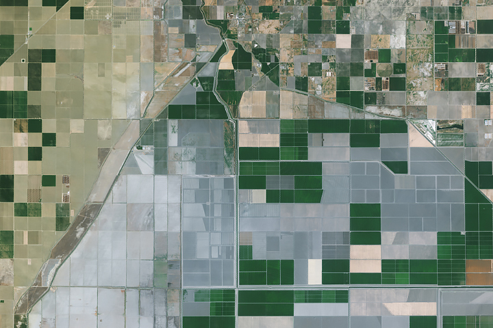
Dust storms recently swept across California’s Central Valley, turning skies hazy and reducing visibility. These events are rare, but growing concerns highlight how land and weather interact. Learn more from NASA’s Earth Observatory: earthobservatory.nasa.gov/images/154363/…
🚨 The NASA Harvest newsletter is live! Catch the latest: • How ENSO helps predict drought in Afghanistan 🌾 • 2025 global crop outlook for wheat, maize, and soybeans 🌍 • Using satellites to boost global food security 🛰️ Read it now 👉conta.cc/4kN3Fhv

🌍 How can satellites help prevent food crises? @G20_GEOGLAM & @GEOCropMonitor use Earth observation data to monitor crops and support early action.🌾 Check out the new video featuring a real-world case from Malawi! 🎥 Watch here: nasaharvest.org/news/how-geogl…
What’s the 2025 outlook for wheat, maize & soybeans? A new blog post breaks down global crop conditions using satellite data and forecasts from the @GEOCropMonitor—highlighting key trends, climate impacts, and food security insights. Read more: nasaharvest.org/news/2025-geog…

