Freeways of Los Angeles
@FreewaysLA
Everything you always wanted to know about Los Angeles freeways but were afraid to ask. We cover state highways too.
"Downtown skyline in the background from 2 freeway southbound." -- courtesy of Carlos G. Lucero.
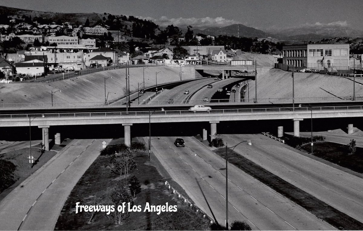
c. 1954 - Looking NE over newly constructed Arroyo Seco Pkwy (US-6-66-99/CA-11, now CA-110) from atop four level interchange. Sunset Blvd OC at center (DOH D7 Archives). This was the last segment of Arroyo Seco Pkwy to be built, connecting it to the four level.
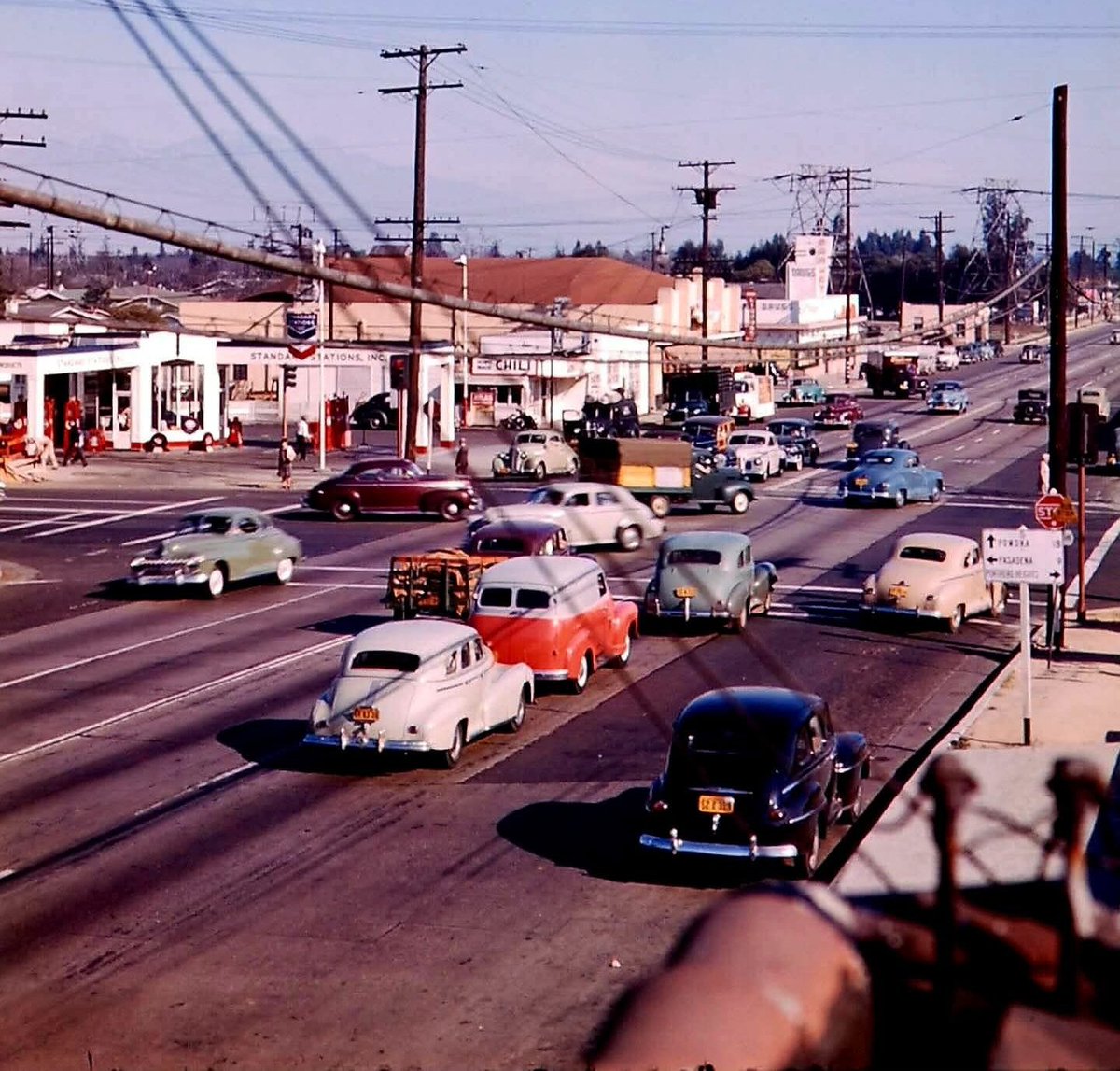
c. 1948 - Garvey Ave (US-60-70-99) at Rosemead Blvd (CA-19). Slightly different easterly view from previous pics. By 1953, Ramona Fwy (predecessor to San Bernardino Fwy I-10) took over US-60-70-99 route to the north. Photo courtesy of Rick Watts of Southern California Memories.
1948 - Arroyo Seco Pkwy (then US-66/CA-11, now CA-110). The NB off-ramp to Adobe St (at right), as well as the SB off-ramp to Chavez Ravine (left), were removed in 1962 when the Stadium Way interchange for then-new Dodger Stadium was built.

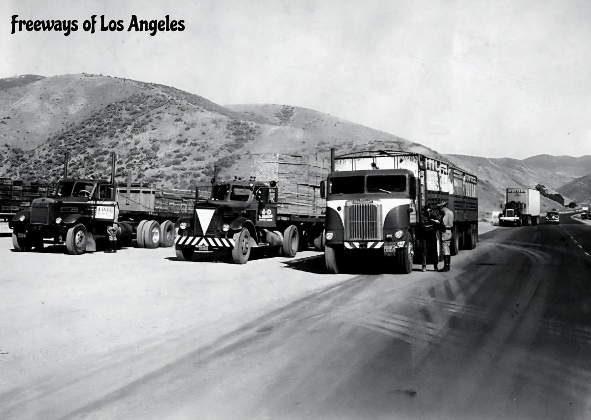
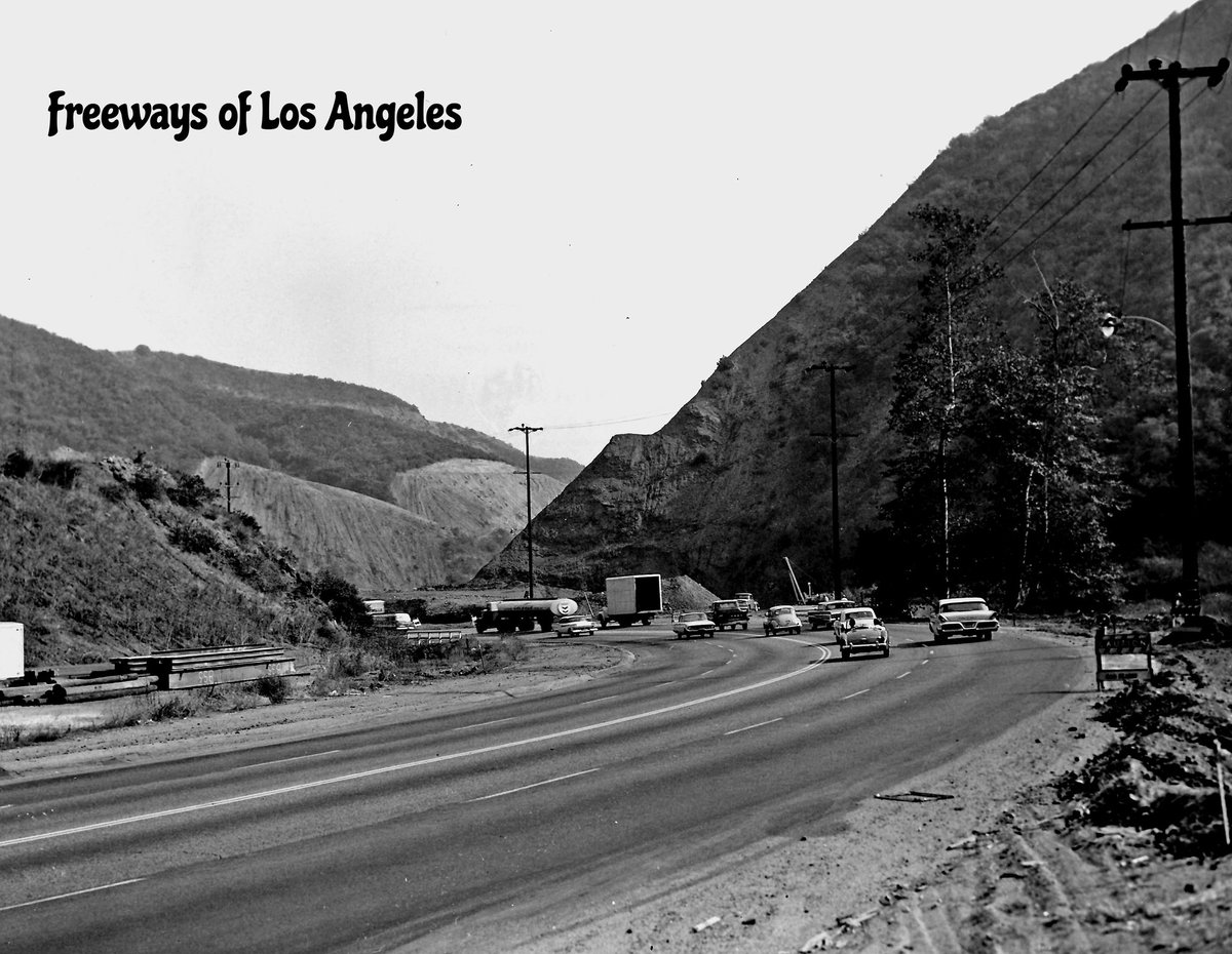
1956-Sept-13 - Highway Patrol brake check stop on Ridge Route Alt (US-99) in advance of steep 5-mile grade near Castaic (Valley Times Collection). This roadway is now used exclusively for northbound I-5 traffic.
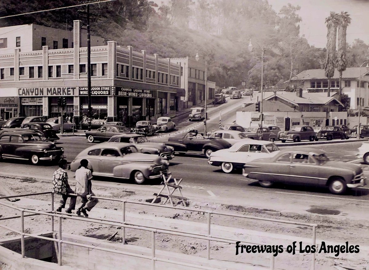
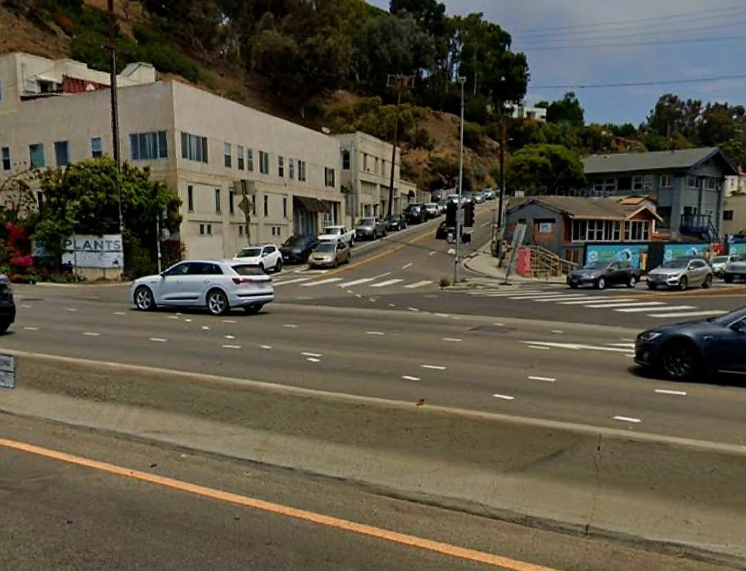
c. 1930, c. 1950 & 2022 - Facing NE across Coast Hwy (then US-101 Alt, now PCH CA-1) at Chautauqua Blvd/Channel Rd in Santa Monica (Ernest Marquez Collection & Google Street View).
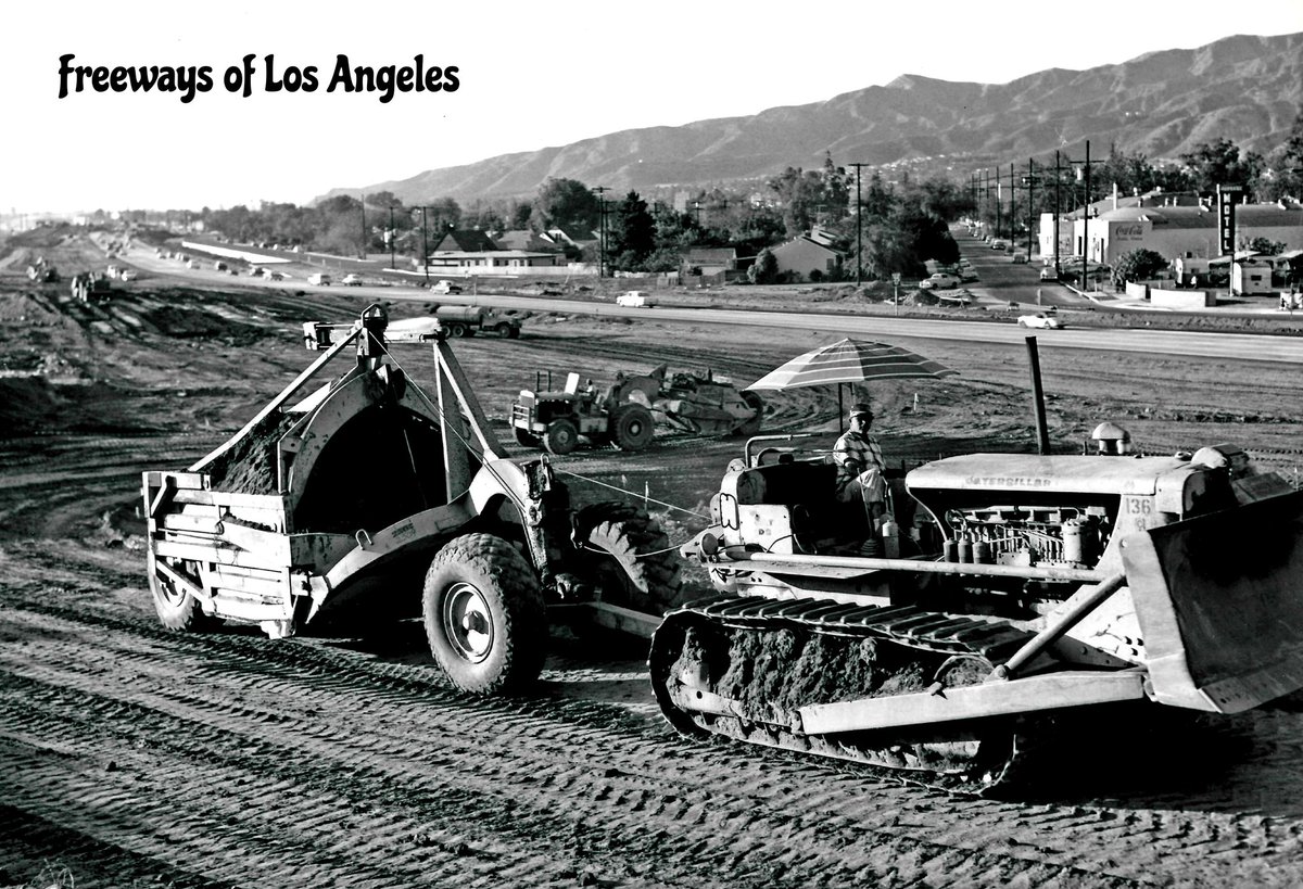
1960-Oct-04 - Golden State Fwy (then US-6-99/I-5) grading construction near Burbank Blvd. Note temporary roadway in background (DOH D7 Archives).
[Courtesy of Carlos G. Lucero] "Classic view from Elysian Park bridge of the 110 [Arroyo Seco Pkwy] freeway (Sunday early morning)."
![FreewaysLA's tweet image. [Courtesy of Carlos G. Lucero]
"Classic view from Elysian Park bridge of the 110 [Arroyo Seco Pkwy] freeway (Sunday early morning)."](https://pbs.twimg.com/media/GuaDeV_a4AAaqEv.jpg)
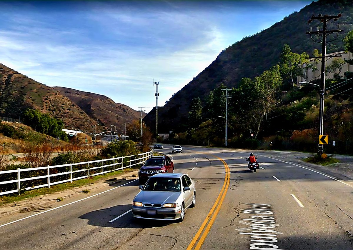
1960 & 2018 - Facing SE on Sepulveda Blvd (then CA-7) at San Diego Fwy (I-405) in Sepulveda Pass. 1960 photo shows early stages of freeway grading. This location is near where Sepulveda Blvd crosses under I-405 (DOH D7 Archives & Google Street View photos).
Until its removal in 1945, the 30-foot sandstone outcrop known as Castle Rock dominated the California coastline between Topanga Canyon and Santa Monica. When it came time widen PCH, engineers needed 350 pounds of dynamite to blast Castle Rock to kingdom come.
The bobs, the hot pants, the heels... Yeah, it's 1962, and that's former Gov. Pat Brown, all smiles as he cuts a ribbon flanked by a bevy of Freeway Beauty Queens to open another segment of the budding Santa Monica Freeway (I-10).
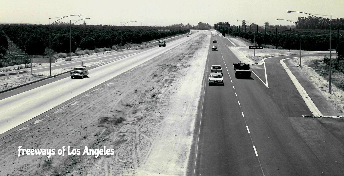
1958-June-24 - 67 years ago today: Looking SE over newly constructed Santa Ana Fwy (then US-101, now I-5) from Jeffrey Rd OC in present-day Irvine (DOH D7 Archives photo). Concrete pavement was built for NB lanes. Original Hwy 101 pavement was overlaid with asphalt for SB lanes.
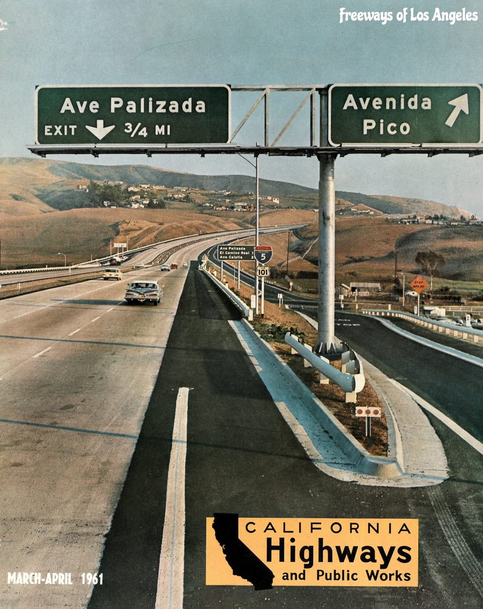
March-April 1961 - CH&PW periodical cover looking SE at San Diego Fwy (I-5/US-101) at off-ramp to Avenida Pico in San Clemente. This was during the transition to today's interstate route numbers.
This postcard was popular in 1956 to advertise the opening of the Hollywood Freeway near the 4-Level. It was repurposed two years later to advertise the arrival of the Dodgers from Brooklyn. I like how it says "of the National League."
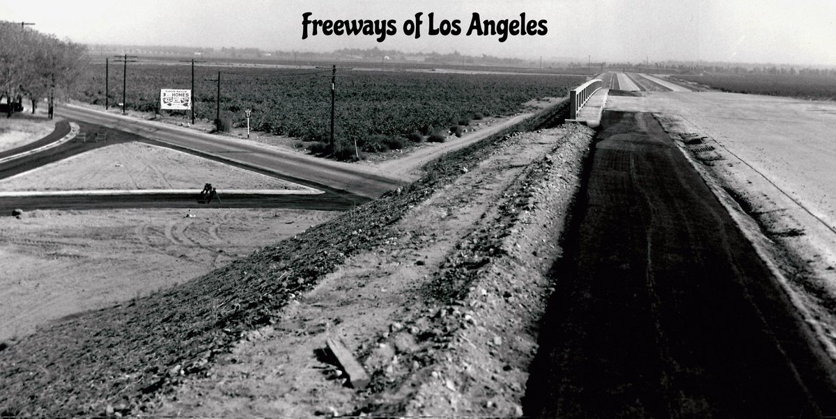
1954-Oct-18 - Facing SE on newly constructed Ramona Fwy (US-60-70-99), now San Bernardino Fwy (I-10), at San Bernardino Ave, now 4th St, in rural and argriculturally-rich Ontario (DOH D7 Archives photo).
LA’s freeways are deeply ingrained in its urban fabric, making it difficult to imagine the city without them. This circa '52 photo shows the construction of the Hollywood Freeway southward, toward the Hill St overpass and #DTLA. The hardest work-excavation- appears to be complete
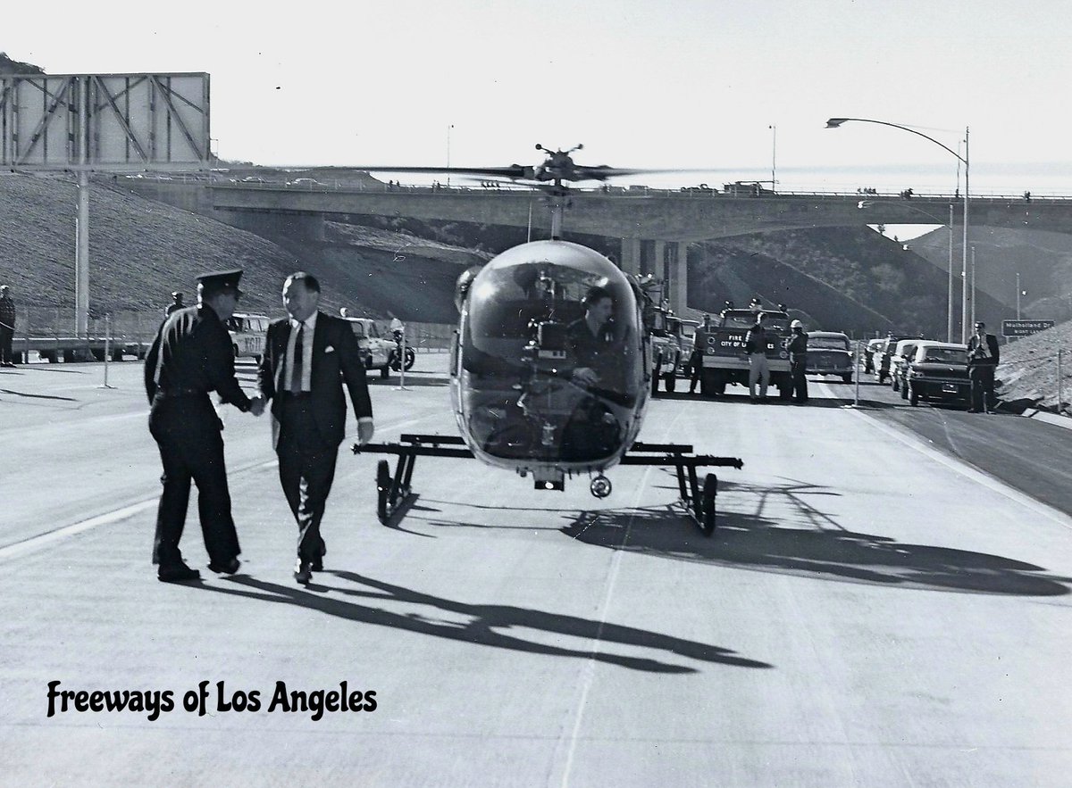
1962-Dec-02 - Then mayor Sam Yorty arriving by helicopter at ribbon cutting opening festivities on NB San Diego Fwy (I-405) lanes near Mulhulland Dr OC (DOH D7 Archives photo).
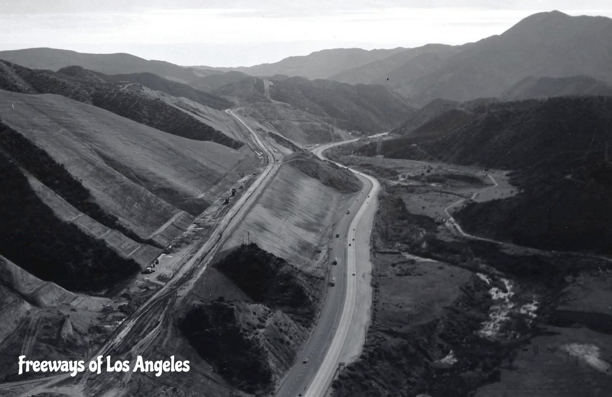
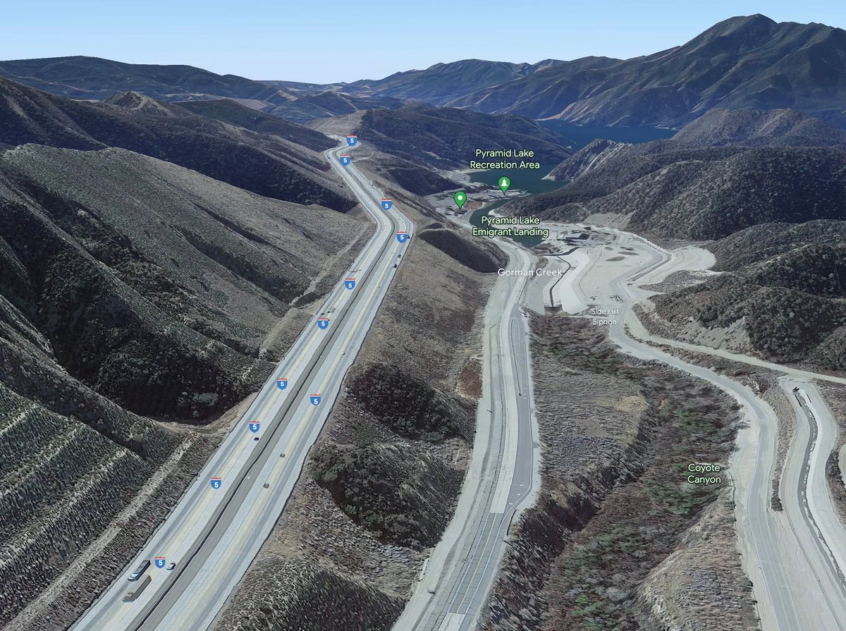
1966 & 2021 - Looking SE over I-5 north of Pyramid Lake. Ridge Route Alternate (US-99), now Pyramid Lake Road, at center. Segment of US-99 at top is now underwater. Pyramid Lake and Reservoir were completed in 1973 (DOH D7 Archives & Google Earth photos).
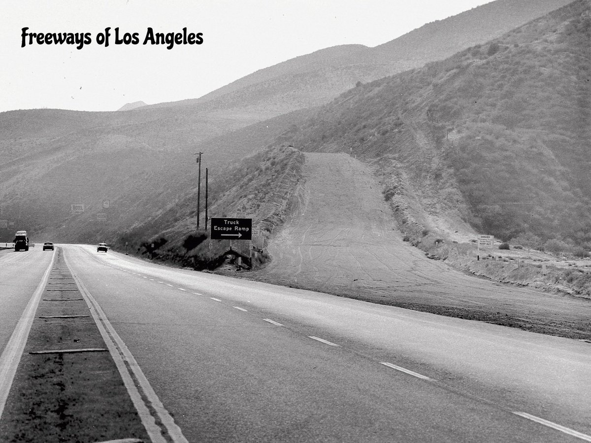
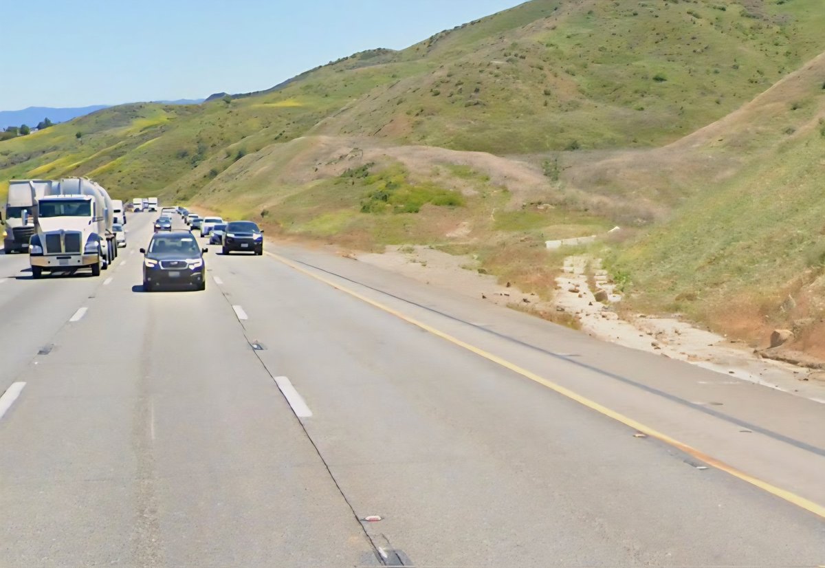
1959 & 2025 - Truck escape ramp on US-99/I-5 on the "five-mile grade" near Castaic. The steep downgrade necessitated the need for this escape ramp; now used for NB I-5 traffic. A separate gentler roadway now carries SB traffic (DOH D7 Archives/Google Street View photos).