
Michael Ferragamo
@FerragamoWx
New England → Oklahoma ☈ OU Meteorology. Tropical Cyclone Enthusiast & Hurricane Historian. A Boston boy living the Tornado Alley life!
It's finally done. Over 3 days of hand-plotting 173 years' worth of data. The end result is unbelievable. What an incredible dataset to look at.

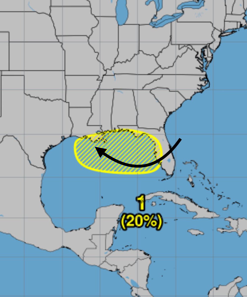
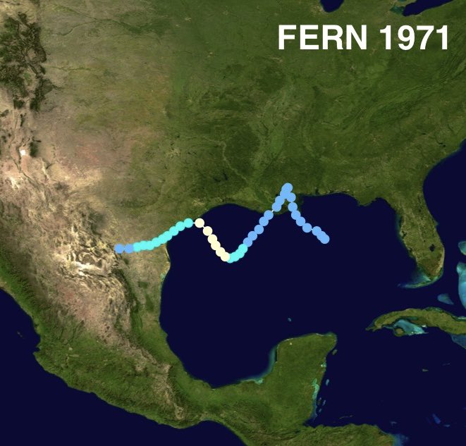
A TC moving due west across the Northern Gulf is uncommon, but not unheard of — other notable examples being BARRY 2019 and FERN 1971. Watching this 20% as it crosses FL and moves over the Gulf. Models hint at a brief spin-up.

Invest 92L looking a lot like a developing tropical cyclone on satellite. NHC now gives it a 70% chance of development.

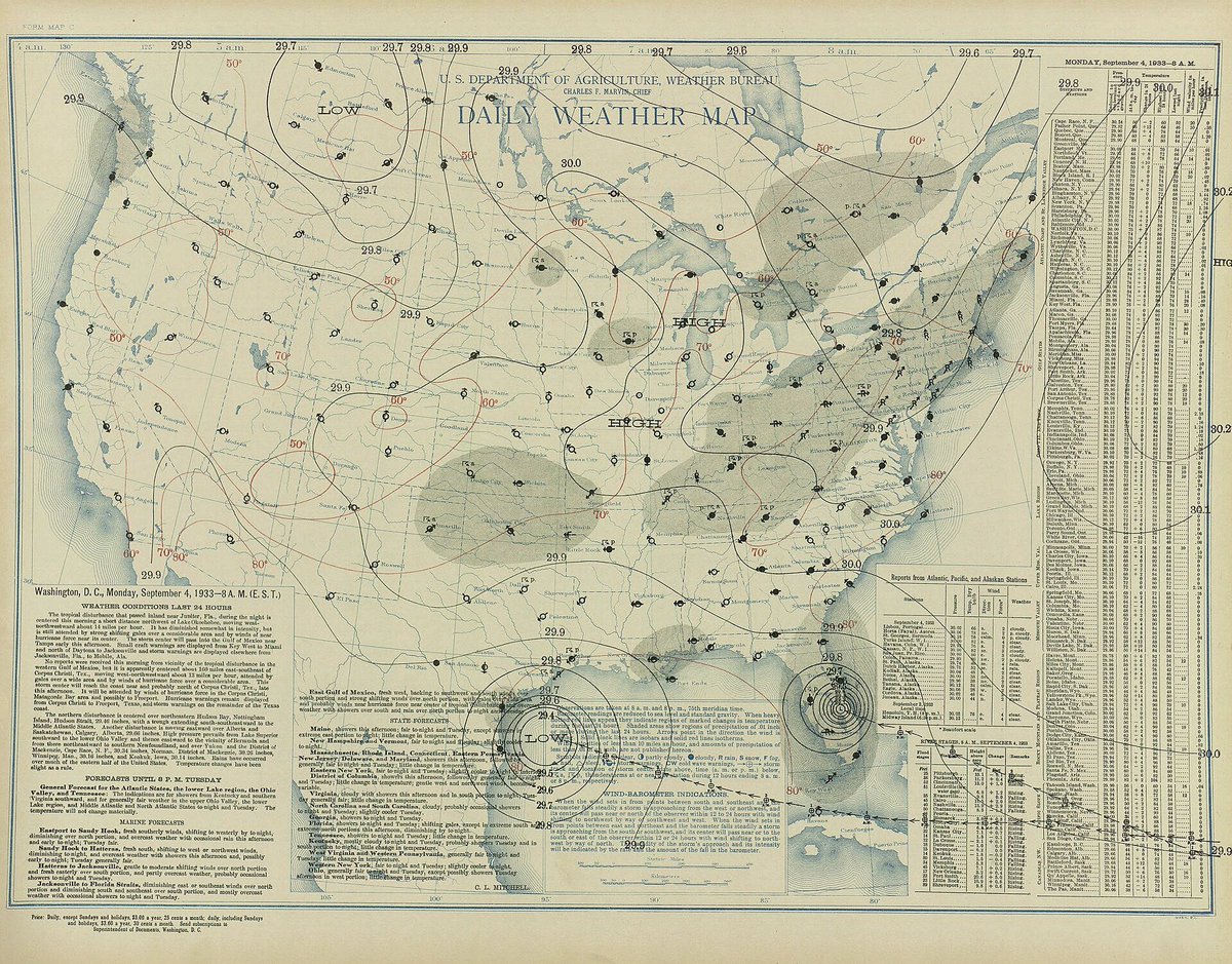
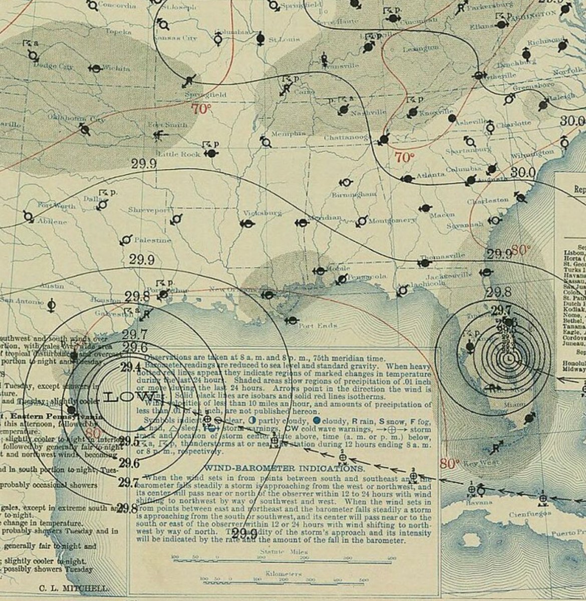
I would pay some serious money to view this on satellite imagery — two major hurricanes strike the US on the same day. September 4, 1933.


If you’re feeling young, just remember Hurricane Katrina turns 20 this year. Kinda unreal.
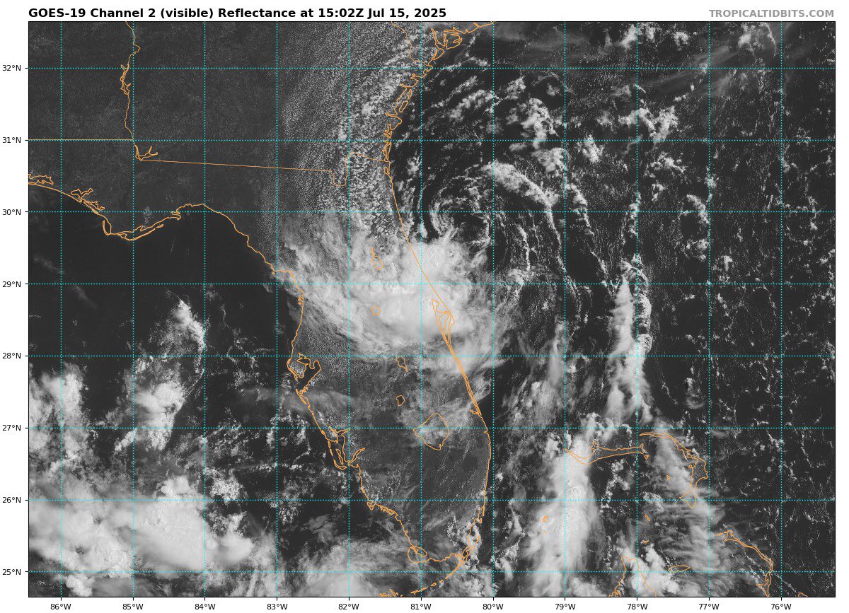
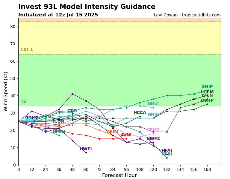
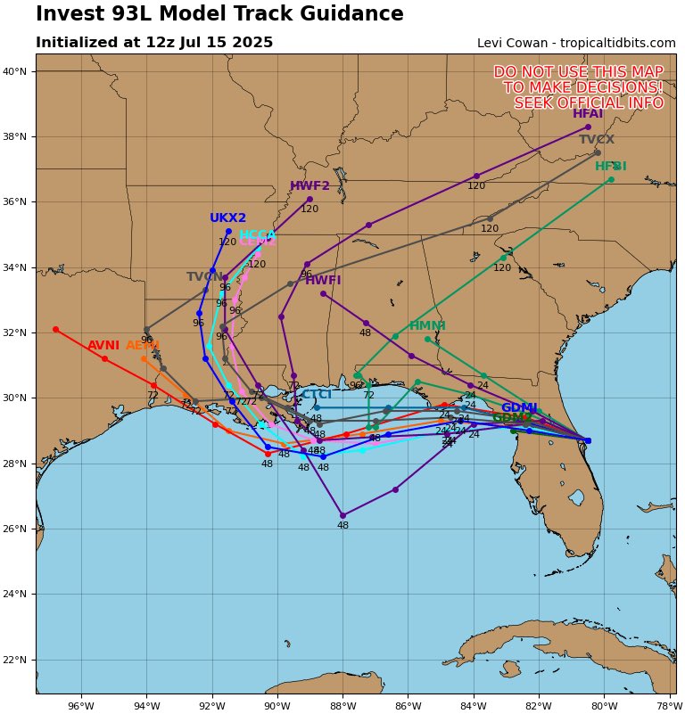
Invest 93L not looking the worst this morning as it approaches #Florida. Not a lot of time for this system to develop once it enters the Gulf, as most models hold it close to the coastline — but a brief TD/TS is possible.


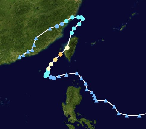
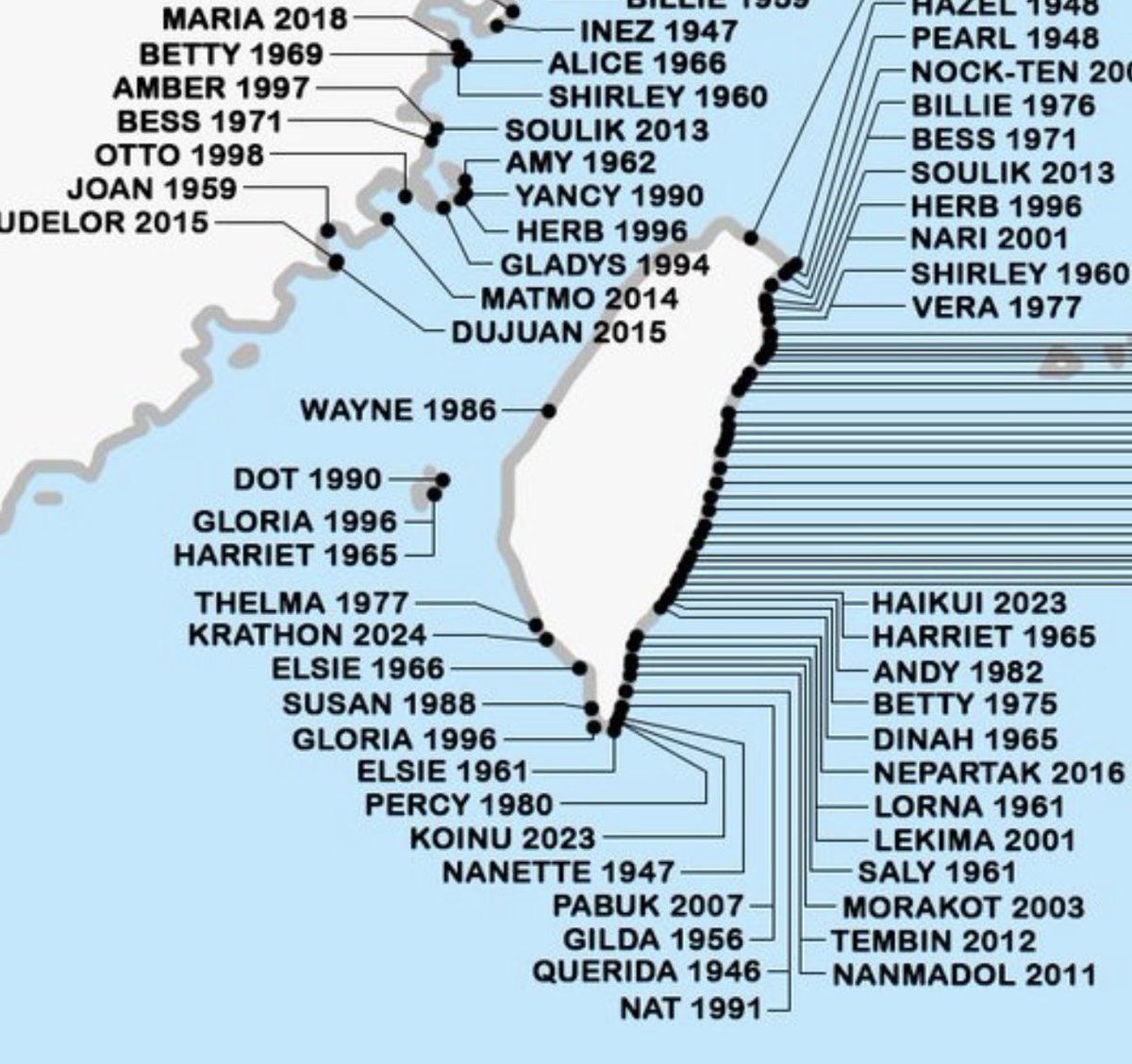
Typhoon #DANAS made an unusual approach to Taiwan recently — becoming the westernmost typhoon landfall on reocrd in Taiwan, surpassing THELMA 1977.
20 years ago, Hurricane DENNIS makes landfall along the Florida Panhandle as a 120 mph Category 3. It was the strongest pre-August hurricane ever observed in the Atlantic until surpassed by EMILY a week later — a testament to how intense the 2005 season was.
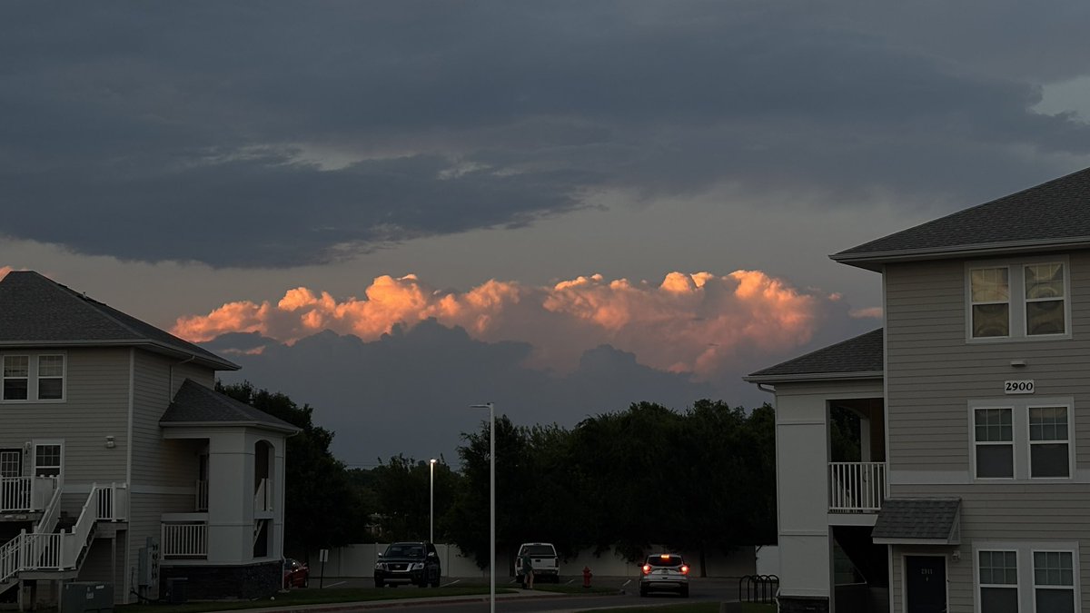
89°F with storms in the distance at sunset. Summer is superior, absolutely no question.

Tropical Depression #THREE has formed off the coast of the Carolinas this 4th of July. It’s forecast to form into Tropical Storm #CHANTAL, which will make landfall in South Carolina as a minimal TS.

We certainly name more sloppy/junk systems now than we used to, but that can be due to better technology and detection practices. At the end of the day, naming 3 junk systems might help the storm total, but it doesn’t help the ACE forecast much.
Yet another named storm that lasts roughly ~12-24hrs. and doesn’t amount to much. Good way to hike up those storm total numbers. #FLwx #WxTwitter #TropicsWx
The 4th of July in 2014 was a little different, with Hurricane ARTHUR making landfall in North Carolina — the earliest hurricane landfall ever recorded in NC.

Convection has increased within Invest 92L off South Carolina. Could become a brief TD/TS. Hurricane Hunters en route to investigate later today.
The active 2025 Eastern Pacific season continues, with a high chance of development right behind #FLOSSIE. 2 major hurricanes already this season.
