Esri
@Esri
Esri builds #ArcGIS, the leading location intelligence and spatial analytics software for mapping, 3D GIS, imagery, and geospatial app development.
The Grand Paris Express is Europe’s largest infrastructure project. 🚆 What’s keeping this megaproject on track and on time? GEOBIM. 🔹Read our latest in @Forbes: ow.ly/pEum50WoBW2
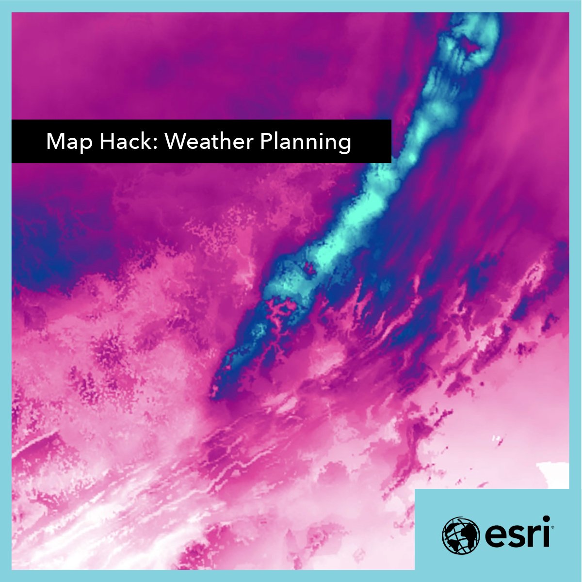
Explore mapping hacks! 🗺️ Esri's Lauren Tierney prepares to map future snowstorms efficiently by testing data processing and design decisions in a whole new location. The result? Mapping an event in a timely manner. Follow her process and tips here: ow.ly/MMnu50WjmSS
La semana pasada fue la #EsriUC2025, el evento más grande del mundo dedicado a los SIG, y nuestra delegación de Esri Chile fue parte de esta gran instancia 🌎🌐 Nuestro equipo pudo conocer los últimos avances en ArcGIS, innovaciones en IA, casos globales de uso real y más 💡🌟
What an incredible week! 🌎 Thank you for making this another memorable and mappy UC. Your work truly inspires us. ✨ We'll see you in 2026! #EsriUC2025
Jack and Laura thank you for making this a truly unforgettable Esri UC! 🌎 We’re inspired to see the impactful and innovative ways you’re using GIS to integrate everything, everywhere for a better future. #EsriUC2025
Collaboration goals unlocked. 🔓 🙌🏽 Make a layer editable for you and your team in just 10 minutes with these steps: ow.ly/WIAM50Waqpn

The @EsriUC Plenary Session videos are available! 🗺️ See the latest in ArcGIS technology, cool demos, and be inspired by the amazing stories showcasing the remarkable work of our user community. ow.ly/hfKM50WqV4a #EsriUC2025
We are truly inspired by the remarkable work you're accomplishing with GIS. 🌎 Let's continue to fuel this inspiration. Like what you saw in the Plenary? Add these sessions to your agenda: ow.ly/O1kt50WpC44 #EsriUC2025
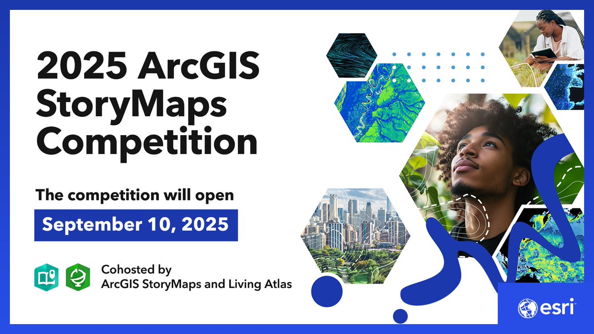
It’s here—the 2025 ArcGIS StoryMaps Competition! 🙌🏽 This year, Esri’s #StoryMaps and #LivingAtlas are teaming up as your cohosts. Join the fun, learn dataviz skills, and share your story. ow.ly/fNn850Woxmy
Today is the big day! 🙌🏼 Don't miss the @EsriUC Plenary Session live stream at 8:30 AM PDT. See the latest advancements in ArcGIS technology, cool demos, and hear incredible stories from global innovators using GIS. 🔹Watch here: ow.ly/jYNz50WkHsl #EsriUC2025

Want to learn ArcGIS Experience Builder from Esri experts? No prior experience needed. 😎 "Top 20 Essential Skills for ArcGIS Experience Builder" guides readers step-by-step through the process of creating visually stunning, highly functional apps. ow.ly/bZCo50WjobU

The Esri UC is a few days away! 🙌🏽 Hear incredible stories from global innovators using GIS, amazing demos, and the latest advancements in ArcGIS. Watch the Plenary Session live stream on Monday, July 14 at 8:30 AM PDT. 🔹Sign up: ow.ly/pywa50WkHaF #EsriUC2025

Wildfires have become a year-round threat. But technology and collaboration are making a difference. Watch how @SBCOUNTYFIRE, @Esri, and the open source community on GitHub use real-time data to help firefighters stay ahead of the blaze and protect our communities.
Nottingham, England is embracing the future of city planning with a digital twin. Using visualization tech, data analysis, and collaboration, they're transforming the cityscape for urban development. 🏙️ ow.ly/6cfy50W3L5S

Get a detailed understanding of U.S. neighborhoods with the third generation of #ArcGISTapestry. 🏘️ You'll also get a chance to download and print the brand-new 2025 ArcGIS Tapestry poster! ow.ly/HnEr50WjmOX

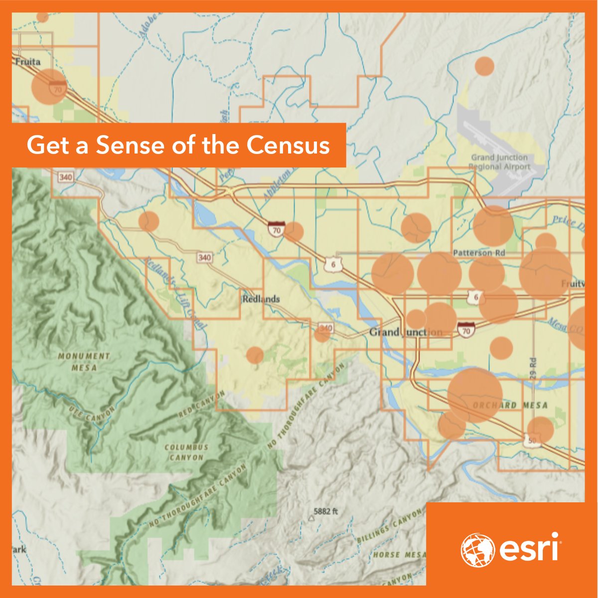
Got an hour? Learn how to navigate the @uscensusbureau website to find demographic data and visualize it in ArcGIS Online. ow.ly/WKF150W8tg2
Check out this great resource for the latest in ArcGIS technology and much more. 😉
The Esri UC Q&A is available! 🙌🏽 Explore this fantastic resource for answers to your questions, insights into the newest Esri tech, emerging GIS trends, and what's coming next. ow.ly/cW4850Whb2Y #EsriUC2025
How do you get the largest wind energy project in the Western Hemisphere off the ground? For Pattern Energy's SunZia project, the answer was GIS. ow.ly/ka4Q50WfAo5 #Drones #RenewableEnergy

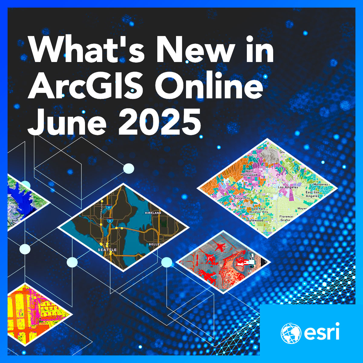
The latest @ArcGISOnline update is here! 🙌🏽 🔸Enhanced user types to better fit your needs & roles. 🔸Streamlined Analysis Workflows 🔸Dive deeper into imagery with the powerful tools in ArcGIS Excalibur. 🔹Learn more: ow.ly/JTvH50Wfawa
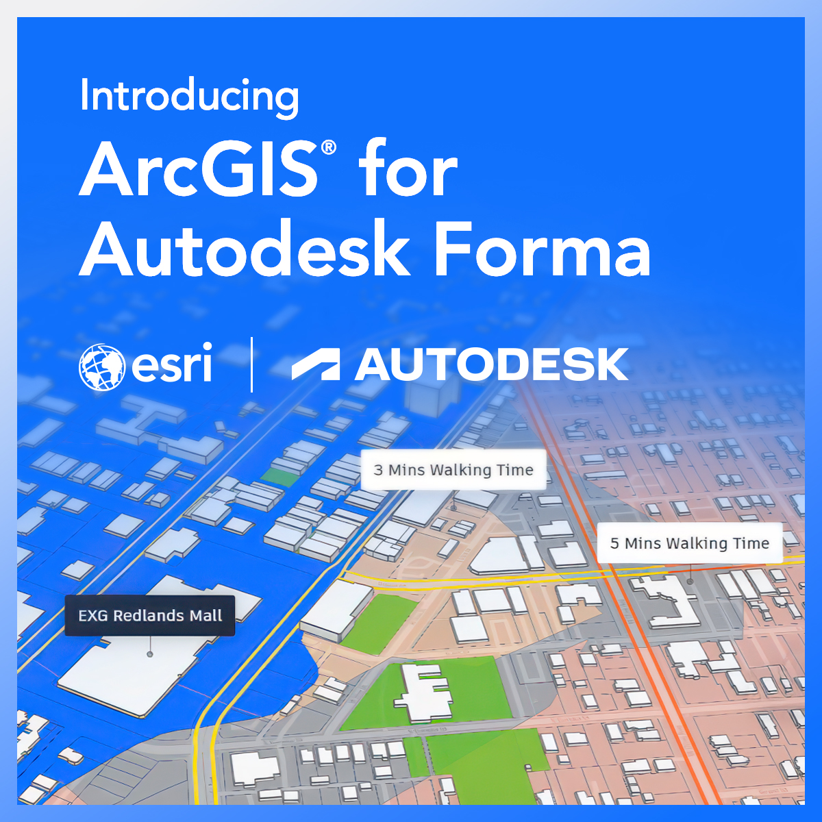
Now available! 🙌🏼 ArcGIS for Autodesk Forma. Enhance your pre-design and design workflows in @Autodesk Forma by seamlessly integrating maps, layers, and other spatial data from ArcGIS—all within a single design environment. 🔸Learn more: ow.ly/bg3k50We1q8 #AutodeskForma