Western Mass Weather
@DHTheWeatherNut
Dave Hayes is a Western Massachusetts weather nut who curates and reports on weather impacts in WMass, CMass, northern CT, southwest NH, southern VT & Taconics.
Western Mass Regional Weather for July 29, 2025: westernmassweather.com/western-mass-r…
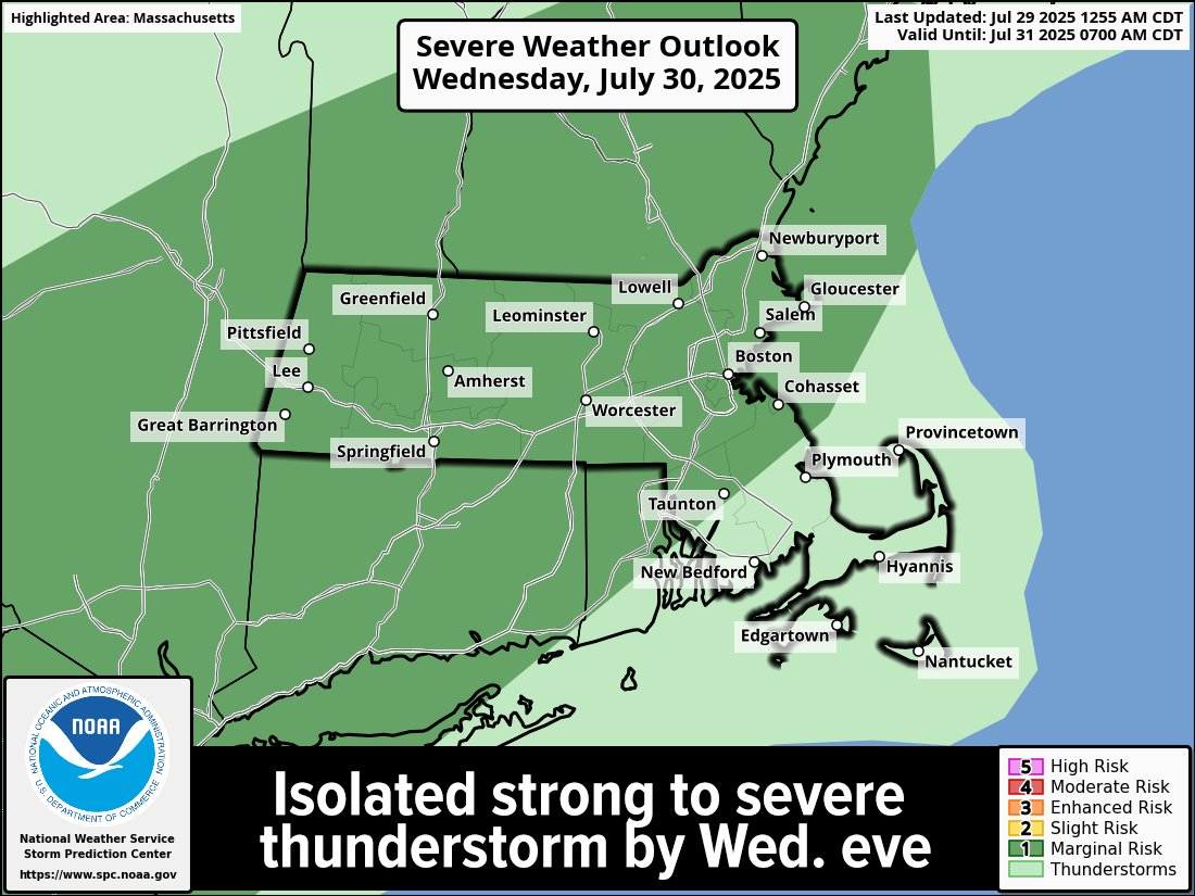


Can't rule out that a storm might become strong to even marginally severe, especially east of I-91 for Wed. eve...
Rain-free, very humid, smoky and hot today, sounds AMAZING... by tomorrow evening, some pop-up showers or thunderstorms possible late before the day's heating diminishes...
Rain-free, very humid, smoky and hot today, sounds AMAZING... by tomorrow evening, some pop-up showers or thunderstorms possible late before the day's heating diminishes...
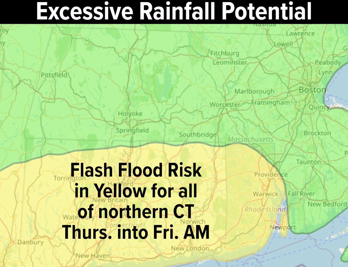
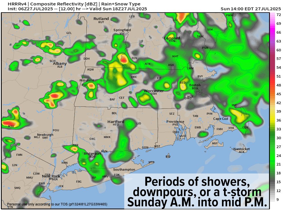
We can't rule out the heaviest stripe of downpours and training of showers and storms occurs over WMass and CMass and far northern CT, but it's more likely that area sags south into at least far southern MA and northern CT...
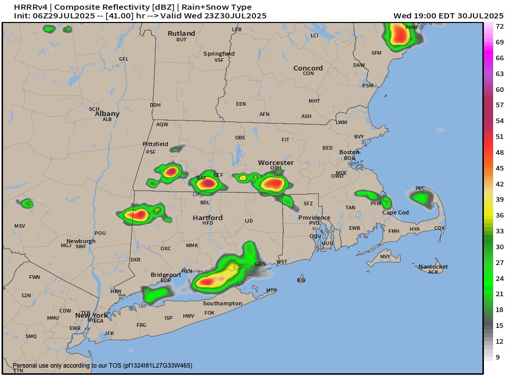
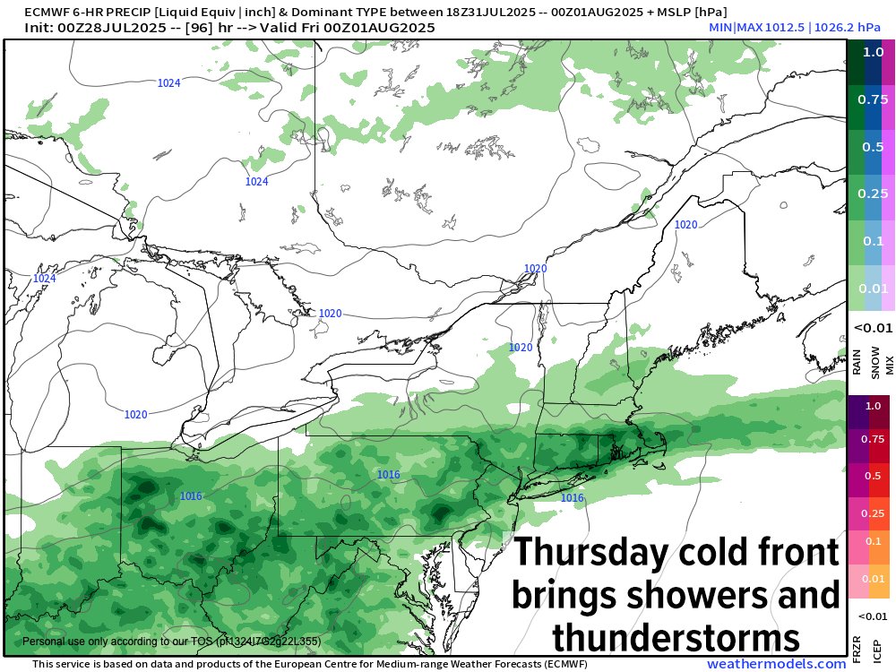
Heat headlines up today and tomorrow, then showers and rain headlines up for Thursday into early Friday, especially along and south of the Pike...
Heat headlines up today and tomorrow, then showers and rain headlines up for Thursday into early Friday, especially along and south of the Pike...
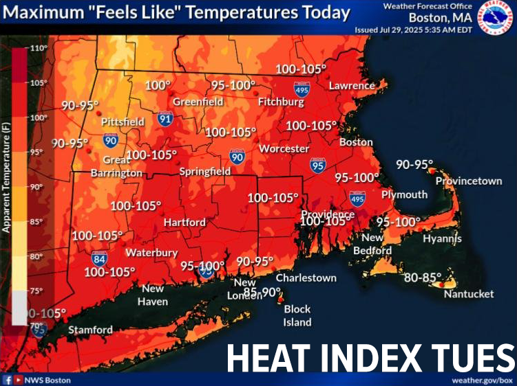
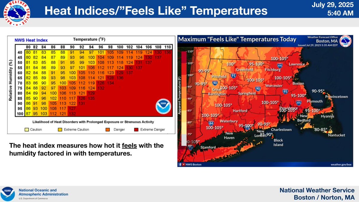
Heat Advisories continue for the valley today, east through CMass and in northern CT... heat indices (combo of air and dewpoint temps) will approach 105º in spots by mid-afternoon... mostly sunny, hot and humid once again, more so than y'day... Advisories extend thru tomorrow
Some of the most violent tornado footage I have ever seen, a perfect threshing machine…
Here is the video clip where I thought I was going to witness multiple chasers die in the Henry, SD #tornado #sdwx after getting too close as the farm disintegrated and flew over them. @MichaelGordonWX @SimonStormRider @JustonStrmRider @scottmcpartland @mikebettes @parkertwc
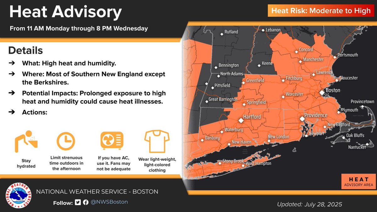
5:20PM MONDAY UPDATE: HEAT ADVISORIES HAVE BEEN EXTENDED INTO WEDNESDAY... Good afternoon folks, many towns hit the upper 80s to mid 90s today for high temps, with some areas in the highest terrain of northwest MA and southern VT hanging in the low to mid 80s. Very warm to hot…
Epic mammatus deck...
Fluffy mammatus clouds appeared at sunset over Graceville, Minnesota, on Sunday.
Western Mass Regional Weather Report for July 28, 2025: westernmassweather.com/66188-2/
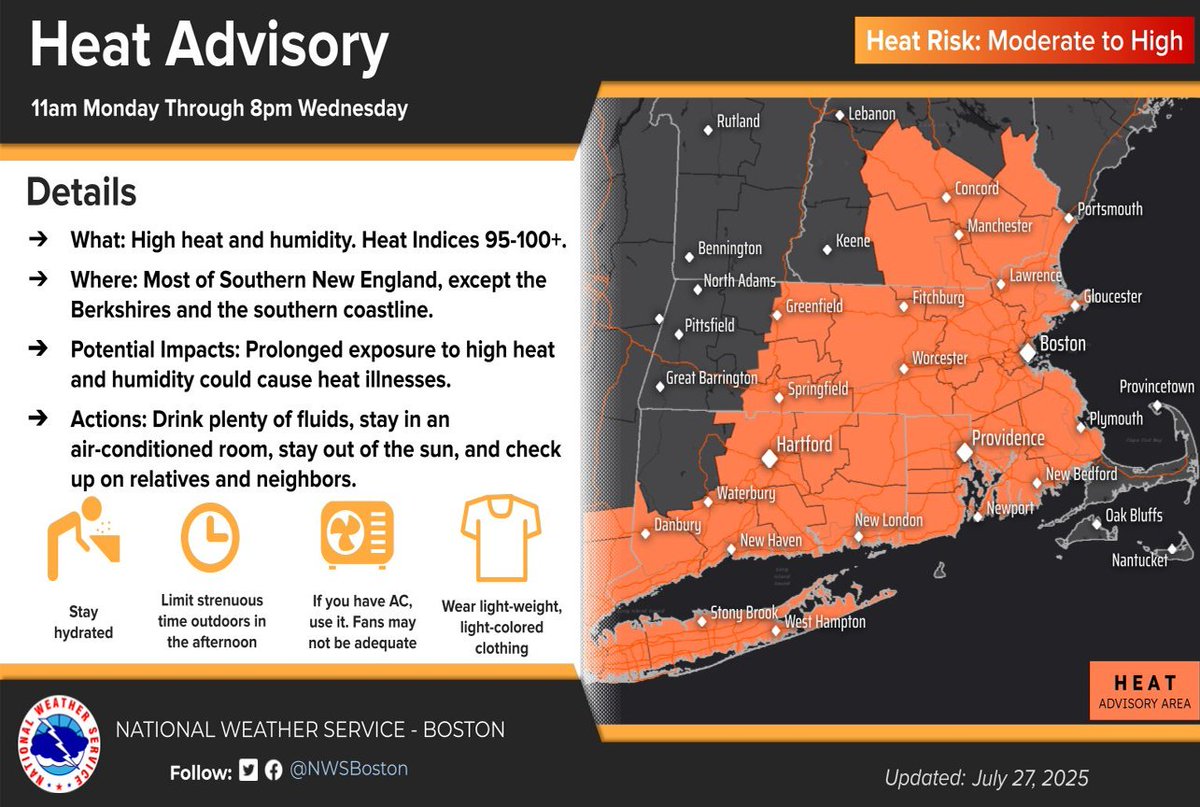
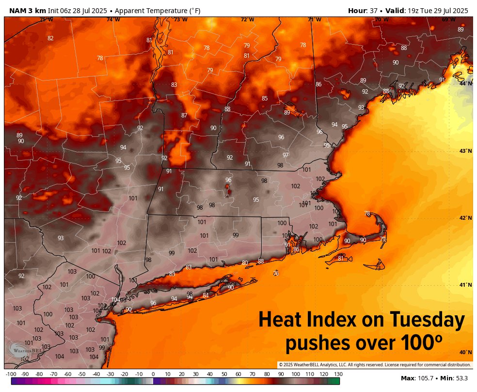
Heat Advisories are up for the Pioneer Valley of WMass, CMass and much of northern CT... highs upper 80s to mid 90s today, tomorrow and Wednesday... maybe some upper 90s Tuesday... heat indices push over 100º Tues. & Wed., mid/upper 90s Monday/today... hydrate, hydrate, hydrate

Patchy dense fog this morning. Especially so in SVT and SWNH… take it slow on the roads this early morning…
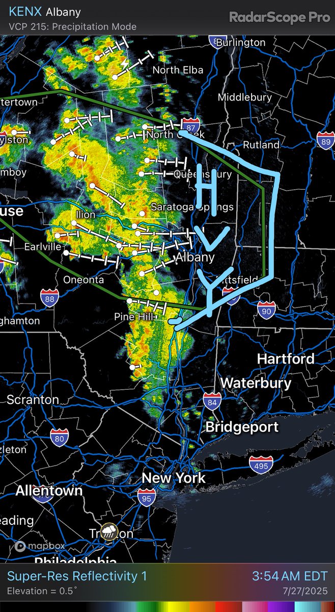
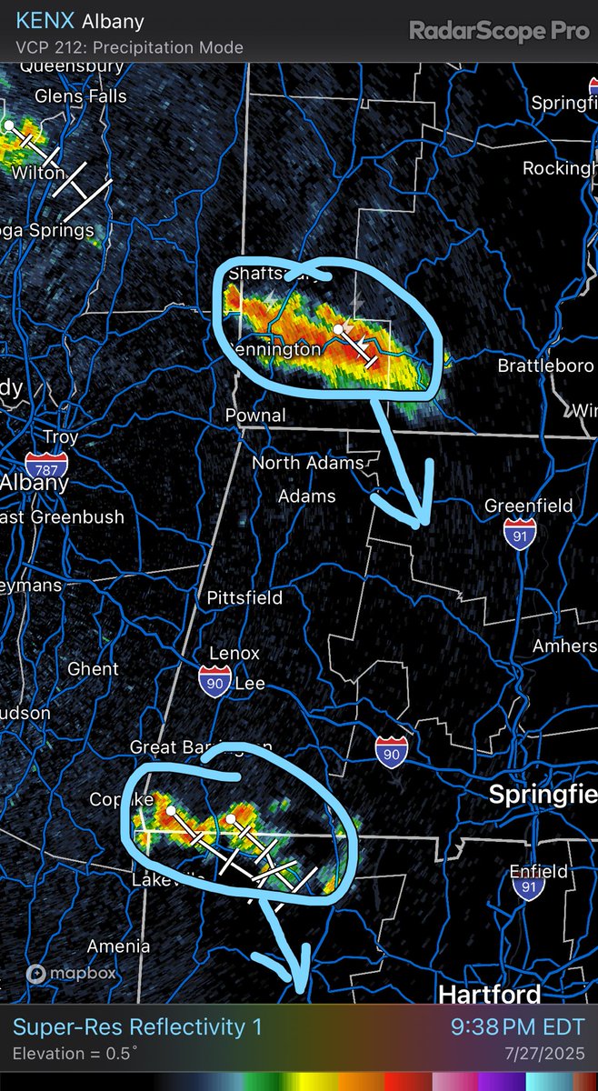
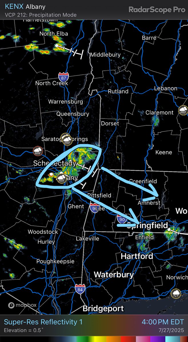
A thunderstorm has formed in southern VT and another downpour in nother Litchfield County CT… both are tracking SSE at 9:40pm…
A final cluster of showers will track southeast through parts of the WMass region between now and 6pm or so…
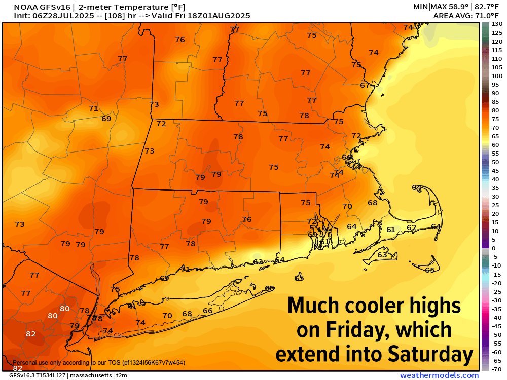
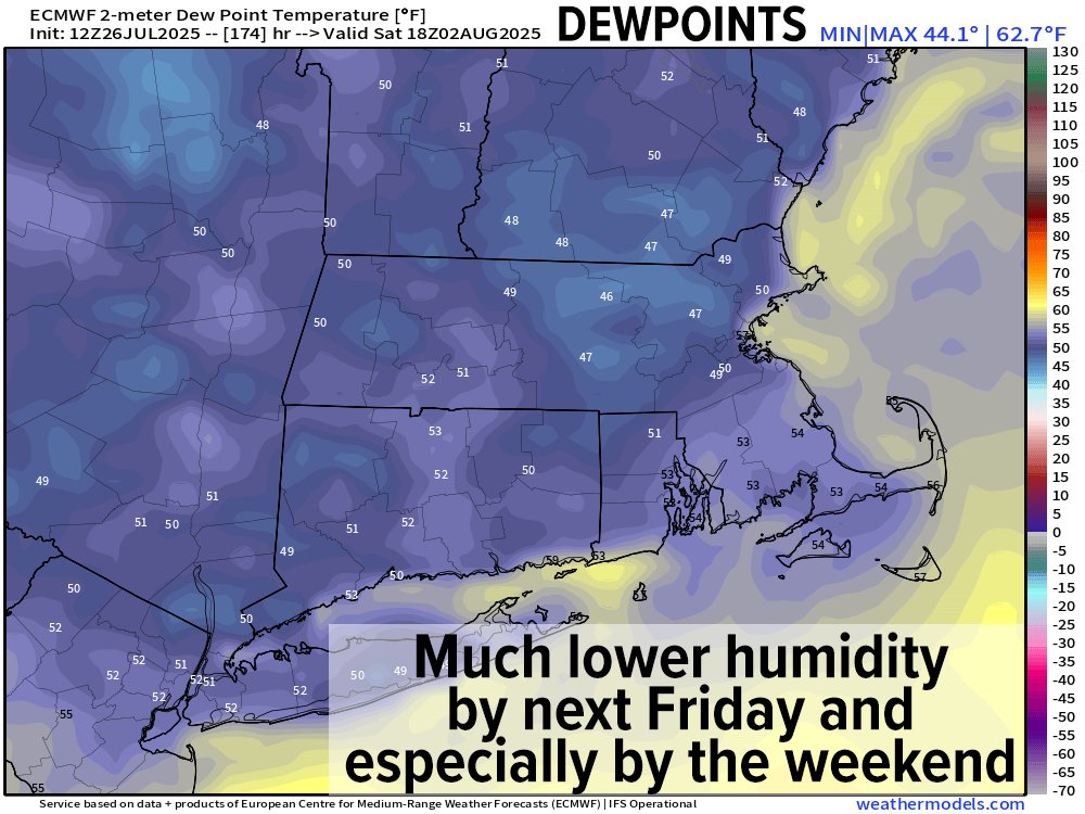
Heat Advisories extended to Wednesday… heat wave coming Monday to Wednesday before the cooldown late week into next weekend
BOX updates Heat Advisory valid at Jul 28, 11:00 AM EDT (extends time and expands area to include 5 zones, extends time of 23 zones) till Jul 30, 8:00 PM EDT mesonet.agron.iastate.edu/vtec/f/2025-O-…
Western Mass Regional Weather Report for July 27, 2025: westernmassweather.com/western-mass-r…
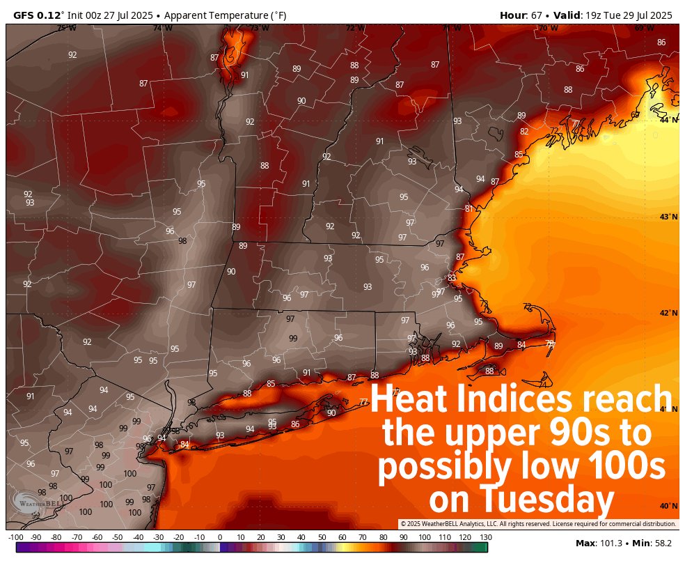
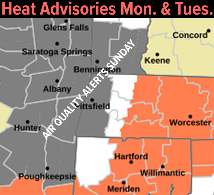
Heat Advisories are up for Monday and especially Tuesday when heat indices will push over 100º

Some heavy rain leading to isolated flash flooding potential into the Berkshires and southwest VT and the Taconics in eastern NY early this morning as efficient rain processes line up with strong air parcel lifting… what goes up, must come down… 4am