
Upper Cumberland Weather
@CumberlandWx
Serving the Upper Cumberland region of Middle and East Tennessee with daily forecast information and live-streaming coverage during severe weather.
10:04 p.m. - Scattered storms have developed across northwestern portions of our region from Pleasant Shade to Dale Hollow Lake. We'll likely see additional storms pop up across the Upper Cumberland overnight. These cells are slow movers capable of dumping two inches of rain per…
We have some pretty exciting things going on with our Patreon site! I'll often receive questions of how folks can support UCW who aren't business owners. While we have various means of donating in place, Patreon is now *THE BEST* way to support us, as I'm able to offer several…

No need for violence folks, but goodness, it's hot. Nothing out of the ordinary for this time of year. Some of you even asked for it when it was 0° at one point in January...myself included. But gosh a'mighty, that humidity... It will get you! The Heat Advisory for Macon, Smith…

It’s hot and muggy. I don’t need to tell you that if you’ve been outside. A Heat Advisory is in effect through Wednesday for Macon, Smith and Trousdale Counties. It’s in these areas where heat index values could climb as high as 105° today. Actual air temperatures will be in the…
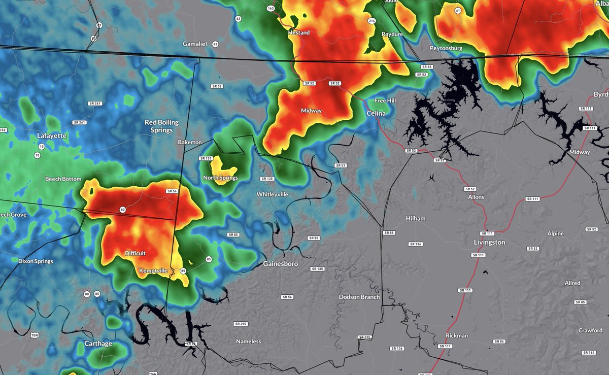
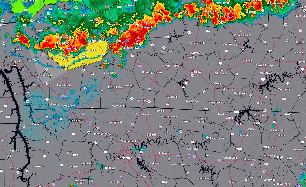
It’s about to come a gully washer in Carthage. Same story for Gainesboro. It’s already arrived in Celina. These storms aren’t severe, but they have held together well. Cookeville/Livingston/Byrdstown, heads up…torrential rain, lightning and gusty winds are all heading your way.
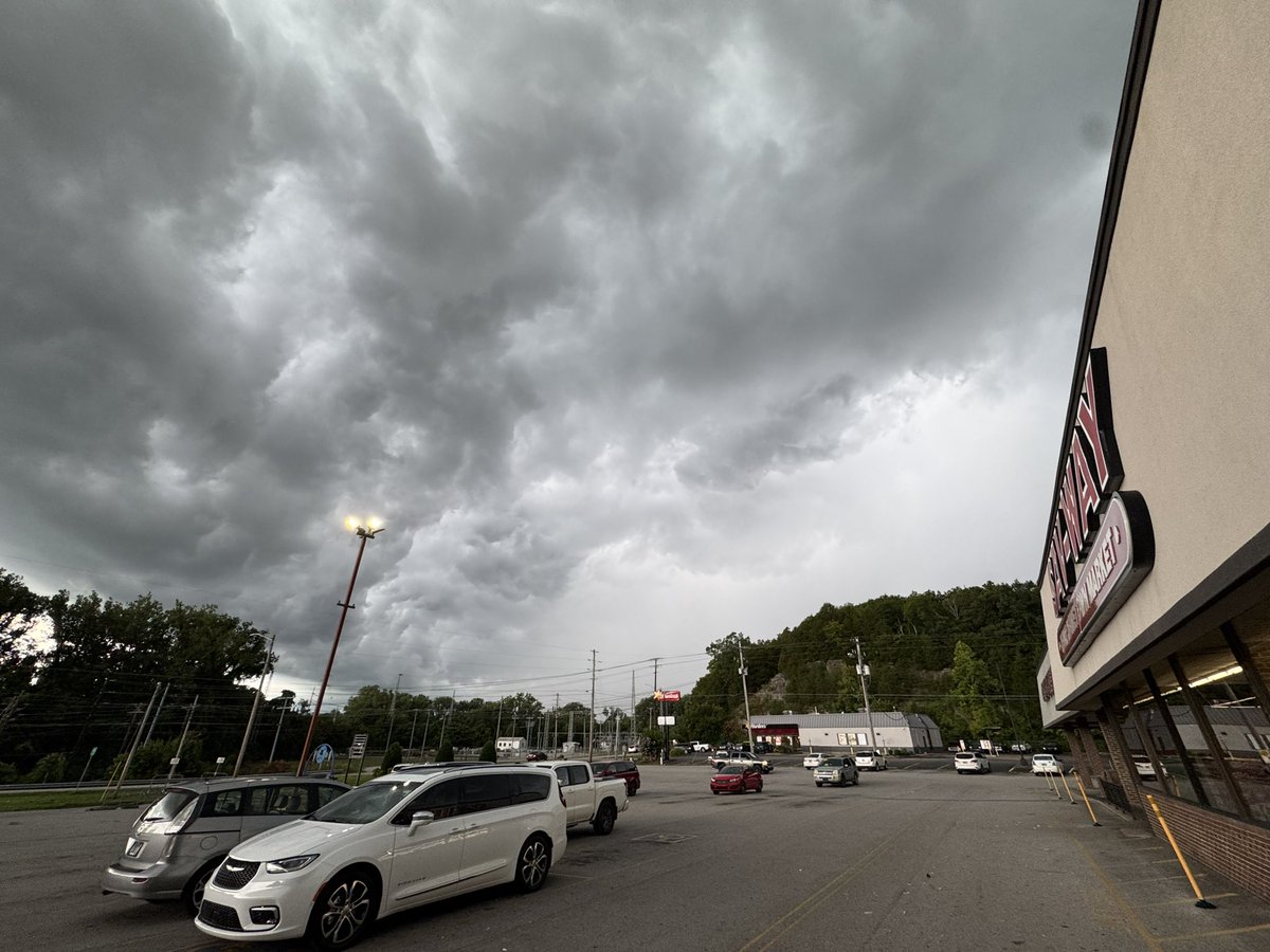
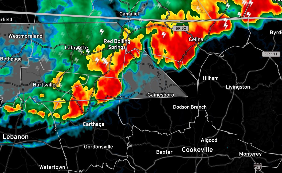
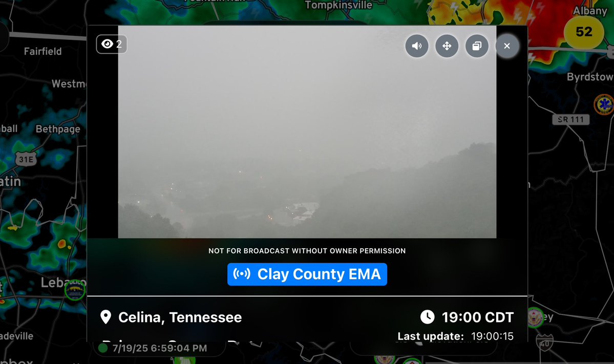
5:55 p.m. - The complex of storms we were monitoring up in Kentucky has indeed held together long enough to reach our northwestern areas. Storms are moving south at about 30 mph, approaching Macon, Trousdale and Clay Counties with isolated cells out ahead of the main storms.…
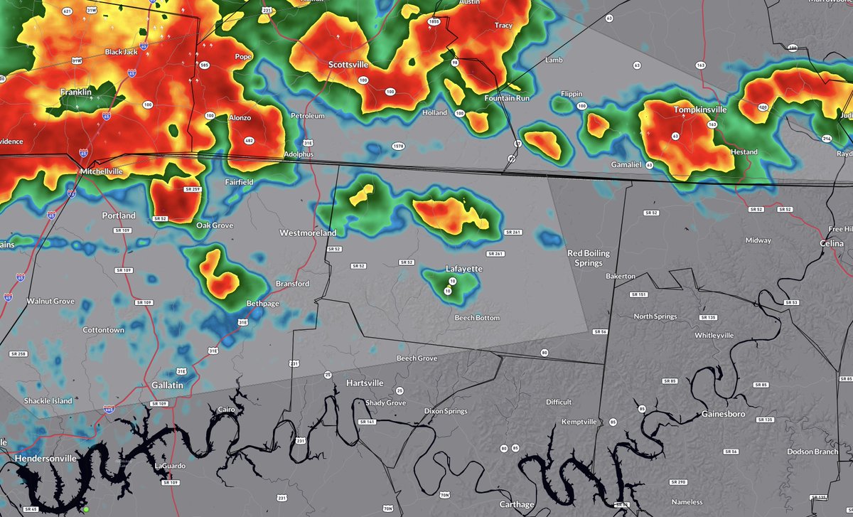
I have my eye on an MCS (mesoscale convective system) well up to our north across central Kentucky. It's doubtful this cluster of storms will make it this far south, but... it may send boundaries down our way that could help kick off scattered to widespread storms here across the…
At this point…probably.
Is Gainesboro gonna get any of that too?
This storm situated between Byrdstown and Jamestown is nearly stationary, capable of producing rainfall rates of 1-2 inches per hour. Flash flooding of streams, creeks, low-lying and poor drainage areas is either ongoing or expected to begin shortly. If you come across a flooded…
Flash Flood Warning for Fentress, Overton, and Pickett County in TN until 6:30pm CDT Friday.
Flash Flood Warning for Fentress, Overton, and Pickett County in TN until 6:30pm CDT Friday.
Absolutely nuts
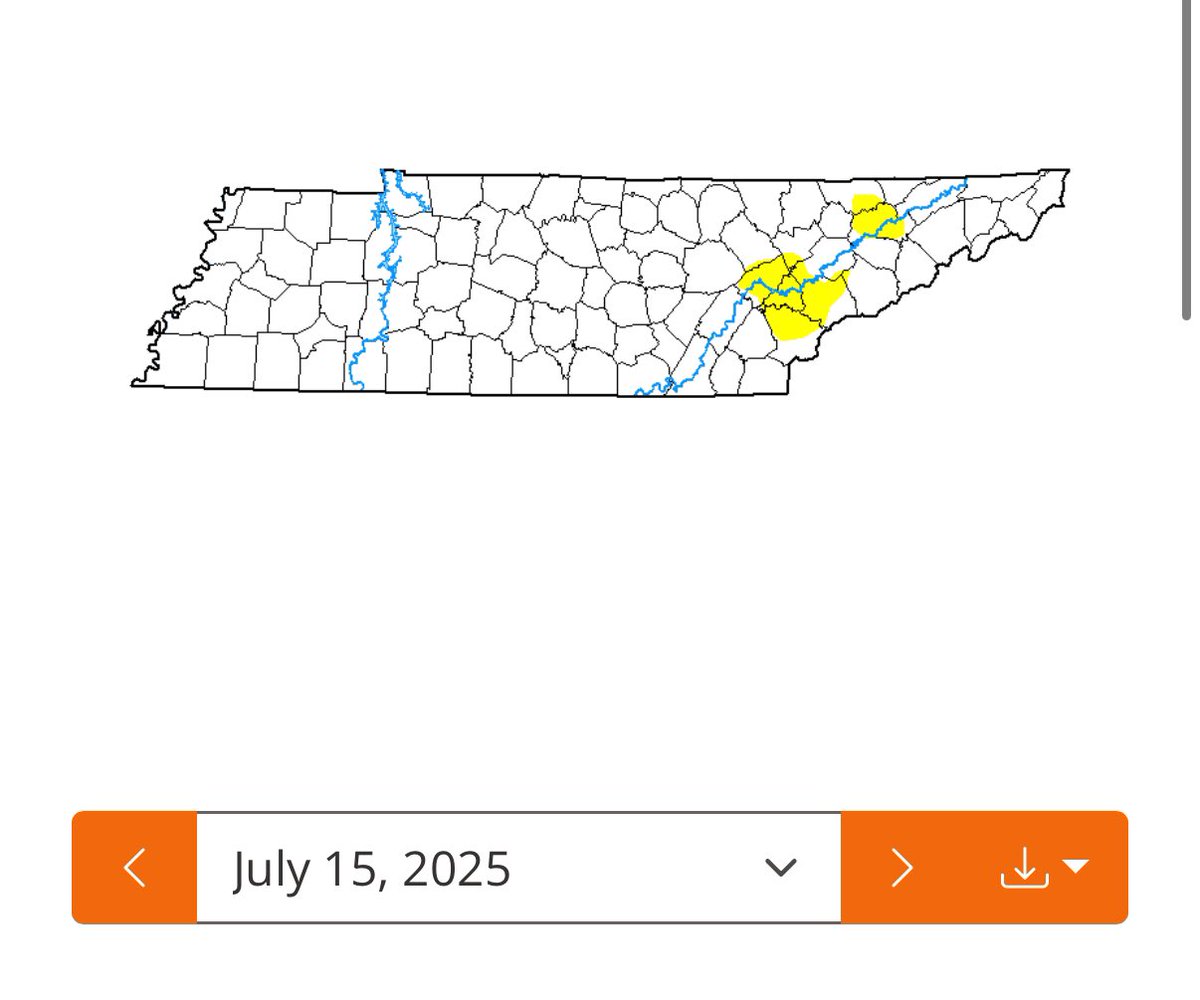
We are moving into drought conditions in Central Putnam. Just .46" for July. 😳
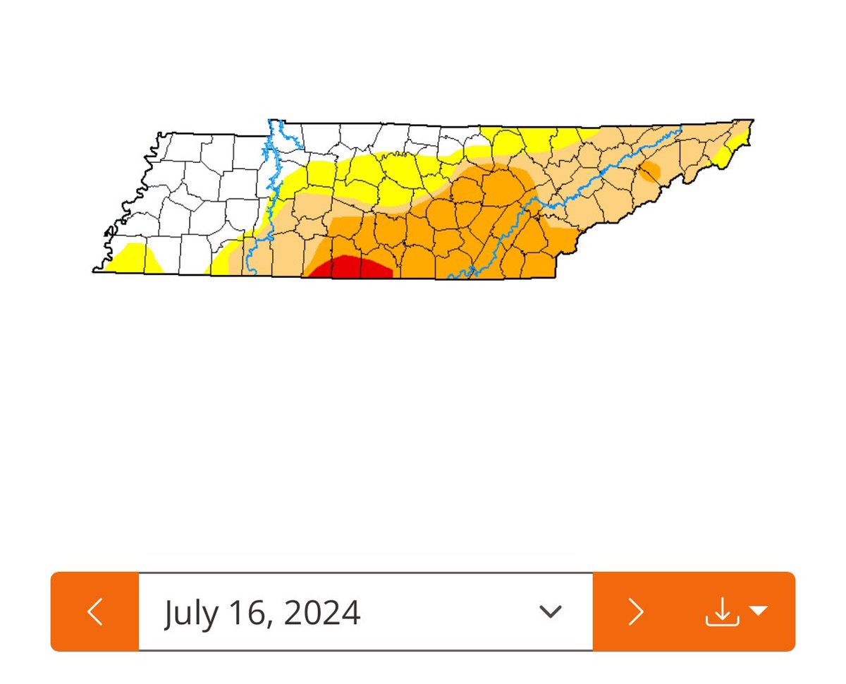
Random Stat: the drought monitor report this week compared to this same week last year is a NIGHT AND DAY difference. No drought this year, that’s for sure!
Good morning from NASHVILLE with your Upper Cumberland Weather forecast on the 100,000 watt 94.7 The Country Giant!
There’s a light show east of Jamestown tonight! Wow! @NWSNashville @CumberlandWx
Meteorologist Elijah Kirby, owner of @ShelbyvilleWx, stopped by the Upper Cumberland Weather Studio this afternoon to visit and gather ideas for his upcoming rebrand that will include expansion into counties to our immediate southwest! He has some pretty big plans for the future,…

@CumberlandWx mission accomplished
@CumberlandWx getting the most epic Milky Way shot of my life right now
The National Weather Service in Nashville has issued a * Flash Flood Warning for... Southeastern De Kalb County in middle Tennessee... Northeastern Warren County in middle Tennessee... White County in middle Tennessee... * Until 430 AM CDT. * At 1230 AM CDT, Doppler…
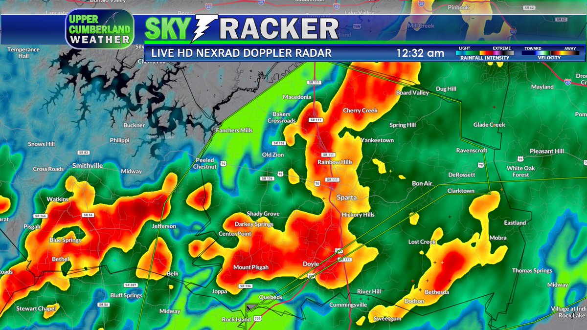
Flash Flood Warning for DeKalb, Warren, and White County in TN until 4:30am CDT Thursday.
@CumberlandWx getting the most epic Milky Way shot of my life right now
Some locations that will experience flash flooding include Spencer, Doyle, Virgin Falls State Natural Area and Lake Tansi.