Chicago & Midwest Storm Chasers
@ChicagoMWeather
Extreme Weather Videographer, Storm Chaser, and Photographer. Video stringer for several news companies.
The Most Impressive Multi-Vortex #TORNADO I have ever seen. The vortices were moving at warp speed. You must watch this! I was very close... I cropped in a bit to show you how intense this tornado was. #OKwx @NWSNorman
🌪️🚨 Tornado risk today, July 23rd, Wednesday 🌪️ A tornadic supercell threat will increase this afternoon and evening across northern Wisconsin and central Minnesota. I will be live this afternoon and evening across the area. Stay tuned! #WIwx

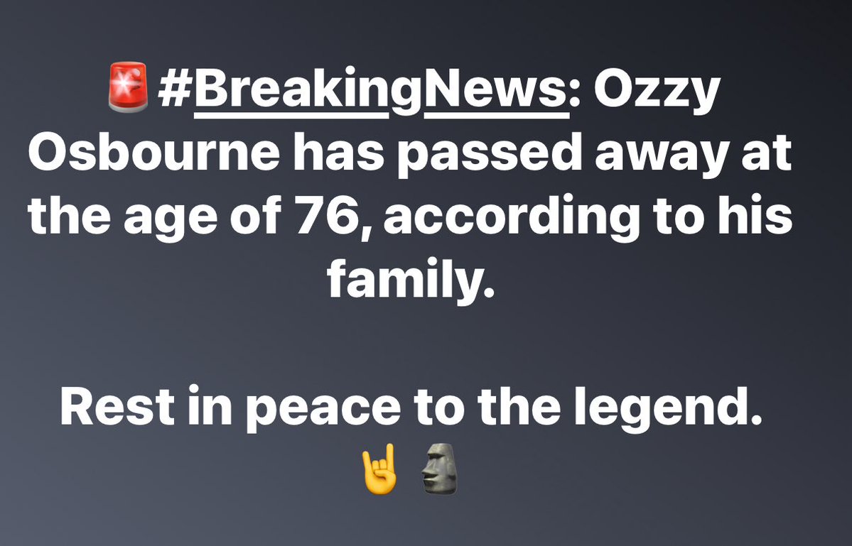
🚨#BreakingNews: Ozzy Osbourne has passed away at the age of 76, according to his family. Rest in peace to the legend. 🤘🗿
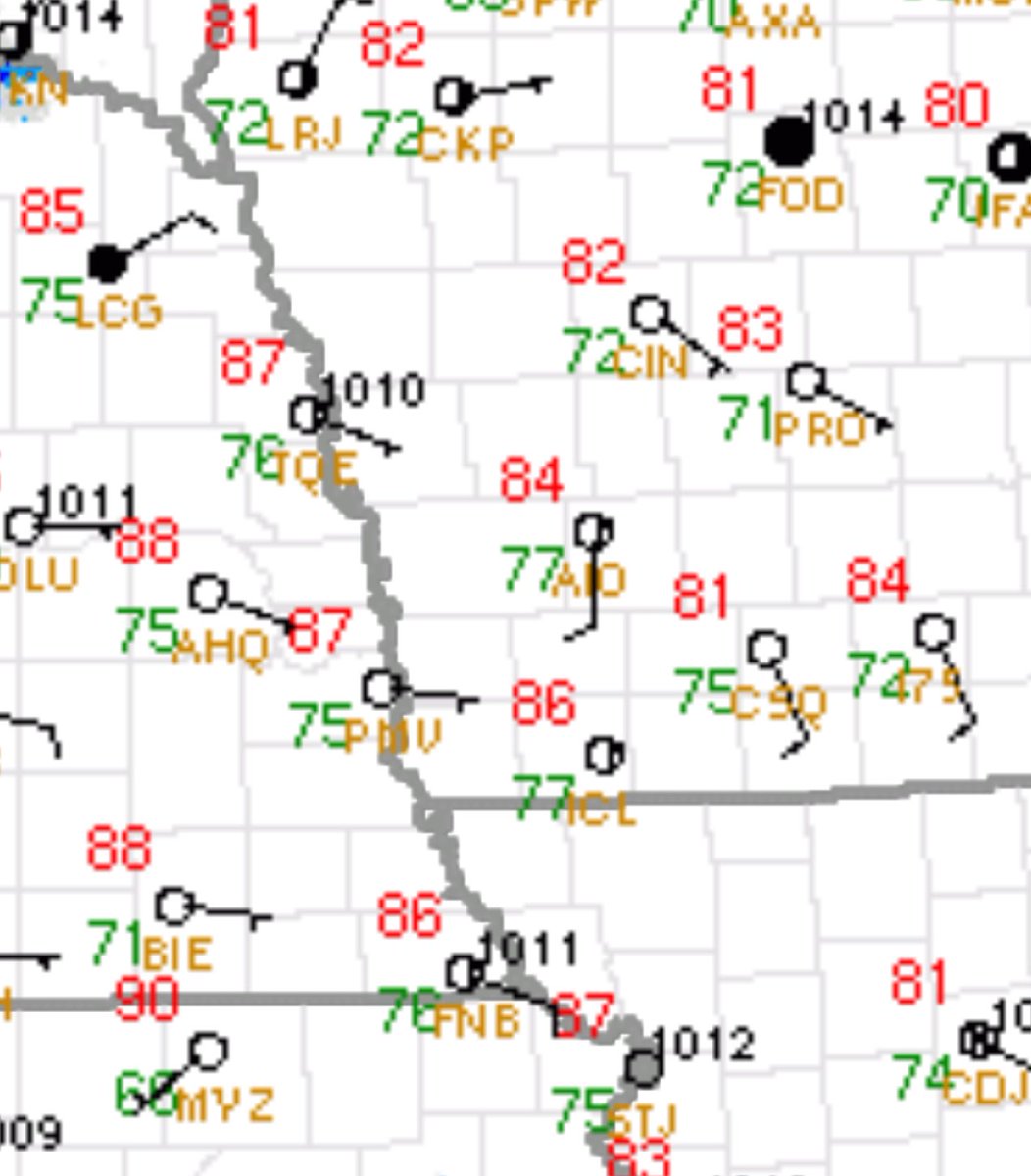
* Tornado Warning for... Southern Shelby County in central Illinois... * Until 515 PM CDT. * At 459 PM CDT, a severe thunderstorm capable of producing a tornado was located near Tower Hill, or near Shelbyville, moving southeast at 25 mph. HAZARD...Tornado. SOURCE...Radar…
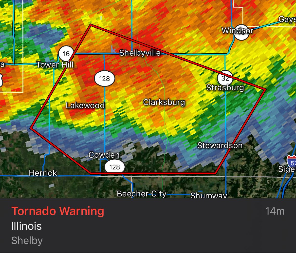
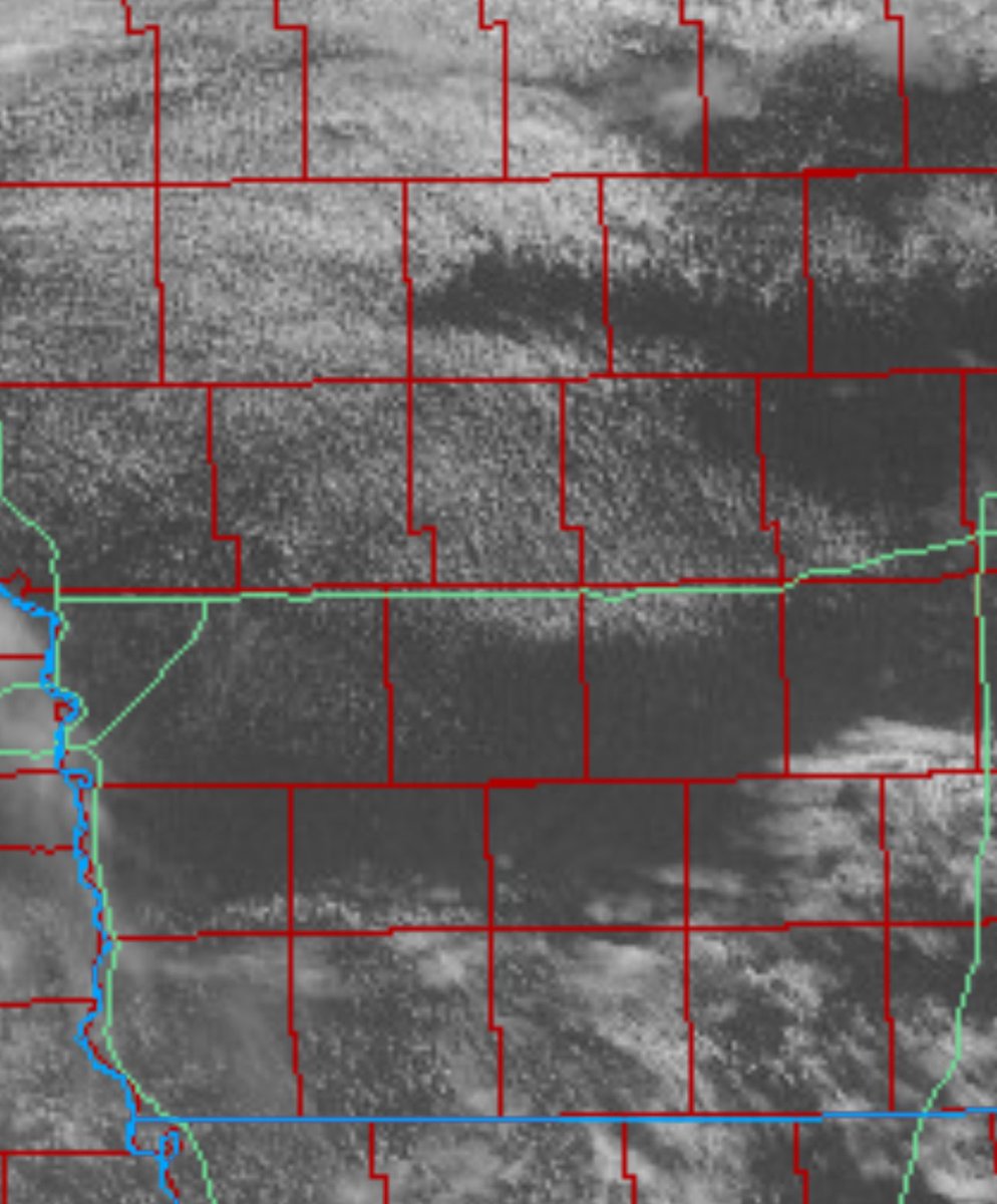
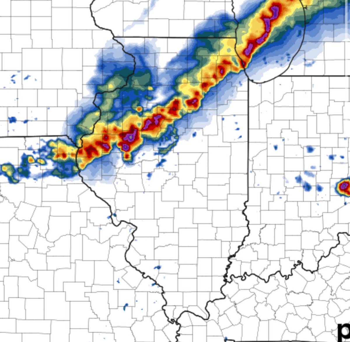
The storm west of I-57 near Lakewood, IL, is producing very heavy rain. Gusty winds with tightening rotation could prompt a tornado warning in the future, and this storm has reached echo tops over 60,000 feet. #ILwx
The setup here just East of Lakewood, Illinois #ilwx #wxtwitter
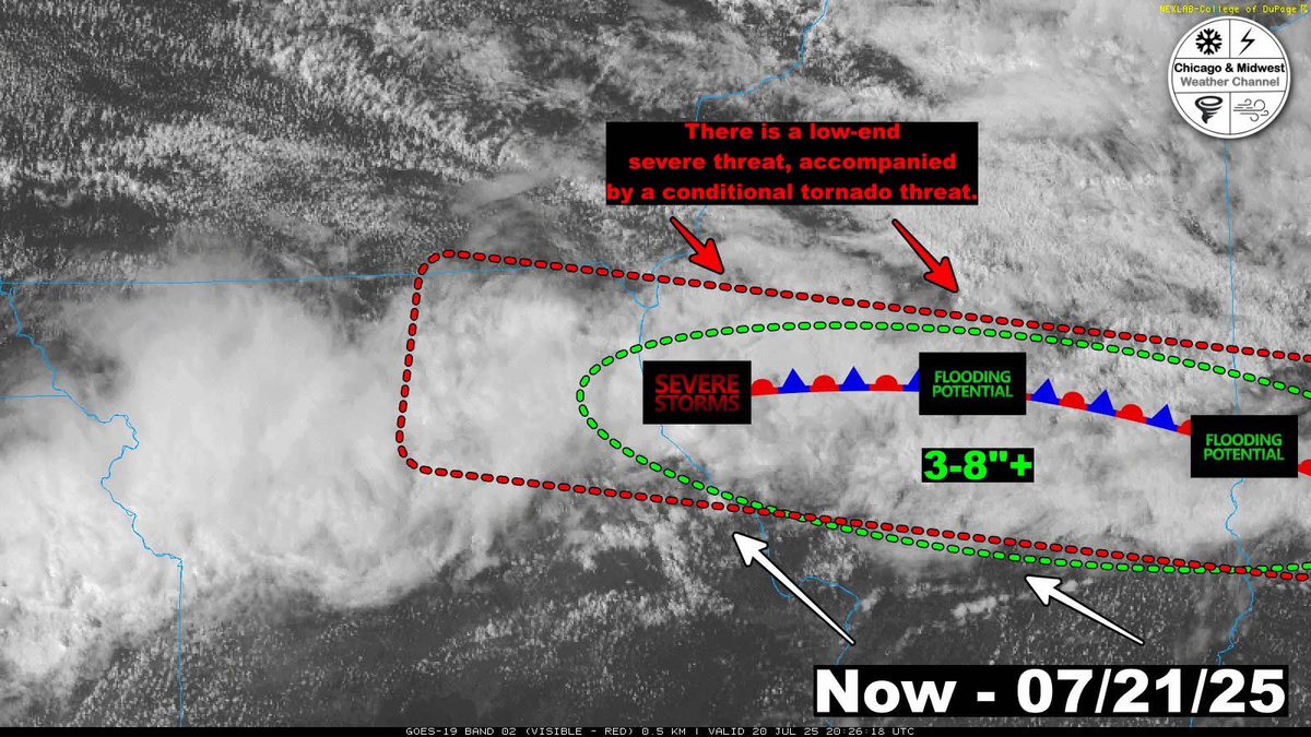
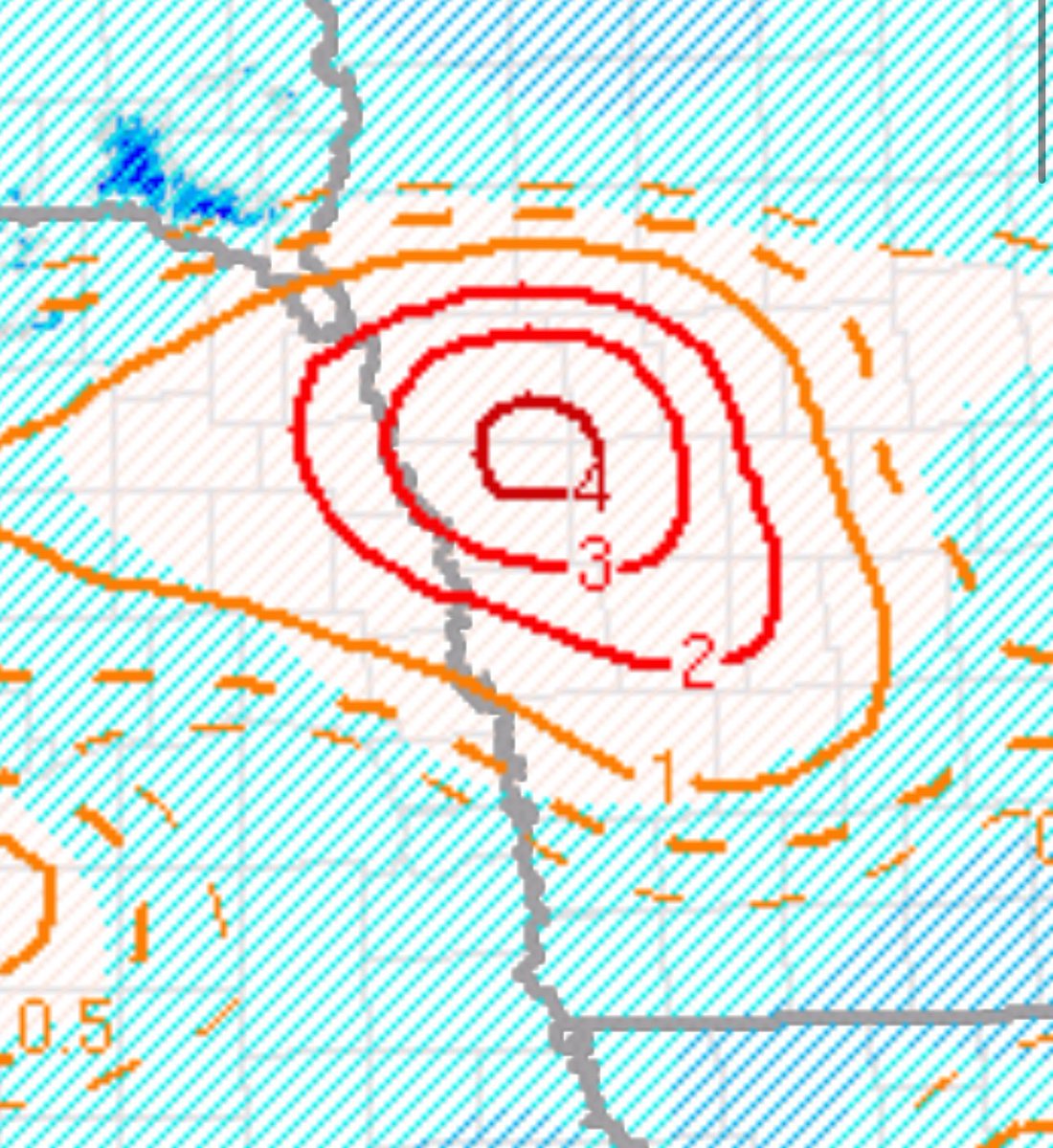
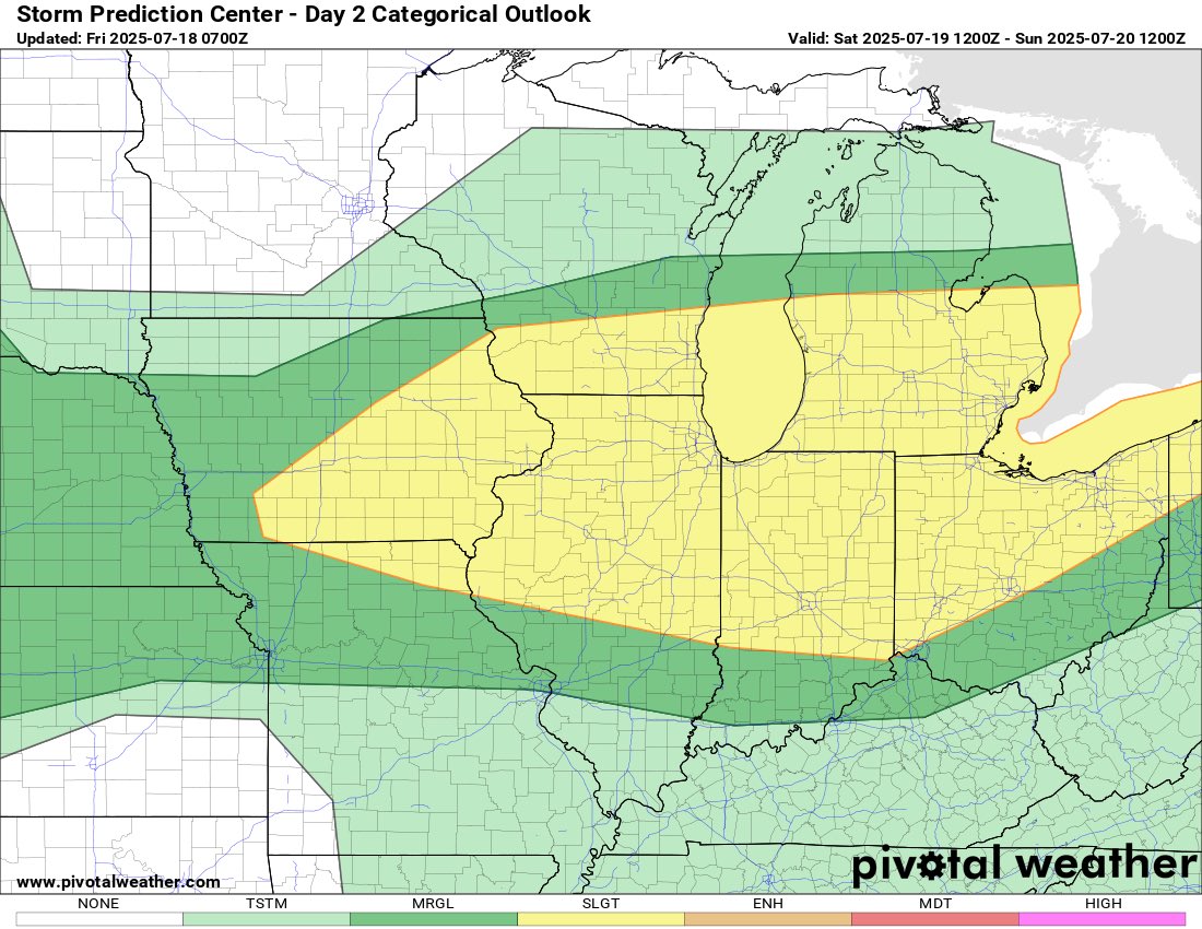
**Moderate Risk of Heavy Rainfall for Central IL** Some areas could experience 3-8 inches of rainfall over the next 24 hours. Certain storms may produce rainfall rates of 1-3 inches per hour, potentially leading to double-digit totals within just a few hours, which could result…
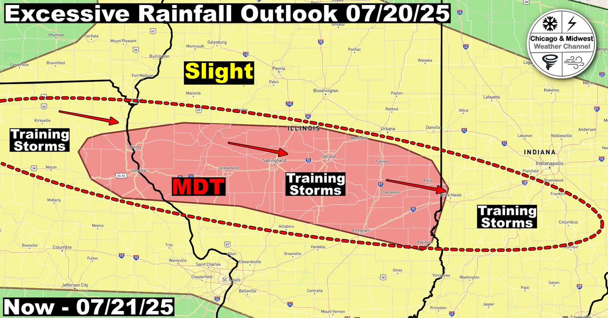
There is a conditional risk for severe storms and tornadoes across Central Illinois this afternoon and into tonight. Additionally, there is a threat of flash flooding as training storms may produce rainfall amounts of 3 to 8 inches. These storms could result in rainfall rates of…
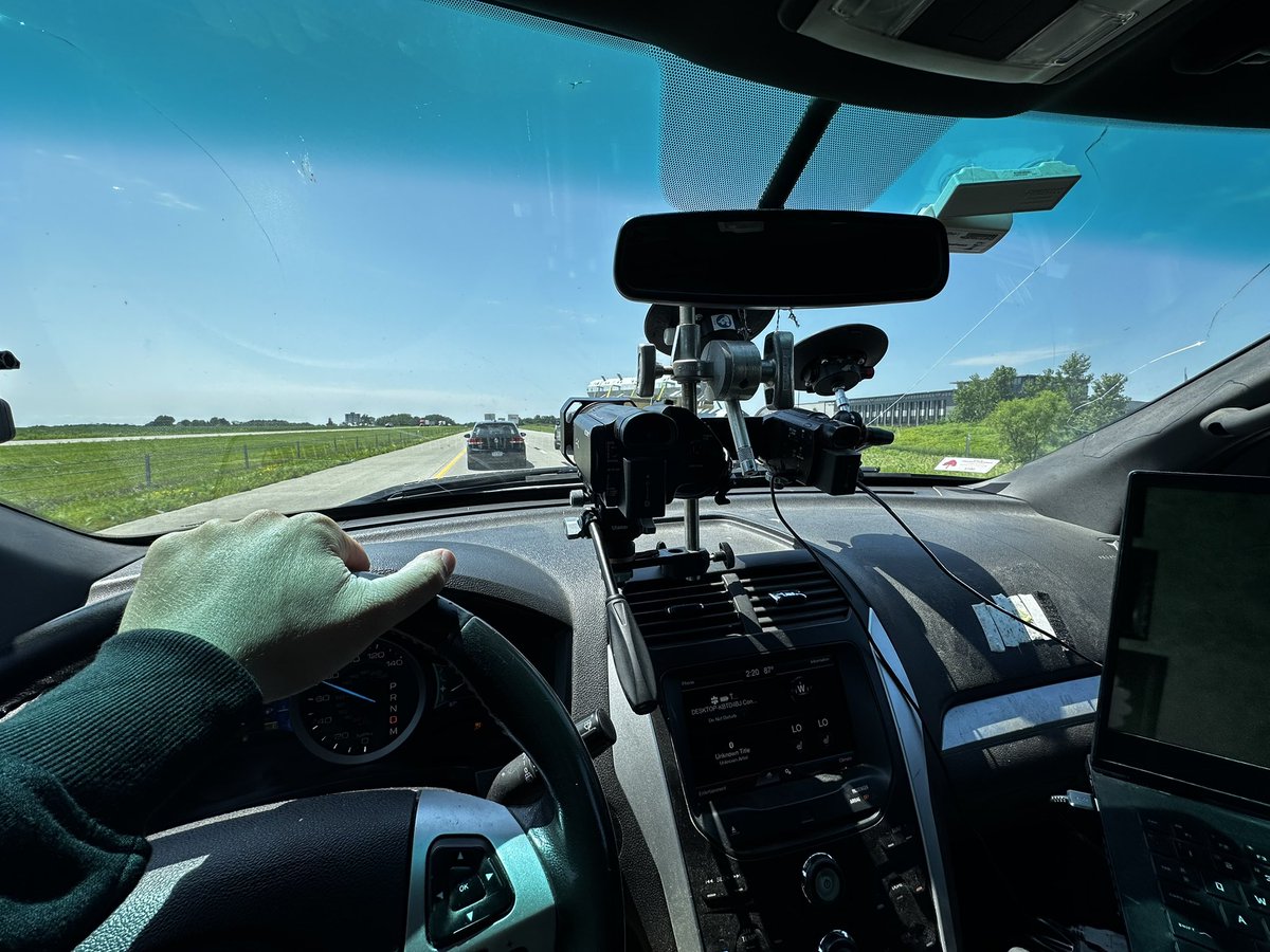
Deciding to leave and head home. The anvils from supercells in western Nebraska will keep the sun away across western Iowa, making it harder for storms to break the cap. It's game over.
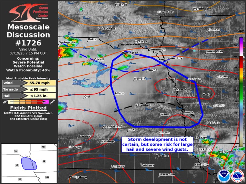
Concerning...Severe potential...Watch possible Valid 192218Z - 200015Z Probability of Watch Issuance...40 percent SUMMARY...Should storms develop, large hail and severe winds would be possible. Convective trends will continue to be monitored, but a watch is not…
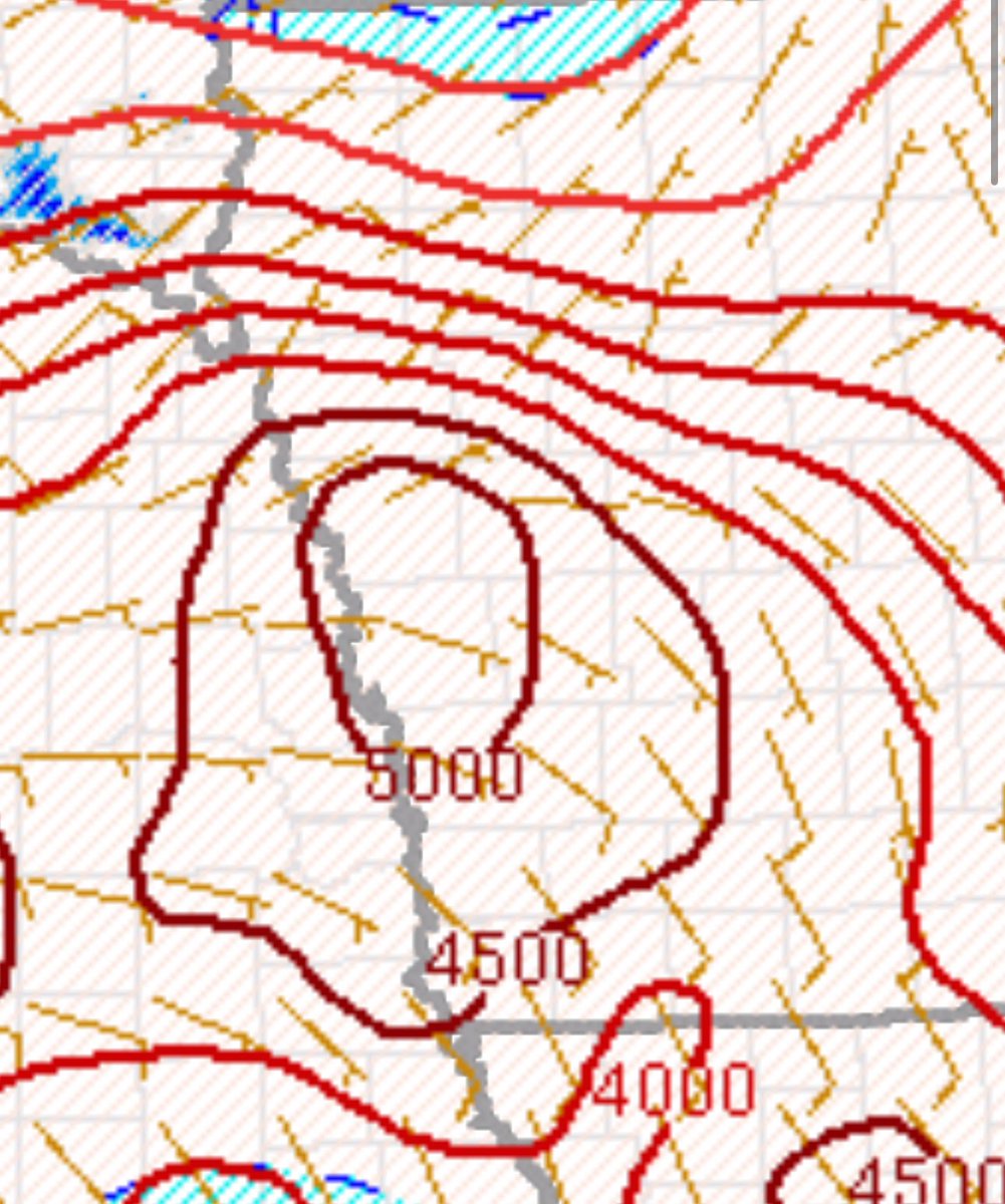
Towers are finally going up on the moist boundary within the tornadic supercell air mass. These storms are expected to intensify, given the 5000 J/kg of instability, dew points over 70°F, and 50-60 knot shear. Stay tuned! #IAwx @NWSOmaha
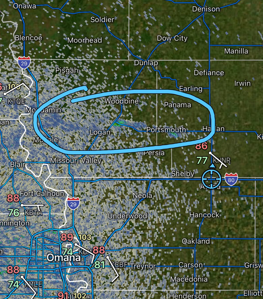

Currently, across western Iowa, we are waiting for supercell development this afternoon and evening. A few tornadoes and very large hail seem possible with any discrete supercell along the boundary. #IAwx
The tornado air mass over western Iowa is intensifying. The cumulus field is becoming more agitated. #IAwx
Western Iowa along the I-80 corridor may experience severe weather later if any supercells develop on this boundary. I will be live this evening! #IAwx
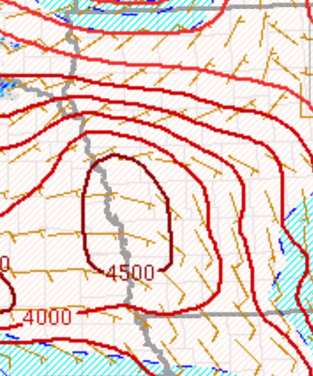
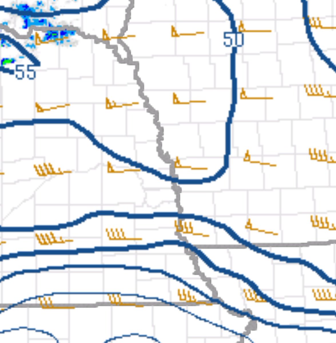
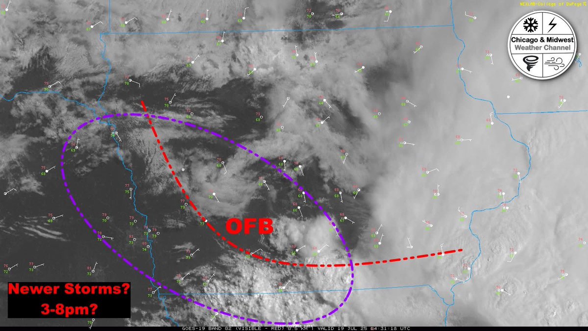
**Today's Severe Weather Forecast for Illinois and Iowa*** **Iowa:** All forecast models indicate a potential for new supercell development along the outflow boundary (OFB) as it moves northwest on the western flank of the mesoscale convective vortex (MCV). This could serve as a…
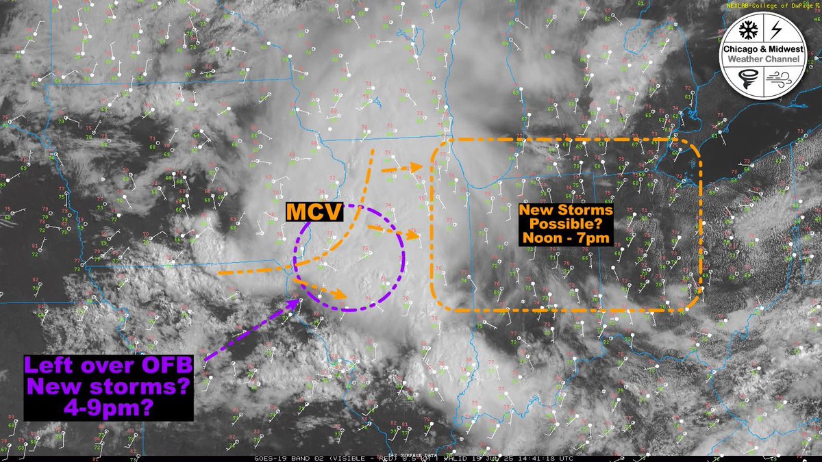
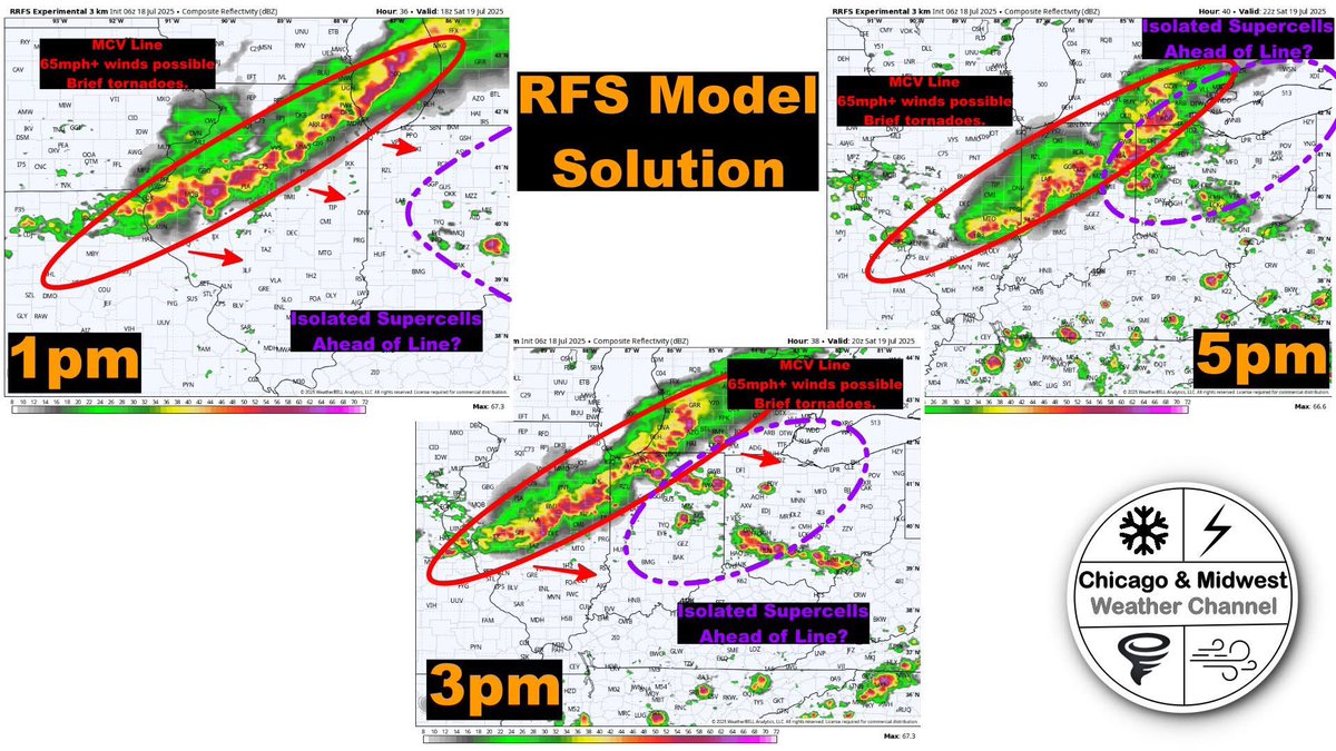
***Significant severe weather is possible tomorrow, July 19th, from Saturday morning through evening across northern Illinois into Indiana, as well as Ohio and Michigan.*** The Merged Convective Vortex (MCV) may pose a risk for strong winds exceeding 65 mph from northern…
Severe weather forecast update now live! x.com/i/broadcasts/1…
Severe weather forecast update now live! x.com/i/broadcasts/1…
🚨🌪️ **Severe Tornado Risk for Illinois, Indiana, Michigan, Iowa, and Ohio on Saturday, July 19th** 🚨🌪️ **Timing:** 11 AM - 9 PM **Details:** A Mesoscale Convective Vortex (MCV) is expected to move through the area, bringing supercells ahead of the main line of storms. This…
Incredible close-up video of a tornado displaying violent motion captured with a drone near Sauk City, WI. Check out the slow-motion footage as it uproots trees and throws debris into the air. #WIwx Contact [email protected] for licensing.