Central OR Fire Info
@CentralORFire
Providing official information on wildfires in Central Oregon on Prineville District BLM, Deschutes & Ochoco NFs & OR Dept of Forestry-Prineville/Sisters Units.
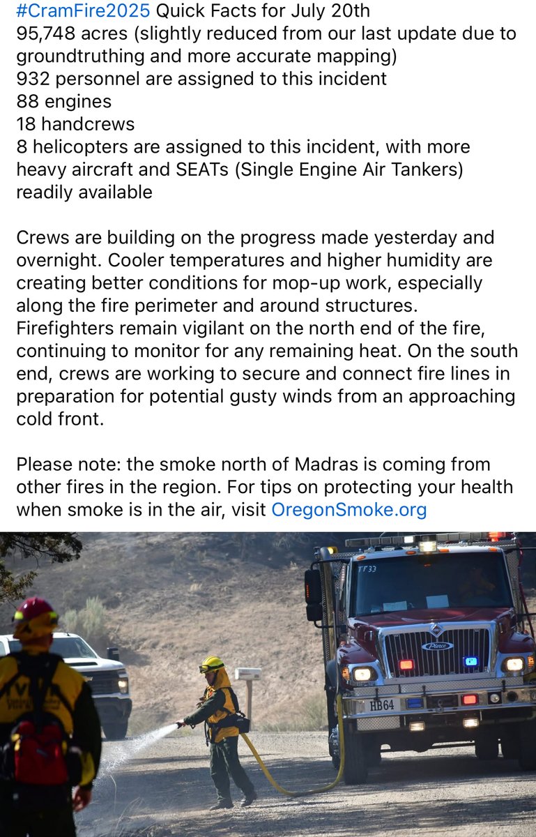
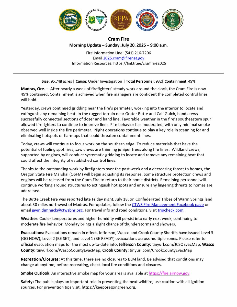
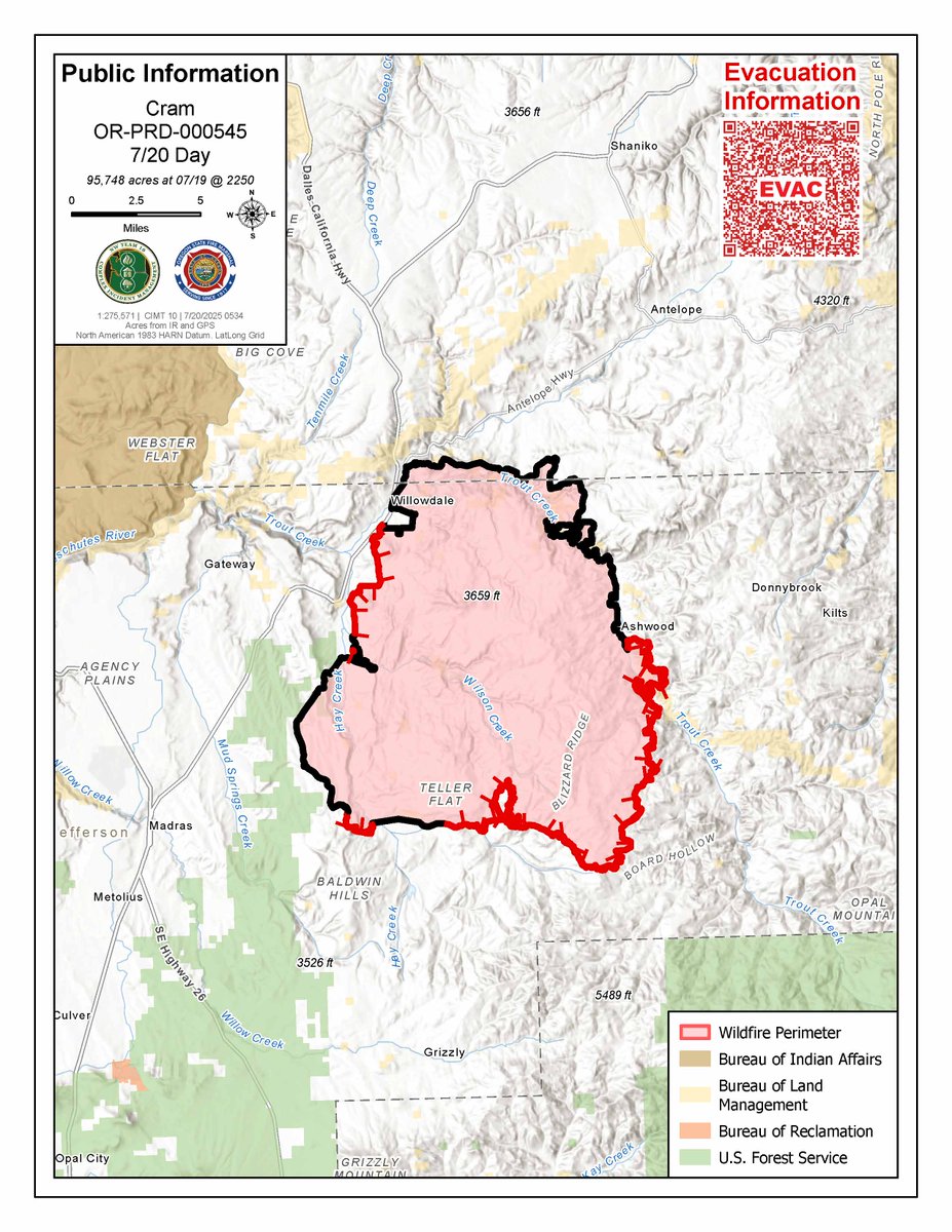
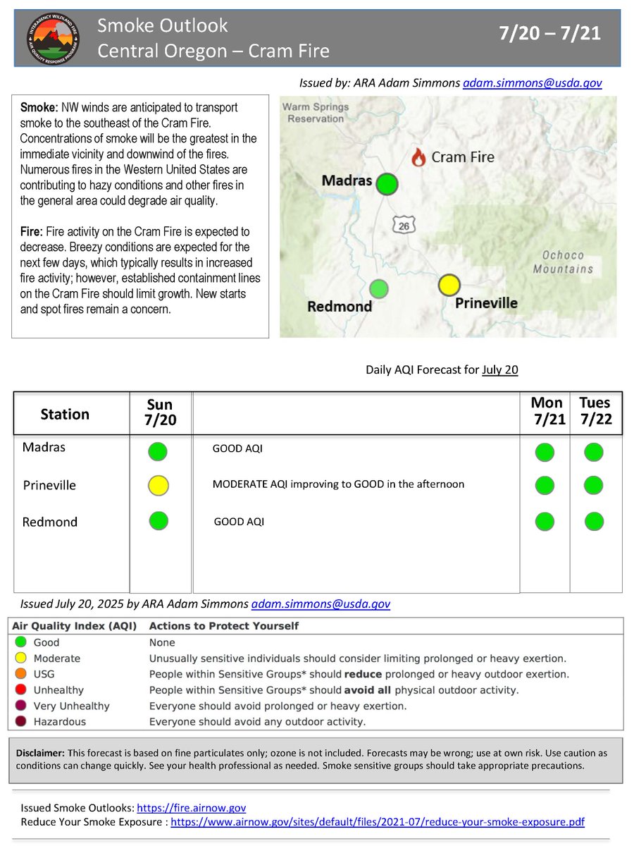
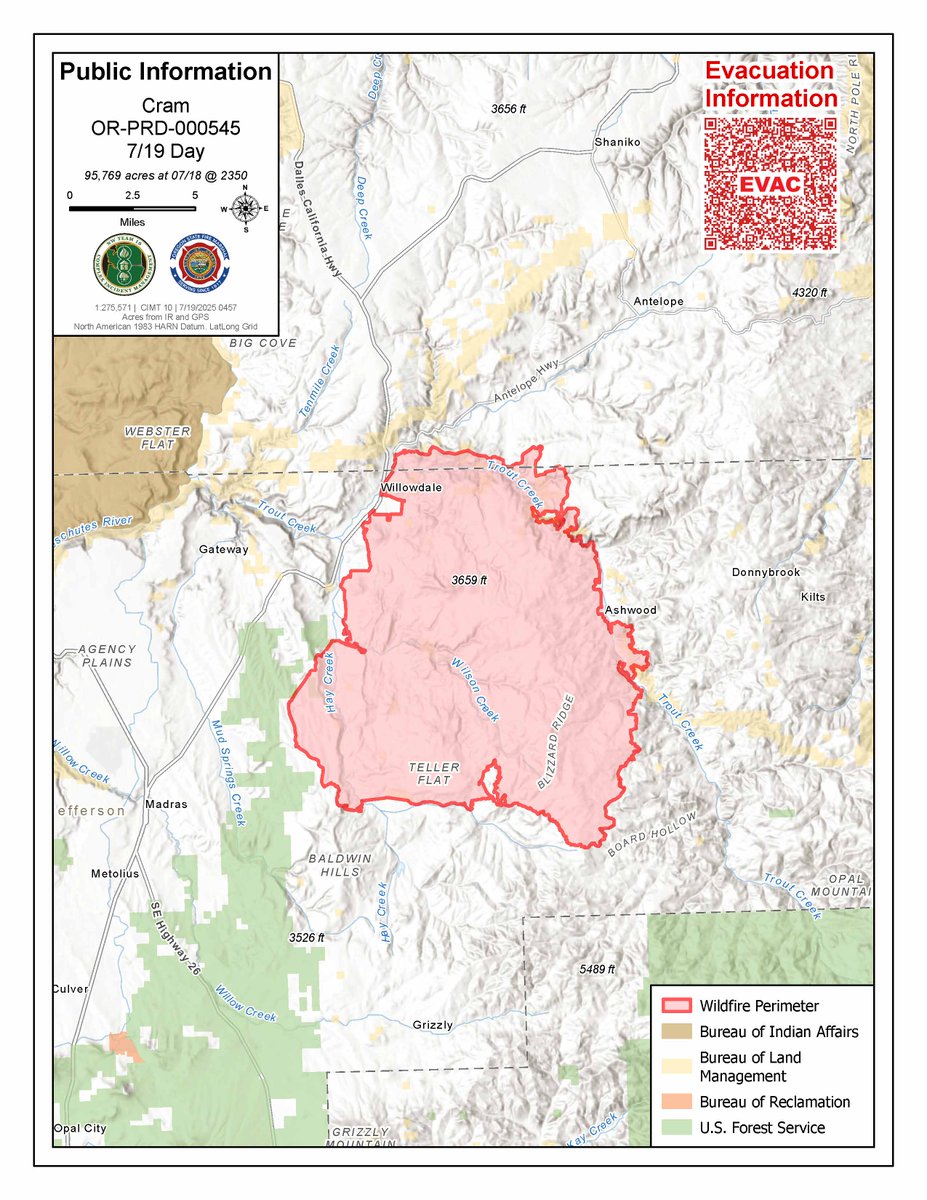
#CramFire2025 Quick Facts for July 20th 95,748 acres (slightly reduced from our last update due to more accurate mapping) 932 personnel are assigned to this incident including 88 engines, 18 handcrews, 8 helicopters.
As fire activity on the #CramFire decreases, fire fighters will continue patrol and mop up and begin suppression repair to restore the areas impacted by fire suppression-related activities. Find the update here: facebook.com/share/v/1B8BQd…
The #CramFire daily update is available on Inciweb here: inciweb.wildfire.gov/incident-news/… And the Operational update is available here: fb.watch/A-G3DhTJfK/
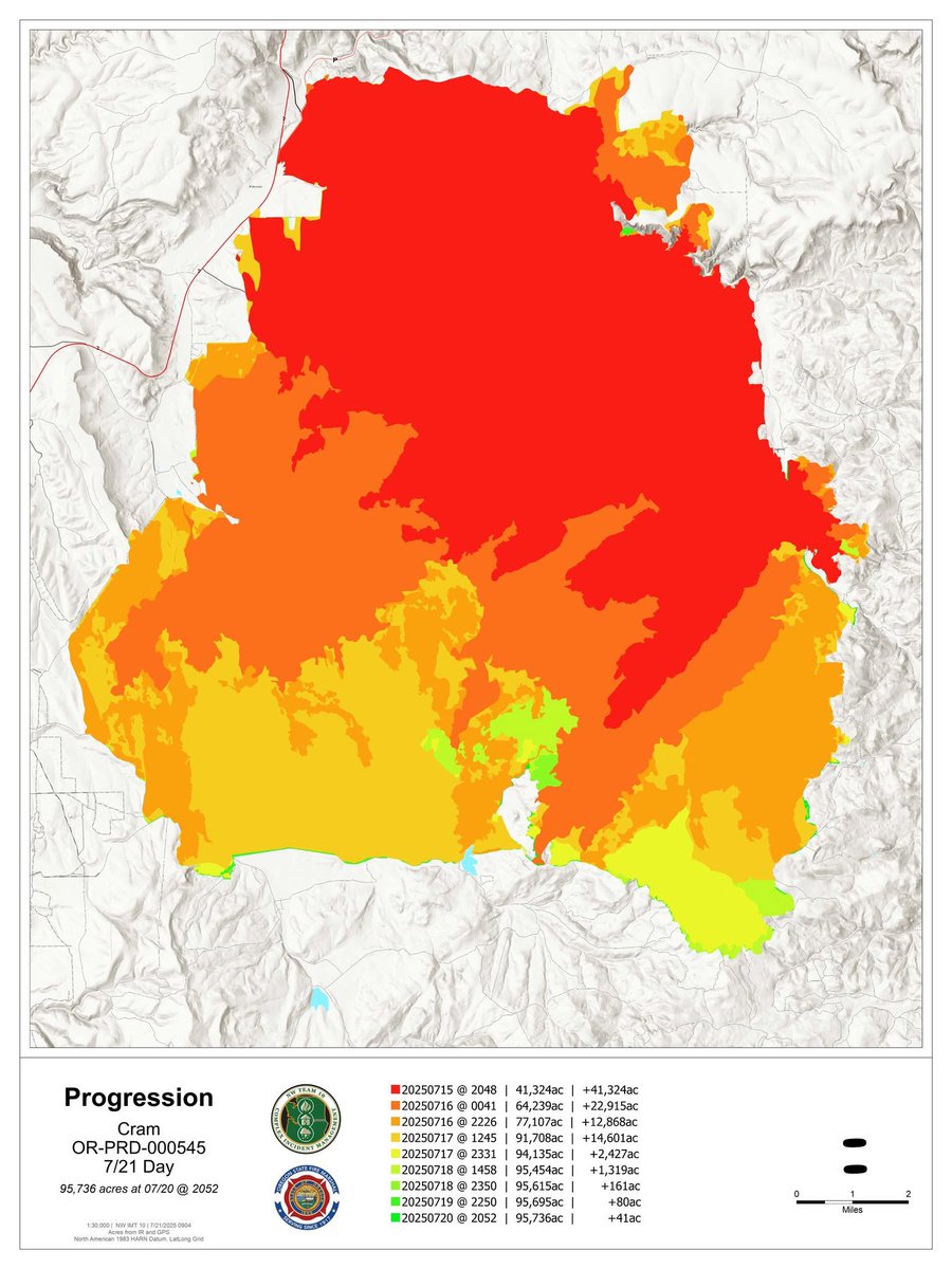
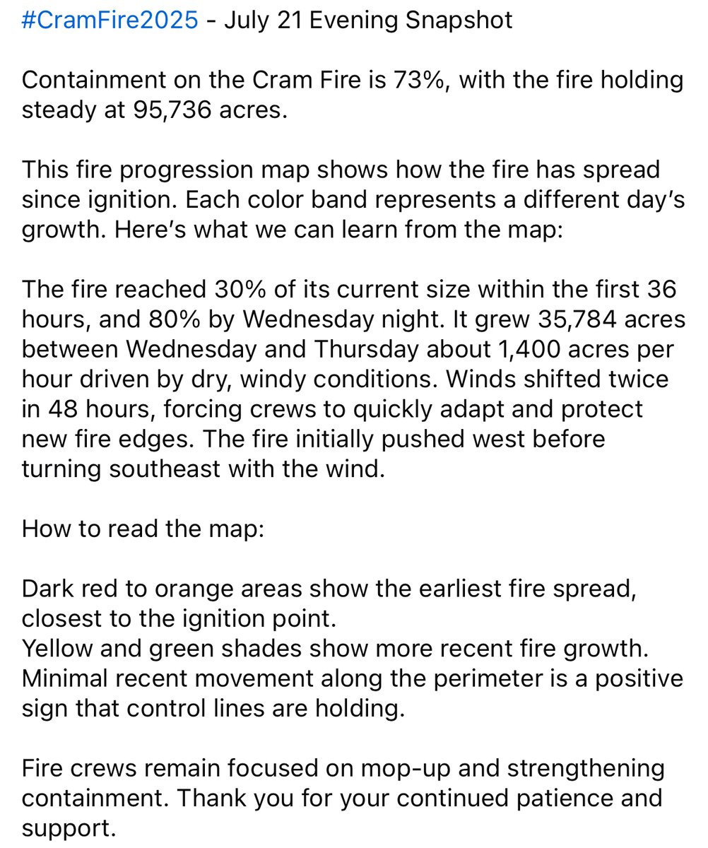
#CramFire July 21 Evening Snapshot This fire progression map shows how the fire has spread since ignition. Each color band represents a different day’s growth.
A #CramFire Operations Brief for Monday, July 21 can be viewed here: facebook.com/share/v/1F9qob…
#CramFire Morning Update for July 21 is posted on Inciweb at inciweb.wildfire.gov/incident-publi…

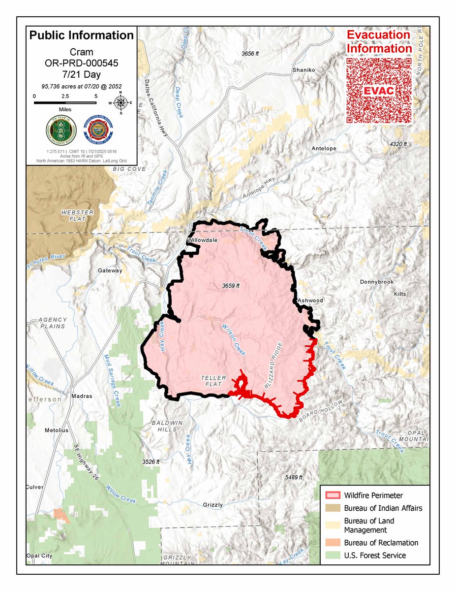
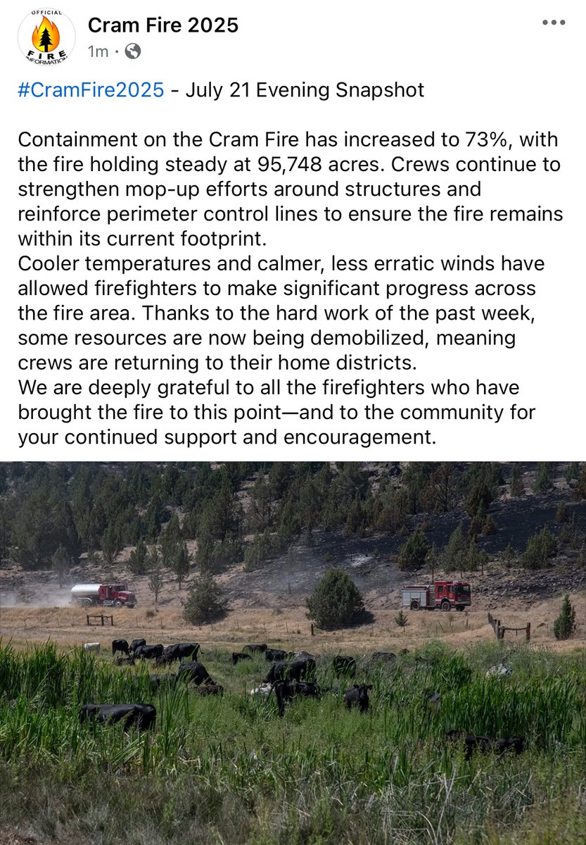
#CramFire July 21 Evening Snapshot Containment on the Cram Fire has increased to 73%, with the fire holding steady at 95,748 acres. Crews continue to strengthen mop-up efforts around structures and reinforce perimeter lines to ensure the fire remains within its current footprint.
#CramFire Morning Update for July 20 is posted on Inciweb at inciweb.wildfire.gov/incident-publi…
A #CramFire Operations Brief update for Sunday, July 20 can be viewed here: facebook.com/share/v/1G2PrL…
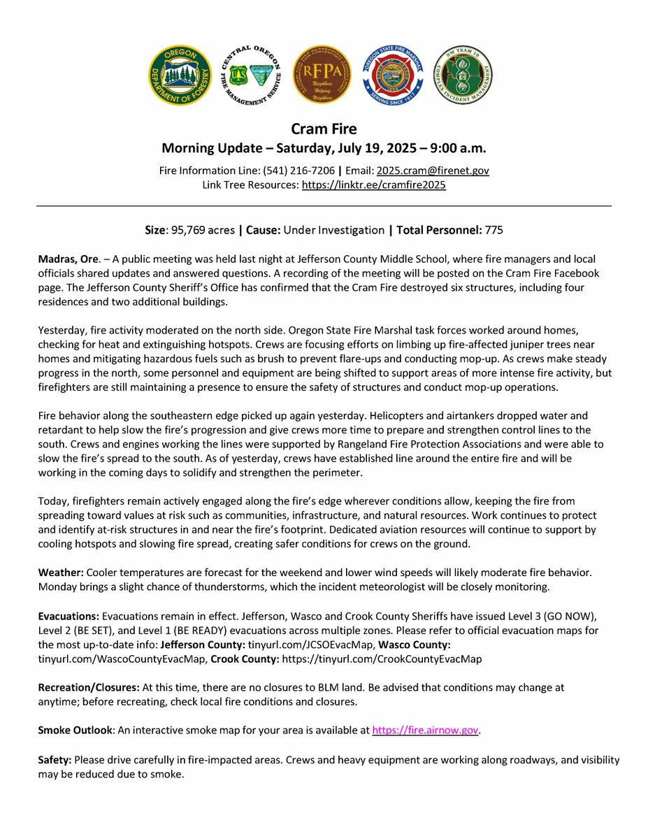
#CramFire Morning Update for July 19 is posted on Inciweb at inciweb.wildfire.gov/incident-publi…
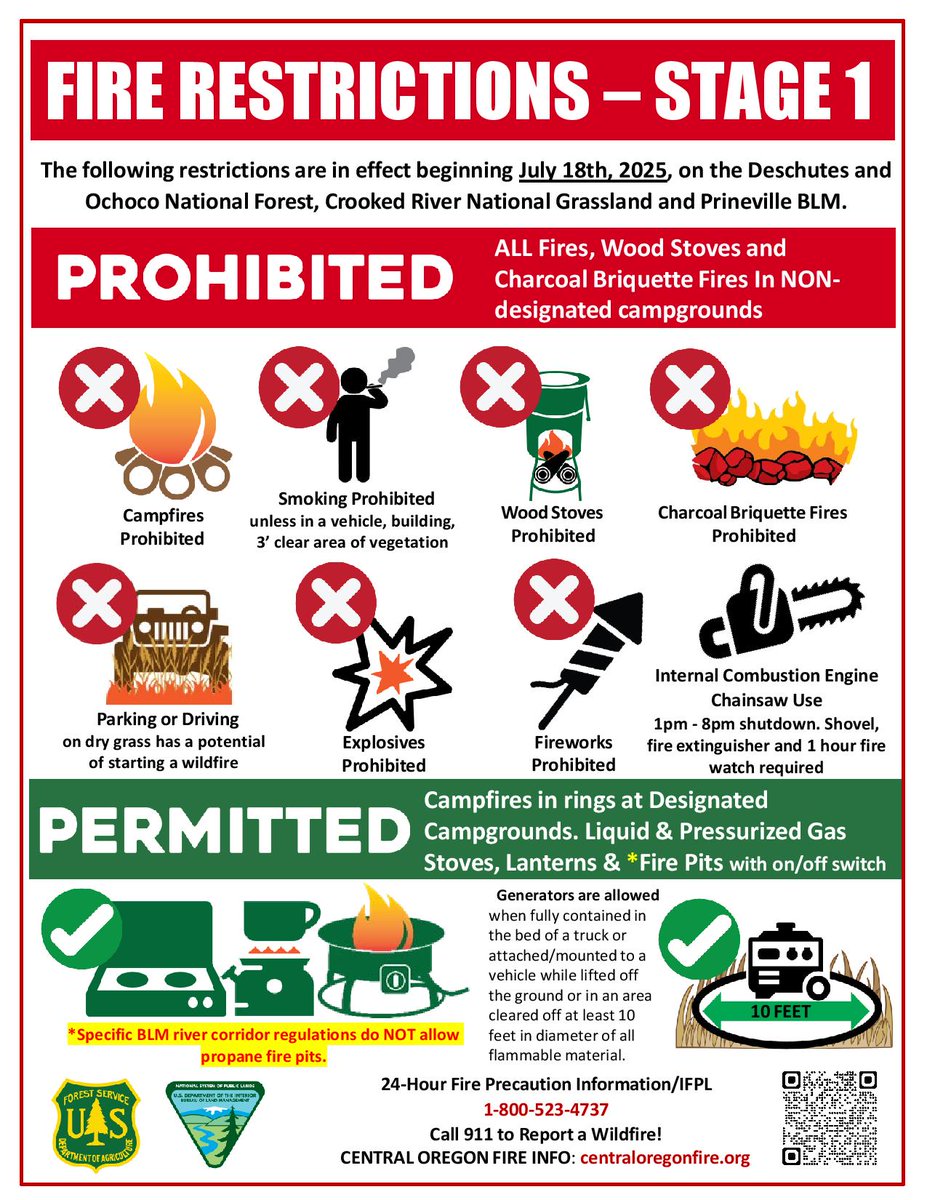
📢Reminders as we move into another hot & dry weekend: ‼️Stage 1 PURs are in effect across all public lands in Central OR including @DesNatlForest, @OchocoNatForest & Prineville District BLM ‼️Fire Danger Rating moved to Extreme today, 7/18 ℹ️More info: centraloregonfire.org/2025/07/15/des…

#CramFire Morning Update for July 18 is posted on Inciweb at inciweb.wildfire.gov/incident-publi…
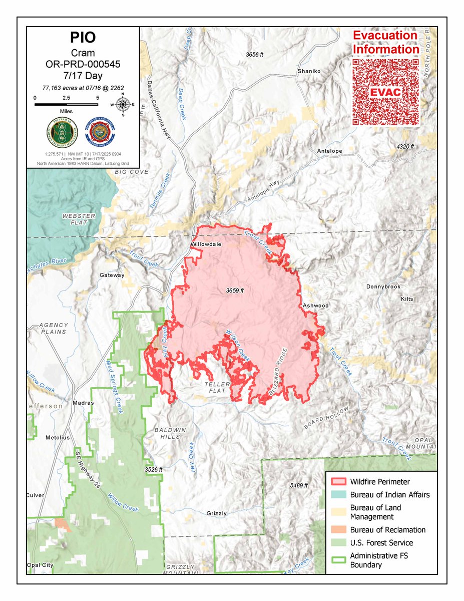
#CramFire Morning Update for July 17 is posted on Inciweb at inciweb.wildfire.gov/incident-publi…

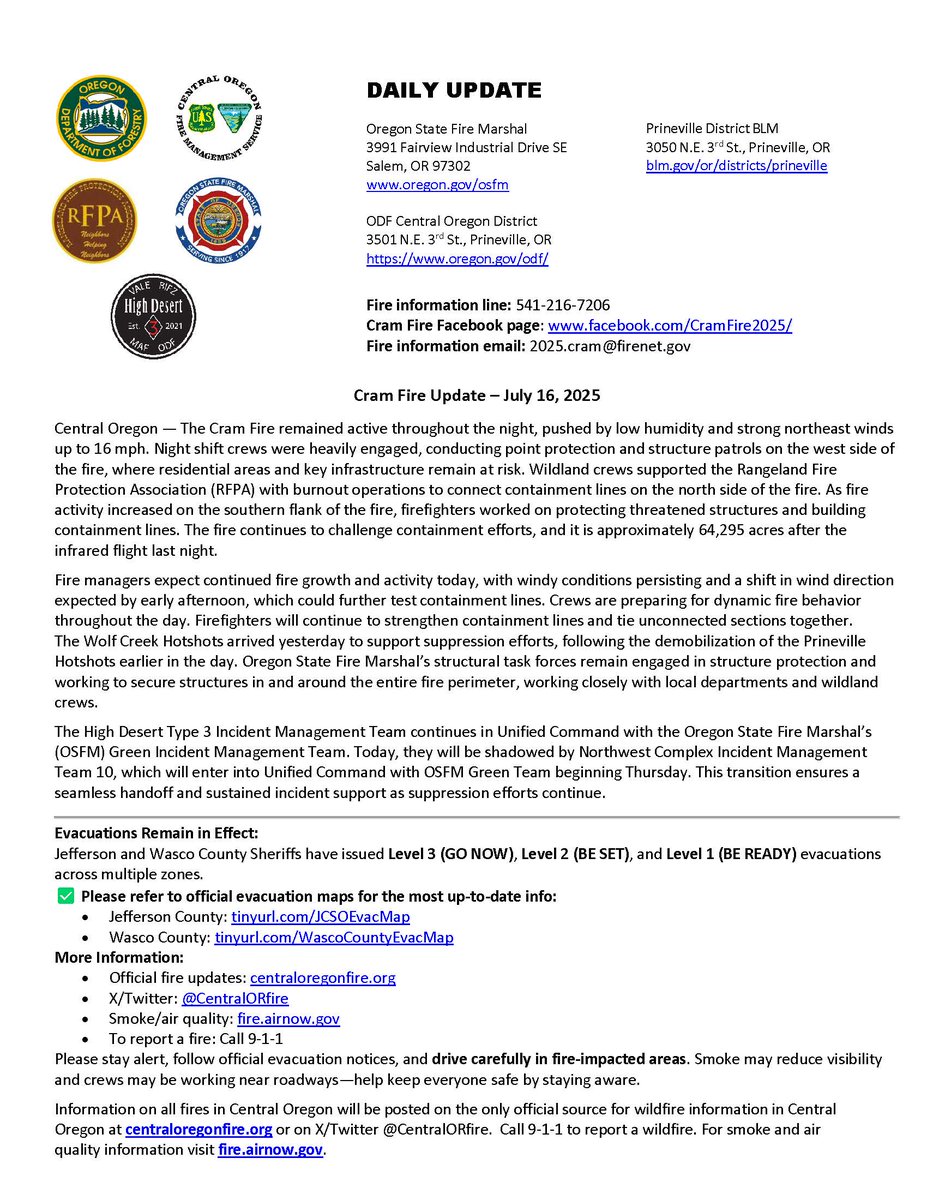
#CramFire Morning Update for July 16 is posted on Inciweb at inciweb.wildfire.gov/incident-publi….
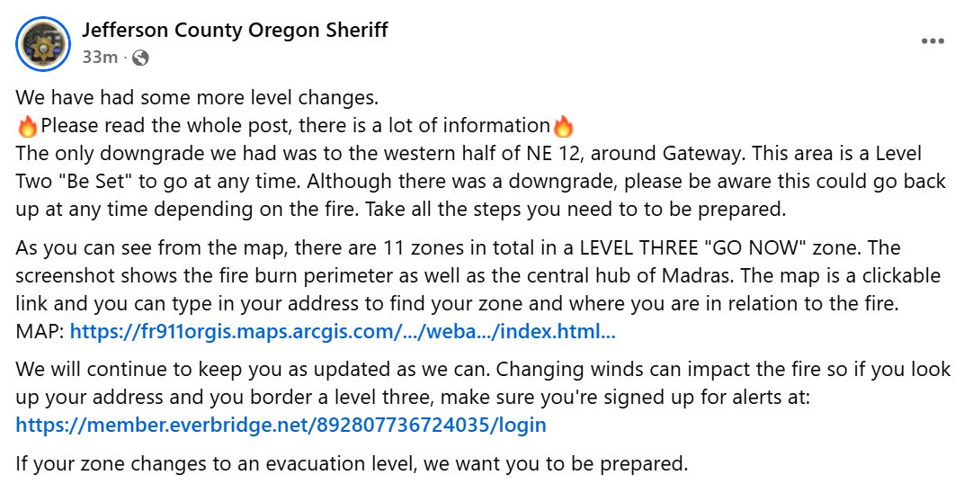
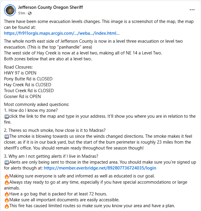
🔥Jefferson County has issued additional evacuations due to the #CramFire, see below for details. 📷Jefferson County Facebook: facebook.com/JeffersonCount… 📷tinyurl.com/JCSOEvacMap
⚠️OR Dept. of Transportation's tripcheck.com currently shows Hwy 97 open w/ delays in vicinity of the #CramFire near Mile Post 76. Per Jefferson County Sheriff's Office at 3 p.m.: ⛔️Pony Butte Rd: CLOSED ⛔️Hay Creek Rd: CLOSED ⛔️Trout Creek Rd: CLOSED 🟢Gosner Rd: OPEN
‼️Road Closures in effect due to the #CramFire‼️ Highway 97 is now CLOSED between mileposts 70 and 76. Use an alternate route, such as Highway 26. For the latest road conditions and closures, visit: tripcheck.com Fire updates: facebook.com/CramFire2025
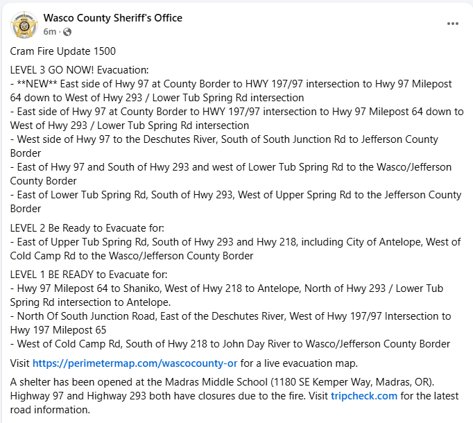
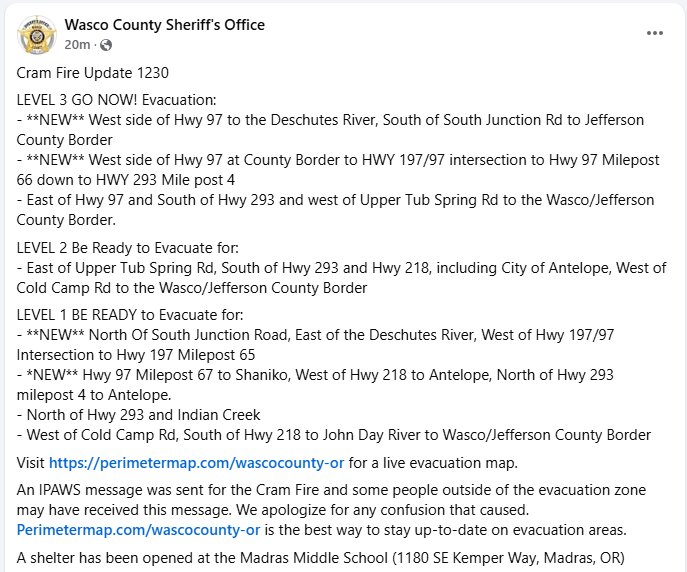
🔥Wasco County has issued additional evacuations due to the #CramFire at 3 p.m. on July 15. For more details visit: ℹ️Wasco County Facebook: facebook.com/WascoCountyShe… 🗺️Wasco County Evacuation Map: tinyurl.com/WascoCountyEva…
🔥Jefferson County has issued additional evacuations due to the #CramFire, see below for details. ℹ️Jefferson County Facebook: facebook.com/JeffersonCount… 🗺️Jefferson County Evac Map: tinyurl.com/JCSOEvacMap
🔥Wasco County has issued additional evacuations due to the #CramFire. For more details visit: ℹ️Wasco County Facebook: facebook.com/WascoCountyShe… 🗺️Wasco County Evacuation Map: tinyurl.com/WascoCountyEva…
📢Due to continued hot & dry conditions as well as increased fire starts, the @DesNatlForest will include all Wilderness areas under Stage 1 public use fire restrictions starting Friday, July 18. ⚠️More info: centraloregonfire.org/2025/07/15/des…