CAWildFire
@CAWildfiretrack
Tracking California's Fires, mainly Northern California | Not affiliated with officials | Based in Placer County | Occasionally on the ground reporting.
Chinook drops water over the #DinkeyFire in the SNF. Probably my favorite photo from that day. 6/27/25 - 6:40PM. #CaFire #FirePhotography #wildfire #photography #firephotographer #Chinook

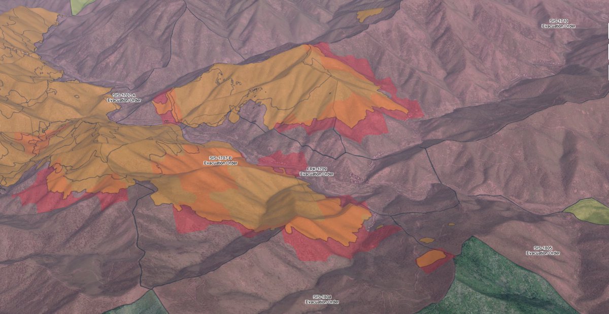
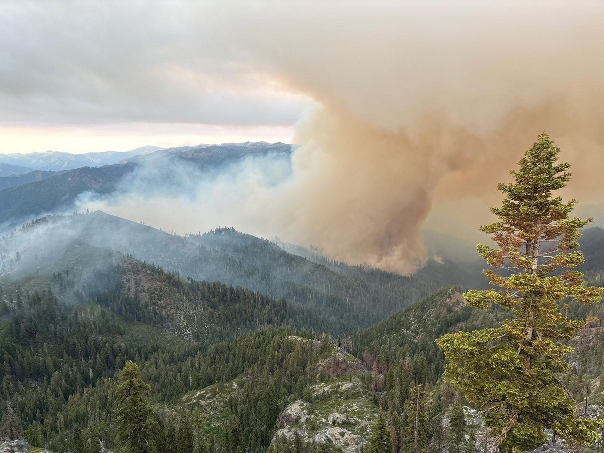
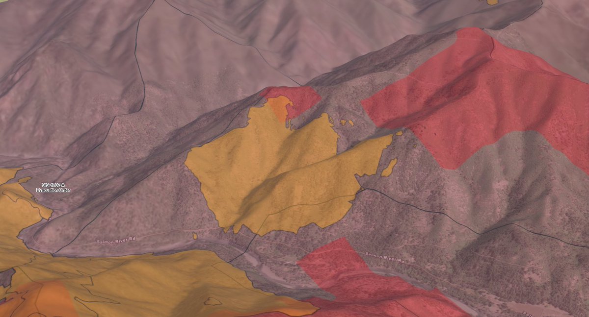
New #ButlerFire mapping shows the fire at 14,676.6 acres per a CAL FIRE flight. The fire has not crossed Sawyers Bar Rd on the east side of the Salmon River as of now. The west side has spotted across McNeal Creek in 4 spots, seen on the bottom right of the map. #cafire
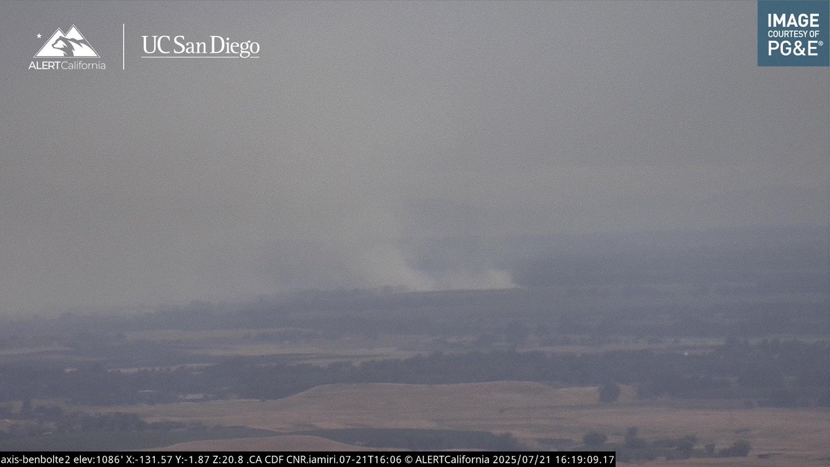
You can see the #ButlerFire on the Hayfork Bally Lookout 2 camera. Its visible on the right side of the image. The fire has a defining pyrocu white top, which is a bad sign. Not much more info right now. #cafire
New #ButlerFire mapping shows the spot fire and the main fire burning SE towards the general area of Forks of Salmon and Sawyers Bar Rd. The fire on the East side of the Salmon river is actively spotting. The fire is now 12,273.9 acres. Structure protection is in place. #cafire
New #ButlerFire mapping shows the spot fire and the main fire burning SE towards the general area of Forks of Salmon and Sawyers Bar Rd. The fire on the East side of the Salmon river is actively spotting. The fire is now 12,273.9 acres. Structure protection is in place. #cafire
Yesterday; the #ButlerFire spotted over the Salmon River, growing to about 300 acres during the day. Later that night, the fire jumped a contingency line completed the day before. The spot fire now sits at around 700 acres and growing. #cafire
The fire is now 15 acres with a slow rate of spread per drone ops. Good progress is being made. #sligerfire
The #SligerFire has been revised to 4 acres with a slow rate of spread in brush and oak woodland.
The #SligerFire has been revised to 4 acres with a slow rate of spread in brush and oak woodland.
The fires location has been updated to the Middle Fork of the American River near Sliger Mine Rd. The fire is well established at 10 acres, moving at a moderate rate of spread. 2 crews, 2 water tenders, 1 dozer, and 5 agency engines have been requested. #SligerFire #BelleFire
The fires location has been updated to the Middle Fork of the American River near Sliger Mine Rd. The fire is well established at 10 acres, moving at a moderate rate of spread. 2 crews, 2 water tenders, 1 dozer, and 5 agency engines have been requested. #SligerFire #BelleFire
New start, Placer County near Foresthill Rd in the North Fork of the American River. Units report a pretty high rate of spread in the canyon from a distance. This is the #BelleFire
New start, Placer County near Foresthill Rd in the North Fork of the American River. Units report a pretty high rate of spread in the canyon from a distance. This is the #BelleFire

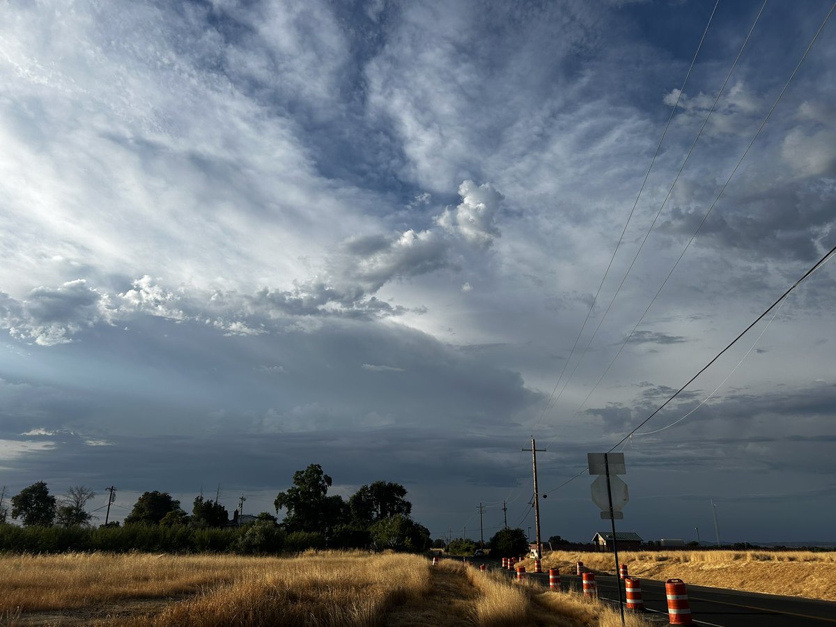
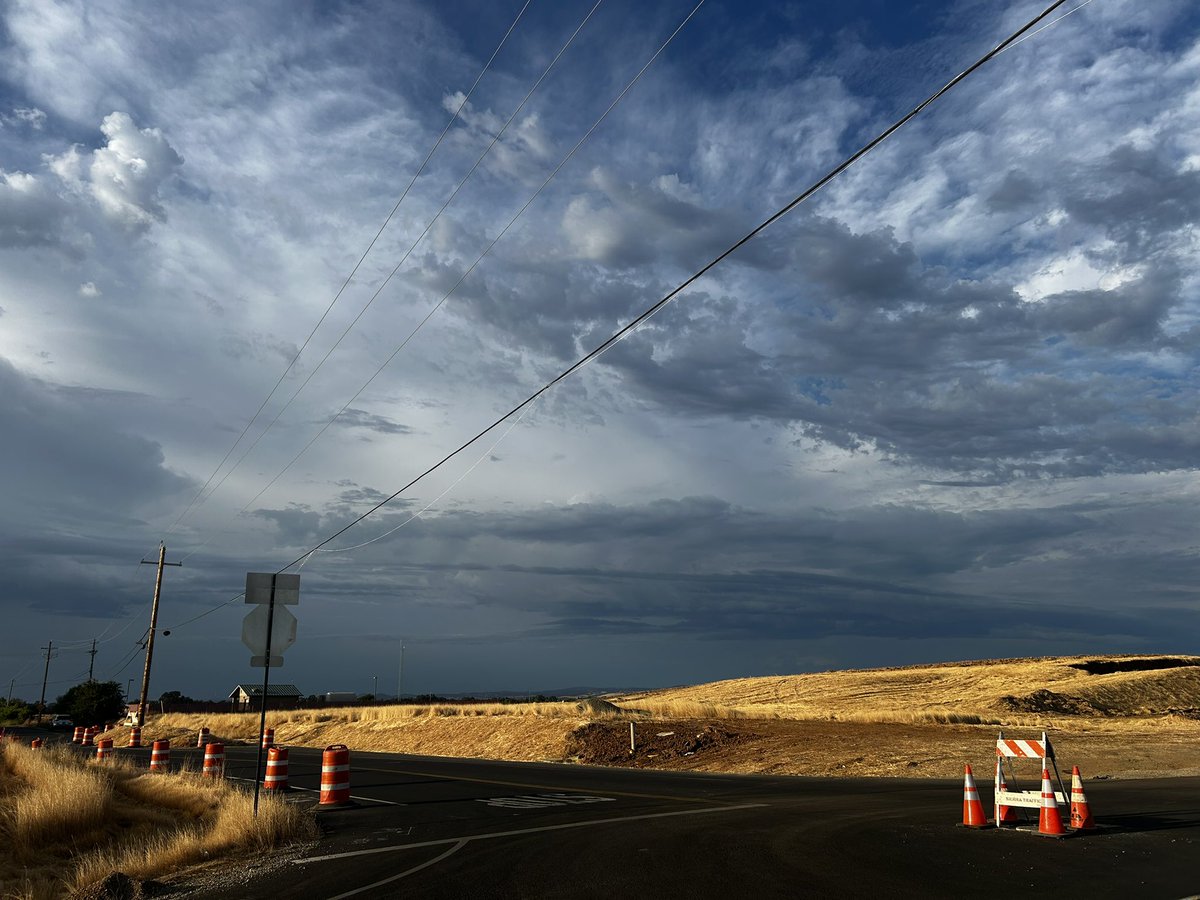
Interesting weather today in the Sacramento Valley, even saw some lightning! #cawx
A Red Flag Warning has been issued for Trinity County and areas of interior Humboldt and Del Norte Counties. Scattered thunderstorms are possible, bringing the potential for new fire starts. #CAwx
A Fire Weather Watch has been issued for portions of Humboldt, Del Norte, Trinity, Mendocino, and Lake Counties. Isolated to scattered thunderstorms are possible, bringing new fire starts and gusty and erratic winds which may lead to fires to spread quickly. #CAwx
2:49pm CDT #SPC Day2 #FireWX Critical: portions of northern california spc.noaa.gov/products/fire_…
The fire is now 47 acres with no active flames remaining. #MooneyFire
A copter overhead has made 3 drops significantly slowing the head of the fire. #MooneyFire
A copter overhead has made 3 drops significantly slowing the head of the fire. #MooneyFire
New start in Elk Grove, Sacramento County. This is the #MooneyFire and is moving at a rapid rate of spread on both sides of the creek. Additional resources have been requested.
New start in Elk Grove, Sacramento County. This is the #MooneyFire and is moving at a rapid rate of spread on both sides of the creek. Additional resources have been requested.
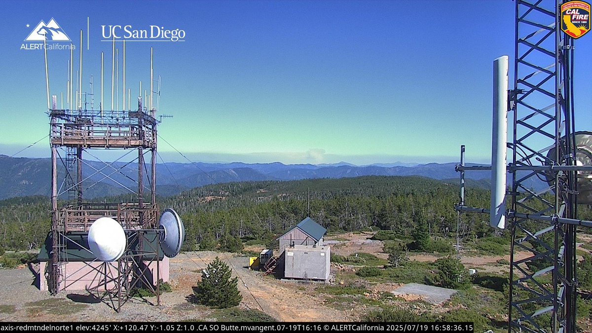
The Butler Fire continues to spread toward the community of Forks of Salmon. Pretty touch-and/go there, now. Here is our assessment for 7/19/25. the-lookout.org/2025/07/19/for…
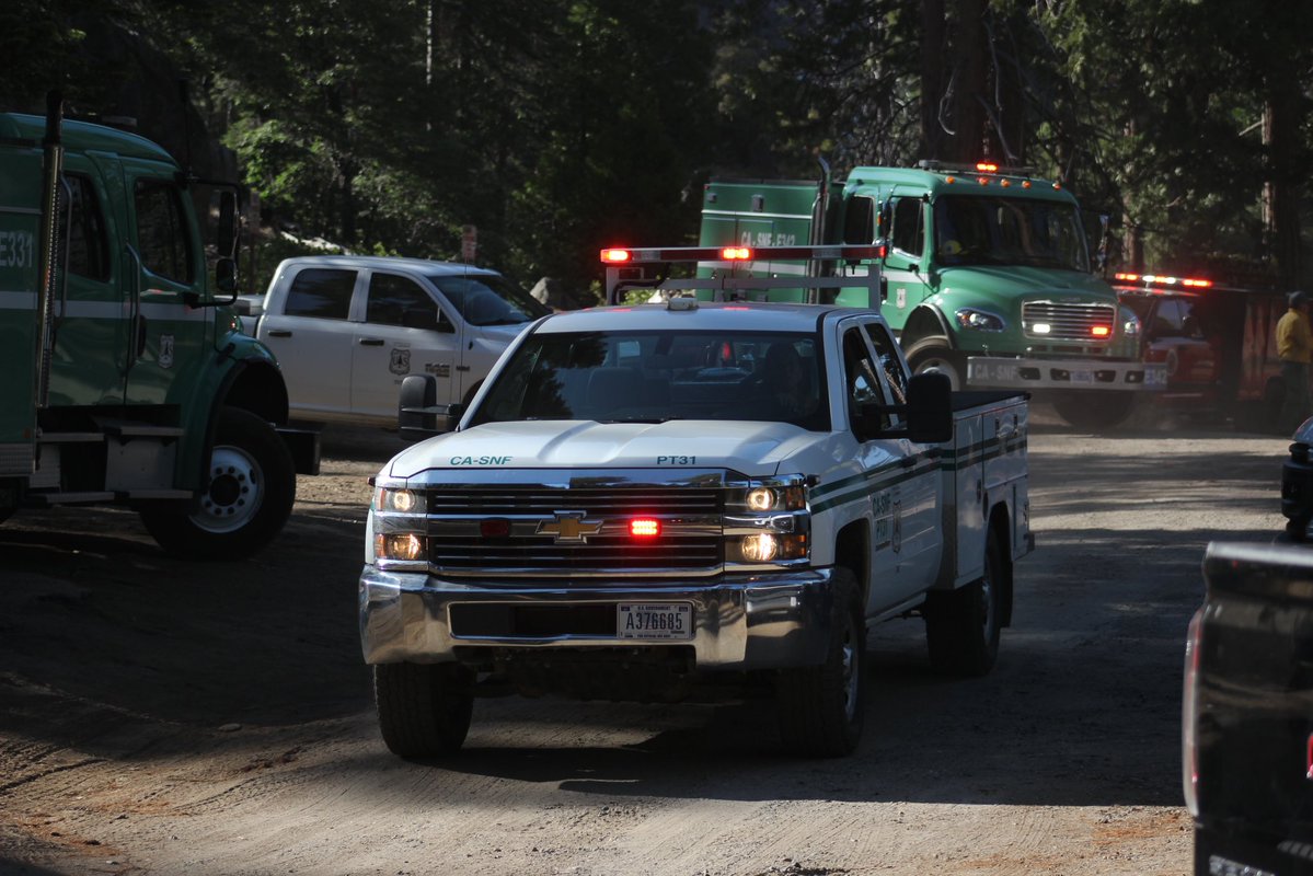
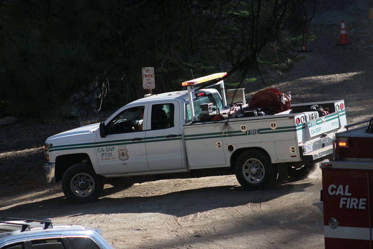
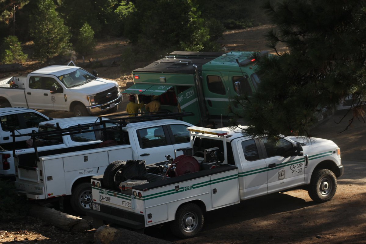
One of my favorite trucks the Forest Service has, the Prevention/Patrol trucks. This one here I got some photos of on a fire in the SNF, thought I’d share. #CaFire #FirePhotography #wildfire #photography #firephotographer
Yesterday; the #ButlerFire spotted over the Salmon River, growing to about 300 acres during the day. Later that night, the fire jumped a contingency line completed the day before. The spot fire now sits at around 700 acres and growing. #cafire
The fire has jumped E Levee Rd but is being held by the water next to it.
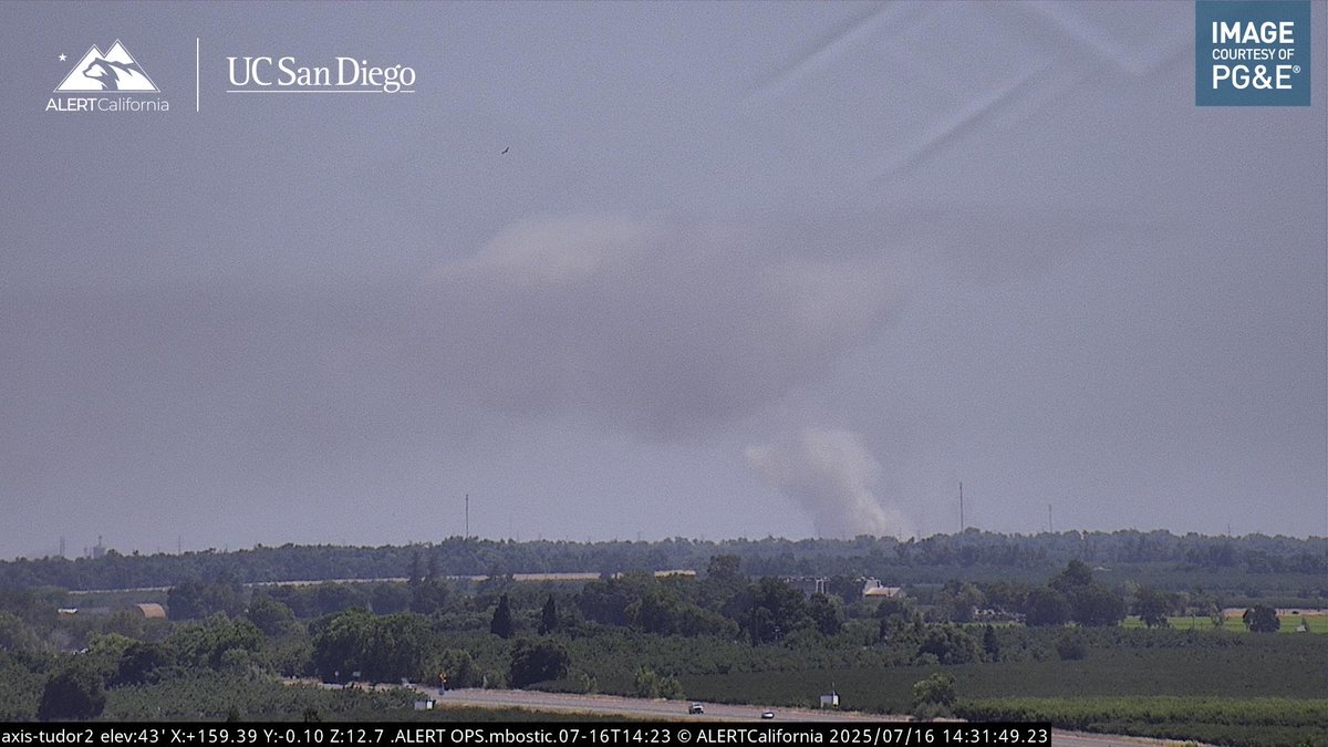
New start in Sacramento County, 1/2 Mile Southwest of Elverta Road & E Levee Road, Rio Linda. The fire is 30 acres with a dangerous rate of spread and an immediate structure threat per the copter overhead. Starting 2nd alarm response. No name yet.
Requesting CHP to close Elverta Rd at E Levee Rd.
New start in Sacramento County, 1/2 Mile Southwest of Elverta Road & E Levee Road, Rio Linda. The fire is 30 acres with a dangerous rate of spread and an immediate structure threat per the copter overhead. Starting 2nd alarm response. No name yet.
New start in Sacramento County, 1/2 Mile Southwest of Elverta Road & E Levee Road, Rio Linda. The fire is 30 acres with a dangerous rate of spread and an immediate structure threat per the copter overhead. Starting 2nd alarm response. No name yet.