BryanHaleCBS4
@BryanHaleCBS4
Chief Meteorologist for CBS 4: Harlingen/Brownsville/McAllen
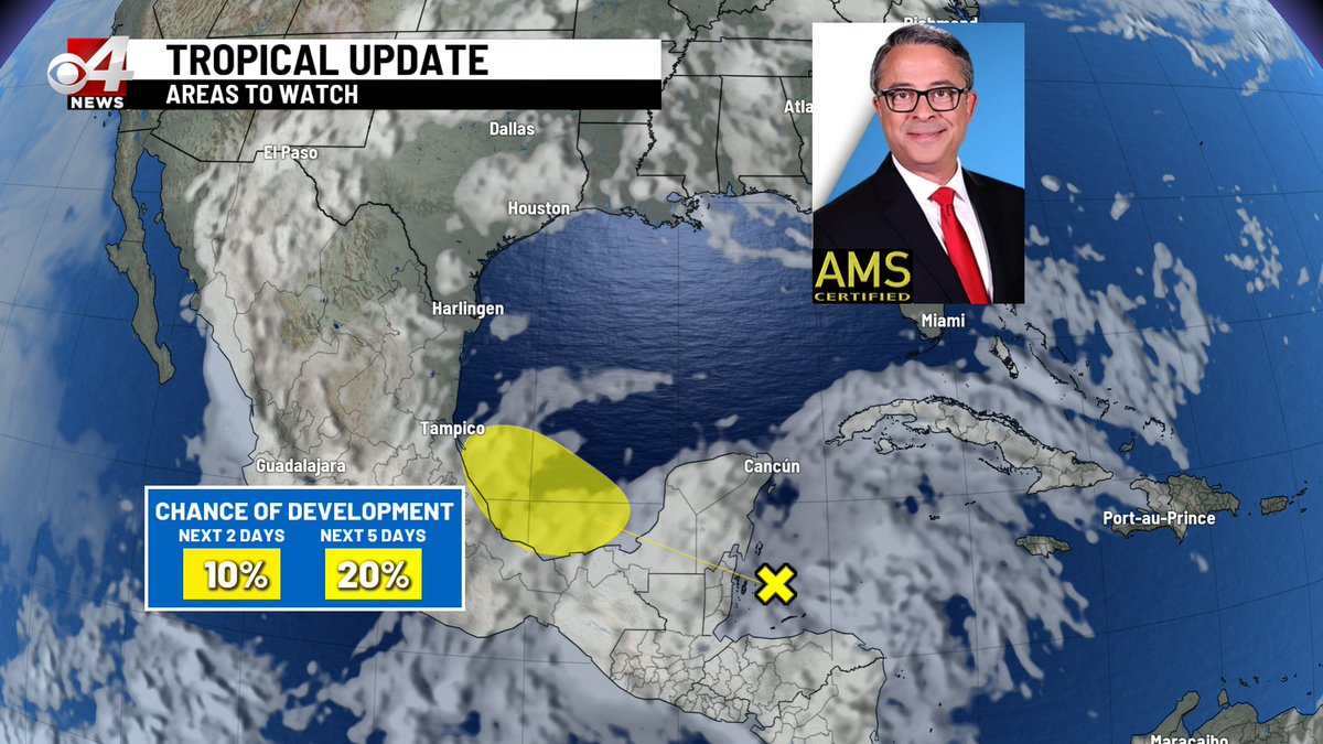
There is an area of disturbed weather developing in the Western Caribbean. The National Hurricane Center is thinking it has a slight chance of developing into a tropical low this weekend over the Bay of Campeche. #rgv #rgvwx #txwx
The NHC is thinking a mid level area of low pressure might encounter favorable conditions for tropical development as it travels west across the Gulf this week. Slim chance but worth watching. #rgv #rgvwx #txwx
The latest drought monitor update leaves the Valley out with no drought. Monthly rainfall totals remain above normal. Good times! #rgv #rgvwx #txwx
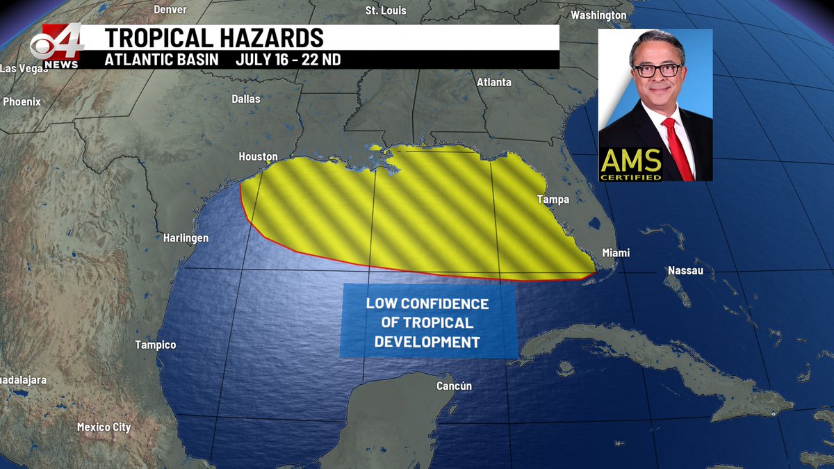
Very little development is expected the next couple of weeks, only a low potential for tropical development in the Gulf July 16th - 22nd. #rgv #rgvwx #txwx
A few isolated, afternoon showers through Wednesday plus an expected increase in the mosquito population from last week's rain. #rgv #rgvwx #txwx
Two to three inches of rain across the mid and lower Valley today alone. The remnant of T.S. Barry continues to push more rain north over the RGV. #rgv #rgvwx #txwx
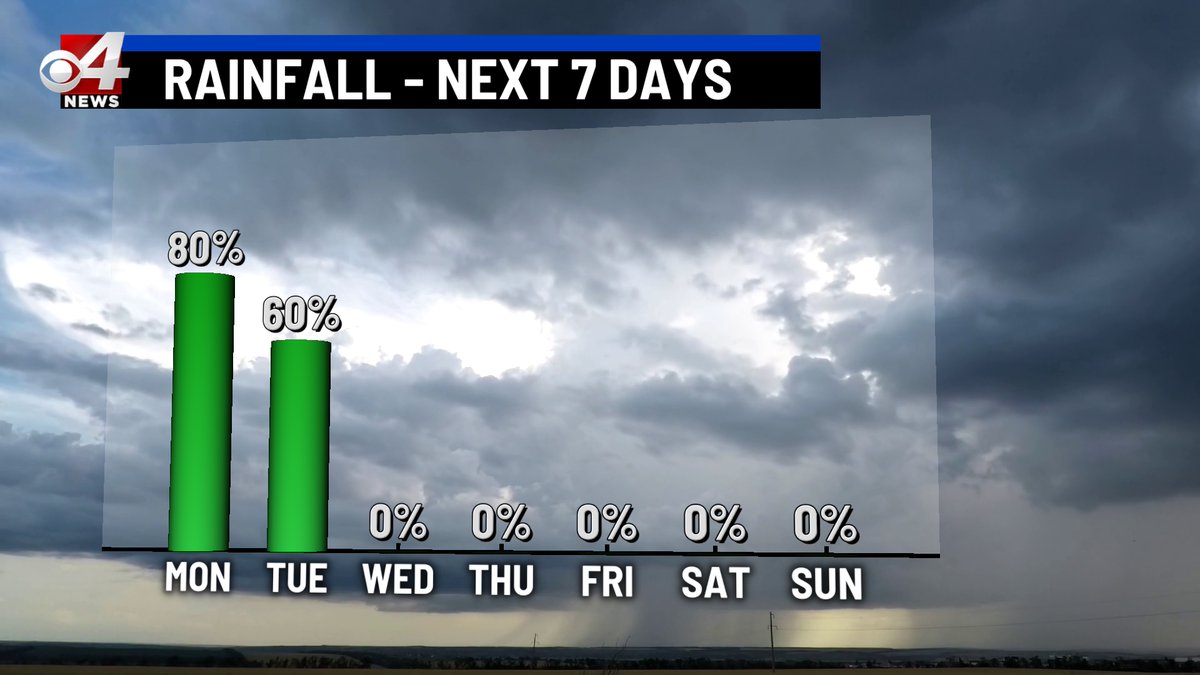
Tropical Storm Barry is now Tropical Depression Barry, degraded with winds around 35 mph. Barry, what's left of it, will continue to push rain our way overnight through Tuesday. #rgv #rgvwx #txwx
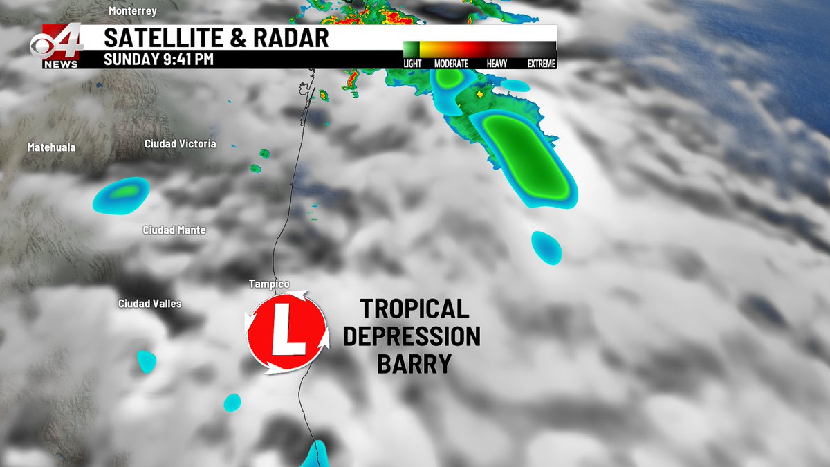

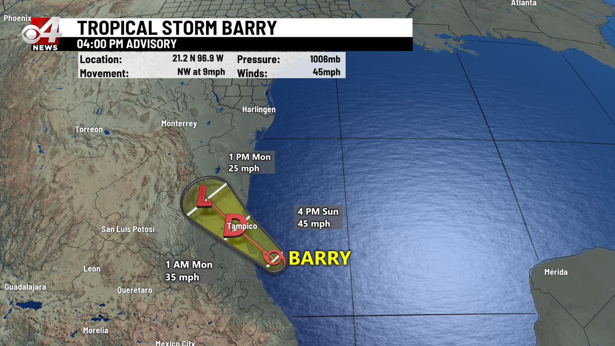
Tropical Storm Barry continues to move toward Tampico Mexico with 45 mph winds. The storm also continues to drive rain toward the RGV through Tuesday. #rgv #rgvwx #txwx
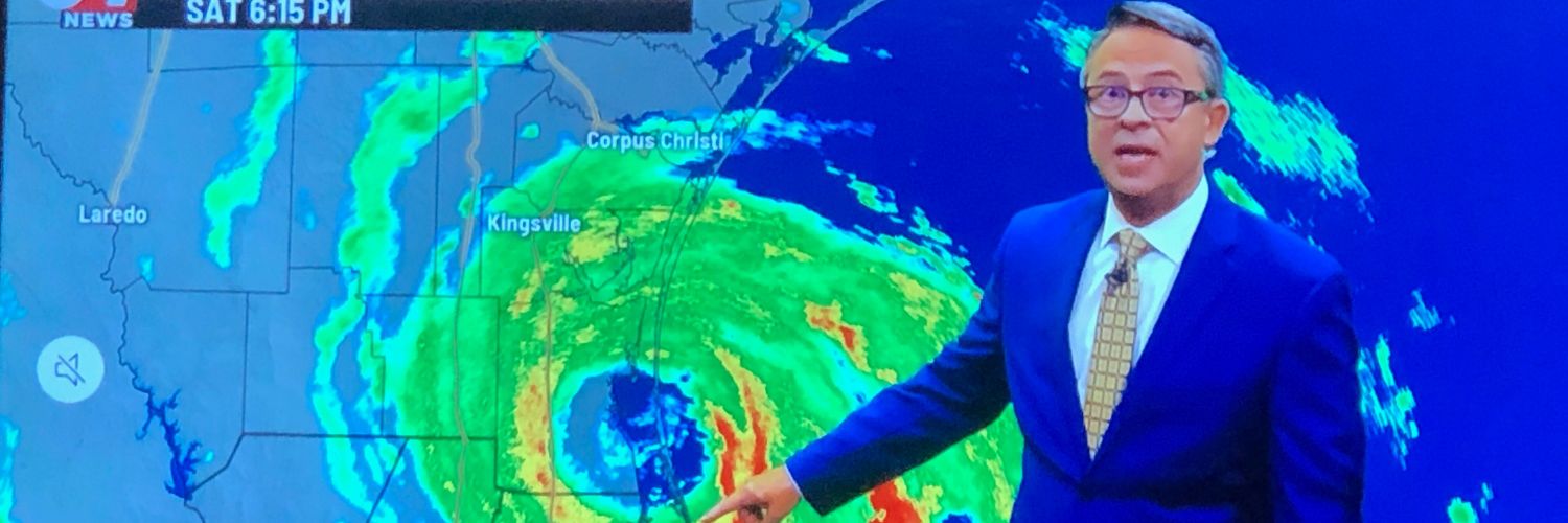
Tropical Depression 2 is now over the Bay of Campeche down east of Veracruz, Mexico. TD 2 will probably become Tropical Storm Barry by Sunday. Track is forecast well south of the Valley but it should bring widespread showers to the RGV Sunday and Monday. #rgv #rgvwx #txwx
A buildup of tropical moisture coupled with upper level low pressure will, together, deliver a chance for rain every day starting tomorrow and lasting through early next week. Not a lot of heavy rain but daily showers and a few rumbles of thunder. #rgv #rgvwx #txwx
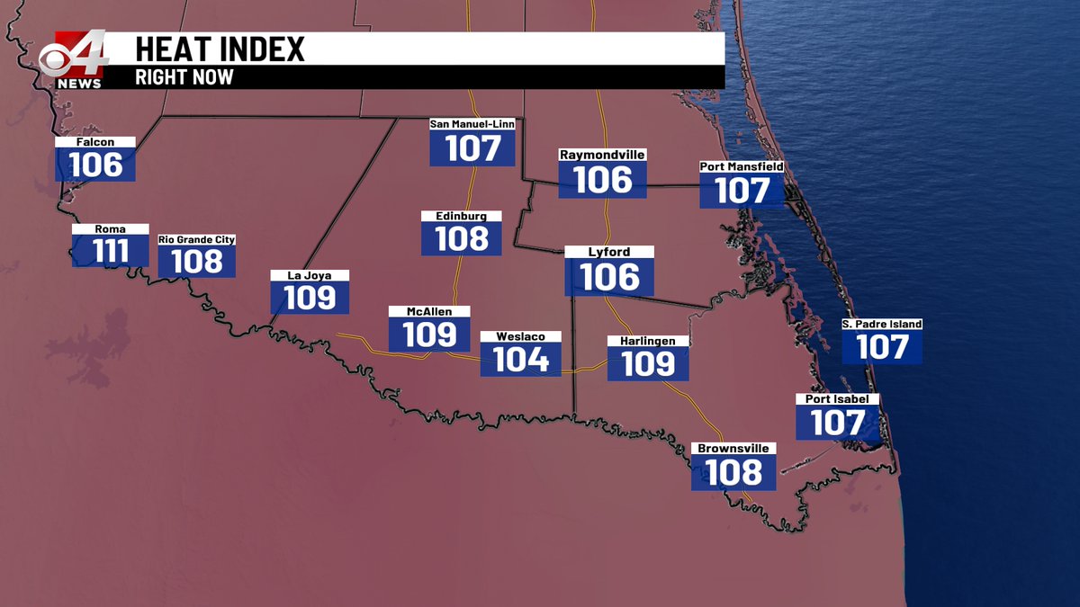
The triple digit heat will continue for the Upper Valley through early next week. Expect the heat index, what it feels like, to edge near 110° each day. #rgv #rgvwx #txwx
Plenty of triple digit heat for the Upper Valley through early next week. The heat index will be pushing 110° each day as well. #rgv #rgvwx #txwx
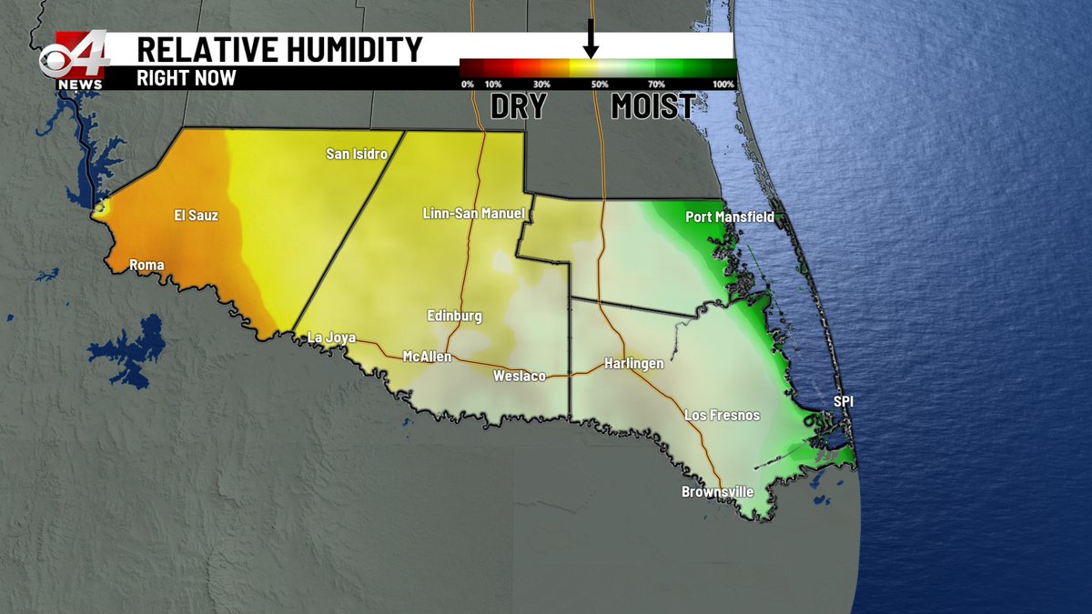
Hot made hotter by high humidity, tomorrow will be in the mid 90's to near 100° but it will feel more like 105° to 110°. Slow down when you are outside and make sure the pets (and kids) have shade and water. #rgv #rgvwx #txwx
A nice, hot day made sweltering by high humidity. Heat index temperatures from 102° to 106° across the Valley right now. #rgv #rgvwx #txwx
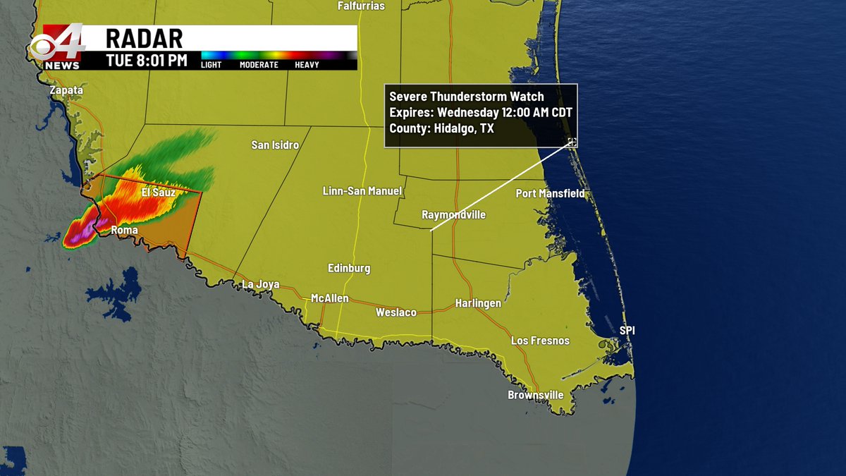
A moderate chance for rain and t-storms for the western portion of the Valley between 7 and 11 pm tonight. #rgv #rgvwx #txwx
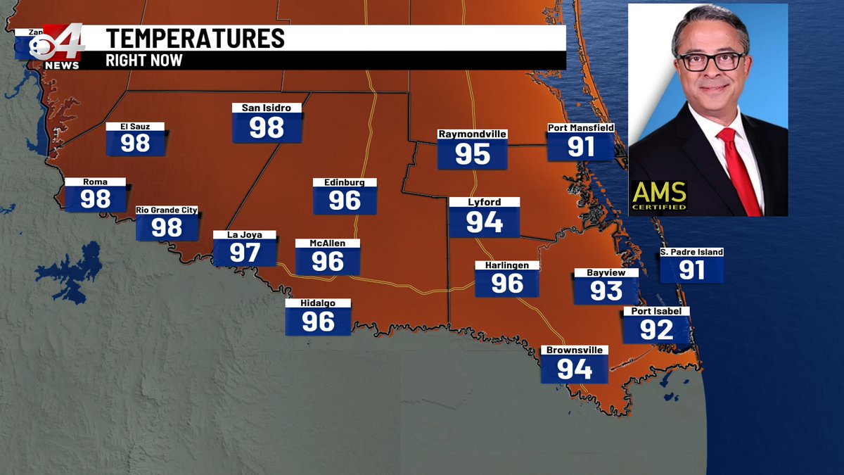
Temperatures in the 90's now but the humidity makes it feel more like 105° to 110°. Stay cool folks! #rgv #rgvwx #txwx
Record high temperatures will be in jeopardy the rest of the week across the RGV. The YELLOW numbers are the forecast highs while the BLACK numbers are the current records. #rgv #rgvwx #txwx
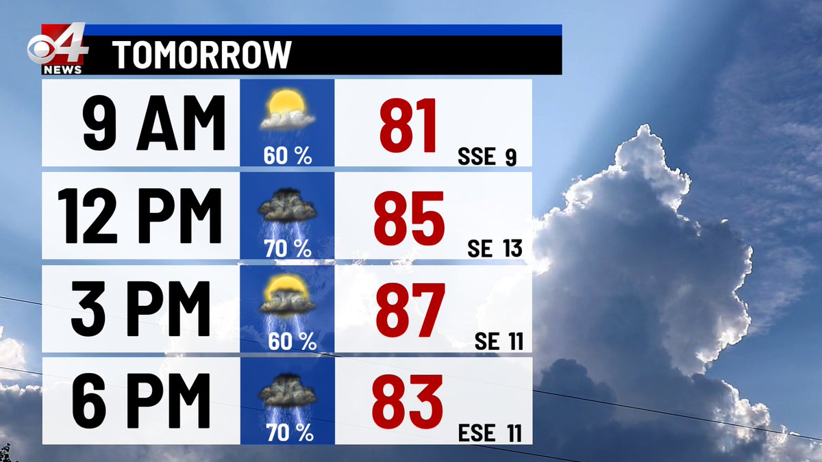
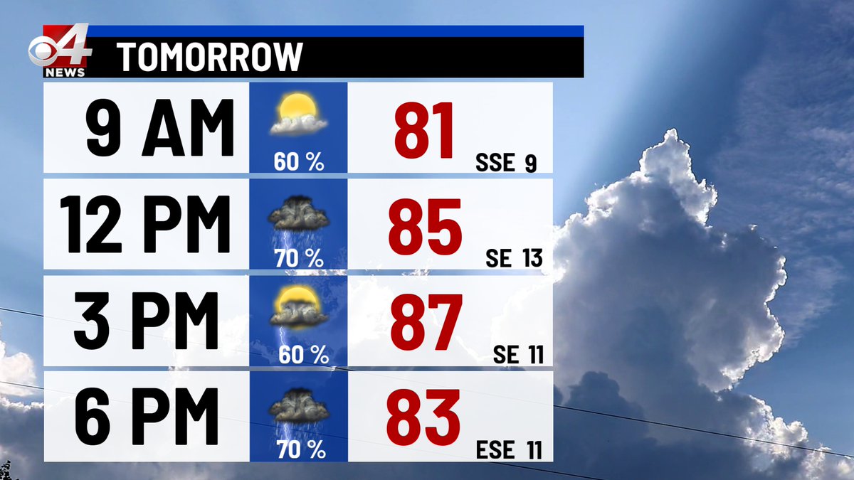
It looks like the Valley will experience widespread rain and thunderstorm activity tomorrow and tomorrow night. Severe thunderstorms may produce strong winds, frequent lightning, heavy rain, and hail. #rgv #rgvwx #txwx
A thunderstorm watch is now in effect for the entire Rio Grande Valley until Midnight. Severe thunderstorms can generate strong winds, heavy rain, frequent lightning, and hail. #rgv #rgvwx #txwx
Have you been sneezing lately with red, itchy eyes or shortness of breath? You may be responding to smoke in the air. A combination of agricultural and volcanic smoke wafting this way from Mexico will continue to reduce air quality through the weekend. #rgv #rgvwx #txwx