Brad Nelson ⛈⚡️🌪
@Brad_nado
Stormchaser, tornado & severe weather junkie, Meteorologist & Solution Engineer, husband to a great woman, father of 2 amazing kids!
My Top 10 #Tornadoes 1. Ashby, MN - 7/8/20 2. Bowdle, SD - 5/22/10 3. Bennington, KS - 5/28/13 4. Parkers Prairie, MN - 6/17/10 5. La Crosse, KS- 5/25/12 6. Gilmore City, IA- 4/12/22 7. Greensburg, KS- 5/4/07 8. Canton, OK- 5/24/11 9. El Reno, OK- 5/31/13 10. Austin, MN- 6/17/09


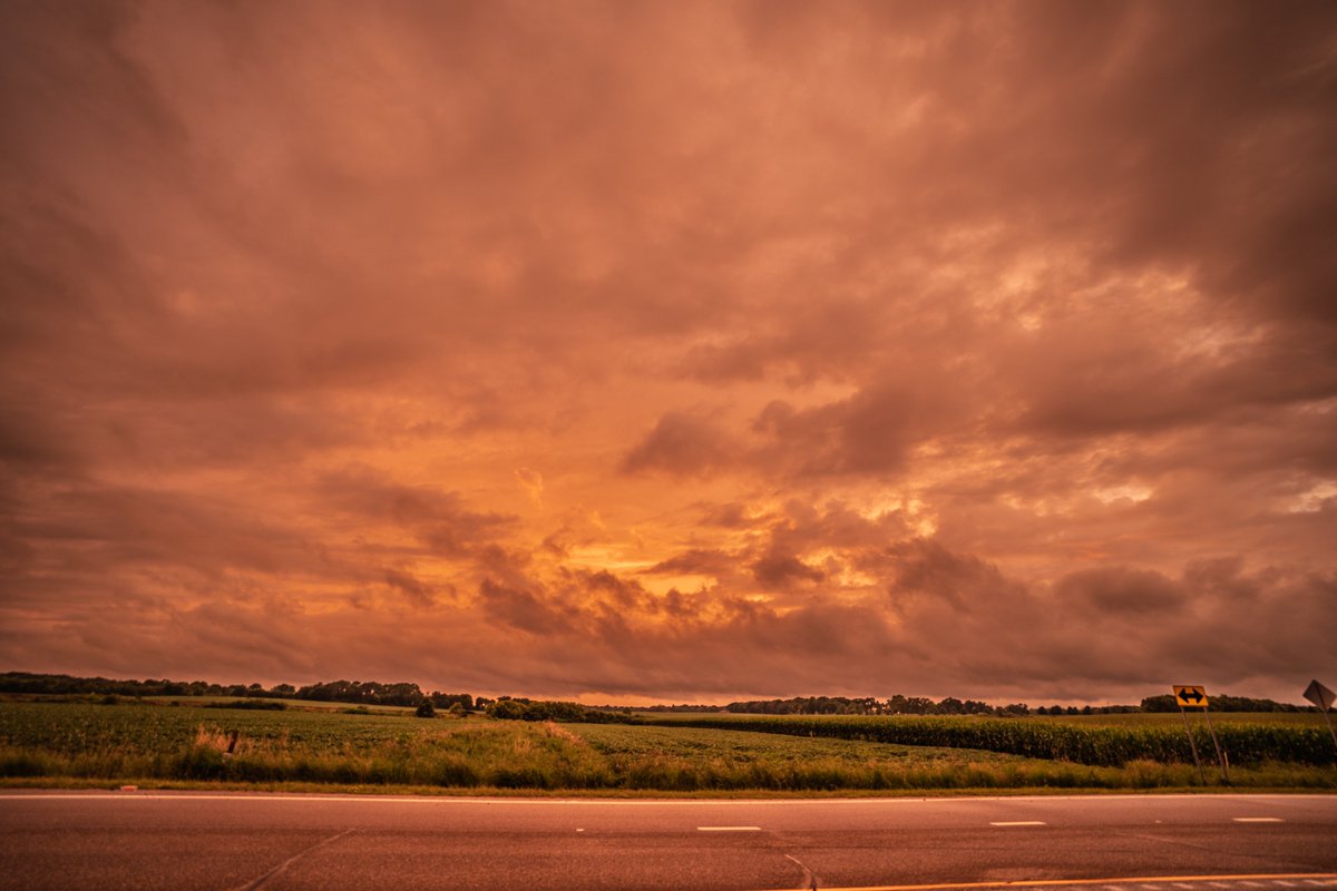
A quick jaunt down to Medford to catch a few meager storms before they turned into a mess. On the way down the storm by Mankato got tornado warned and produced a reported funnel cloud but I didn't make it in time catch. The colors at sunset on the way back were terrific! #mnwx


A couple shots of the storm and shelf cloud rolling into Farmington this morning near my house. #mnwx


Cool to see one of the DOW trucks at the @EsriUC User Conference in San Diego!

Beautiful MCV moving across southern Minnesota this midday. #mnwx Also, can see the shortwave moving across central Nebraska, ready to fire up severe storms on the leading boundary later today. #newx
5 years ago the EF4 Ashby, MN #tornado brought the craziest, most intense chase moments of my career with my friend, @MetzStormMedia! My 100th tornado. We drove right up to the tornado near its strongest point, viewing from 350 yards away. I think about this day all the time.


Expert #WeatherRisk intelligence for Emergency Response & Safety professionals, tailored to your site, & 1:1 workshops to best understand you, your event, & #WeatherRisks. See how DTN #RiskCommunicator services give you the upper hand against #weather: dtn.link/r1zflp
I found the weather modification machine! But where’s the tornado 🌪️ button?

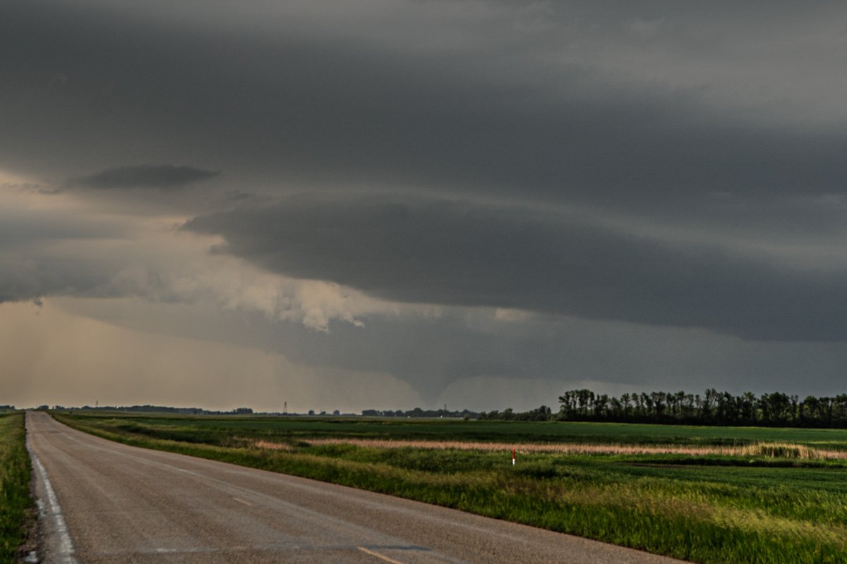
Another shot of the amazing #Gary, South Dakota tornado. #sdwx #stormchasing

Beautiful tornado and structure near Gary, South Dakota yesterday.


youtu.be/vknKZfQbuD4?si… << Confirmed on my Sony cam that there was ground circulation under this rapidly rotating wall cloud east of Ostrander, MN on Wednesday! This video is pretty wild with the merry-go-round and attempts at fully condensing. Be sure to watch in 4K! #mnwx
A big lowering that was rotating and condensing under the meso near Rushford, MN today. Very suspicious and wondering if it ever touched down. Notice the RFD surge of rain and hail coming around the south side at the time. #mnwx #stormchasing

This was fun! Nearly had a tornado 🌪️ drop right in front of us today east of Ostrander, Minnesota. #mnwx #stormchasing
Storm chasing in North Dakota is awesome. Had a great day with @weshyduke as we saw at least 4 tornadoes and some incredible storm structure. #ndwx #stormchasing


Fun impromptu chase yesterday evening along the Minnesota/Wisconsin border! The #supercell had several lowerings through its life cycle and a couple ragged wall clouds. It did have rotation going on with the action area and a short lived funnel cloud. #stormchasing #mnwx


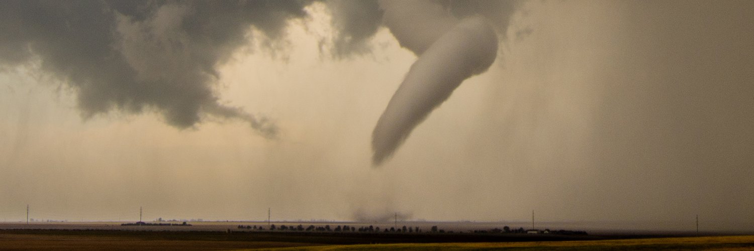
Still can't believe this happened. Still can't believe this is a photo I took. 📍Wellfleet, NE 6/16/25
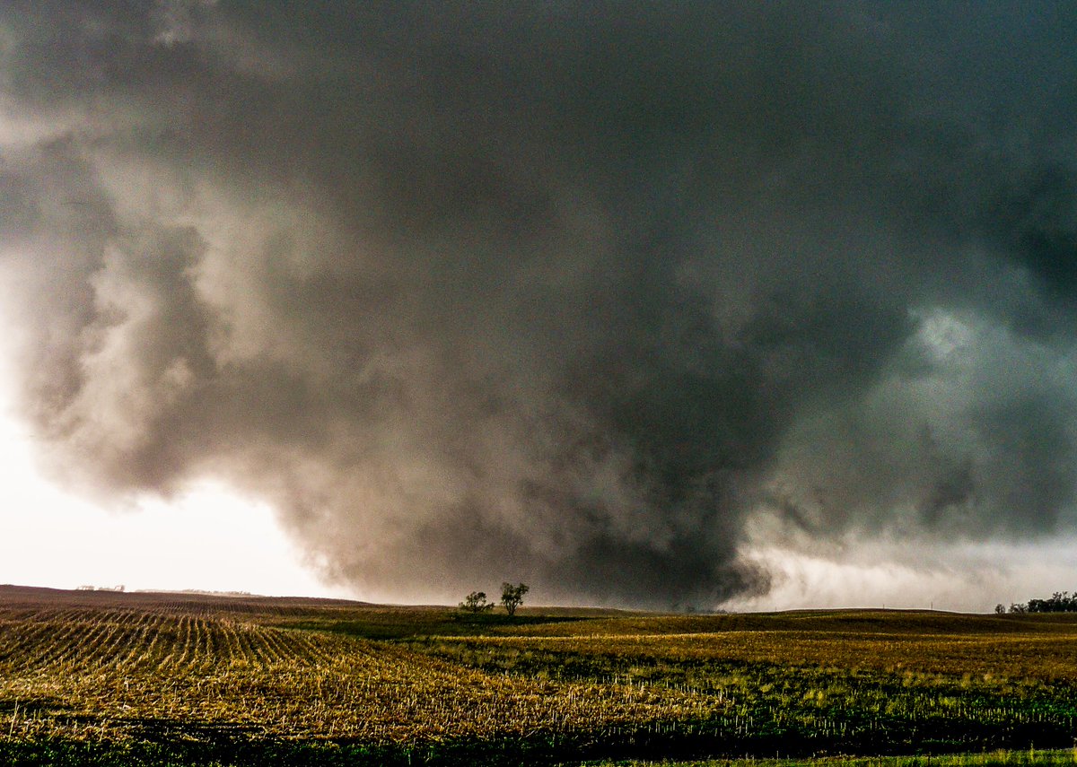
WOWOWOW!!!! It doesn't get much better than this, EVER!!! Dickens, NE today. #NEWX