HilltopWeather(HREF truther)
@AnubizzzBurner
🇯🇵🇺🇸 Remember to always seek official information from the NHS or NWS. Mainly reporting on 🔥 weather and severe weather🌪️ Also go 'Canes
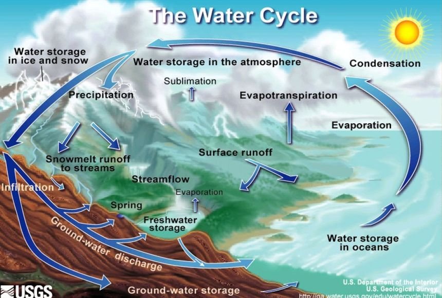
A graphic for the Water Cycle for the more visual learners from the USGS.
This is not a good look for Minnesota and Wisconsin
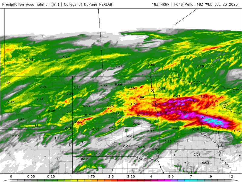
Flash Flood Emergency including Brownstown IL and Vera IL until 2:15 AM CDT
There are these magic things called rain and snowmelt
🇨🇦 Niagara Falls never stops. 🌊🚫 Day and night, year after year… Millions of gallons pour over the edge every minute. But where’s it all coming from? How does it never run out? 🤔 We’re told it's just the Great Lakes… but no one questions the infinite supply of water or how…

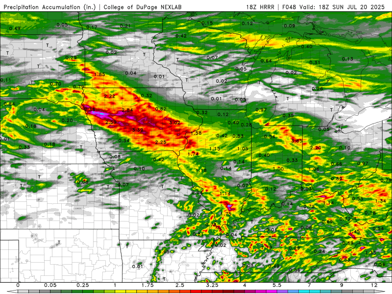
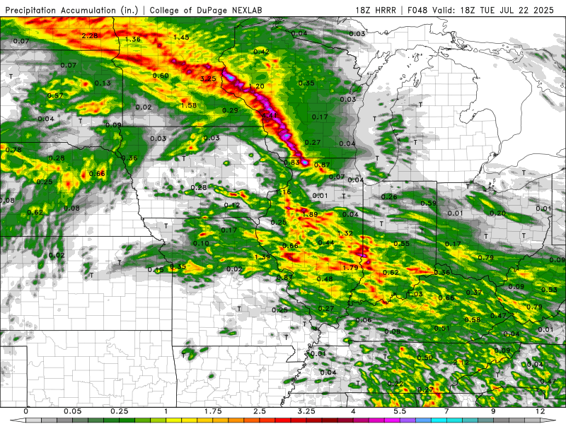
Monday night: HRRR is showing a flash flood situation for the Driftless area. We'll see how this evolves but it is a possibile situation

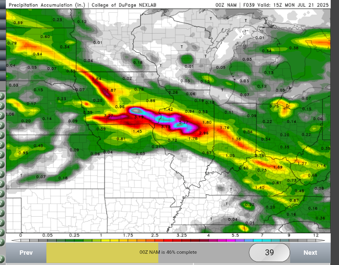
A letter to the NAM: Can you please stop trying to forecast the mega Uber flood of the century for Davenport and Lincoln Illinois. Thank you!
Rock and Sligo creek are about to see catastrophic, life threatening flooding over the next couple hours
Significant Flash Flooding is occurring along Sligo Creek from Bethesda through Takoma Park. Seek higher ground IMMEDIATELY if you are in these areas! Head all road closures and avoid this area. FLASH FLOOD EMERGENCY is in effect!
Back building thunderstorms are forming and training over the DC metro. Dangerous flash flooding is about to occur
I'm begging you. If you live in a flood plain please have a plan of action
The Weather Prediction Center has upgraded much of central and western Kentucky to a Moderate Risk of flash flooding this afternoon and evening. There are still no Flood Watches for our region. Pretty big disconnect between NOAA agencies right now. #kywx
That's not good
At 12:18 PM CDT, Cisne [Wayne Co, IL] Emergency Mngr reports Flash Flood. Significant flooding occurring in and around Cisne, IL. Multiple roads being impacted and some sandbagging in progress. #ilwx mesonet.agron.iastate.edu/lsr/?by=wfo&wf…
#WPC_MD 0757 affecting southern Illinois, southern Indiana, much of Kentucky, #kywx #inwx #ilwx, wpc.ncep.noaa.gov/metwatch/metwa…
#WPC_MD 0757 affecting southern Illinois, southern Indiana, much of Kentucky, #kywx #inwx #ilwx, wpc.ncep.noaa.gov/metwatch/metwa…
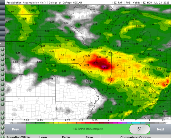
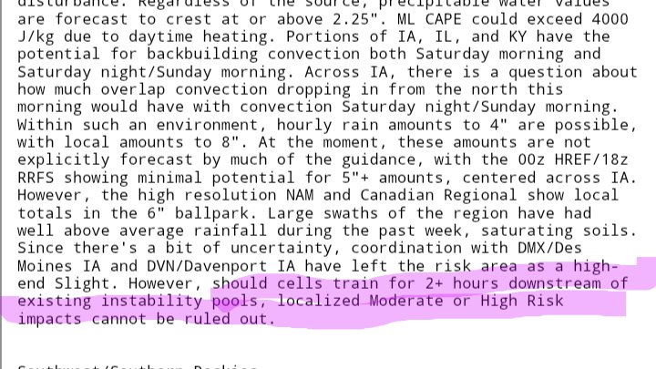
RAP is showing a concerning signal over the next 48 hours. This is on top of the rain that has already fallen
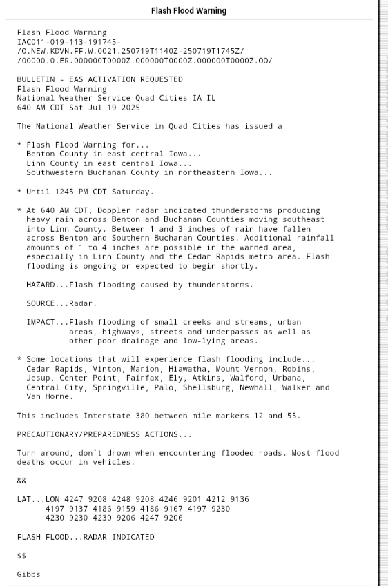
Rainfall totals are vastly overperforming the models at this time with Cedar Rapids and surrounding about to get 7 inches of rain. This is very quickly becoming a life threatening situation with already elevated stream flows and a secondary round evening overnight. I expect a MDT
This is a very dangerous situation evolving for Iowa city and Cedar Rapids. Up to three inches of rain has fallen with another 4 expected from this storm. A second round can be expected during the evening and overnight hours
Oh. So there's a coin flip chance at disastrous flash flooding later tonight

Update: it did in fact get interesting
Just depends on if it can get surface based. Could get interesting
Meanwhile somebody is intercepting a beautiful photogenic tornado
LBF continues Tornado Warning [tornado: OBSERVED, hail: 1.25 IN] for Brown [NE] till 9:00 PM CDT mesonet.agron.iastate.edu/vtec/f/2025-O-…
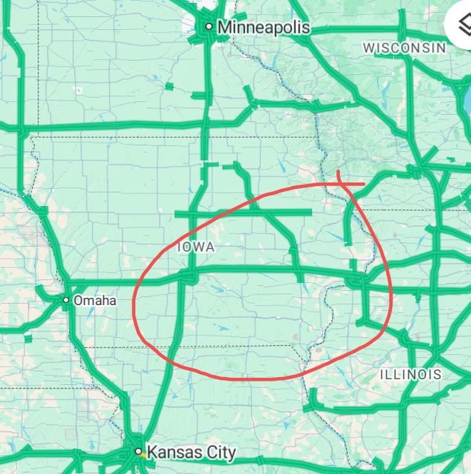
Some localized serious flash flooding could be realized in Iowa over the next couple of days. Soils are still wet from last week's rain